Yesterday, I went up into Johnson's Pasture again to hide the first stage of Exploring the Technology, the multi-cache the Tadpole and I worked on this weekend. When I got home from work, I noticed that he wasn't home from school yet. When my other son got home about thirty seconds later, 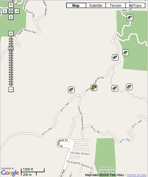 I asked him about it and he didn't know anything, so I called the Tadpole. Gotta love technology sometimes. I reminded him about letting me know where he was if he wasn't going to come right home and then asked him if he wanted to help hide the first stage, which he agreed to do, so I went and picked him up.
This was probably one of the best calls about geocaching that I've ever made. Had I headed up the hill without him, I probably would have gone up with the single purpose of hiding the cache, then getting back home and clicking that, "Yes, it's active" button on the cache page so it would go to a reviewer for approval. But, on the way back from the hide, Tadpole noted to me, "You know, we've never gone up that way before." And yes, he was right, because we'd never gone up the trail to the west of us. On the map, it's labeled at B P L Rd. As you can see, it's also bereft of caches. The four caches in a line from left to right are, Pasture-ized, Exploring the Technology, Rusted Gate and Melted Cheese.
I'm really at a loss as to why I've never explored this part of the trail before, but there's all sorts of terrain over on that side that's open for some neat caching. As we walked along the road, we encountered a nice trail that wound its way to the north along a ridge. We walked on that one about a quarter mile and it didn't seem to be petering out at all, so I expect that it would eventually hook up with another fire road to the north of the B P L Rd.
After hiking back out to the main road, we took it further west to another spot overlooking the city below. The possibilites for caching and for hiking were tremendous and I'd never even thought about going that way before. I estimate the trail is about 1.5 miles in length, so roughly 3 miles over and back. And it's all about 2.5 miles away from my house, once again, literally in my own back yard and I hadn't even realized it before yesterday. I owe a debt of gratitude to my son for having the foresight to explore new territory.
Wednesday, January 28, 2009
Backyard discoveries

Sunday, January 25, 2009
Hidden weekend
Part of the game of geocaching is hiding caches. If no one were to hide any caches, how would anyone find any? As noted in this post from earlier in the month, I had several caches  ready and waiting for me to get out and hide them. This weekend became that time.
About 2 miles north of my house is a large plot of land known locally as Johnson's Pasture which was purchased by the city to remain open space for the enjoyment of everyone in the city. It is adjacent to the Claremont Wilderness Park which abuts the pasture to the east. There are a series of fire roads which can be used as walking trails through both parks. Inside the wilderness park is a five mile loop trail that is quite strenuous and used quite frequently. There are side spur fire roads leading from Johnson's Pasture over to the wilderness park. There is not loop within Johnson's Pasture, but when geocaching friends come to visit, we usually end up taking two cars and creating a shuttle. We park over by the wilderness park, then drive everyone over to the Johnson's Pasture area and then hike from there over and down to the parking lot at the wilderness park. It's about a five and half mil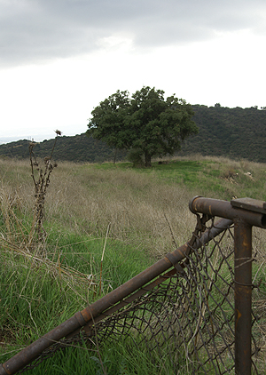 e trek that way and a nice way to find a bunch of caches.
Most of the caches up in these two parks were hidden by me. I enjoy roaming around the two areas and whenever I feel the need to hide a cache, that's usually where I end up going first. This weekend was not exception. The Tadpole and I loaded up our backpacks with four caches, took our GPSrs and hit the trail. As long as we were up there, we might as well find some of the caches that my son hadn't found yet. He found the first one as we entered into Johnson's Pasture. Then we hiked up to a mystery cache of mine to do a maintenance check on it. After the Tadpole found that one, we tried to find a spot in between these two caches that would work, but they were too close together to hide another one, so we moved on to where I wanted to hide the cache the Cheeseheads sent to me at Christmas.
There is a microwave tower that dominates this area, since it's on one of the high hills in the two parks. It serves as a benchmark for surveyors as well and I thought it would make an excellent spot for a cache hide. We hiked up there and found several spots where a nice sized cache could be hidden. Once we chose the site, we got coordinates for it and then started back down. As we had been hiking up, we'd been taking coordinate readings for a letterbox cache that I wanted to hide up here, but couldn't find a good spot. I may have to look along another trail for a spot to hide that one. But on our way down, we found a perfect spot for a small decon container and hid that one as well.
We'd also been working on a multi-cache. I had already scouted out the final location. That wasn't a problem, but we needed to check out possible sites for the first stage of the multi. Once we agreed on a good spot for the first part it was time to make our way back home. We came back the next day to take some final readings for the multi-cache as well as tak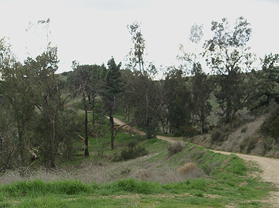 e some pictures that I could post on the cache pages. At post time for this entry, I'm still waiting for the paint to dry on the first stage. The wet weather we've been having this past week hasn't been helping, so I brought it inside today in the hopes that will quicken the process. I suspect that I will be making one more hike up there tomorrow after school to hide the first stage and complete that cache.
The first two, Melted Cheese and Rusted Gate have already been approved and I would expect the third, Exploring the Technology to be approved sometime this week. That will bring me up to 25 hides. The Tadpole and I also discussed how we should list these. We agreed that we should list them under my geocaching account, but we should come up with some kind of name that would let people know that it was both of us that worked out the hide. We both like what we decided as a moniker for the two of us.
Pictures were taken at or near the following caches:
Melted Cheese - by The Swamp Things
Rusted Gate - by The Swamp Things
Exploring the Technology - by The Swamp Things

Thursday, January 22, 2009
On the Boardwalk
It really wasn't the boardwalk, but last Monday I actually went out on a pier to get a virtual cache and get a picture taken for a webcam cache. The 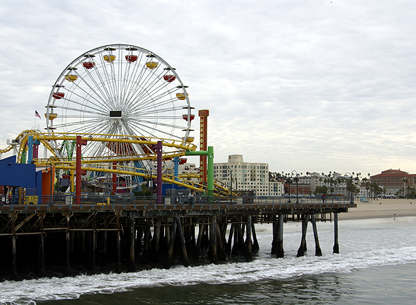 virtual was in the middle of the pier near one of the entrances to the amusement park built on the pier. It was a fairly easy virtual because I only had to answer a couple of questions to gain credit for the find. The webcam was a little more difficult. I had a cacher prepped for the picture, but I originally thought I was going to be there before noon, but I was there in the morning when this cacher wasn't available, so I called my son and walked him through the steps. As it turned out, the webcam wasn't broadcasting pictures, so I had to resort to having my picture taken at the right spot to get credit. I was expecting this to happen, since the webcam had been out since Saturday evening. When I got home to log the cache, the webcam was back up and operational. Doesn't that always seem to happen?
The way everything was laid out on the pier, it gave much the same feel of an old fashioned boardwalk, complete with carnival barkers, games of chance and a couple of thrill rides, including a giant Ferris wheel and a rather tame looking rollercoaster. I knew this was going to be there when I came out and tried to get the Tadpole to come along for the ride, but he wasn't interested, so I came alone. Hopefully, he'll come next time I come out this way. I think he would have had a good time.
It's been years since I've been on a pier of any kind. I can remember as a child in the mid 1960s, my parents would take us down to Newport Beach frequently where we'd walk out on the pier and get out over the ocean. I would love to look into the buckets of the fishermen on the pier to see what they'd caught that day. There were other  fishermen who'd been out in the ocean who would bring their small boats right up onto the beach and sell their fish directly from their boats. Occasionally, my father would bust out his wallet and we'd have very fresh fish, usually halibut, sometimes swordfish for dinner that evening.
The last pier I was on, was more of a boat dock and it was located on Catalina Island, 24 miles away from Los Angeles. For a couple of years, we had a science camp field trip for our 8th graders where we'd take them over to Catalina Island, away from the touristy places near Avalon and teach them different things about the ocean that you couldn't do in the classroom. The hands on labs with plenty of ocean critters was, for many of my students, the first time they'd encountered many of the creatures in the Pacific Ocean. While on the Santa Monica Pier on Monday, the air was so clear, I could see all the way to Catalina, something that is becoming increasingly difficult to do here, because of ocean clouds (called the marine layer here) that block the view, but also because of the smog the area generates.
The last actual boardwalk I've been on, in fact the only boardwalk I've been on, would be the Santa Cruz boardwalk. I was up in Santa Cruz with a couple of buddies of mine right after we'd graduated from high school. This was our senior trip and we made the most of it, camping in different spots along the coast of California. My friend's sister was attending UC Santa Cruz and so when we got up there, we crashed at her apartment.  That evening, we went down to the boardwalk and enjoyed the sights and sounds of the place. One of the highlights of the boardwalk was the Giant Dipper, a large wooden rollercoaster that consistently rates in the top ten of great woodie rides by coaster enthusiasts. I couldn't tell you how many times we rode it that evening, but it definitely makes my top 10 list as well.
The Santa Monica Pier, which I visited this weekend was a much smaller version of the Santa Cruz boardwalk. The Ferris wheel was large, but most of the other rides were scaled down versions of rides that I've seen before. As noted above, the rollercoaster appeared to be quite tame, though I didn't ride it. Had the Tadpole been along, I'm pretty sure we'd have ridden it, but with a couple of helixes and one and a half small drops, I don't think that one will make anyone's major list.
The atmosphere of the place is what I enjoyed. I could constantly hear the waves crash on the beach as I walked around the pier taking in the sights and getting plenty of pictures. The screams of kids as they rode the rides told of their enjoyment, or terror in some cases, of the different rides there. The park  was very colorful and noisy, just what I believe one would expect of this kind of amusement park. And yet, there was a quiet side of the pier as well.
The pier extended out quite a ways into the Pacific Ocean and the amusement park is situated close to the entrance to the pier. There is a good portion of the pier that extends beyond the park. There's where the fishermen are, plying their craft. It was a different kind of attitude there. There wasn't any kind of bustle. Fishermen march to their own drummer I suspect and they have this inner calm. I don't have that kind of patience to be a fisherman. Throw that hook in and a fish better start playing with the bait pretty quickly, or I'm going to be bored.
As you can probably guess, I'm more attracted to the glitz of the park as opposed to the other extreme also found on the pier. And yet, I could relate to these people, because I know that I can sit for hours doing things that I enjoy doing, like reading a book, or contemplating a set of photographs. I used to do needlepoint and cross stitching for enjoyment, but can't do that anymore, because a mild case of carpal tunnel syndrome gets in the way. So I can understand the appeal of fishing, but it's just not for me.
While I was  walking along the end of the pier, I noticed a couple of people pulling in their lines. They appeared to have snagged each other's lines and were trying to get them untangled. As they brought the lines up, I head one gentlemen state, "Man, that was a big sea bass that got away!" Now, I've grown up believing the myth that fishermen tell tall tales and the stories get taller by the day, and yet I still kept wondering to myself how big that fish was. I wished I'd been there a couple of minutes earlier, so I could have seen the size of the fish for myself. I wonder how big that fish has become in the story now that it's been a couple of days?
Pictures were taken at or near the following caches:
Santa Monica Pier - by GeoCraig
Don't Get Sucked In !! - by Splashman

Monday, January 19, 2009
The Geocache flies at midnight
Today, I was in Santa Monica meeting some friends I've made over the Internet. One was flying in from Kansas City and the four of us (two others from Southern California plus myself)  were planning on having lunch somewhere in downtown Santa Monica. This is becoming almost a ritual now as it is the third year in a row that the four of us have gotten together to enjoy each other's company in person as opposed to just on-line. Before our meet and greet, I went caching.
I got down to the Santa Monica Pier and found a virtual cache and a webcam cache. At that point it was getting late in the morning and I knew I would have to make my way over to where we were going to meet, but I wanted to find a real cache container. There was a cache just to the southeast of the pier called Lord of the Rings, so I checked that one out in my PDA. The beach front area here is very busy, so imagine my surprise when I saw that it was a regular sized cache.
As I walked over to the cache, I noticed that this area of the beach is the original Muscle Beach where Jack LaLaine and other body builders trained in the 1950s. There were all sorts of physical apparatuses there that people could use to build up their bodies. I wasn't dressed for this type of activity, so I went right for the cache. This was where it got interesting.
I'd looked at the cache page and wasn't quite sure what to expect after reading it, but once I got down there, I realized where this cache must be. Once I got near ground zero, I realized what I had to do, so I waited patiently in line for my turn. Once I got to the front of the line, I said the code words to the man behind the counter and I had the cache in hand, a nicely sized rubbermaid type of container. I took the cache over to a nearby bench and looked through it, perusing all of the travel bugs and other stuff that was in the cache.
I decided to take one travel bug mainly because I didn't have any travel bugs with me at the time. I didn't want to deplete the entire cache, but I did want to move at least one travel bug, so I settled on Pluto's Dog Tag, which wants to visit Disney themed area. I wasn't aware of this goal at the time, but I think I now need to set apart a weekend next month to get down and cache in the Anaheim area near Disneyland to get this travel bug closer to its goal.
When I was done signing the log and looking through everything, I closed it back up and walked over and handed it back to the man behind the counter.  I'd heard about caches like this and have actually experienced one or two of them in the past. I actually think they are neat kinds of hides (this one has made my top 5% list) and I've often thought about creating one like it. I have a friend who owns a coffee shop near my school that I thought about approaching with this idea, but someone else has since placed a cache outside of their shop, so that's out. I also have another friend who owns a cake making business which is even closer to my school. They used to be our next door neighbors but we have since moved away.
Looking at the latest Geocaching map, the area is free of caches in the general area, so it would be possible to hide a cache in their facility. I'll have to think about this for awhile to see if it's even feasible, but I think it merits a possible thought or two. Who knows, perhaps in the near future, there might be a cache near my school entitled, Let Them Eat Cake.
Pictures were taken at or near the following geocache:
Lord of the Rings - by SpyBlade and SpySix

Sunday, January 18, 2009
More Odds and Ends
Sometimes when I go geocaching, I encounter stuff that's out of the ordinary, some of it good and some of it bad and some of it ju st plain different. Maybe I think it's out of the ordinary because I wasn't expecting it. When I came down from Stockton at the beginning of the month, I met a friend of mine for lunch in Visalia. He used to teach at my school, but has moved on to community college where he enjoys teaching history. He was best man at my wedding over 21 years ago. It had been about three and a half years since I'd seen him last, on a return trip from Sequoia National Park with the Tadpole in tow. We had a good lunch, talked about the kids, our aches and pains, with a little political discussion thrown in there as well. We've been in touch via email, so it wasn't like we were catching up, more just continuing our conversation that we've had for the past 10 years electronically. It was good to see him and his wife again and it reminded me that good friendships are hard to come by.
After I left, I found a couple of caches on the western edge of Visalia near the airport. The airport is right by the 99 freeway which I use to drive up and back from Stockton. I can't tell you how many times I've driven past this airport, yet have never noticed the large propeller planes sitting at the side of the airport alongside the freeway. These planes are actually located just south and alongside Hwy 198 which leads into Visalia, but the airport is also just east of the 99 where it crosses the 198, so I'm pretty sure you can see them from the 99 as well, yet I don't recall ever noticing them before this past visit. Once again, I have to blame geocaching for getting me off the highway and taking the side streets, which in turn allowed me to get a better look at my surroundings.
At another cache that I found last weekend, we ended up finding coconuts. The cache was an ammo can hidden in the far reaches of a bush near the side of a road. It was located at a viewing spot for a dam in the area so there's  quite a bit of level land, with grasses and other types of vegetation nearby, but definitely no coconut palm trees. They probably wouldn't survive the colder nights in the winter here. Needless to say, finding the coconuts was quite a surprise. It almost appeared to me to be like a makeshift memorial that someone had created there. There were four coconuts with some red carnations lying on the ground. We actually thought we might have some problems with the cache find because the coconuts were leaking and attracting a fair amount of bees. Fortunately, the cache was far enough away that they didn't present a problem. We chose not to disturb whatever it was, mainly because we didn't want to disturb the bees, but the mystery still persists why they were there in the first place.
On the same day, we'd also found several nice caches along a trail that we'd never hiked on before. One of the final caches was hidden in the roots of a tree. I didn't pay much notice to the type of tree. Once we got there, we pretty much forgot about the tree and just marveled at the root system of the tree, which was about seven feet high or so off of the trail and running down into the ground at the base of the trail. It was like a spider web on steroids with rocks interspersed within the web pretending like they were the spider's catch for the day. I kept thinking about what this particular hillside would look like if that tree hadn't been there to hold back everything. Somewhere in that picture is a small cache container that also ended up on my 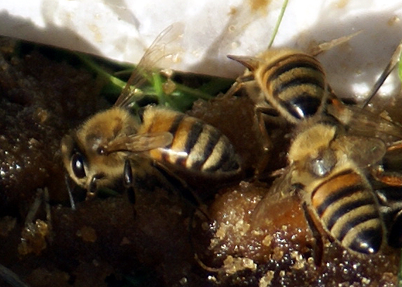 top 5% list because of the placement and the hike to get to it.
Lastly, I've been somewhat remiss in placing my next cache, so much so that I actually have enough cache "ingredients" to hide about four caches. I expect to probably hide four more caches, one ammo can, one cache that was sent to me for Christmas by the Cheeseheads and two decon containers, sometime by the end of the month. Usually, when I hide caches I have names for the caches in mind way in advance. This is partially the case with these as well. I've pretty much made up my mind that the ammo can is going to be my first letterbox hybrid type of cache. The hike to the cache will pass by several forks in the main trail, so I've decided to name this cache, Yogi Berra's Fork.
For one of the decon containers, I'm working on a puzzle cache that will have cachers using their GPSrs in more than one way. I found a cache once where I had to project a waypoint a distance away and then find the cache at the new coordinates. I thought I'd like to try something like that with this one and am planning on naming it, Exploring the Technology. The last two caches don't have names yet, but the one that Cheeseheads gave me, will probably have something in the title that will link it back to them.
With these four cache hides, I'll be up to 26 hides. Not all of those are active, but that's enough hides for me at the present time. I want to make sure that I can adequately maintain all of my cache hides for some time to come. I know my own limitatio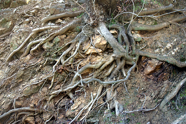 ns and know that I couldn't hide several hundred caches and be able to maintain them very well. I've found many caches that had degraded or had full log books and several cachers in the past had already alerted the cache owner of possible problems. I went to find a cache on Friday and looked at the logs posted beforehand. The last four logs were all DNFs dating back to August. It seems to me that the cache owner isn't doing his caches justice by not responding to these logs. I don't want that to happen to my caches, so I'll continue to limit my cache hides to 1 for every 100 finds that I have. It just makes more sense to me to hide quality over quantity.
Pictures were taken at or near the following caches:
ZOOM, ZOOM - by Evil Cow Pie
View of Morris Dam - by esquimaux
UJs SILVER MOUTIAN #4 - by UNCLEJON AND NOT TOM

Tuesday, January 13, 2009
Exploring your own backyard
I'm pretty sure that I've noted in other posts about one of my general likes about geocaching. When I first got involved, most of 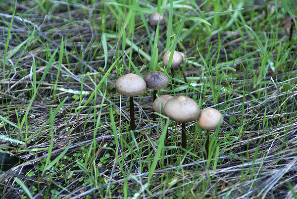 the caches hidden were on trails in the foothills which required hikes to get to them. Urban micros didn't exist yet, so you had to get out on the trail, exploring your own backyard in a way.
3blackcats and I did just that this weekend, taking a ride up into Azusa Canyon and exploring a trail that supposedly leads up to Silver Mountain. I'm not sure whether it does or not as we were relying upon the two cachers that hid 6 caches between them along this slightly strenuous trail. The trail rose gently from a road turnout, overlooking Morris Lake Reservoir and dam. The lake was low and there was a substantial bathtub ring along the lake, but I'm sure that was in preparation for spring runoff because they were 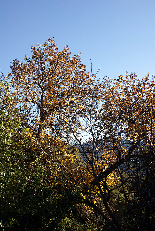 letting quite a bit of water go from the bottom of the dam.
I'd never been up in this canyon, either by just car touring, or hiking, so this was another case of geocaching getting me out to explore the gems that are hidden in my own backyard. I know in the past I've written about my first cache find which took me to a park, only seven miles away from that I'd never heard of before that day when I went hiking with my two sons to find a cache. I've explored quite a bit of that park since that time and will go back again in the near future to hide several more caches. From a geocaching perspective, I view the caches as my spot on the geocaching map and yet 8 years ago, it wasn't a blip in my mind.
With the rainy season upon us in Southern California, the area where we hiked has "greened" up tremendously, so much that we were walking in many spots on a carpet of grass as opposed to a dirt trail. I'm not much of a botanist, so I don't recognize all of the plants alongside the trail, but there were berries in profusion in one area and mushrooms growing in the shadows that hadn't seen much sunlight over the past couple of months. There were several non-native plants in the area 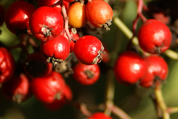 that made an impression on me as well.
At one point on the trail, we had to stop because a small breeze had picked up. It wasn't the breeze so much as it was this very tall aspen, which is definitely not native to this area, that had started quaking. The wind rustling the leaves of this tree made it sound like we were standing next to a small creek listening to the water flow gently over the rocks. I was reminded of a rain stick that I've seen in stores that sell Australian artifacts. Just as suddenly, the breeze stopped and our creek symphony stopped as well. At one of the cache sites, we noticed a very large Pampas grass plant, quite out of place, yet the position on the ridge overlooking the dam was quite stunning in my mind. I took quite a bit of time composing the picture that I finally ended up taking. I hope I did the subject justice.
The more I geocache, the more I'm drawn back to areas like this. These hidden treasures close to urban America hopefully will 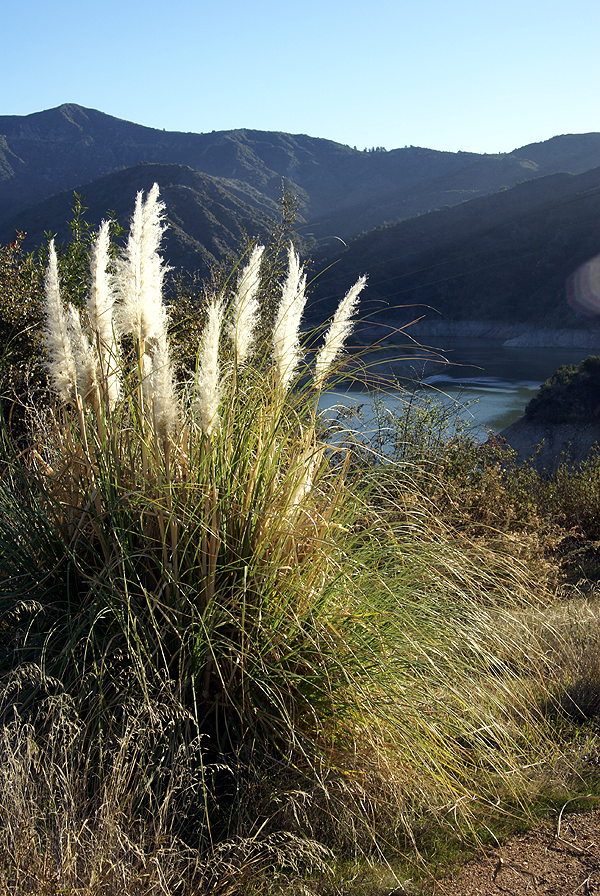 be preserved for many years to come. I would suspect that this particular trail gets more traffic on it now because of the geocaches that have been hidden nearby, but I'm not sure if this is such a bad thing. We found a couple of areas that obviously were drinking areas for people and were probably drinking areas before the caches were hidden. We carried out a couple of empty beer cans we found alongside the trail. We chose to leave the used condoms where they were. Ugh. Maybe the increased traffic will cause a reduction in some of these other types of activities.
Your "backyard" is probably different than mine, but I would be willing to bet there's still areas that you haven't explored. I encourage you to explore them a little bit more. You might be surprised by what you find out there. I'm already looking at other trails to explore in the coming months before it gets too hot out here again. This is the perfect time to walk on our trails and I intend to make the most of this time.
Pictures were taken at or near the following geocaches:
UJs SILVER MOUTIAN AMO CAN #1 - by Uncle Jon
My Silver Mtn Trail #1 - by nottom
My Silver Mtn Trail #2 - by nottom
UJs SILVER MOUTIAN AMO CAN #2 - by Uncle Jon
UJs SILVER MOUTIAN #3 - by Uncle Jon
UJs SILVER MOUTIAN #4 - by Uncle Jon

Sunday, January 11, 2009
Changing perceptions
Back in June, I wrote about finding a benchmark in a vertical fashion, attached to the wall of a bank. Now before that time, I was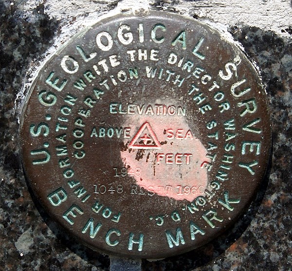 under the impression that benchmarks were disks that were found flat on the ground, either on curbs, or on structures that probably weren't going to go anywhere, like bridges. Then, I found another one on the side of a courthouse in Merced, CA last August. Hmmm. Now I had found two benchmarks that were positioned on the side of a building. I stumbled across a third one this weekend, also placed into the side of a bank.
Well, it's starting to make sense now. Placing a benchmark disk on the side of a building, is placing it on a structure that's probably not going to go anywhere, although there could be some doubt about doing that extensively in Southern California due to earthquake activity. There's at least three that I've found recently that are on the sides of buildings, so it must be more prevalent than I previously had thought. And it does make a lot of sense now that I look at some benchmark pages with this kind of placement. The settings for the benchmark are listed as "massive structures with deep foundations" and the stability of the 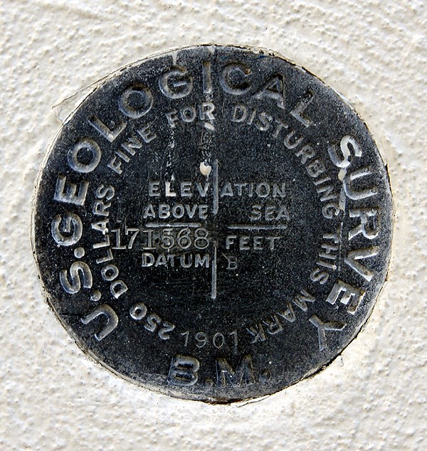 benchmarks are deemed "most reliable and expected to hold position/elevation well."
The one that I found on Saturday was one of those serendipitous finds that I just happened to stumble upon. I had been out caching with my friend 3blackcats in Azusa (the town that has everything from A to Z in the USA) and we had just finished up our day of caching. We had already passed the benchmark once heading to the cache and were making our way back to our car when I noticed this nice benchmark at chest level stuck in the side of a Wells Fargo bank building. Since it was labeled a US Geodetic benchmark, I knew instantly that it would be in the benchmark system at geocaching, so I had 3blackcats take two pictures of it for me with her Blackberry. She sent them to my via email from her phone (geez, you have to love what our technology can do today) and I logged the benchmark later on that afternoon. It was my 20th benchmark logged.
Not noticing the benchmark on the first pass by, to me is really inexcusable since it's right there. I saw it right away coming back, but I can use as an excuse that I wasn't paying attention to my GPSr or looking out ahead to see if I could figure out where the cache could be placed while we got to the cache area. I can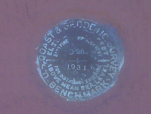 remember talking with 3blackcats, theorizing where I thought the cache might be as we walked toward it, so I have to assume that my attention was diverted enough that I didn't see the benchmark. I need to work on that in the future. Looking over some of the cache pages of other caches that I logged this weekend, I missed at least one other benchmark.
But, I also go back and forth over this all the time in my mind. I went through a period of time several years ago where I was actively seeking benchmarks. Now, if I'm in an area, I'll check out likely structures or areas where there might be benchmarks, but I haven't really gone out of my way to seek them out. The sudden finds, like this one on Saturday seem to be the most fun for me right now. That could change over time. The one thing that I want to continue to do is take a picture of each benchmark that I log. I don't understand why people would log a benchmark if they haven't taken a picture of it.
Pictures were taken at the following benchmarks:
EV9089 - San Bernardino City Anderson Building
HS1151 - Merced County Courthouse
EV2527 - Wells Fargo Bank Building - Azusa

Sunday, January 4, 2009
Billboard Jungle
The holiday season is over, yet my Christmas tree is still up and will probably be up for another week or so. This is not out of design. Usually, I take the tree 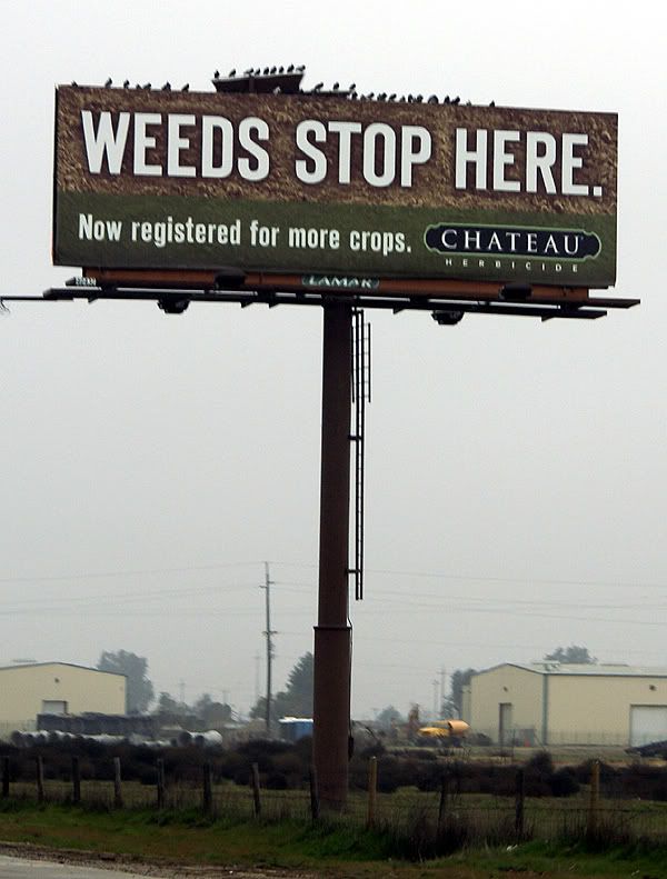 down sometime between New Year's day and the first day I have to go back to work. That didn't happen this year, mainly because of timing. My daughter went back to school this weekend. I drove her up to Stockton on Friday and then drove back home on Saturday. The drive and the lack of sleep because I was sleeping in a different environment took its toll and I ended up watching much of the Eagles win over the Vikings through the inside of my eyelids today. I woke up just when Donovan McNabb threw a nifty little screen pas to Brian Westbrook who took it 70+ yards for the deciding touchdown. So the tree didn't get taken down.
The road trip was rather uneventful. I drove, mainly because there was Tule fog in the big valley. It wasn't noteworthy or dangerous, and my daughter could have driven, but I like to drive. The last couple of hours she ended up napping in the car. What I really should have done was let her drive the middle two hours. But that didn't happen, so I was tired when we got to Stockton. She was actually amazed that I didn't stop even once to geocache. I figured since I was coming back down by myself, that I would get some caching in at that time, which is what happened.
On the drive up, I started looking at all the billboards at the side of the highway. Most of the time, I usually just tune them out, preferring to look at other things, abut there was something about this billboard that stated in no uncertain terms that "FOG KILLS" peaked my interest and I started looking at the billboards with a little more interest, at least for this trip.
America seems to have a seemingly unboundless interest in food. There were more billboards advertising restaurants than I could probably count, most of which were of the 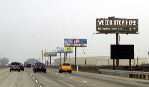 fast food variety. It makes sense to post those along the freeway. It seems like when we're driving, we always seem to be looking for a caffeine stop or a burger place to eat lunch. Have you ever noticed how many Starbucks stores there are? The joke in the movie Shrek II where one Farbucks store gets destroyed, so all the patrons run across the street to another Farbucks store seems rather appropriate. Have you also noticed when you're actually looking for a Starbucks store that you never can seem to find one? Driving down the road at 70+ mph, it becomes more difficult sometimes to determine if there is a place like that at this particular off ramp or not. So it seems that billboards indicating where a particular food product is located, or what exit to take seems to be an appropriate message.
What seems less so, is the billboards that have websites attached to them. What was the designer of that advertisement thinking when they decided to put the website of their company on a billboard knowing that almost everyone that sees it will be driving by so quickly that the entire sign is almost a blur anyway? "Oh look Martha, there's a website address on that billboard!!! We should look it up right now and see what great information it has for us!" I can't even imagine a conversation like that ever happening, but there were several billboards that had the website addresses on them for everyone traveling on Highway 99 in the central valley of California.
Now there were just as many billboards that didn't have websites posted on them, some of which are pictured here. I actually think what got this whole thing started was the Weeds Stop Here billboard. My daughter mentioned something about posting a billboard about Marijuana along a highway as being possibly inappropriate, but then she realized that it was about stopping weeds in farm crops. I'm not sure why, but I particularly liked the Apple Annies signs, plus the FOG KILLS signs. Those just stuck out in my mind as we drove along the freeway.
Just for fun, I started looking at some of the billboards and then asked my daughter to write down some of the websites for later. One of the first catch phrases I noticed, besides the FOG KILLS was one by the California Farm Water Coalition. They 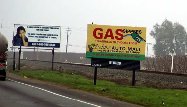 want the world to know that Food Grows Where Water Flows. I wonder who they paid and how much to someone to come up with that statement. Looking at their website, it's apparent they want everyone to be aware of possible water shortages in our state and how those shortages could affect food production in California. It even has a kids section complete with cartoons featuring Gigi Grapes, Kari Carrot, Callie Cotton and Randy Rice, not to mention Tommy Tomato and Jack Cheese.
Besides telling us all that FOG KILLS, the FOGUniversity billboards also had a website to get more information about fog. The site is still under construction so there's not really a whole lot of information there except links to places such as CalTrans and the California Highway Patrol. There is a media link that has a short video about driving in the fog. Once again, Father knows best and is driving too fast, much to the chagrin of his child who warns him that he's driving too fast. It ends with an implied collision caused because of excess speed and fog. Now if he'd just listened to his kid in the first place. Tule fog is a very dangerous thing in the central valley of California and according to Wikipedia it is the major cause of weather related accidents in California so I'm not trying to make light of this as much as I am trying to understand why an organization would go to the trouble of putting up a website and then say, "Oh come back, we're not ready for you yet." I think it would make more sense to get the website up and running, then post the information on the billboards.
Another catch phrase that had me wanting to know more about it was the Check before you Burn billboards that were placed by 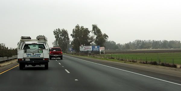 the San Joaquin Valley Air Pollution Control District. It makes sense after looking at their websites what they were talking about since the San Joaquin Valley is a major agricultural area and there is a lot of burning that takes place after crops are harvested. I just found it a rather interesting message when first viewed.
Several other billboards that contained website addresses catered to our stomachs or our palates. Cacciatorre Fine Wines has an interesting website. It has two buttons on its splash page, one for those of us who are over 21 and one for the younger set. I checked both out. The over 21 set get to go right to the main page of the website, while the younger set get directed to Disney.com. I'm wondering if Cacciatore Wines gets a kickback from Disney for this arrangement?
The second billboard that I noticed a website on that was strictly food related was the Valley Pistachio Country Store. It has a nice looking website with a variety of information about what the country store sells. It also has a Recipe of the Month section, although that appears to have just started around the holidays since there is only two recipes and both require the use of cranberries either to make Cranberry Pistachio Biscotti or Pistachio Cranberry bark.
The last two billboards that I noticed website addresses on were the Three Crowns billboard and the Pixley RV Resort billboard. I have to admit when I was reading these websites to my daughter, I knew what most of them would be, but I wasn't sure about Three 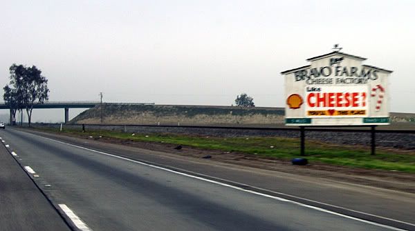 Crowns. It turns out that it's for an industrial complex located in Fresno, California. I wonder if 37 cents per square foot is a good rental price or not. The Pixley RV Resort is a recreational vehicle spot for travelers looking for a good place to park their RV for the night. Cost $29 per night, but there's a 10% discount if you come as a group and take at least 5 spots. I didn't notice how prominent the phone number was on the billboard, but in my mind, that would have made more sense to have in big numbers as opposed to the website address.
I guess the question I have for all these places is why. I realize that with all of our technology today websites are pretty much ubiquitous and a company that doesn't have a website is probably in the dark ages, but why post a website on a billboard? WiFi probably doesn't exist along the entire corridor however California does offer free WiFi at all of their rest stops. If the driver doesn't have a partner, it makes it unsafe for them to grab a pen and write down the website or even look it up on their Blackberry unless they pull over and that probably isn't the safest thing to do either along our highways as the shoulders of the road 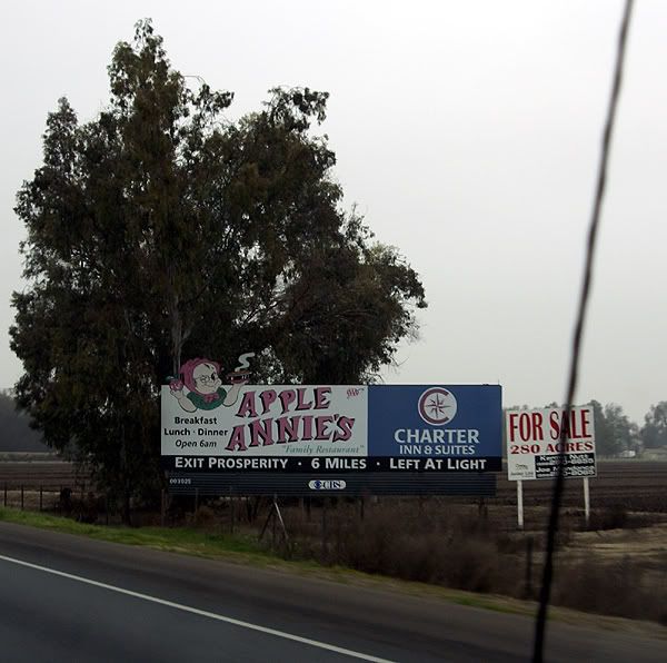 aren't always the widest.
The logical explanation to all of this is the billboards are generic, designed for areas where people can stop and write down the website addresses. It's probably cheaper overall to make one set of billboards as opposed to two different ones, one for city areas and one for highways corridors. I'm not sure if this is a good thing or not, but I can visualize in the future where cars will have receivers to grab information off of billboards. Drivers will just have to push a button on their steering wheel and the car will automatically download the website address from the billboard. At the next rest stop, the driver will be able to plug his or her computer or Blackberry into the car's USB port and upload the information. Hmmmmm. I wonder if I can market this and make my first million in the next ten years?
Pictures were taken by my daughter along Highway 99 between Bakersfield, California and Stockton, California.


