Wednesday, April 30, 2008

A personal bug

When I first started caching, travel bugs didn’t even exist, but they were in the making. I remember thinking that they were a good idea at the time and ordered four of them right away when they came out. At that point in time, I didn’t know what I wanted to do with them, but decided that one of them would be my personal bug that I would take with me to every cache. I would virtually log it into each cache so I could keep track of mileage for myself when I was caching. It was also nice because it has every log that I’ve written for each and every cache that I’ve found. I’d copy and paste the log I’d write for the cache and then paste it into my retrieval log for the travel bug. I decided to call the travel bug, A Walk With Webfoot, not particularly because I walked to every cache, most I did drive to, but I wanted it to convey the message that geocaching was a walking activity, that you should get out and enjoy the outdoors.

If you clicked on the link above, you probably noticed that the travel bug page takes an incredibly long time to load. I started noticing this several months ago. I even wrote emails to friends asking them to check it out and they all agreed that it was loading slowly. It seemed like all other pages at GC.com loaded quickly, with the exception of that particular page, so it seemed like I couldn’t even blame the hamsters that were running the servers at GC.com.

I have a system worked around, so I never have to worry about how long the page takes to load when I’m logging caches. When I log a cache, I click on the “Log your find” link, then use another tab to then click on the Walk With Webfoot page. While I’m writing my cache log, the Walk With Webfoot page loads. It’s loaded by the time I’ve finished writing the cache log and clicked the submit button, so then I just toggle to the travel bug page and then retrieve the travel bug from the cache page and repeat the process for the caches. It hasn’t been a problem thus far, but I wanted to know from the Powers that Be at GC.com what was up and why it was taking so long for that particular page to load, so I sent a trouble ticket to Groundspeak.

A couple of weeks passed and I’d long since forgotten about the trouble ticket when I got a response from Groundspeak.

“Trackable pages were never intended to be used as personal log pages. Because it is being used in a manner for which it was not designed, it will take longer and longer to load, the more content it takes on. There may be others with more entries, but yours is one of the largest for total data size.

Eric
Groundspeak, Inc.”

Is this his polite way of saying I’m verbose?

But then, I started thinking to myself, wait a minute. This is a travel bug. It's designed to travel from cache to cache, having cachers find it and write on the page about it. Groundspeak has on one of their pages the following information about travel bugs. “A Travel Bug is a trackable item that moves from place to place, picking up stories along the way. Here you can add your own story, or live vicariously through each bug's adventures.” So why is a personal log page different than a regular travel bug? If a travel bug ended up in a cache and then was taken by the next cacher who then wrote a story about it and then dropped it in another cache and it happened again and again, wouldn’t that cause that particular bug’s page to load more slowly? Of course it would. So I guess the next question is, did Groundspeak not anticipate travel bugs having lots of entries, or were they just expecting travel bugs to disappear quickly?

Now, I know most people will read this and say, “but your page has a lot more entries.” Yes it does, but if it’s a travel bug, shouldn’t Groundspeak have anticipated a travel bug possibly having a lot of entries? I mean, isn’t that what they were supposed to do, travel from place to place, picking up stories? It’s a puzzlement, that’s for sure and it’s just been on my mind recently.

I’m planning on retiring A Walk With Webfoot when I get to 2000 cache finds. I have a geocoin all picked out to continue my caching trek. Until then, I’ll continue to use my logging method described above.

All pictures have been main pictures from A Walk With Webfoot at different points in time.

Profile for Webfoot

Sunday, April 27, 2008

To Dash or not to Dash...

That is the question. I’m in one of those dilemma modes where I think I’m going to enjoy GeoDashing, but not sure whether I want to start doing something else. The more I look at the game, the more it intrigues me. It’s very similar to GeoVexilla, in that you need to get to within 100 meters of a particular point. There’s no flag, just a spot on the map, but it’s competitive, with monthly competitions. You can join teams, or you can just have fun going it alone.

This Saturday, the Tadpole and I captured some flags, four actually. We’d made the conscious decision to get an El Salvador flag in Camarillo, where my friend Chaosmanor lives. We though we’d hook up with him and do some caching after capturing that flag. Well, earlier this week, a bunch of new flags popped up on the map, so we ended up getting a couple of other flags on our way there, one in Pasadena, and one in Sunland. I thought I’d check the map one more time Saturday morning, just in case and sure enough, another one had popped up in Oxnard, only 10 miles beyond the one in Camarillo. All were easy to get, requiring no hiking, outside of the 200 feet hike we had to do in an alleyway in Pasadena.

Anyway, to make a long story short, after we got the flags, we did a very nice loop of caches in a very nice area of Camarillo called the Spanish Hills. All of the caches, for obvious reasons, have Spanish Hills in the name. We initially ended up finding four of five. At the last cache, we noticed a couple getting into a truck just as we were pulling up, so after finding that fourth cache, we decided to go back and see if they were geocachers heading the opposite way we were. We hadn’t been able to find Spanish Hills Overlook, so we thought if we hooked up with other geocachers, we might be able to succeed. We caught up with RonFisk and EeeBee and discovered that they’d already found the Overlook. They supplied us with a small hint that helped us in eventually finding it. It was a tough hide, but I was using some preconceived ideas while searching which is why we both missed it the first time.

It was then on to lunch at the local In-N-Out, and then we took a chance and drove over the Chaosmanor’s place in the hopes that he might be there, which he was. We talked geocaching shop while he ate lunch, then went out caching. Sometime during the afternoon, we also did a lot of talking about GeoDashing. I actually think it might have been during lunch, but that’s beside the point. I’d known about Dashing for quite awhile, actually seeing Chaosmanor get a dashpoint when he hid this cache over three years ago. I couldn’t quite grasp the concept at that time, but I’m now seeing the allure of it along with the other GPS games on the site. It’s something else to do while you’re geocaching.

With GeoDashing, you make your way to prescribed points during a month. If you get within 100 meters of the point, you score points for yourself, and if you’re on a team, you also score points for your team. If you’re the first person to the dashpoint, you score three points. If you’re second you score two and all subsequent finders of the dashpoint score one point. There can be up to five people on a team.

I’ve looked at teams and I’m not sure if I want to become that involved in it yet. My thought process on this is to do some “freestyle” dashing for a couple of months to get my feet wet and then find a team to join. Plus, if I decide that I don't like GeoDashing, then I won't have let a team down by joining it and then not contributing to the team effort. I’ve already noticed that there’s a four person team in my immediate area that I could join. That might be interesting, or I could start a new team too.

I’ve looked at the game for April, thinking that I might start there by getting a dashpoint or two this month in the last four days, but there’s nothing really close to my area that I could reasonably get. However, in May, I’m taking a road trip to Stockton and there are several that I could get next month. Three are close to my local area, and there are several that I could get in the central valley while on my trip. Needless to say, I probably need a new obsession like this like I need a hole in the head. But it’s not like I’m adding something else that’s going to require a lot of time, rather I’m adding another layer to something I’m already doing. Yep, and Denial is just a big river in Egypt too.

The first two photos are from GeoVexilla Flag captures - Singapore and El Salvador. The last two pictures were taken near Spanish Hills Paradise - by Boofers

Profile for Webfoot

Thursday, April 24, 2008

I Gotta Ticket to the Moon

In the past, I’ve bemoaned the death of the locationless cache. Well, maybe bemoan isn’t quite the correct term, but I definitely liked the locationless cache because they made me aware of the environment that I was in at the moment. I would keep a list of 10 to 12 locationless caches in my head, so if I spotted something, I’d be able to log it, as an extra bonus cache when I was out and about doing my normal routine. The one problem with locationless caches was the fact that only one person could log any one of a particular group. When I found the national flag locationless, I actually did two different flags in case the first one, had already been taken by someone else. The first flag, a gigantic banner outside the Oasis Casino in Mequite, NV hadn’t been logged, so I got credit for the US Flag locationless cache.

Since locationless caches have all been archived at GC.com, the substitute for them is Waymarking. The title of the Waymarking webpage, calls it a scavenger hunt for unique and interesting locations in the world. It works a little bit differently than the old locationless, mainly because anyone can find a waymark, once someone had created one in the first place. There are multiple categories from which to choose and just about anything could qualify as a waymark. As a friend of mine once noted, “eventually everything in the world will be a waymark and then what will we do?” I think that’s going to take a long time to accomplish, so I guess we’ll just have to plug along until that happens.

The premise behind waymarking is that someone finds something interesting out there and posts the coordinates on the Waymarking website with a brief description of it. Once the waymark is approved (I’m an approver for the Water tower category), then anyone else can visit it. I guess I view it not so much as a scavenger hunt, but a way to see where some interesting places might be where you’re going to travel in the future. If you happen to like fountains, there’s a waymark category for fountains. You can search find a given area, and do a search for fountain waymarks in that particular area. I’ve found that going to the waymark site can sometimes be a little daunting, so I actually go to the Geocaching site and do my search from there.

Since I know I’m going to be geocaching, I can look at some of the caches that I’m probably going to be hunting and do a search from the cache page for the nearest waymarks. Once again, I keep a running list in my head of 10 to 12 waymarks that I’m interested in so if I see something in one of my categories, I can plan a “visit” to that particular waymark. If I don’t, I don’t sweat it, but I’m still on the lookout, because some points of interest may not have been waymarked and so I could possibly be the first to post that particular one.

That’s what I plan to do this summer on our camping trip. We're going to be camping near Point Reyes National Seashore and Redwoods National Park this summer. It will be the first time that the Tadpole will have seen coast redwoods in their natural setting. One of the waymarks that I follow is the Moon Trees category. Moon trees are trees that were germinated from seeds that were taken in astronaut Stuart Roosa’s personal kit as part of an experiment between NASA and the United States Forest Service. The seeds orbited the moon with Roosa in the command module of Apollo 14. When the seeds were brought back to earth, they were germinated by the Forest Service and then distributed around the country as part of the bicentennial celebration in 1975 and 1976. Three coast redwood trees (Moon trees) are growing on the campus of Humboldt State University in Northern California. What’s interesting to me about this is those trees were probably planted about two years before I started attending the university. My memory is hazy at best, but I seem to recall some sapling redwood trees on campus and a plaque, but nothing more. This summer, we’ll explore the area in more detail and make a waymark of those three trees since none exists at this time.

As far as other waymarks go, the only one that I’ll probably go out of my way to create would be the water tower category, since I am an officer of the water towers management. Since most water towers kind of stand out from their surroundings, it’s a perfect fit when you’re driving on the road. Spot a water tower, get off the freeway, mark the water tower’s coordinates in your GPSr, take some pictures, then, find some caches in the general area. Some of the other categories, you either have to know they’re there ahead of time like Presidential Birthplaces, or you just stumble upon them, like Sundials or Post Offices. Either way, I’ll keep my list small and hope that from time to time, I’ll stumble across something that fits one of my favorite waymark categories. Or, I might actively seek one out like I plan to do this summer.

Pictures were taken at the following waymarks or locationless caches:
US FLAG - by Saundersboys
Lincoln Village Maintenance District Water Tower - by Webfoot
Richard Nixon Library Fountain, Yorba Linda, CA - by BackPak
Richard M. Nixon Birthplace - by showbizkid
Larkin Memorial Sundial - by Webfoot


Saturday, April 19, 2008

Oddities

Every now and then, I encounter things while caching that defy an explanation. It’s either something that is really out of place, or I can’t get a handle on why it’s there in the first place, or it’s just something that seems really different. I’m used to the occasional rusted out car that can be found in a ravine somewhere. Those seem to be rather ubiquitous and not nearly as surprising as they should be if you considered how they got the car up there in the first place to then push it over the side and down into the ravine. Nor am I talking about the odd dinosaur or giant spider that sometimes can be found near cache hides. With names like Dinosaur Droppings, Arachnophobia, or Out of Africa, you’d probably expect something like that at those caches. What I’m talking about are those things that just make you scratch your head and think, Huh?

Like the time we were caching in the hills overlooking Whittier. It had been a good day of caching, with a nice hike involved. This particular cache we were headed towards was on top of a small hill. As we continued up to get this cache, we came upon one of those enclosures that the electric company seems to have on various hills around here, or perhaps it was the water company or a cell phone tower this time. No matter, the enclosure was in our way, so half our party went one way around it and the other half of the party went the other way, and encountered the bathtub – filled with water.

At first, you just stand and stare trying to comprehend what you’re seeing. Sometimes it’s hard, other times it’s not. Now since this was May and we hadn’t had any kind of substantial rain in a good long while, it was kind of odd to see the tub filled with water, until, upon closer inspection, we noticed that it had a spigot that was keeping it filled. The only thing we can think of was that someone had hauled a bathtub up here and was using it as a modified horse trough. Still, I can honestly say that I’ve only encountered a tub one other time while caching and I was actually expecting that one.

My daughter goes to school in the big valley of central California and I’ve had numerous chances to drive up there, either taking her for visits when we were first looking at colleges, or visiting her, now that she’s firmly ensconced up there. It goes without saying that I get my fair share of caching in on the drive up and back. One cache outside of Visalia, California called The Muirman had me intrigued. I could never figure out how to get to the cache, because by the time I was near the cache, it seemed like I was already by the cache. I think it was the third time that I knew I was going to be heading by this cache, I decided to look at a Google map closely to see if I could figure out how to get there. The cache page even gives it a difficulty of 2 for figuring out how to get there. Once there, I wasn’t sure what to expect, but I was still blown away. It’s not really odd, just different, something that you would normally expect to be up on the northern coast of California as opposed to in the central valley, even if it is close to the giant Sequoia forests.

Several times I’ve cached in Griffith Park in Los Angeles. There are an abundant amount of caches here in the park. The park has quite a few scenic overlooks with strategically placed benches that afford a good view of the city, probably even more beautiful at night with all the twinkling city lights below. When we got to one particular cache, we found a bench, that didn’t have that same kind of knockout view as most of the others. Why the park hadn’t cleared the bushes and trees away, is beyond me, but there was several yeas of growth accumulated in front of that bench. It made for quite a sight gag to say the least.

Today, the Tadpole and I went caching in a nice park in Riverside. While walking alongside the lake in the park, we came across, what I initially thought were willow trees along the bank, although they didn’t look quite right, not having the right kind of droopiness to their branches. But what were these trees? After closer inspection, I realized that I was looking at a row of coast redwood trees. Obviously, these hadn’t started here and they looked very odd, not the typical type of coast redwood you would normally expect, with the tall slender trunk and symmetrical branches. The only explanation I have for the strange shapes of these trees would be that they were over watered. I know that sounds strange, since they naturally live in a temperate rain forest, but these trees were right on the bank of the lake, not where you’d normally find them in their natural setting. It’s the only thing I can think of to explain it.

It's those strange things that you encounter from time to time that make up life stories, things that you can tell your friends about. Some of them are funny, some can be downright weird, and some are just plain interesting. And if I find other oddities in the future, I’ll probably get a chuckle out of it, or one of those huh? moments and then it will either dawn on me, or I’ll remain clueless. Knowing me, it will probably be the latter.

Pictures were taken at or near the following geocaches:

OUT OF AFRICA - by RANTAN & NineSix
Sunset at 17-A REVIVED - by The Cable Car Clan
The Muirman - by redwoodcanoe
Debs Park - by GPSKitty
Water Buffalo - by Bigmouth

Profile for Webfoot

Tuesday, April 15, 2008

Foxtails, Foothills and Flora

Most of my articles seem to be inspired by the pictures in my gallery, and this one is no exception. Earlier, I posted about animals that I’ve encountered while hiking and caching. I guess it’s about time I wrote about the plant side of hiking as well. Animals get more notice, because outside of the bu
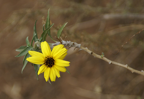
g world, they’re not nearly as plentiful as the plant world, and yet the beauty of the plant world is amazing when you stop and take a look.

Many times a hike becomes more than a hike, just by that little bit of accent color of a wildflower by the side of the trail. A dandelion, while viewed as a weed in our back yard, is an unexpected bonus while out on a hike. Other times, it’s the magnificence of a Giant Sequoia that you’ve encountered, either where it’s supposed to be, or more curiously, where it’s not supposed to be. Now I don’t claim to be a botanist, no do I play one on TV or anywhere else, but a little plant knowledge can usually enhance a hike and make it more enjoyable.

Even if you are not into plants, it’s usually wise to know a few of the ones that can cause problems, particularly, those nasty “leaves of three” varieties that can cause all kinds of skin problems. I cannot tell you how many times I’ve encountered poison oak while hiking and searching for caches. I can tell you how many times 
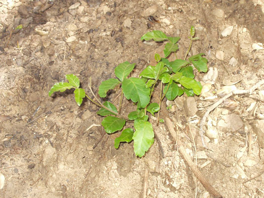
I’ve broken out because of an encounter with poison oak – exactly one time and it happened in the fall after the leaves had fallen off the plant. Yep, even the stems can cause problems. For the most part though, poison oak is one of those minor annoyances that you encounter when you’re hiking that can easily be avoided once you’ve educated yourself on what it looks like.

I would be remiss, if I didn’t mention one other annoyance that I don’t enjoy while hiking and that is foxtails. I have a cache dedicated partially to foxtails and I’ve had friends of mine threaten to name caches after my least favorite flora. Some people in Southern California even know about my running commentary in my cache logs when I encounter foxtails while going for a cache. It’s really become something of a standard joke. “Have I ever mentioned how much I hate foxtails?” But even foxtails can sometimes hide those little wildflower gems that might go unnoticed.

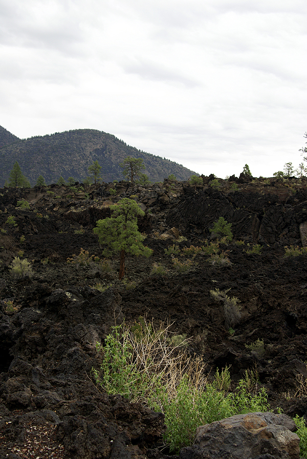
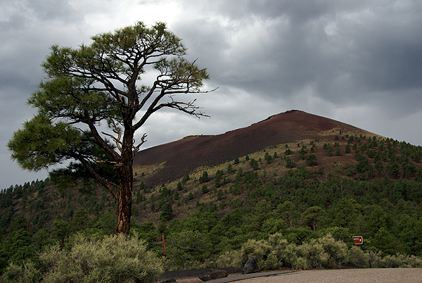
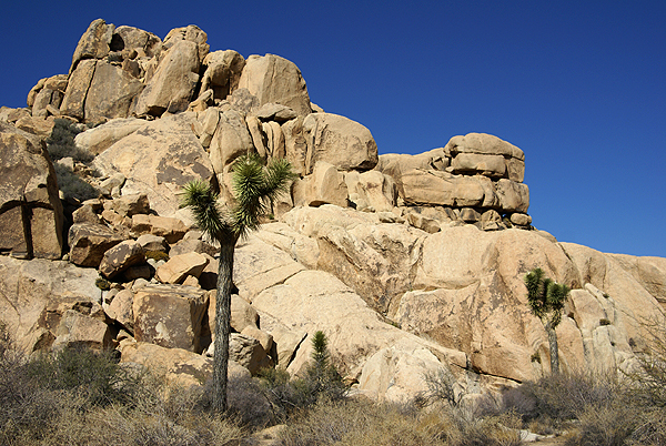
But enough of that. I think those little surprises, a wildflower at the side of the trail, a plant, growing where you wouldn’t expect it to be growing, are a few of the reasons why I enjoy hiking to find caches. I view the hike as part of the experience, not just a trip from point A to point B with nothing in between to enjoy except the found cache at point B. No, rather, the slow walk through the woods will bring all sorts of enjoyment, from the tiny sprout of a pine tree just starting its life, to the dead snag that houses an azalea bush up in its crown and after it falls, will nourish other plants that will start the forest anew.

I can attest that while hearing and seeing a coast redwood fall while out on a cache hike was a sad experience, it was also an experience that I wouldn’t have wanted to miss. Since we heard it, the definitive answer whether a tree makes a sound when it falls if no one is there goes unanswered. However, a tree makes an awful racket when it’s plummeting to the ground, and after it hits, it seems the entire forest holds its collective breath for the briefest of moments, and then the natural sounds of the forest begin again.
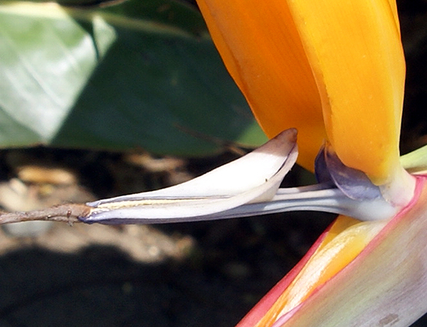
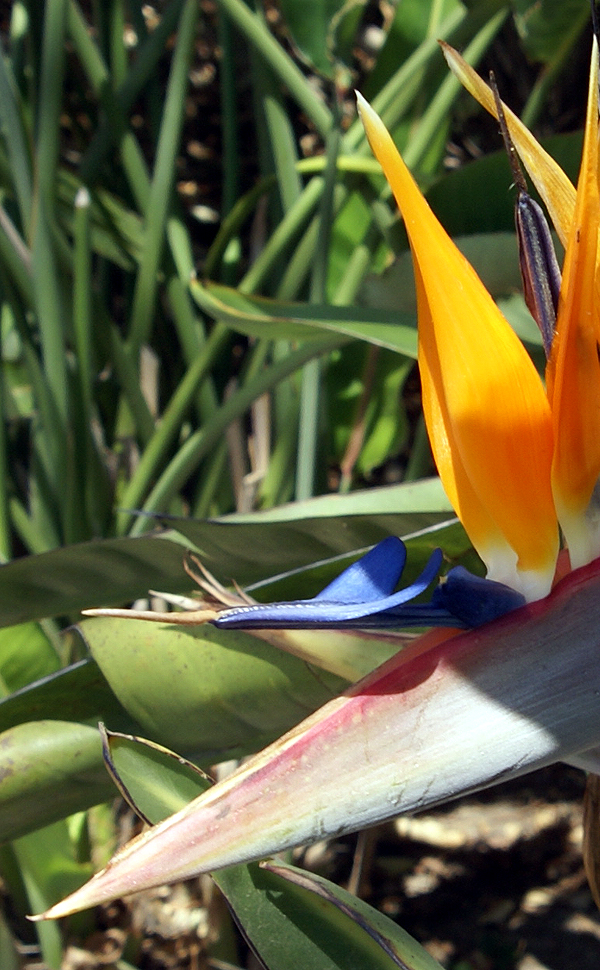
And yet, most people, if asked to color a forest, would probably color it a dull green color. With the different wildflowers that grow in the forest, or meadowland, it is definitely not all green. I’ve seen riots of purple and orange, with sprinkles of red and yellow many times. But mostly, the colors are subtle, announcing themselves to the pollinators saying, “Here I am, come and get it.” The subtlety of the colors makes the experience enriched, in my opinion. You have to look for them, discovering how the veins of a leaf intersect, how the colors of an iris blend together in different shades of purple. Looking at that creek bank, you see a hint of brownish orange and only upon closer inspection do you realize that you’re looking at a multitude of tiger lily blossoms.

And once again, it’s because of geocaching that I have these memories. I fully admit, I wouldn’t hike along the trails in the foothills behind my house. I had no interest. I basically thought that there wouldn’t be anything of interest, instead preferring the grandeur of places like Yosemite or Yellowstone. Over the course of the last seven years, I
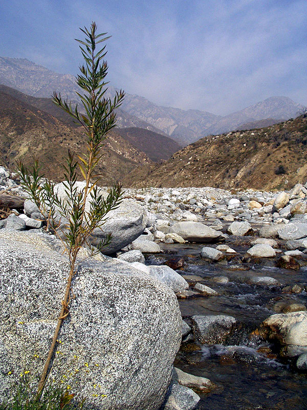
’ve come to appreciate the natural beauty that can be found in my own backyard. I no longer need to travel hundreds of miles to find nature at its best. I’ve also decided that I want to share these little hidden gems with others as well, by hiding caches up in the foothills near my house so that others can seek the beauty to be found here at home. And the beauty of their hike is that it will be different than mine. The seasons will change, the colors will change and then it will renew again, a little bit differently each year.

I believe that cachers, on a whole, are nature lovers, wanting to enjoy those unknown pockets of wonderment, to take the road less traveled and enjoy the walk as opposed to the number. It’s the local cachers who make it all happen. They know the area. They know where the trails are and what lies down that hidden path. If those local cachers continue to share their knowledge of their area with the larger caching community, through their hides, we will all be better for it.

Pictures were taken at or near the following geocaches:

Oak Trail - by Lab Rat
Hermosa Falls - by Team Chloe
CV Trail #3 - by BrianK124 & Tomahawk chop shop
Mountain's Majesty
- by Mandy's Mom
Cucamonga Creek
- by Team CEREO

Profile for Webfoot

Saturday, April 12, 2008

A day with my son

One of my friends said to me via email this week, “They say that there is nothing so dangerous as a new convert” in regard to my sudden interest in capturing virtual flags. This might be true, as I tend to get kind of obsessive about things that I really like. But then again, I think many people do the same thing. I took the Tadpole out today to capture some flags and find some caches, trying to get him out of the house on a gorgeous day. Our high today here hit 93°. At least that’s what it said on my backyard thermometer this afternoon. I’m sure it was hotter in other places. After reading about weather in other parts of the country, I'll take it.

Anyway, I finally convinced the Tadpole that I needed a navigator to help me out with all the twists and turns in the streets I would be driving today. Somewhere in the conversation, In-n-Out was also mentioned and he readily said yes. Our goal today was to capture five flags in our local area and find 10 caches, a two for one ratio. It looked doable at the time. Well we all know how that goes.

I was seriously thinking about writing a blow by blow description of the day’s happenings, but then decided that it might be too over the top for some. I might be becoming too dangerous for my own good. And I really can’t say why GeoVexilla intrigues me so; it just does. Suffice to say, we didn’t hit our quota, finding only two flags (Haiti and Dominica) and striking out on two others due to private property issues, but that's the way the game plays out sometimes. We also found four caches and had a great time together just enjoying each other’s company while we spent some time using billion dollar satellites to hunt for small hidden things. We’ve already decided where we’re going next weekend for some more caching, so all is good in life at this point in time. He’s getting out of the house into the fresh air and so am I which is the important thing.

After logging all of our caches and flags, I decided to play around a little bit with one of the pictures I took today. With our two flag captures, we were incredibly fortunate to actually zero out on the virtual flag in both instances. One was actually out in the street, so when there weren’t any cars coming, we quickly walked out to ground zero and then walked back, but the other one was in a parking lot of an industrial complex, so we were able to get some pictures. I decided to take a picture of my son at ground zero and then later got a copy of the flag of Dominica that we “captured” there and created the image that’s here now. Just a little bit of whimsy to round out our day together.

Profile for Webfoot

Wednesday, April 9, 2008

Virtuals Reborn?

When I first started caching back in March 2001, caching was still new. President Clinton’s executive order de-scrambling the satellite signals so that the average person walking around on the planet could utilize the GPS technology was less than a year old. Caches were few and far between and there weren’t as many regulations regarding caches, probably because not everything had been thought out yet.

The sport is still evolving today. I remember looking at the website, even before I’d purchased my first GPS unit and marveling that there was actually a physical cache hidden in Yosemite Valley. I thought at the time, “Wow, that’s kind of cool that they would allow someone to place a cache right there near the chapel in the valley.” In actuality, they really hadn’t given permission and the cache, I believe, was removed by the National Park Service, as “abandoned property.” I know that there are a couple of physical caches still in existence in National Park areas, most notably, the one down at the bottom of Grand Canyon, but that is maintained by the Park Service. As of this writing, permission hasn’t been granted to hide any in national parks, nor probably won’t be in the foreseeable future.

And that’s not necessarily a bad thing, more likely, just the way things have worked out over the past 8 years that the sport of geocaching has been around. I think physical caches in national parks would become problematic no matter how well they were maintained by the owners. I found a Pop-Tart in one of my geocaches once. Imagine what would happen if an uniformed cacher placed a small granola bar in a cache that had been placed in a national park where bears frequented, or any animals for that matter. Animals would be attracted to that cache like honey to a hive. In all likelihood, the cache would probably be destroyed and if the animals became a problem, they could as well.

Within the past year or two, we’ve seen the development of a new kind of cache called an Earthcache. Earthcaches are places that people can visit usually to learn more about the geology of a particular area. In reality, what Earthcaches do is replace the Virtual Cache (which has been eliminated by Geocaching.com) in spots where physical caches can’t be placed, like national parks. Cachers learn about the geology of an area, do something for the cache “hider” to prove that they were there, and they get credit for finding an earthcache. Similar to virtuals, usually the requirement is to answer questions about the site, or posting a picture of you and your GPSr at the site.

My son enjoys going out and finding earthcaches. He stated one time that he likes the educational nature of an earthcache. “You get to learn something about the earth when we visit them Dad.” Needless to say, when we went on our tour of the pueblo areas near Flagstaff, AZ and the Grand Canyon area last summer, we found several earthcaches. One was a blow hole near some pueblos in Wupatki National Monument. The underground chambers reacted to the outside change in air pressure and actually blew out or sucked in air through a small hole in the ground. We actually missed a pretty spectacular display of this blow hole by about four hours or so. We’d visited the blowhole in the morning while we toured the area. There was a gentle breeze blowing out of the blowhole when we were there. When we got back to our campsite later than evening, we learned from other campers who had been there later in the day that a girl had been floating her Crocs on the column of air that was being forced out of the blowhole. That’s pretty impressive, even if you don’t particularly like Crocs.

The larger national parks within the United States have several Virtual caches placed in them that have been grandfathered into the geocaching system. The smaller or lesser known parks, never made the cut probably because they weren’t really visited by cachers before GC.com placed a moratorium on Virtual caches. What has happened is Earthcaches have now filled the missing niche in some of these areas. When I first investigated the area northeast of Flagstaff as a camping spot for last summer, I looked and saw a multitude of earthcaches. I figured we’d get a couple of them and move on. I was surprised, although I shouldn’t have been, knowing my son, that we found all of them in that area once everything was said and done. He loved the concept of an earthcache and wants to find more of them in the future. Who knows? Perhaps on our next camping trip, we’ll find a geological area and create our own earthcache.

Pictures are from the following caches:
Bonito Lava Flow - by TerryDad2
Cinder Hills Overlook - by TerryDad2
Wupatki Pueblo Blowhole - by TerryDad2
Walnut Canyon Geologic Sampling - by TerryDad2
Joints of the Wonderland of Rocks - Joshua Tree NP - by TerryDad2

Profile for Webfoot

Saturday, April 5, 2008

Capture the Flag

The past two days have been a welcome change of scenery for me. Friday, I was able to get out again and hike up in the foothills. Not much mileage, less than a mile total, but I took along my new cache and hid it up there. I came back home, submitted the cache page and it was approved by the powers that be in less than fifteen minutes. That has to be a record for me. The Window of the Soul is now live. No one’s made a find yet on it, but that will come eventually.

Today, I went caching with my friend Chaosmanor from Camarillo which is out in Ventura County to the west of where I live. He was kind enough to come out this way and we went caching in my neck of the wood, picking up some stray caches here and there, getting a couple of those bugaboo caches off of my list that I had been having trouble finding by myself. We also played a new GPS game today (well, new for me anyway), called GeoVexilla. It’s basically a virtual “Capture the Flag” kind of game.

“GeoVexilla is a GPS game that uses the globe for a playing field. At random times, in random places, random virtual flags appear on a map of the world. The challenge is to visit a flag’s waypoint before the flag disappears. Each time you succeed, you collect that flag, increasing your score.” Any number of people can capture the flag, as each individual can score points for themselves. Every time you capture a flag, the website generates a set of flags that you need to complete. The first flag is worth 1 point, the next 2, the third 4, the fourth 8 and the fifth is worth 16 points. Each completed set can get you 31 points.

The first flag I captured today, the flag of Canada, happened to be in a residential neighborhood about 12 miles from my home. According to the rules, you have to be within 100 meters (328 feet) in order to claim a capture. According to the coordinates listed, the flag (remember that it’s virtual) was on the rooftop of a garage on this one street. One of the criteria for logging a capture is to provide enough detail to “prove” that I was there. This might include sights, sounds and perhaps even smells that cannot be learned from maps or aerial photos that you can readily find on sites such as Google maps. So I noted things like how many trees were in the front yard, what the front of the house looked like, etc.

After finding that first flag, chaosmanor and I started working our way back to my house by finding some caches. I found 11 caches today, including several excellently camouflaged containers, one being a very large ammo can that both of us looked at several times before realizing that it was a cache. It was sitting on the ground under a bush, but the person who hid it had done an excellent job of matching the texture of the camo with the type of bush it was next to. It was in plain site, yet very difficult to see.

We worked our way back beyond my house caching and then we decided to find another flag in the GeoVexilla game. This second flag, representing the Caymen Islands, was in Frank G. Bonelli Regional Park. When I looked to see approximately where it was using Google Maps, I realized that it was in an RV campground within the park. So we drove over there and got within 14 feet of the flag, thus capturing it as well.

So now, I am the proud owner of two virtual flags and have two points in the game. Why not three points since the second flag should be worth two points? Well, when I logged the Canada flag into the system, the set was generated and I ended up with Canada, Bermuda, Madagascar, Bangladesh and Bahamas in the first set. No Cayman Islands, so when I logged that one into the system under my account, a second set was generated with Cayman Islands, Cuba, Guernsey, Gambia and Syria. None of the other flags are near me at this point in time, but over the course of the next couple of weeks, flags will disappear and others will take their places in different areas near me, so I’ll need to monitor the site. I can see where this can easily become a new diversion for me.

There are other games that you can play using your GPSr at the GPS games site. They include Geo golf, Minute War, Geo Poker, Shutterspot and Geodashing. Check out the site. You might find something that just might click with you. Right now, I’m reliving my Boy Scout days of capturing the flag.

Profile for Webfoot

Wednesday, April 2, 2008

Camo the Ammo

Since I’ve been home this week, I’ve been working on the puzzle cache, The Window of the Soul. I thought I’d share with you my camouflage technique. Last week I went down to our local surplus store and picked up two ammo cans. The Grade 2 cans were a little bit too worn, so I took two Grade 1 cans for $7.97 each. One is an interesting orange color and the other one is the standard green that most of us have seen.

Last time I posted I was uncertain whether I was going to place this cache on the east or west side of the park. Since that time, the decision was semi-taken out of my hands by the placement of two caches, Where is the parking lot? and The kings Heart on the east side. I was originally planning on placing my final for the puzzle where this cache, "Call" of the Wild, used to be. If you click on the nearest caches, you’ll see that Where is the parking lot? is only 470 feet away from the original placement of the “Call” of the Wild cache, so I figured that for cache density sake, it would be prudent for me to place this new cache on the west side.

Today, I hiked up to scout possible locations for the cache. I’ve had one spot in mind for awhile and actually, it’s where I should have placed my Size Matters…..Especially in California cache. I had so many problems with muggles where Size Matters was placed, that if I’d placed it up here instead, it probably would still be with us today. Why I didn’t place it there is beyond me, but I probably had my reasons at the time. Anyway, the hike was fairly easy, considering that I’m still recuperating, but I found the perfect place for the cache, just off a fire road, yet secluded from muggles eyes and giving a 360 degree panoramic view of the hills and the city below. Today, I didn’t have any kind of view because the hillside was shrouded in fog. It was a different view, but beautiful in its own right.

After coming down the hill, I finished up the camouflage on the ammo can. Yesterday, I painted the ammo can a rusty color using primer paint. Much of the foothills in this area are this color rock, so it’s a good color with which to start. Fortunately, I have a very similar type of bush in my back yard that matches where the cache is going to be placed, so I picked three sprigs from the bush to use as cover on the ammo can. I laid the three springs on the side of the can, then did a quick spray through with both a flat green and then a flat black paint. This creates some break up in the main color of the can and will probably make it a little bit tougher to spot. My purpose is not to make it that much tougher for the cacher, but to make it tougher for muggles to spot it should they wander up in the area. I think if cachers don’t think that muggles will ever spot their cache, they are deluding themselves.

With the camouflage applied to the can, now all I have to do is gather some goodies together to place inside it while the paint dries. Depending upon how well I’m feeling after today’s hike, I may be able to place this cache tomorrow or Friday. Once placement has happened, all I’ll have to do then is send a reviewer note on the cache page and wait for our local reviewer to look at it and hopefully approve it.

Profile for Webfoot