After getting to Couer d'Alene, Idaho, we spent most of the day just resting. We'd literally been on the road for nine straight days and caching all of those days. I slept in a little, then spent the better part of the day just watching the water lap up on shore. 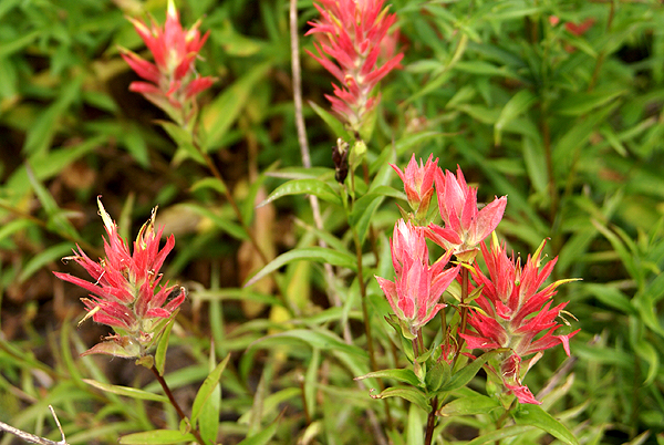 It was very peaceful. Then my dad's realtor came by with his boat wondering if the boys wanted to go boating. I came along and enjoyed the ride watching 11 pre-teen and teenagers get towed behind the boat for the rest of the afternoon. It was a relaxing day to say the least.
The next day, the Tadpole and I had decided that we wanted to do some caching along Interstate 90. We figured we'd spend most of the day, grabbing caches here and there and would eventually make our way into Montana, which would be our 5th and last state we would cache in on this trip. I had placed three caches inside Montana into the PQ I ran for the trip.
Just inside the border there were dueling rest areas on both side of the interstate, with caches hidden at each one, so those two made obvious choices. Since we were driving east, we had to get off the freeway and make our way to the westbound side, so the first exit into Montana past the rest areas, I noticed another cache, so I put that one in there as well.
The eastbound rest area, our first cache find in Montana ended up being the most enjoyable and also the most difficult find of the three we found in Big Sky Country. The rest area was a bit of a geographical curiosity for these two Southern California boys. 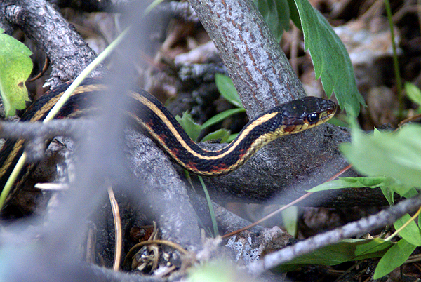 At first, I assumed that the state of Montana was just putting a lot of effort into their rest areas. The bathrooms were all single stalls found inside a common room area. The entire building was very nicely done with historical displays along the inner panel separating the men's side from the women's side. It wasn't until after we'd gotten home that I realized that this was built more because of the weather in the area as opposed to extra tax money being available. I would expect with lots of snow in an area, people would appreciate indoor areas to wait for a bathroom.
Eventually, we headed over the cache area. The cache was well hidden away from the main rest area along a service road. We didn't have to worry about muggles trying to figure out what we were doing. Behind the rest area we found a stream, with a multitude of plants and trees growing beside it. Wildflowers were blooming everywhere. I noticed Indian Paintbrush, Lupine and some sort of daisy alongside the service road.
We also spotted snakes. At least the Tadpole spotted snakes. I just spotted one garter snake, but it was a nice two footer who seemed to tolerate me getting close enough to get a decent picture of it. 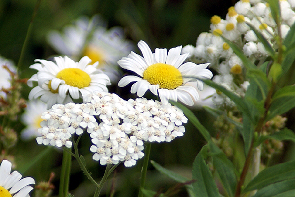 While I was stalking that one, the Tadpole spotted two others in an area he had been searching.
At first, I thought we might strike out on this one, but I've found with perseverance, we are usually successful. The key was taking my camera back to the van. I know I don't tend to search as vigorously when I have my camera strapped around my neck, so the act of putting it back in the car, I believe, liberated me enough that I wasn't as afraid to put my hand into bushes in search of the cache. In this case, it wasn't bushes that I needed to be parting, but rather rocks that needed to be moved. We had the cache in short order after that. Because of the scenic beauty of the area, I put this cache on my top five percent list. It was a worthy addition to the list.
Pictures were taken at or near the following geocache:
Rockhound - by RockhoundMT
Monday, August 31, 2009
Montana

Saturday, August 29, 2009
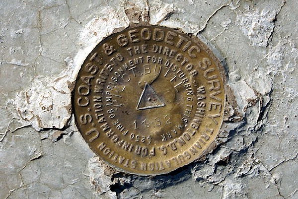
Benchmark Buttes
After leaving Crater Lake, we headed up to Bend, Oregon where we were planning on spending the night with friends of ours. A real mattress and a hot shower were looking really good after tent camping it for the past week. 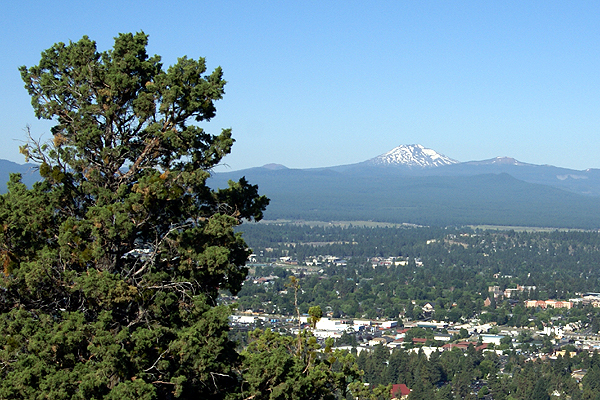 We cached at several places along Hwy 97 and got up to Bend around 5:00 in the afternoon.

Tuesday, August 25, 2009
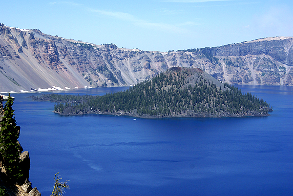
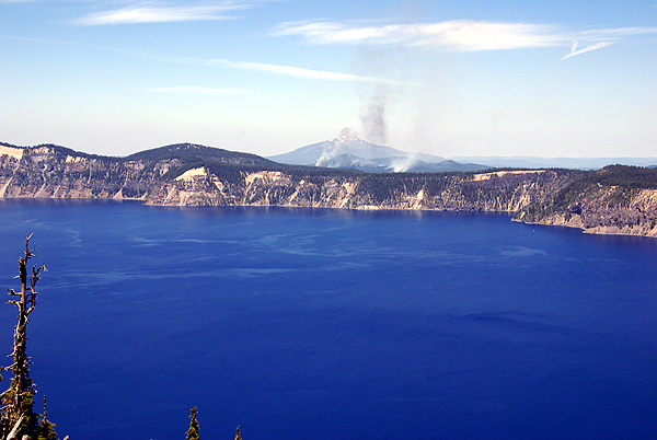
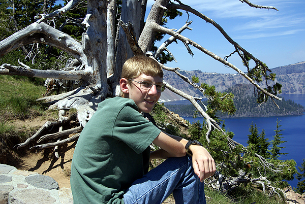
Crater Lake
It seems odd that I'm still writing about our camping trip almost a month later, but we ended up doing a variety of things on this trip 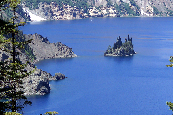 which kept us busy. Once we'd finished our camping trip at Redwoods National Park, we headed north to Idaho to meet up with my dad at my parent's place at Couer d'Alene. They've owned this cabin for over 20 years and it's a nice spot to relax, while watching the boats go by. We haven't been able to go up there much, mainly because it's a three day drive of at least 8 hours a day. That's a long time for a kid to be strapped into a car seat with not a whole lot to do except look out the window. So both of the boys got to experience Idaho for the first time and they loved it.
 thing about the drive. The Tadpole and I left Crescent City and headed north toward Bend, Oregon. There's a friend of mine in Bend who

Tuesday, August 18, 2009
Underground wonders
While camping in Redwoods National Park, we made a day trip into Oregon to tour Oregon Caves National Monument. 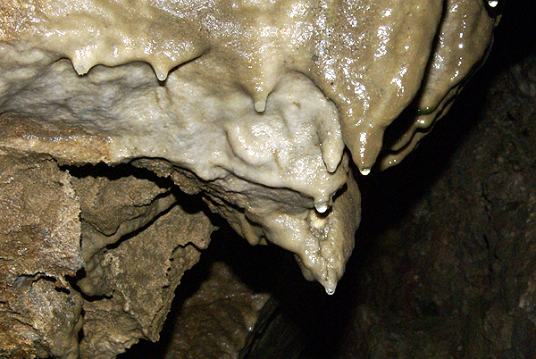 The caves here are some of the five percent of the caves around the world that are marble caves. Most are created from limestone. Those that are near major plate boundaries tend to be marble, because of added heat and pressure from below which metamorphoses the limestone into marble. Sequoia National Park has a marble cave tour that we've gone on several times and have enjoyed. This one would be no exception.
We were fortunate to get as our tour guide one of the park rangers whose specialty is geology, so we got a very informative tour. We got to experience a cave blackout, which is pretty standard on most cave tours, but it's always kind of creepy to experience that total darkness, where no light penetrates. I can't imagine getting lost in something like that, yet it seems that most of the early discoverers of caves seemed to have done just that: went in with minimal light, then had to grope their way out. I guess they all make good stories to tell on the tour.
When touring a cave, the number one rule is always, DON'T TOUCH THE FORMATIONS! I can't stress that enough. Oils from your hands can get on the formations, which will alter the water flow of the formations, usually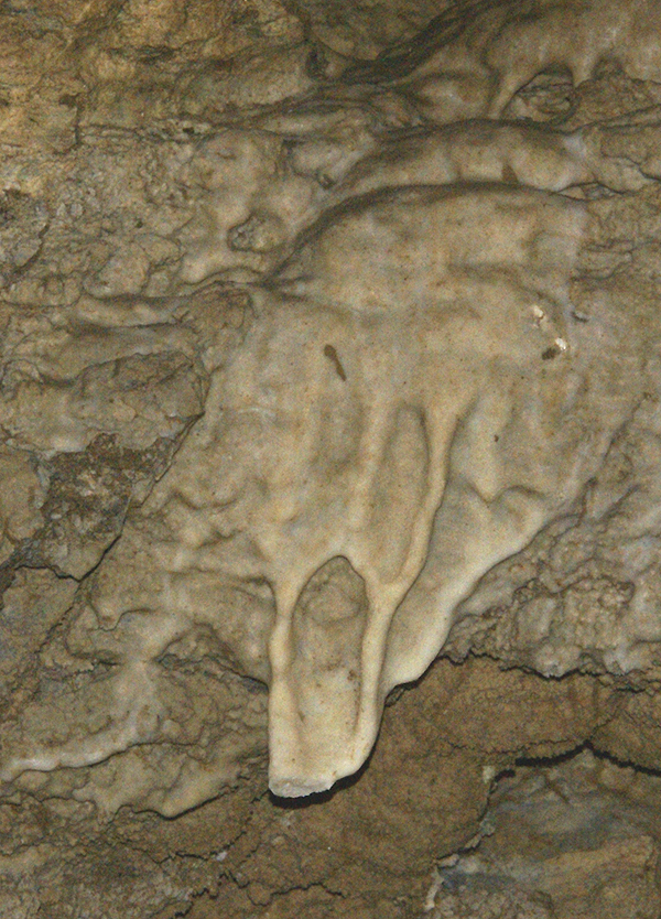 causing them to stop growing. I've toured several different caves during my lifetime, including Wind Cave in South Dakota, Carlsbad Caverns in New Mexico, Crystal Cave in California (Sequoia), Lehman Caves in Nevada, and now Oregon Caves. To a greater or lesser extent, all of these caves have had some damage from humans. It's pretty much inevitable.
I can't remember much of Wind Cave, since I was there almost 40 years ago. Carlsbad seemed to have the least, although it does have an elevator shaft built in it, complete with stalactites growing in the roof of the elevator shaft. The worst damage that I can recall was in Lehman Caves. This was primarily because the caves were an entrepreneurial adventure for Absalom Lehman back in the 1920s. He let people literally go into the caves with sledgehammers so they could leave the caves with souvenirs. The damage was pretty evident in those caves.
The human damage was much less here in Oregon Caves although it was evident. We came across a rock where past visitors, from the 1809s felt it necessary to write their names on the stone in pencil. We walked right by the rock formation. It seemed obvious to many of us on the tour, that if the graffiti had been written in pencil, it should be fairly easy to erase it. Not as easy as it was thought however, because the cave is still a growing cave the pencil marks have since been covered over by a thin patina of flowstone. In other words, the graffiti has become one with the rock. The only other damage I noticed was a formation that reminded me of a painting by Edvard Munch entitled, "The Scream." At the bottom of the scream, there appears to be a piece that has been broken off.
This particular cave has gotten me to think about creating an earthcache. I found a nice spot where geocachers can observe some different cave formations. In the next week or  so, depending upon my schedule, I'll be working to create this earthcache. I already have permission from the chief geologist of the park, so it's now just a matter of writing it all up and submitting it. That's the kicker though is finding the time.
The past week has seen me start back to school. We keep starting earlier and earlier. 14 years ago, my wife was pregnant with our third child, the Tadpole. His due date was September 12th, which was problematic at the time because that was my scheduled first day of school. Fortunately, I worried about this needlessly, because the Tadpole decided to make an entrance into the world 11 days early, so it didn't impinge upon my schedule. Look again though. September 12th was the first day of school in my district in 1995. My first day of classes this year was August 10th. Sigh. My apologies for not writing much this week. It was a busy first week.
Pictures were taken at or near the following future (hopefully) earthcache:
Oregon's Hall of Marble - by Webfoot

Tuesday, August 11, 2009
Travel bugs
We took with us several travel bugs, some of which I was able to get decent pictures of before dropping them off and others where I wasn't. I'm still having a hard time taking pictures of each travel bug that filters through my hands, but I try to get most of them. 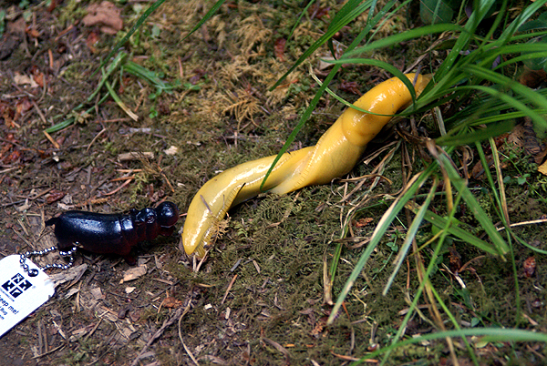 I guess that's a step in the right direction. Two of the bugs we had on our trip this summer were Road Warrior and Hungry Hungry Hippo. Both of which were travel bugs that were fairly photogenic.
Our first caching foray took us into Oregon. We'd been camping along the coast of California, just south of Crescent City, CA, so we took the highway inland up to Cave Junction, Oregon. Our primary reason for going this way was to visit Oregon Caves National Monument to tour the caves there. I also wanted to set up an earthcache there. I'm slowly working on that. The caves were very interesting and we spent several hours there exploring the area, which also included the guided tour. On the way back down into Cave Junction we found our first caches in Oregon.
We stopped at a particular cache that we discovered on private property. The cache page stated that it was on the cache owner's property, so we went ahead and walked into their field and found the cache at the base of a large oak tree. This was a really large oak tree, with a rather large ammo can hidden in the base of the tree which had been hollowed out sometime in the past due to a fire. 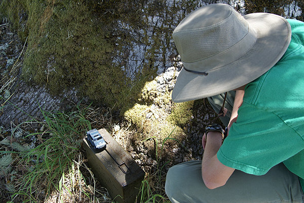 The hole was big enough to stick my head in, and after clearing out the cobwebs (the last find had been in May), I stuck my head in and eventually found the cache. We decided to leave Road Warrior there, since it was a nice 500+ mile bump to the travel bug's travels.
I wasn't too worried about getting a picture of that travel bug. I was, however, more concerned about the Hungry Hungry Hippo. Every time we'd make dinner, I'd forget to take a picture of the hippo with our dinner and I thought for sure we'd get all the way to the end of our camping trip and I wouldn't have a good picture to show for it. Well, I actually ended up with two decent photos.
In our camping site at Mill Creek Campground, we noticed several banana slugs. Our family likes banana slugs since my older son will be attending the University of California at Santa Cruz come this fall. Their mascot is the banana slug. So what's a banana slug? It's just what you think it is. It's a rather large slug that is yellow, sometimes has black spots on it and resembles a small banana. They move slowly and have a decent relationship with the redwood trees. One ranger stated that a banana slug will eat just about anything in the redwood forest except a redwood tree. 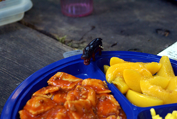 They're interesting to watch, so we figured why not get a picture of the hippo attempting to eat the slug.
Afterwards we did get a picture of the hippo poised on the edge of my plate of ravioli, peaches and corn that we had that night. Canned ravioli could only mean one thing. We were either running out of things to eat or more likely, near the end of our camping trip. In fact, I believe we broke camp the next day to head to Bend, Oregon to start the visiting portion of our camping trip.
Pictures were taken at or near the following geocaches:
Back to My Roots - by Boxerlovers and the Boxer too!!
334 - by Arse&Hemi&Dante

Saturday, August 8, 2009
Highway Character
For most of the week we were camping, we traveled along Hwy 101 in Northern California. The 101 is a very interesting road. Now  depending upon your perspective, the 101 either starts or ends in Southern California. From my point of view, that's where it starts, so that's where this tale starts.
The 101 starts in Los Angeles as an 8 lane superhighway at one of the worst congested intersections of two freeways in the entire world. It is labeled an odd numbered freeway or highway. Usually, but not always, odd numbered roads run north/south while even numbered roads run east/west. There are always exceptions as we found out later on our trip when we were traveling almost due north on the southbound side of Interstate 5 in Oregon, but that's another story.
Anyway, the 101 is a north/south highway/freeway and starts in Los Angeles. For the next fifty miles it runs east/west along the coast, then veers into a 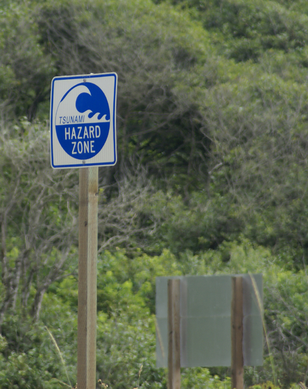 northwesterly direction until it gets up into San Luis Obispo County before it starts on a more northerly route. Suffice to say, it seemingly goes every way. And it also seems to have a life of its own with regard to how many lanes it's going to have. On our trip, just on the northern section of the road north of San Francisco to the Oregon border, this road had 8 lanes, 6 lanes, 5 lanes, 4 lanes, 3 lanes and 2 lanes. You gotta admit, this road has some character to it, perhaps to the point of schizophrenia. I'm not sure it knows what it wants to be, but that's the fun of the road. You never know what's going to be around the next bend or over the next hill.
On our trip along the 101, we noticed all sorts of interesting things, most of which you don't normally see in your daily travels. How often do you recall seeing a sign along one of your highways indicating that you were in a Tsunami hazard zone, or that this was a Tsunami Evacuation Route? We noticed these signs every time the 101 came down close to the ocean, or was close to sea level even though it could be inland for quite a ways. This stems from the 1964 earthquake in Alaska which caused tsunamis to strike along the coast of Northern California, killing several people.
When was the last time you drove along your nearby highway and saw a statue of Paul Bunyan with a fifty two foot waist who stood next to a just as large big blue 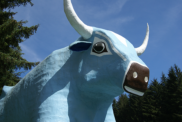 ox named Babe who also happened to be anatomically correct? This was all part of a local tourist trap known as Trees of Mystery. I'm not sure which is more disturbing, the fact that people were getting their pictures taken near Babe's anatomy, or that if you stood in front of Paul Bunyan, he'd talk with you and answer some of your questions. Roadside kitsch like this is becoming few and far between, but the 101 still has it.
Wildlife seems to be common along many freeways and the 101 is no exception. The fact that it winds its way through a national park also increases the chances that when driving along the highway, you'll see wildlife. Having driving along the highway many times when I was going to college, I was prepared for the large herd of Roosevelt Elk we saw right along the road. I'm not sure the Tadpole was the first day, but by the third day, he was pretty much used to it. You just learn to drive slowly, so that one of those big 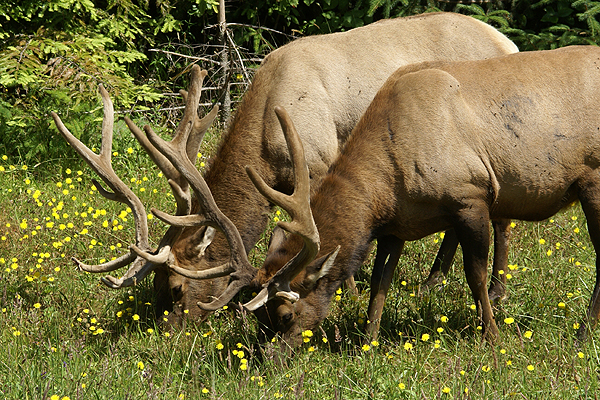 creatures doesn't end up becoming part of your car's exterior paint job and everything will be OK.
All of these encounters happened when the 101 was in two lane mode, in other words, in the more rural parts the highway wound through. The larger part of the road tended to be in the urban area. But that's what was really enjoyable about the road. No matter how big it got, it always seemed to go back to its roots, a two lane road, connecting point A with point B. A lot of these roads seem to be disappearing. I hope this road never loses its character.
Pictures were taken at or near the following geocaches:
Code by the Coast - by Phobos+Demos
Babe - by ChrissySkyking + Blaze
Big Critters With Antlers - by NCFLYERS - The Double J's of Fortuna, CA

Wednesday, August 5, 2009
Back to school
Part of the anticipation of this trip was touring the campus of Humboldt State University in Arcata, CA. Back in the dark ages of the late 70s, early 80s, I attended Humboldt as an undergraduate, eventually earning a degree in Geography from the school. I spent the better part of  3 and a half years communing with the organic and groovy, enjoying the outdoors and pretty much getting rained upon during long stretches of the winter months.
Surprisingly, outside of a brief driving tour on some of the roads in 1987 with my young bride at my side, I hadn't been back to campus since 1981 when I graduated. That changed this past month when the Tadpole came on campus to find a cache and explore the campus.
The first thing we noted was a lot of construction going on. The alumni newsletter has been mentioning expansion of various facilities for several years now, but it's different when you're being remotely told about changes and actually seeing them. It appeared as if new dormitories were being added to the campus. When I attended, there were some apartments in the middle part of campus and then a series of three different style dorms on the north part of campus; Canyon, Cypress and the Hill which was composed of Redwood and Sunset dorms.
The Canyon dorms were built on the opposite side of a small ravine/canyon on the north edge of town. 8  red buildings, four stories high, each housing approximately 50 students per building loomed high on the north side of the canyon. It was there I chose to live during my tenure at the school, living in Chinquapin, Maple, Tan Oak and Alder. Opposite those dorms were the Cypress dorms that were built up the hillside on the south side of the ravine. Then on the flat hill behind Cypress, were Redwood and Sunset.
Now, there appears to be several other building for student housing plus the ones that were being built this summer. Many universities want to establish a "feeling of community" among students and many require that freshman live on campus. My daughter's school requires that freshman and sophomores live on campus. I have a feeling this is where this expansion is coming from.
But apart for the living arrangements expansion, there were also many new buildings to be found on campus. We ended up walking through the admissions building which was new. I couldn't begin to tell you where the old admission building was when I attended school there. But I made a comment to one woman behind the main counter about how much the school had changed and she said that it's mostly been in the last 10 years that most of the changes have occurred. We ended up realizing that we'd both attended the school at relatively the same time period. The big difference was she stayed up there and I came back down to Southern California mostly due to financial reasons.
As we wandered around campus, I started getting my bearings. There was the library and the open plaza in front of the library. The school has added a new sundial to this plaza, which I waymarked. To the south of the plaza was the theater arts building. This was another "must see" on our tour of the campus because of the moon trees planted next to this building. Late last year, I'd discovered that seeds of five different species of trees had been taken on Apollo 14 to the moon, then germinated back here on Earth. These seedlings had eventually been distributed all over the country. Three Coast Redwood seedlings had been donated to Humboldt State University and planted on the west side of the theater arts building.
Interestingly, there is no plaque commemorating that these trees are in fact Moon Trees. There is a website on NASA indicating that they are, plus a newspaper piece from fall 1999 on the school newspaper's website. Here these trees grow, in relative obscurity, with very few of the student body or faculty who know about their interesting history. I didn't know they were there until last year and they were probably freshly planted when I attended the school. I'm at a loss for words as to why the school hasn't placed some kind of commemorative plaque by them.
Eventually, we worked our way up to the east side of campus. And by up, I do mean up as the school is built on a hill, and so we literally were climbing up hill, up to Founders Hall, the oldest building on campus, built around 1913. I can remember sitting in a classroom in Founders Hall once, listening to  Professor Bennion talking about some long forgotten aspect of geography when an earthquake rolled through the area. It was a relatively small quake, small enough that only about half the class felt it, the back half where I was sitting. We asked Professor Bennion to please stop while we investigated the Seismograph downstairs and verified that we had indeed had an earthquake.
The quake rolled through the classroom diagonally starting where I happened to be sitting. I can remember lifting my head up from my notes and then with curious amusement, watching the other students pop their heads up as they felt the motion of the quake. The back diagonal of the class felt the quake, so it was really interesting to see the dynamics of how the earthquake wave had been perceived, since Professor Bennion hadn't felt it in the front of the room, nor had other students sitting in front. I can remember thinking about sitting in a 60+ year old building that probably hadn't been retrofitted for earthquakes. Founders Hall is close to 100 years old now and I'm pretty sure it has been retrofitted.
After wandering around in the school bookstore and purchasing two HSU t-shirts to celebrate our own trip to the school, we finally turned our attention to geocaching and went and found the cache hidden on campus. It wasn't anything really special as far as caches go being a lamp post cache, but it brought back many fond memories of my life as an undergraduate there.
Later on, we wandered over to the dorms so I could show the Tadpole where I lived. In the picture, the back two are Maple and Tan Oak. To the right of Tan Oak, when I attended school was redwood forest with a logging road leading up into the hills. If you wanted to get away from it all for a little bit, all you had to was leave the dorm and start walking up that gravel road. It was you and the wilderness within five minutes.  Now, the paved road goes farther back and there's another dormitory complex back there. Time marches on.
I also showed the Tadpole where we used to eat most of our food at the Jolly Giant Commons. The thought that was pretty funny. I actually thought it was pretty funny where I was going to school there, but apparently they still haven't changed the name of the place because I noticed some reference to JGC while walking through the building. The mailboxes are still the same and haven't been moved. In fact about the only change to this complex was to make it ADA compliant by adding an elevator for handicapped students. With the complex being in the middle of the canyon, students had to climb four sets of stairs to get up to the Redwood/Sunset hill where the main body of campus was.
The Tadpole indicated that he might want to come back here and visit again, perhaps in his junior or senior year in preparation for deciding where he wanted to go to college. But that could change as he's only a freshman in high school at the moment. Still it would be fun to go back to school on a fairly regular basis, as opposed to once every 28 years or so.
Pictures were taken at or near the following geocaches or waymarks:
Cache in a bottle - by hunter1440
Humboldt State University Sundial - by Webfoot
Humboldt State University Moon Trees - by Webfoot

Monday, August 3, 2009
Rats
The third day of our camping trip was devoted to breaking camp and moving northward. Our plan was to spend two days in the Point Reyes area, then move north to Redwoods National Park where we'd camp for the rest of the week, so 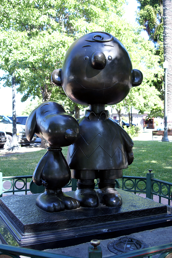 Thursday morning, we had a quick breakfast, broke camp and moved out.
This particular trip really was the first trip where the Tadpole and I had made geocaching the primary focus. In other times, we'd spent time geocaching, but it wasn't primary like it was this trip. That created a little bit of a problem on this particular day. With another goal being to get caches in each county we passed through, we had to find at four or five caches spread out over several hundred miles. We had thoughts of looking for one of the oldest caches hidden in California, but that didn't pan out either due to muggle activity in close proximity to the cache.
We had one side trip to Lake County along Hwy 20, but for the most part, we just headed up Hwy 101. Every time we crossed a county boundary line, we started looking for caches to find. Once we got into Humboldt County, I knew we were good since we were going to end up spending a lot of time in Humboldt and Del Norte Counties over the next couple of days, so those two weren't as critical on this driving day.
I ended up taking pictures at two different caches. One was a tribute virtual cache to Charles Schulz the author of the Peanuts comic strip. As a boy, Peanuts was one of the first strips I'd always look for in the Sunday comics as well as the daily strips. The Tadpole reads the re-runs found in our paper, so he's well versed in the mannerisms of the different characters.
Santa Rosa, California, in Sonoma County is where Schulz made his home. There is a museum celebrating his life and legacy and several monuments including a small sculpture near the city's information center. Unfortunately, there wasn't any free parking in the surrounding area, so we felt rushed as we walked through this small park to the sculpture. The meter was running syndrome  caught up to us with this one, but we still had a good time getting the answers for the virtual.
The other cache that stood out in our minds was the last cache we found in Mendocino County. This particular cache we had decided that we were going to bypass to save some time. We'd already found another cache in Mendocino County, so we didn't need another, but as we came around the bend, I happened to look at the GPSr, saw the name of the cache and made a quick stop. The Tadpole, obviously wanted to know why we were stopping so I told him the name of the cache and he blurted out, "Are you serious?!?" We used teamwork to make the grab on this one, had a good chuckle while we signed the log and then used teamwork again to replace the cache.
It's these kinds of caches that usually strike my fancy and end up on my 5% best cache list. They might not be really great in many ways, but they made me laugh or bring back fond memories. Both of these caches certainly did.
Pictures were taken at or near the following geocaches:
Oh Nuts! - by Bryce and Laura Powers
Pit Stop - by Huntnlady...Adopted by 007BigD

Sunday, August 2, 2009
18 feet
Our second day of our camping trip was pretty much dominated by a couple of very nice hikes, one 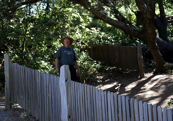 we'd planned on and one that doubled in length due to my own stupidity. We were camping in Samuel P. Taylor State Park which is adjacent to Point Reyes National Seashore. It was at Point Reyes where we made our first hike along the earthquake trail.
Just east of the visitors center, is a nicely laid out interpretive trail, which tells about earthquake activity in the local area. Point Reyes sits atop the San Andreas fault zone and was formed by the fault. To the east of the park lies Tomales Bay, which is a drowned part of the fault zone as it heads out to sea. The trail we took wound through the fault zone area south of Tomales Bay, with interpretive signs alongside the trail where we could read about earthquakes, most notably, the deadly 1906 San Francisco earthquake, which destroyed most of the city, either by shaking or by fires after the fact.
The area we were hiking through was the epicenter for that earthquake. There were fence posts that followed the fault line which was responsible for the shaking over 100 years ago. At one point we focused on a fence that had been offset 18 feet by the earthquake. Having experienced several 7.0 or larger earthquakes in my lifetime,  I've never seen that kind of horizontal movement of the earth. I can only imagine how terrifying that might have been. If you look at the picture of me standing behind the fence, you can see the 18 foot gap where the fence had been ripped apart. This was not the original fence, but a replica created on the site of the original.
Besides the geology, which we used to complete an earthcache in the area, we also enjoyed the diversity of animal life. At one point, I heard a rustle in the bushes to our left and spotted a newborn fawn, complete with spots. It was too dark to get an adequate picture of the fawn and I was prevented from getting any closer by trail manners and this deer's own skittishness. After this one started walking away, another arose from the bushes to follow its sibling. As we rounded another corner, we spotted what we think was the mother of these two walking along the fault line. We also saw many fence lizards enjoying the sunny day. Bumblebees were enjoying the summer flora by taking in the pollen and nectar from some poppies that we noticed in the field.
The sunny skies were an illusion for us as we traveled out to the point. There is a lighthouse out on the point which we wanted to visit. 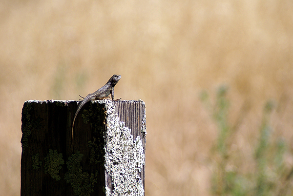 Unfortunately, due to budget cuts in the National Park Service, the lighthouse and visitors center wasn't open that day. We figured we still might be able to walk out to the point to get some perspective on what it would have been like. As we drove the 18 mile road, the weather started getting worse and worse. Finally, we were driving in fog in open range country. The seashore is home to 7 historical dairy farms and I had to drive very slowly in the fog in order not to hit any cows that might be in the roadway.
When we got to the parking area for the lighthouse, we noticed wind blowing. Hard. We got out of the car and the wind hit us with gale force intensity, probably gusting to 50mph or so. Fog was traveling horizontally over the point and we couldn't see much more than 20 feet or so in front of us. Even with coats, we would have been defeated by the weather. But it was an adventure we'll not lose the memory of, so that's a good thing.
After being stopped by the weather, we decided that we needed another hike and Tomales Bay State Park provided the spot for that. Our entrance fee was waived because we were camping in nearby Taylor State Park, so we drove down to the beach and parked. We ate a nice picnic lunch, then headed over to find a geocache where I wanted to drop off a travel bug that 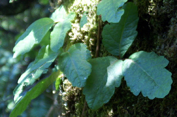 I'd brought along. We got out to the cache after a half mile hike and encountered several difficulties. One was a bee hive in a dead tree about 50 feet away from where the GPSr was saying ground zero was. This could be a problem, because the tree cover was heavy which could affect the accuracy of the GPSr. The cache could very easily have been near the bee hive. Reading over past logs on the cache page verified that it was not so that was a relief.
Our second problem was large amounts of poison oak. Along the hike in, we'd spotted it in several locations and it was flourishing along this trail. I spotted some with leaves as large as my hand. There was some around ground zero that we noted when we finally spotted the cache, but nothing that would cause a problem. However our third problem was the most idiotic. There was no pen in the cache. Why such a large cache didn't have a pen is beyond me, but I should have come prepared anyway. With no pen, we couldn't sign the log so we had two choices: sign in 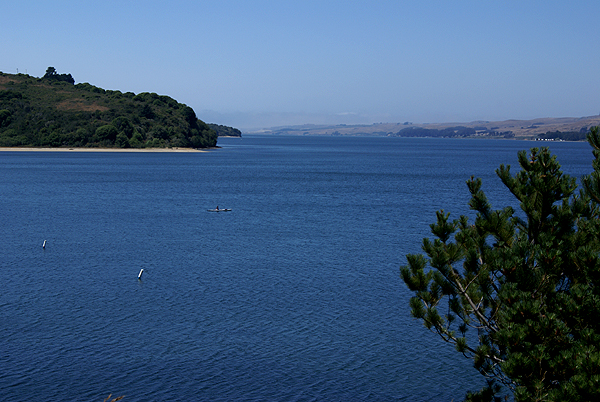 blood or hike out to the car and get a pen. We opted for the latter option thus turning a one mile round trip hike into a two mile round tripper. But then again, it's an adventure.
After dropping off Roger Racoon (sic) the travel bug, we felt we'd had a pretty successful day caching, even though we ended up finding but three caches. It wasn't about the numbers, but the experiences we had. We would have other days where we'd find more. Today was a day to stretch our muscles and get some exercise, while finding a couple of caches. We accomplished that.
Pictures were taken at or near the following geocaches:
Point Reyes EarthQuake Trail - by forman
Johnstone - by Mike P. (MPERC) adopted by forman
