Wednesday, January 30, 2008

Road Trip

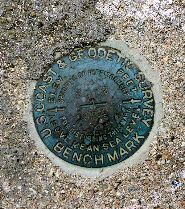
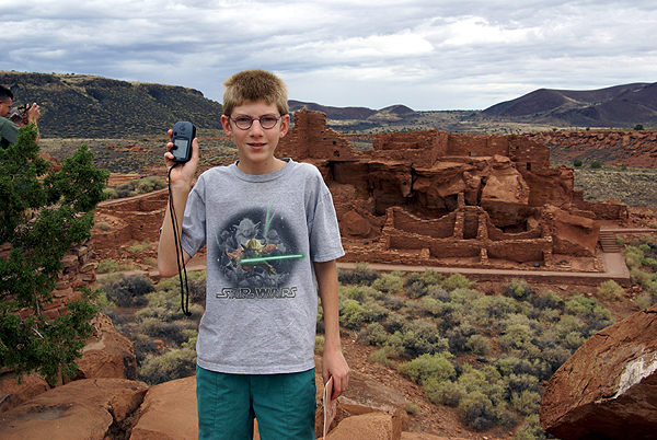
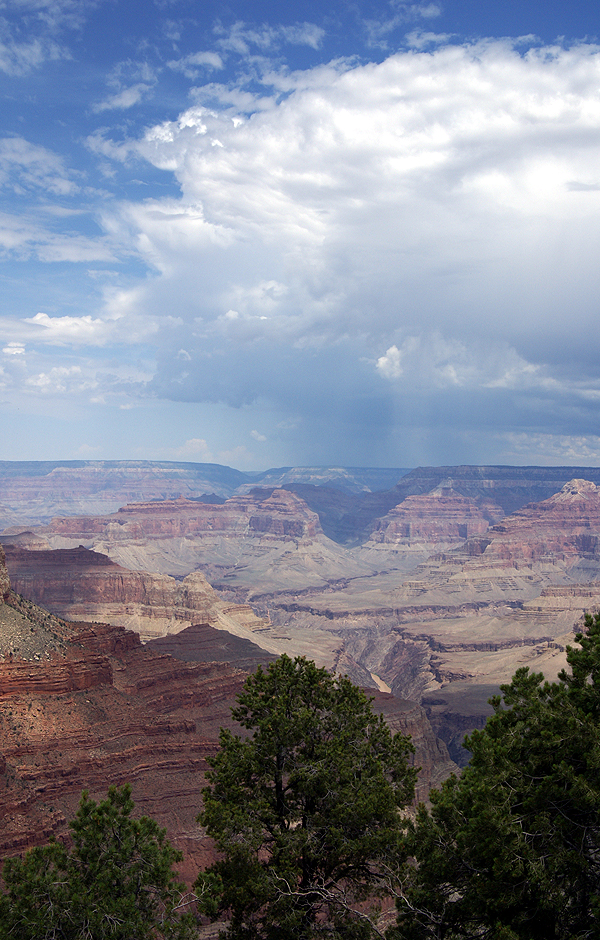
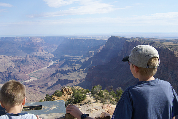
I graduated from college with a degree in geography, so I love maps. I’ve always loved getting out the atlas and pour over the individual state maps and see where I might want to go next on a vacation. Where was our next road trip going to take us? Should we take this road, or that one? I wonder what this town is like? Next month, I’m planning a road trip to Stockton, CA, ostensibly to listen to my daughter sing in a concert with her college choir. But we all know that the real reason for road trips is to go caching and this one is no exception.

There is a mystery cache in Southern California called Discovering & Logging California's 58 Counties. The requirements to find that cache is to first find a cache in all 58 counties in California. It’s similar to the DeLorme challenge caches that have been set up in several states across the country. As of this writing, I have a paltry 22 counties with cache finds in them. I figure if I plan this road trip correctly, I can knock a couple more counties off the list. Next summer, we’re planning a camping trip in Northern California, which will also help, so my county map will be more colorful by the end of the summer. Anyway, this series of articles is just designed the document the road trip.

This particular road trip took some advanced planning. I decided that this one was going to take the scenic route, so I’m going to be traveling on a lot of back roads this time, which is fine with me, but making the route queries for this one took a little bit longer. After searching the geocaching data base, I was only able to find this one route that fit my needs for any part of the trip. All the other routes, I had to create. In the end, I have 8 different route queries that I’m going to have to run right before I take off on my road trip. That also is going to take some planning since I can only run five per day. I need to remember to run at least three of them two days before I leave, otherwise I’m screwed.

My next step has been to go through each route and check out the mystery/puzzle caches to see if I can solve some of the puzzles and get those. Interestingly, there don’t seem to be a whole lot of puzzle caches, but I have gone through and solved 12 puzzles for the upcoming road trip. Several of them are right along county lines and involved looking up local history for each county. Right now, I’m a little bit more knowledgeable about Calaveras, Amador, Madera and Tulare Counties. Of those four, I have already found caches in two, Amador and Calaveras being the non found ones in that list. What’s even more interesting is Amador County is the only county that I have not traveled through in California during my life span on earth. I plan to change that on this trip.

There was a puzzle cache that used Pig Latin, one that used the symbols from a computer keyboard, one that had me investigating a certain government agency within Kern County and two cipher puzzles. All of these puzzles have been solved, now my next step is probably going to be to whittle down the list. I have over 500 caches right now, and since my GPSr doesn’t have a memory card slot, I need to get that down to under 500 waypoints for them to all fit in the unit. Once I load all the queries into GSAK I’ll start by eliminating the puzzles that I haven’t solved. That will probably do the trick, but if it doesn’t I’ll then probably drop the multi-caches. I like multi-caches, but they tend to take a little bit longer to find than regular caches and I do have some time constraints so it makes sense to drop them next.

Ok. Now as I look over my check list, I see that I have my routes planned and I have puzzles solved. I still need to run the queries and then reduce the size of the queries down to under 500 caches. Then I need to upload them into my GPSr and my PDA and I’m then set. If all goes well, I should add 6 new counties (San Benito, Sacramento, Amador, Calaveras, Tuolumne, and Mariposa) to my found list for the 58 county challenge. That will leave me just one county short of being halfway to the County Challenge goal. Since there are three basic legs to this trip, I’ll make separate posts on each leg. For now, it’s just a process of waiting.

Tick, tick, tick, tick, tick, tick, tick, tick, tick, tick, tick, tick, tick, tick, tick.

Profile for Webfoot

Sunday, January 27, 2008

Another diversion?

When I first started Geocaching, I was a very casual geocacher. I went caching maybe once a month and found three or four on that particular trip. My first three years (2001-2003), I found 17, 28 and 32 caches respectively. Then I took off in 2004 and found 99 caches! Woooooo. During the same time period, I found out about benchmarks and checked it out. This looked kind of interesting, so I decided to do some reading before trying to find any local ones. I was familiar with benchmarks, having seen some while camping at Yosemite back in the 1970s, but really hadn’t thought a lot about them. I figured surveyors had put them there for a reason and that was that.

What is a benchmark? From the geocaching.com website,

“A benchmark is a point whose position is known to a high degree of accuracy and is normally marked in some way. The marker is often a metal disk made for this purpose, but it can also be a church spire, a radio tower, a mark chiseled into stone, or a metal rod driven into the ground. Over two centuries or so, many other objects of greater or lesser permanence have been used. Benchmarks can be found at various locations all over the United States. They are used by land surveyors, builders and engineers, map makers, and other professionals who need an accurate answer to the question, "Where?" Many of these markers are part of the geodetic control network (technically known as the National Spatial Reference System, or NSRS) created and maintained by NOAA's National Geodetic Survey (NGS).”

The site also goes on to state that many benchmarks are in plain sight, but mostly ignored by the general population.

Further reading on that page listed above kind of gave me a glazed over look. There’s a lot of technical information on it. I discovered that geocachers could log benchmarks, and could even fill out a form to update the benchmark with the NGS as well. There’s a FAQ page in the geocaching forums dedicated to helping people fill out recovery forms as well. I decided that I’d start small and just try to find and log one. So I printed out a couple of pages and then promptly forgot about benchmarking entirely, at least for a month or so.

Then, on a Sunday morning I was driving my daughter over to her violin lesson and we were stopped at an intersection. My gaze drifted over to the curb and there, painted on the curb, were two letters, BM with an arrow pointing up to the top of the curb. All of a sudden, the light came on. Here was one of those benchmarks, in plain sight, largely ignored by the general population. After I got home, I looked it up in the GC benchmarking database and sure enough, it was there. The next weekend, I went back to that intersection and took my pictures and logged the benchmark.

Now, I guess the big question would be, was I hooked? The next day, I went out and found two more benchmarks in the same general area, but I wouldn’t say that I was hooked. In fact, I find benchmarks interesting, but I haven’t gone out of my way to find them. One of my caching friends, chaosmanor, enjoys benchmarking and has logged over 150 benchmarks in the system. He has also logged over 80 recoveries into the NGS database as well. I’ve logged two other benchmarks since that first flurry of a weekend back in 2003, both were on a caching expedition with him and they were both found because we sort of stumbled over them while hiking as opposed to actively seeking them. In fact, we walked right by another one that was about 50 feet away. Like I said, they’re in plain sight, but usually ignored by the general population. Even two geocachers who were on the lookout for some missed it.

As I’ve continued to take my son out caching, I look for a variety of things at the same time, mostly because if they’re interesting, I like to take pictures of them. Benchmarks are the same way, they’re interesting and they tell a little bit of the history of the area where they’re found. My son has gotten quite adept at finding all sorts of benchmarks while we’re out caching and hiking. Most aren’t in the database, but we check them out nonetheless. We found a beautiful one, right off a trail in Utah that we were caching on, so we decided to take the measurements and pictures and log it when we got back home. Imagine our surprise when we discovered that it wasn’t in the GC benchmark database. We still got a nice benchmark picture to post (the last picture) on the cache log that we found and a nice story to tell. To answer my original question as to whether I was hooked or not, I guess the answer would be no, but it’s a nice diversion that I keep coming back to from time to time.

Profile for Webfoot

Friday, January 25, 2008

Using GSAK Point Filters - Part II

In my previous post, I showed how to use a simple GSAK point filter. As you saw, it did pretty much the same thing as filtering based on distance from your centre point, but you're not restricted to using your centre point or, for that matter, any cache in your database. The point filter can be based on any arbitrary lat/long you wish (although it's obviously useless to pick a lat/long outside of the area covered by your database).

Now, let’s do the same thing with multiple points. Let’s say I’m going to be at the Marriott in Schaumburg for a day, then I’m going to be in Lombard the next day. I’d like to find caches near both locations and load them at the same time, so I’ll be all set for my trip.

Using Maporama again, I find that the lat/long for the location I’ll be in Lombard is 41.887 , -88.018. So, I just add that to the same filter in GSAK. (Remember, you can click on the image here to see a bigger view of it.)

You can see that the list of points now includes TWO lat/long combinations. When I apply this filter, I now get 79 waypoints – 17 more than I did for just the Schaumburg filter.

When I plot those on a map, I now have two clusters of waypoints – one set within 3 miles of the green flag in Schaumburg, and another set within 3 miles of the yellow flag in Lombard.

It doesn't get much easier than that!


Coming up next: Arc filters


Profile for WascoZooKeeper


Thursday, January 24, 2008

Using GSAK Point Filters - Part I

A lot of geocachers use GSAK (Geocaching Swiss Army Knife) for managing an offline database of geocaching waypoints, and most have used simple filters for focusing in on a subset of caches they're interested in. Many I've spoken to, however, have never explored the power of "point", "arc", and "polygon" filters. At first glance, they can seem intimidating -- but they're quite powerful and useful, and once you've tried them you'll find they're not that hard to use. I wrote up some documentation on this subject a while back to share with some other members of GONIL (Geocachers of Northeastern ILlinois), which I'll share with you here. Due to its length, I'll address each type of filter in a separate post.

My default GSAK database contains over 4000 waypoints in northern Illinois, roughly from I-80 north to the Illinois/Wisconsin state line (also known as the “cheese curtain”). This is what the waypoints look like when plotted on Microsoft Streets & Trips -- click the map to see a bigger image.

Let’s look at point filters first. You’ve probably used filters before where you specify an existing waypoint (or a defined GSAK “location”) as your center point and then specify a given distance from that waypoint. That filter would look something like this. A point filter is similar, in that it selects waypoints within a circular boundary, but there are two key differences – you can specify any arbitrary lat/long coordinates as your center points (not just an existing waypoint or location), and you can have multiple center points.

We’ll start with a simple example of a single point for a point filter. Let’s say I’m going to be at a meeting at the Marriott Hotel in Schaumburg, Illinois. I expect to have some free time, so I want to know what caches are within 3 miles of the Marriott. I need a way to center a filter at (or very close to) the Marriott.

One way I could do this is to find an existing cache near the Marriott and specify that as my center point in GSAK. But another way is to simply find out the lat/long of the Marriott. There are many ways to do this, but one easy way I do this is to use the website www.maporama.com, because once I find the location I want, it displays the lat/long right there on the map page. So I’ve found the Marriott at Golf Road just west of I-290:
and to the left of the map, I see that the lat/long at that location is 42.05, -88.038 (I’ve highlighted it in blue). (Important note: Maporama displays the lat/long of the CENTER of the current map – NOT the circular target you see on the map. The target may be in a different location because of how you searched. Don’t worry about whether you SEE the target or not – as long as the location you want is in the center of the map, the lat/long displayed is what you want.) Google Earth is another good option for locating the lat/long of a location for you.


So now I go to GSAK and set a filter. Click on the “Arc/Poly” tab. Enter the lat/long of the Marriott into the box on the left, select “Points” as the filter type, and specify a distance. Click “Go”.


When I apply this filter, I get 62 waypoints returned, and they look like this on the map (I put a green flag on the map to display where the Marriott is). As you can see, I could have picked that cache just SW of the Marriott and used it as my center point for a simple filter, but by specifying the lat/long of the Marriott itself, it doesn’t matter whether there’s a cache nearby.

That was pretty painless, wasn't it? In my next post, I'll show how to use multiple points in the same filter.


Profile for WascoZooKeeper

Tuesday, January 22, 2008

Chaz the Spaz

I’m probably going to jinx this guy as soon as this one is posted, but I have to write about Chaz the Spaz. Chaz was a fuzzy little guy that was given to me by one of my students almost 6 years ago. I told this student that I was going to make him into a travel bug and send him out in the world, perhaps never to be seen again. As anyone who has ever released a travel bug or a geocoin into a cache can attest, those words are aptly spoken. There are probably a million different ways travel bugs can disappear, so expecting them to live long and prosper can be a crap shoot. Getting them to their destination? That can be even harder to achieve in most instances. Unless the travel bug is huge and unmistakable like Cindy (the Cinderblock), or Spare Tire, eventually, it’s probably going to disappear. But every now and then, you get a travel bug that takes a life unto its own, like Chaz the Spaz.

I released Chaz July 5, 2002. In the 5 and a half years he's been traveling, Chaz has been to some very interesting places. He started out in a rather nondescript cache off a mountain road in Los Angeles County in California. From there, he went several other places and then suddenly zoomed to Texas 1185.3 miles away.

Chaz was now racking up the miles, but I figured since he was in the urban area of Austin, he’d probably jump around from cache to cache in the city and not really get much mileage. OK. I could live with that. Actually, I really didn’t have much of a choice unless I changed his page saying that Chaz wanted to come back home. I think that would defeat the purpose anyway, so I decided to enjoy his travels. He bounced around, traveling 7 miles here, 20 miles there. One time he was placed in a cache and when he was retrieved from the same cache he had moved 53 feet. Go figure that one out, but it shows up on his cache page.

Chaz stayed in Texas from August 2002, until September 2003. Then he needed to get a passport. His next stop was 5654.3 miles away in Italy. Immediately after that he was in Germany and then three months after that, he was in the Netherlands. Once in the Netherlands, he started to do the Texas Two-Step, not straying very far from the first location he had been placed. Chaz spent 10 months touring the Netherlands and then he got on another plane.

His next stop, 9369.6 miles away was in Queensland, Australia. From October 2004 until October 2005, Chaz toured around the outback and along the coast of Australia. He was removed from a travel bug hotel in October and promptly disappeared. 8 months later he resurfaced again, this time back in Europe in Germany. The last cacher to find him in Australia apparently never logged him back into the cache that he was placed in, so the only reference we have of him is a log by a cacher in Germany stating, “Don't know how it came back to Germany...but today I found it in this cache (Auf dem Polle (visit link) )” This German jump added another 9928.5 miles to Chaz’s trip total.

Within two months, Chaz was back in the Netherlands and stayed there for over a year, 8 months of which were in another cacher’s possession. By August 2007, I started getting discovery notes for Chaz. That was good because it told me he was still out there, but it was also bad because he wasn’t moving. I should have known better. On August 19, 2007 Chaz was picked up. Two weeks later he was placed in a cache in Japan. Ten days later, he was picked up from Japan and is now resting comfortably in A Silly Story in the United Kingdom. Total mileage for Chaz as of this writing is 41310.8 miles.

Other interesting stats for Chaz.

He’s disappeared twice and resurfaced twice.

The oldest cache he’s been in is Bull Creek Overlook GCFE9 – yep only three digits in that GC number and it’s still active.

Chaz has seen the insides of 38 geocaches, half of which have since been archived. He’s also been posted to one virtual cache for mileage purposes.

For comparison purposes:

Cindy (the Cinderblock) has been out for 4 and a half years and has traveled 11851 miles.

Spare Tire has been out for almost the same length of time as Cindy and has traveled 1891 miles.

I guess the point I’m trying to make here is don’t give up on travel bugs. Yes, they disappear and many are shortlived, but every now and then you get a jewel of a travel bug like Chaz the Spaz and it all becomes worthwhile.

Profile for Webfoot

Sunday, January 20, 2008

Virtually yours

I have found 67 virtual caches since I started caching back in 2001. Not a lot, but it represents 3.8% of all of my cache finds. Count the couple of Mystery caches which were really virtuals, the one webcam cache that I’ve logged, the earth caches that I’ve found and those pesky locationless caches and some folks would say that about 5% of my cache finds aren’t “real.” And those people would be right, when you consider that you’re supposed to find a cache container when you go out geocaching.

Does that make virtuals non-caches?
It seems that Geocaching.com appears to believe it since they don’t allow virtuals to be listed any more. They have allowed ones that were already created to be grandfathered in to the system. The same holds true for webcam caches. I know, because I own the Blue Jay Webcam cache. I don’t own any virtual caches, mainly because I couldn’t find, what I thought was a suitable location for a virtual. And I think there is where the problem lies with virtual caches. I’m not trying to pat myself on the back for this one, but I think if people had been a little bit more discriminating when they set out to create virtual caches, we might still be allowed to post virtual caches today.

The principles of a virtual are pretty simple. Instead of a cache to find, you have to find information. You then email the owner of the virtual with that information before you can log the cache. Sometimes, you have to post a current picture of you at the site which will satisfy the logging requirement. Sometimes you have to do both. Most are educational in some way and many are fun and whimsical.

As I went through the 67 different virtuals that I have logged, I can remember most of them right away. I can remember some of them being very interesting, helping me learn about the history of a given area, or perhaps taking me to a place where a real cache couldn’t be placed because it was either in a National Park, or on private property. Yet those caches still allowed me to play with my GPSr, got me to exercise my brain, and usually helped me learn something. What I also found interesting was the amount of pictures in my gallery that were devoted to virtual caches. Usually virtuals have that “Wow” factor built in that makes you want to grab your camera and take some pictures of that unique and/or beautiful area.

Since I've started caching, I’ve learned about the first Mayor’s house of Atwater, California, walked around Downtown Disney to find 20 – yes you read that right – 20 different waypoints, and seen the gravesite of one of Wyatt Earp’s relatives. I’ve been moved by a memorial to the Space Shuttle Challenger and almost brought to tears by a memorial to the California victims of 9/11. I’ve also hiked a trail in Joshua Tree National Park that I’ve avoided many times in the past because it didn’t look that interesting compared to some of the other spots in the park, and yet when I took that trail last November, my son and I found four virtuals along the trail and learned some interesting history about one of Joshua Tree’s local characters. Each of these I found to be good examples of what virtuals should be.

On the other hand, I can also remember several virtual geocaches where, after I’d gone through the motions of doing the required elements to log the cache, I thought, “Eh, that was ok, but couldn’t he have just placed a micro over here, or perhaps she could have set up an offset using some of the information on the plaque?”

Some of these virtuals I’ve found, were just plain lacking. The information could have been easily transmitted on the cache page and a real cache could have been hidden at the site. One virtual I found was about an oak tree that wasn’t there anymore. All the history of the tree was on the cache page, so why didn’t the hider just hide a cache there and leave the history on the cache page? Another was a shrine to frogs. Now I love frogs probably just as much as the next cacher, maybe even more, but couldn't the person have found a good sized plastic frog and created a cache with it and then placed it at the frog shrine? That might have been quite a tough cache to find. Still another virtual, required you to post a picture in front of a house that had, what can be described as pretty tacky landscaping. This particular house was featured in Steve Martin’s movie “The Jerk.” Yet another virtual looked down upon a movie studio in Hollywood. There were plenty of spots to hide at least a micro in the same general area and still have brought cachers to see the movie studio.

Some of the more questionable virtuals that I’ve listed above, and I’m sure you could probably look over your own list and find some that also fit that bill, are what probably prompted Geocaching.com to place a moratorium on the posting of new virtuals. It’s their website and they have the right to do that. I agree with what they’re trying to do, but I don’t necessarily agree with their methods. I think it would have been better to try and weed out the ones that were more questionable and allow those new ones with the “Wow” factor.

The one spot where I really think they should still allow virtuals is in our National Parks. In general, National Parks are the epitomy of the “Wow” factor. Since the National Park Service won’t allow traditional caches in the parks, virtual caches fit the bill perfectly. But, with the moratorium, they can’t be placed and I believe that’s a shame. As noted above, I would have missed out on some really interesting local history were it not for some geocaching virtuals. I’m sure it’s the same way for others. How easy would it be for Geocaching.com to make that exception regarding virtuals and allow them to be placed in National Parks again? Unless we, as a community speak up, it won’t happen. I’ve written letters and I hope others will as well. I think the early geocaching community didn’t police itself well enough and now we’re paying the price of no new virtuals. That is a shame, because a good virtual is worth its weight in gold in my opinion.

Profile for Webfoot

Saturday, January 19, 2008

It's not about the numbers...or is it?

I am still fairly new to geocaching. Well it still FEELS like I'm new compared to most of my caching buddies. I'm still under 300 finds in a year and a half. Does my find count matter? Well in the grand scheme of life, no, but in my mind it does.

While I enjoy caching as a way to take me places and enjoy time in the great outdoors with my family, I am a very competitive person at times. Coming into the game late there are so many people with a huge lead on me and there is no way I can ever be in the top cachers in the country list. So what's a gal like me to do? I find other ways to compete.

One of the ways I satisfy the monster of competition in my soul is to challenge myself. I set goals to reach certain milestones by the end of the year. My first 6 months caching, I challenged myself to find 150 caches. December 30th I was out with the entire Royal Bug Family tracking down the 16 caches I needed to reach my goal. I did find a bunch of micros that day, but we also found several small parks in a neighboring town that we didn't know existed. My kids, who normally aren't happy with a day with mostly micros, had a ball that day making sure we reached my goal. My goal for 2007 was to reach number 250. I was 5 short on New Years Eve, so we headed out for a quick run! In three hours we grabbed the 5 caches and saw a pink elephant!

I also satisfy my need for a win by using the site It's Not About the Numbers to record my cache stats. I can push myself to get a higher average terrain or difficulty rating or something as make sure I keep my status as one of the top 10 wordiest cachers in Kentucky with my average log length. I'm sure it's silly to most, but it keeps me happy!

I found one final way to make caching a "sport" for myself. I realized that a good friend I met through caching was fairly close to me in the numbers game. He's not a big numbers person, but he has humored me with a challenge. Whichever of us reaches 499 first, picks any cache in the continental US for the other to take us both for cache number 500. At the time I wrote this blog we are at 253 (me) and 252 (him). I don't do a lot of caching in the winter and he's currently stationed in Iraq for 3 more months. Come warm weather though, the race is REALLY on!

Maybe after I win this competition, I'll make my next goal to complete the KY Delorme Challenge. Yeah...for me, the numbers keep me caching.

Profile for queen_ladybug

Monday, January 14, 2008

To route, or not to route, that is the question

When I first started geocaching, I was strictly a paper kind of guy, since I had an old school GPSr Garmin 12. No computer connection with that one, so every coordinate had to be entered by hand. Make one mistake and your searching far away from your intended cache.

Once I got the new GPSr - yeah it's still a Garmin - and a PDA, I went paperless. It was great having the nearest 500 caches in your GPSr all the time. Going out on an errand? Oh look! There's a cache over there. I took my daughter to a music audition and she "gave" me permission to find a cache before we came home. That was assuming that I had my GPSr with me she asked. I gave her a wry look and off we went, to find a really nifty lamppost cache. Well, the cache wasn't nifty perhaps, but the surrounding landscape was very cool, a sculpture made from some of the remnants from the Northridge earthquake from about ten years ago. The power of Mother Nature is awesome.

Now where was this going? My youngest is the only one who caches with me on a regular basis. Every summer, we'd pick a place to go camping and then we'd start plotting out which caches looked good to get. Then, I'd print out the cache pages and we'd have a stack of 15 to 25 cache pages that we would attempt to find. It was not a very efficient way of caching. If we couldn't find the cache, that was one cache we couldn't find and we wouldn't necessarily have any other close caches to find because of our paper stack. Throwing away those printed pages, was almost like throwing away a friend. Our best trip was a camping trip we took to Utah and Nevada where we ended up finding 18 caches, many of those were locationless caches (before they'd been archived out of the system) and virtuals.

This past summer, we decided that we'd be camping at the Grand Canyon and surrounding areas down near Flagstaff. I'd played around with the Google Routes in the past, but this was the first time I actually put the route query into play. From our area in Southern California, I ran my first route from Barstow, CA to Cameron, AZ, which is north of Flagstaff. I'd originally thought of just sending it to Flagstaff, but I couldn't get Google to create a route the way I wanted to go if I stopped the first route in Flagstaff, so I had to make the route a little longer, so it would go the correct way.

From there, I created a second route from Cameron to Grand Canyon and then I created a third from the Grand Canyon to Williams, AZ creating a large backwards shaped P lying on its back across the Arizona landscape following Interstate 40 and other Arizona Highways with the footing of the P in the eastern California Mojave desert.

I then saved the routes from Google, uploaded them to Geocaching.com and then ran the queries. With the route, I was able to set parameters, like how far off the route do you want to search? What kind of caches? I set the width at 2 miles figuring we wouldn't be doing off roading and also figuring that some towns that had been bypassed by the Interstate, might have some interesting caches, but might be more than a mile from the Interstate.

Once that was done, I then did some spot queries to fill in gaps. I ran one around Flagstaff, since we'd be spending some time there and one around Grand Canyon since I noticed that the route didn't pull in the four virtuals that were in the western part of the park, more than 2 miles from the route. With that done, I then loaded all the queries into GSAK and found I had 429 caches for this seven day trip. I knew we wouldn't be able to find all of those, but it was nice to know we had those available to look for depending upon where we ended up going. I figured that if we found 5% of the ones in the GPSr, we'd be doing pretty well.

Once we started on our trip, it became evident that we'd find a lot more than that. We found four on the first day without any difficulty at all, just stopping at rest areas along the way. Using the old way of searching Geocaching.com, we might not have even noticed all of those caches along the road. This way, all we had to do was watch the GPSr and let it do the work for us as opposed to the other way around. "Oh, look Dad, there's a rest area up ahead with a geocache. PDA cache page says it's an ammo can!" Yep, we're going for this one.

In the end, we ended up finding a variety of caches of nearly all types - some puzzles, some virtuals and a lot of traditionals - for a grand total of 43 caches in six days. That was double my original estimate and a pretty good average of 7 cache finds per day. Yeah, we probably could have had more, but we also took in the views as well. This was the first time I'd ever used a route query and I was hooked. One of the nice aspects of the route, was you had a full set of caches at your disposal, not just a couple that you'd printed out. If you couldn't find a particular cache, it wasn't going to be the end of the world, because you knew there were others close by. Just do a search with your GPSr for closest caches and pick another. That was especially handy when I had the kid in tow. He wanted to find caches. This made it much easier.

I've used a route query now four more times, with varying degrees of success, but always with better success than just picking caches that "look good" while looking at areas that you might be near. My last trip, this past weekend, I was able to find 5% of the caches that I uploaded into the GPSr and if I'd been a little bit more patient in my search techniques, the results would have been higher. Getting back to the title of this article - I know what the answer will be for me in the future.

The newest GPS technology

daschund, loldogs n cute puppy pictures I Has a Hotdog!
moar cute puppy pictures

Thursday, January 10, 2008

Our Sport’s Dreadful, Hidden Disability

Geocaching doesn’t have any couth, it seems. Really.

To be with-it or in, it seems you ought to have some obligatory disease or disability. Tennis folk have “Tennis Elbow”, skiers have “Skier’s Thumb” and for heaven’s sake, there’s “Runner’s Knee”! Meh. We need a disease or injury of our own.

And I have a likely candidate: “Cacher’s Hand”. Symptoms: multiple laceration of the dominant hand, including scuffing of the skin on the knuckles, cuts ranging from nearly invisible to gashes requiring bandages, general swelling and tenderness.

My own experience bears out this horrible disability.

While I am a sporadic cacher, I am an avid one when I’m out. No hill too high, no swamp too deep, yada, yada… My best beloved will tell you that I will climb the tree, swing over the creek and (here’s the segue) be willing to search in hidden spots with my ungloved hand. (I just cannot tell what I have unless my skin is in contact with the object of my search.)Thorns? To laugh, sez I! Moldering leaves with sticks, sharp and pointed? No problem! Rocks with ragged edges? Phoof! Small, unlikely hiding places with hidden dangers like broken glass? Give it not a thought! Poison ivy? Contact allergies? Nary a consideration!

The tragic and inevitable result, wise readers, is Cacher’s Hand: abraded, wounded, swollen and bruised. And I know, deep in my cacher’s soul, I am not the only zestful, thoughtless participant in this sport. There must be hundreds of broken and bleeding hands pressed back into the Monday morning world of work out there.

I’m willing to spread the word. How about you?

One reason why I love my Garmin 60CSx


So I was on my way from the western suburbs of Chicago up to Appleton, WI, where my lovely daughter, hangglidinghippos, attends college. Heading north on US 41, all of a sudden a tiny ghost appears on the screen of my Garmin 60CSx! It turns out I was about to pass Power the Future, and I was able to figure the info I needed to log the find as I went by.

I've got several areas where I cache regularly -- Northern Illinois, parts of Wisconsin, and parts of New Jersey (where my in-laws live). With the help of a few pocket queries, GSAK, and the Garmin POI Loader (POI = "points of interest"), I've got over 6000 caches preloaded in my 60CSx, for all the areas I'm likely to be on a regular basis. And it's a no-brainer to add in more for special activities like Geobash. Special icons for them, so I know at a glance whether it's a traditional, a multi, a puzzle, a virtual, whatever. And with the click of a button, I get the difficulty/terrain, summary of the last four logs, the last find date, and some more information.

And yet, with all those preloaded caches, and detailed street maps for about a dozen states, I've still got about half of my SD card still available.

Oh, and I see there's a traditional cache nearby -- have to grab that on my next trip!

Profile for WascoZooKeeper

First post - a Travel Bug Adventure!

A travel bug named Smokey belonging to "Paws"itraction had quite an adventure!
Cacher GrievousAngel posts:
"On October 30, Smokey was placed in Off Base, a new puzzle cache of mine. At the beginning of December, we had heavy rains and some flooding. My cache should have been well above the flood line, but possibly the high winds blew it out of its hiding place and into the river. The cache, with Smokey inside, floated seventeen or eighteen miles down the river to an island--the last stop before the open waters of Puget Sound--where it was picked up by a kayaker. He is not a geocacher, but he has a friend who is, so he brought the box to his friend. Contrary to GS's recommendation, I had not written the coordinates on the box, but the cacher identified the cache by looking up Smokey's tracking number.

The cacher emailed me before Christmas, and I finally retrieved the cache this afternoon (January 9) with the entire contents dry and intact--thanks to the kayaker, the cacher, the Lock & Lock box and Smokey. I don't know if I can replace the cache yet, but I'm going to put Smokey in a more accessible cache so it can move along.

I just thought this might be an interesting note on your TB's history."