When we geocache, it's all about the smileys, well not really, it's really about the fun. However, every time you log a find, you get a smiley on your profile. We're headed out to the 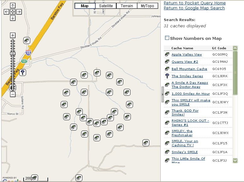 desert this morning to find some caches and in the process we're going to try and get this gigantic smiley. Dog Will Hunt, bigdaddygrc, Mr. G. and Rhino Assault Team apparently have a pretty good sense of humor as well as a great imagination. That series must have taken some time to set up. This is the pre-found image. I'll post another image after we get back, hopefully, with a bunch of smiley's on the map instead of geocaches.
Saturday, February 28, 2009
A Giant Smiley

Thursday, February 26, 2009
Letterbox Hybrids
Over the past 8 years of caching, I've found four letterbox hybrids. In my opinion though, I've only really found one true letterbox hybrid. 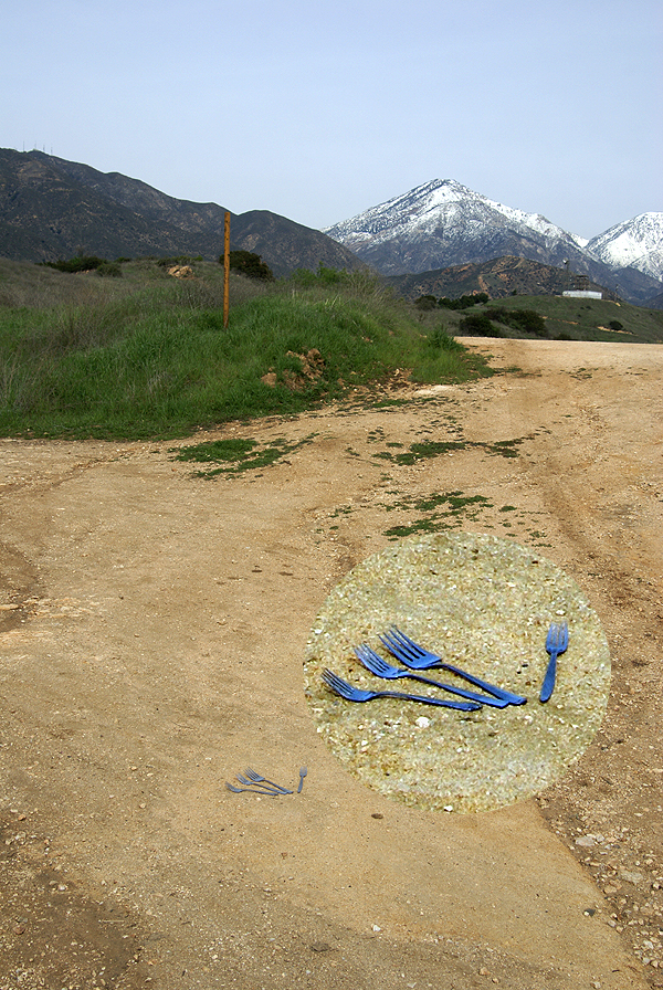 Looking at what Geocaching.com says is a letterbox, I guess I'm partially correct.
"A letterbox is another form of treasure hunting using clues instead of coordinates. In some cases, however, a letterbox has coordinates, and the owner has made it a letterbox and a geocache."A letterbox, according to Letterboxing North America, is a water proof container that has a logbook where a person can stamp their personal stamp in the logbook and collect another stamp from someone else's collection. Clues are given instead of actual coordinates to find the letterbox.
I've found three actual letterboxes that had been posted on the Letterbox North America site. Two of them I happened to stumble upon while out finding geocaches in the same area. The Hunt for the Borg Cube, is a letterbox that I found, while looking for a cache spot for my Bad Swag cache. I had my eyes set upon hiding Bad Swag near this beautiful oak tree. When I got up there on one of my hikes in the area, I found a cairn of rocks and the Borg Cube. I decided that two such caches of different types that close together wouldn't necessarily be the best thing, so I decided to look elsewhere for a spot and found a nice spot for Bad Swag. I could see where people might get confused, possibly finding one and thinking it the other.
That actually happened on one cache that I found up near Lake Arrowhead. Looking at logs on that particular cache,
 you can see that people have logged one cache, or perhaps the letterbox based upon their descriptions. I actually found the letterbox first, then with the help of my daughter, found the real cache a couple of minutes later.
Getting back to my original premise however, I've always been under the impression that a letterbox hybrid was a geocache where you had to find it via clues and that it would have a stamp pad and stamp in it so people could trade stamps when they found the cache. As I noted above, only one of the four letterbox hybrids that I've found fit that bill having both a stamp pad and stamp and the clues leading to the cache. The other three had the clues, but were micro sized caches that couldn't have held a stamp, let alone a stamp pad.
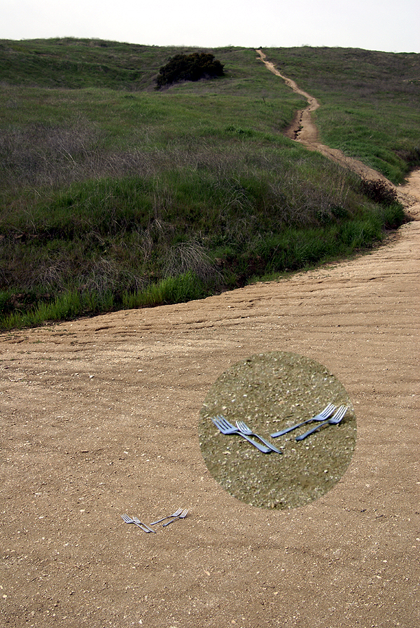
This was one of the reasons I wanted to created a letterbox hybrid that was a little bit more involved that the one that I found where all you had to do was stand at the back porch of an old abandoned house and look to the corner of the yard where the cache was hidden. I wanted my letterbox hybrid to be a little bit more lengthy with several clues needed to find the cache. I hope I've succeeded with Yogi Berra's Fork.
At the same time the Tadpole was hiding his two caches, I was also hiding the letterbox hybrid. The premise behind it was that Yogi Berra dropped some forks at forks in the road, leaving people clues that would lead a cacher to the geocache. I took pictures of forks in the forks in the road (got that?), but they didn't come out
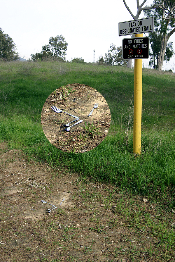 exactly the way I wanted. I was hoping to make this more of a visual type of cache, with cachers using the pictures to find their way, but after looking at my pictures, I decided to utilize some PhotoShopping and also tell a story. This would also allow me to add some more Yogi Berra malapropisms into the story.
There's been two finders of the cache thus far and apparently they both enjoyed the cache, so I'll take that. The one note to the cache seems to indicate that the cacher who posted the note was able to figure out where the cache was using Google Maps. I can see where that would be very possible to do, especially with the quality of the satellite images that are on that site today. He'll still have to hike the trail to get to the cache as there's not an easier way to get to the cache site even if you do use Google Maps. As a lot of cachers probably do, I view Google Maps as another tool to use while geocaching.
Anyway, I hope this particular cache lasts a long time. It was fun creating it. It was a forkin' good time to do.
Pictures were taken at or near Yogi Berra's Fork - by Webfoot

Tuesday, February 24, 2009
Tadpole
This weekend I got to see my son working on his second and third hides. We'd gone on a hike last Saturday morning and discovered that his first cache had been muggled. Now, this was not unexpected, but nonetheless, it's got to be disappointing when  your first cache disappears, especially if you've put some effort into placing it and making sure that it has some good swag in it.
I posted over a year ago that the Tadpole, my youngest child, is the one who has taken to caching. The others went along from time to time, but when other interests came along, caching became the thing that was quickly dropped. Now, this may happen again as he ages. Last September, he turned 13, which means that his interests could change, especially when he gets to high school next year. It was about that age when his older siblings started to drift away from geocaching. He's assured me that it won't happen to him and I tend to believe him.
I'm not sure if him turning 13 is making me feel old or the fact that my youngest turns 20 next month. I can remember a camping trip to Yosemite one year when he was about 5 years old and he looked up at Half Dome and proudly proclaimed  "I'm going to the top of that some day." I immediately started calculating how old he'd have to be before I figured it would be safe for him to climb to the top and I figured that 13 was the magic number. Then I started figuring out how old I'd be at the time and that just wasn't computing very well.
He told me recently one of the things he enjoys doing when he finds other people who geocache is to literally name drop. He loves telling them that he geocaches and that his father also geocaches. Apparently he really gets a kick out of people's reactions when they find out his dad is Webfoot. As he likes to tell it, "YOUR DAD IS WEBFOOT!!!!!" Apparently, I'm developing quite a reputation in the local area for some strange reason. I hope that's a good thing.
After lunch on Saturday, we went out for the second leg of our caching expedition. The first leg had been a maintenance run. The second leg in the afternoon would be a hiding run. We'd already hiked along the trail and had scouted out some locations. Now it was just a matter of setting things up in my case and him picking the right spots for his caches in his case.
I have to say I'm impressed with his hiding ability. After I hid a my letterbox hybrid cache, we then  started back working away from my cache to find the perfect spot for his. After getting past the requisite 528 feet as per the geocaching.com rules, I suggested several spots that I thought would be fine for a cache, but he would have none of that. He wanted the spots to be perfect. I kept thinking to myself, wouldn't it be nice if all people took this much care in hiding caches? He scoped out several spots before deciding on a location.
He started taking coordinates for the cache, determined where the cache would be and started doing all the things an experienced cacher would do while hiding a cache. He let me verify his coordinates with my unit and then he hid his cache not three feet away from the trail. Yet the cache is so well hidden that a person would have to stop in that exact spot in order to see it and there's not obvious reason for a person to stop right there. In other words, it's a perfect spot for a cache.
After the first hide, we did it again in another spot along a side trail in another very good spot. At both spots he decided on the names for the caches using local features as his guide. He asked me for help in writing up the cache page for each cache and then they were submitted. Within a half an hour, he was the proud owner of two new caches, Bike Ramp and Reservoir View. Within hours of publishing both caches had two finds apiece.
The way he went about hiding these caches makes me believe that he'll be into caching for the long haul. He enjoys going out and finding, but he also likes to hide them and he takes great care in his hides. One of the first two finders sent me an email regarding the caches and had this to say about Tadpole's caches:
"I really enjoy Tadpoles hides, there is always lots of swag in the decons."I showed my son that particular note and the grin on his face lasted most of the evening. That really made his day. I think he's also been checking his email more frequently as well to see if there have been any more finders. That's the sign of someone who seems to care about what others think about their caches.
Pictures were taken at the following geocaches:
Are We Not Men? - by Firehouse16
Wupatki - by wolfb8 (libby)
Grand Prix Crache - by crash77
Sunset Crater - by wolfb8 (libby)


Sunday, February 22, 2009
Maintaining Caches
Yesterday turned out cool and cloudy. After last weekend, which saw rain and/or cold temperatures all weekend long, it was a welcome respite.  The Tadpole and I had thoughts about caching out near the Rose Bowl yesterday and were well into our plans when a perusal of the sports page, of all things, put the kibosh on that little trip.
One of the reasons for going yesterday was to grab a virtual flag just north of the Rose Bowl. The flag actually had been placed by the computer in between two fairways of the Brookside Golf Course close enough to the clubhouse that it looked like we could score from the driving range of the golf course. However, I noticed in the paper that the Tour of California bike race was to end in Pasadena yesterday with several trips around the Rose Bowl. That would surely cause logistical nightmares and parking problems for us, so we decided to pass and do a couple of other things that needed to be done geocaching-wise.
Tadpole's first cache, Vic-Tree, had apparently gone missing. With the weather and his Dad's schedule, it made it a little difficult for him to get up there and check it out, so I suggested that we do a maintenance run on his cache and one of mine that had two DNFs (Did Not Find) reported in the past month. Both caches were located along our favorite trail in the Claremont Wilderness Park, so it wasn't much of a push to get either of us out the door and on our way to a strenuous 3+ mile hike round trip.
We came with two decon containers in case either cache was indeed missing. Both had been pretty much filled with stuff from our collection of swag. Yesterday was the first nice day of weather on a weekend we've had in awhile, so the parking lots were both jammed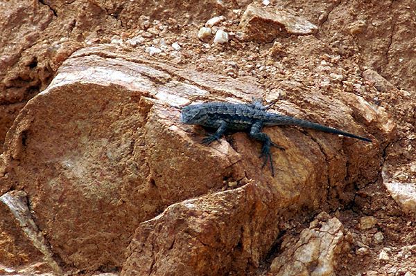 for the park, so needless to say, there were lots of people and dogs on leashes roaming the trails.
Vic-tree lies off the main trail in a canyon wash area. The wash makes a nice right hand bend from the trail affording cachers some privacy without having to worry about muggles while looking for the cache. Tadpole had picked the site out on one of our other hikes and was very proud of his placement. This is why I wasn't too concerned about it being missing since it was well hidden in the stump of a tree up above the wash area around shoulder high to me. You'd really have to be looking for it in order to find it. Yet, when we got there, it was gone. We searched all around the tree to no avail.
At that point in time, Tadpole also decided not to re-hide another cache there, but instead opted for a different hide. I suspect that p art of the reason for that was his Vic-tree wasn't in a victorious mood anymore. The cache was so named after Winston Churchill's victory picture taken many years ago. The tree had a V shape to it and it was a natural name for the cache. However, in the recent rains we've been having, a nearby tree had had its roots undermined by the water running in the wash and had toppled, taking one of the V branches from Tadpoles tree with it when it fell. One could still hide something there, but I think he wanted to let it go for now and hide some new ones.
We hiked back out to the main trail and continued further up the trail, checking on my Scenic Value cache and then finally to, Today, I saw a Lizard cache. Both of these caches are decon containers that I have added camoed duct tape to and they, for whatever reason, are extremely difficult to find. I had to search for a minute or so for Scenic Value and I knew where it was. I wasn't too worried about it since someone had logged a find on the cache on Friday, but the same person had logged a DNF on the Lizard cache as well, so I knew there could be a possible problem with that cache.
As we walked, we also scouted out locations for another hide for Tadpole, but none of the spots that we looked at really suited him, so we kept going up to Today, I Saw a Lizard. As luck would have it, there were two muggles back near Lizard, so we kept walking back to another cache that the Tadpole ended up finding. I'd already found this one awhile ago while out hiking with friends of mine. We then walked back down the trail and got to ground zero for Today, I Saw a Lizard.
As noted above, this one is another decon that is hard to spot. Once again, my eyes failed me and I couldn't spot my own hidden cache. All at once, the Tadpole  announced he'd spotted it and even as he pointed it out to me, it took me a good 30 seconds or so before I could see it. At least that mystery was solved and it was still there. When we got back home, I ended up posting a note to the page and sent two emails to the last to DNFers letting them know that the cache was still there.
The mile and three quarter walk back to the car took most of the rest of the morning, so we decided that our stomachs were more important than trying to find hiding spots for the two caches that we'd brought along on this hike. I started thinking about my own record of cache maintenance and decided that I need to make sure and check my caches from time to time, especially if there have been DNFs logged recently. I know that I don't like it when I get out to a cache site, try to find the cache and then notice on the cache page a string of DNFs logged. The maintenance run on Today, I Saw a Lizard started that process. After all, maintaining caches is part of the game.
As a side note, all of the pictures were not taken yesterday, although in hindsight, I really should have taken some pictures because the views from up there were gorgeous. In the last picture, the mountain in the background is covered with large amount of snow at this time.
Pictures were taken at the following caches:
Vic-tree - by Tadpole95
Today, I Saw a Lizard - by Webfoot
Scenic Value - by Webfoot

Tuesday, February 17, 2009
Endangered Species?
A comment from Chaosmanor in my last post got me to thinking. Now, that in itself is sometimes a scary thought, but think 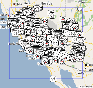 I did and I didn't hurt anyone in the process either. Chaosmanor commented that virtuals might still be around as a cache type had there been some kind of rating system in place when the archiving of virtuals was being discussed. The rating system never came to fruition and the virtuals were archived as a type of cache. However, with the amount of virtuals already out there, were we already saturated with them, or could there be more?
My initial thoughts were there could be more, and then in the same thought, I also pondered, is the virtual in danger of becoming extinct? After a little research, the answer to that one came back a resounding no. The powers that be at Geocaching.com have not decided to archive all of the virtuals like they did the locationless caches a couple of years ago, so the ones that are still out there are still there to find and enjoy. So in reality, it isn't as big a deal as some, perhaps even me, make it out to be. I actually confess that one of the main reasons I would have liked to have seen them continue was purely selfish. I wanted to hide one myself. I have to live with the fact that I missed that particular boat.
The research I conducted was hardly scientific. It was more on the order of looking at different areas and seeing what kinds of virtuals were available in any given area. I ran three maps at Geocaching.com just to see how many virtuals there were in those areas. I 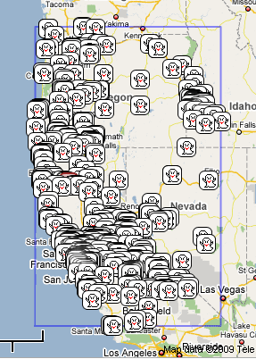 took screen shots of each map to upload to this post. Each map shows 500 virtuals surrounding the center points of each map.
The first map I ran was around my home coordinates. I keep this available more just for interest as opposed to anything else, but because I have it available, it was a good starting point. As you can see from the map, those 500 virtuals stretch into four states and two countries. I know for a fact that I will never find all of those even if I tried. I've already conceded the fact that they aren't going to be all gone ever during my caching career, so I'm not going to worry about it. But then, just for the fun of it, I ran two more maps.
The second map I centered around Redding, CA. Why Redding? Since I live in the southern part of the state about 100 miles from the southern boundary, I decided to pick a point about equal distance from the northern boundary. I've also discussed this with the Tadpole and more than likely, we're going to be camping the next two summers n the northern part of our state, the first year near Redwoods National Park along the coast of California and the second year at Lassen Volcanic National Park, which is east of Redding. Thus, Redding became an obvious second point for a virtual map.
500 virtuals later and you can see quite a bit of overlap between the first two maps. From Redding, the virtuals stretch all the way up to Mt. St. Helens in the north, along the Snake River Valley in the northeast and through most of central Nevada to the east. 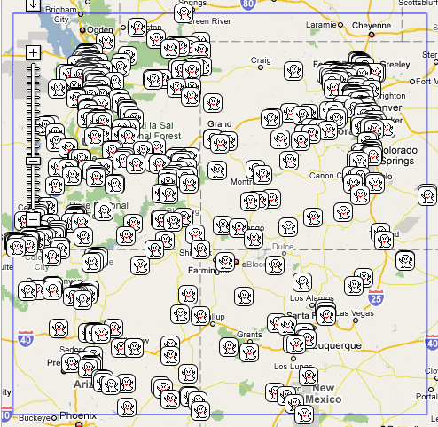 Everything from Lancaster in the south up to almost Sacramento in the north is overlap with the other map. Looks like there's plenty to keep any virtual cache hound busy for quite awhile just in the state of California.
I centered the last map around Mesa Verde National Park in the southwest corner of Colorado. We'd talked about going to Mesa Verde a couple of years ago, but certain events conspired against us and we weren't able to make the trip. The Tadpole brought up Mesa Verde again in our discussion about camping, so I'm thinking that in the next couple of years, it would be prudent to take a trip that way. There's not nearly as much overlap with this map and my Southern California map, but enough that I think I have most of the southwest covered with these three maps. The Mesa Verde map stretches into Wyoming and covers most of the four corners states. Utah seems to have the lion's share of virtuals. Perhaps it's because, at least in my opinion, Utah seems to have that "Wow" factor going with regard to scenery. I'm not saying that the other states don't, but Utah is a very pretty place.
After looking at these maps, it's become clear, at least in my mind, that we seem to have enough virtuals to last us a good long while. I 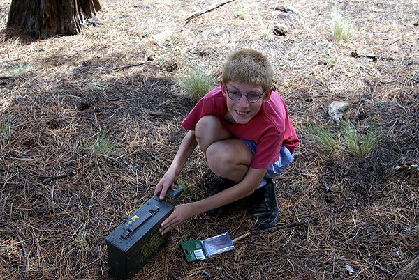 think it would take years, possibly decades for a hardcore cacher to find all of the virtuals shown on those three maps. With that in mind, I guess we just keep virtuals as an option to find if we wish, or not find if we don't.
The Tadpole likes to find virtuals because he finds them educational. He loves learning new things and so the virtuals appeal to him, but I know he also loves finding those containers, especially the large ammo cans. He still gets that excited look on his face when he opens it, almost like it's a Christmas present getting unwrapped for the first time. Even now as a teenager, he still likes looking through all the swag and possibly grabbing some small trinket to take home and savor. I love the last picture, mainly because it reminds me why I continue to geocache. No matter what kind of container we find, or what we learn, we remember that we're having fun doing this silly hobby of ours. We get to spend time with each other which, in the long run, is much more important that worrying about a lot of other things.
Pictures were taken at or near the following geocache:
Old Frat Cache - by jeff jones 86004

Saturday, February 14, 2009
Wow Factor
Over a year ago, I wrote about virtuals and why I thought they had been discontinued by Geocaching.com. The powers that be at Geocaching tried to 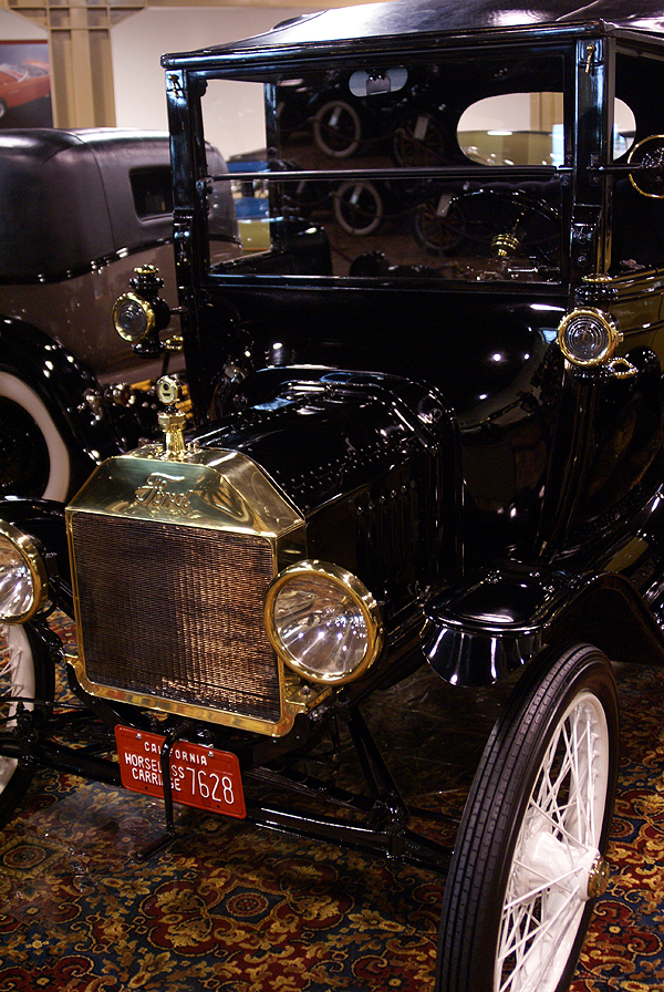 come up with some type criteria for virtual caches that they could live with in order to keep approving virtual caches. Unfortunately, they couldn't come up with a standard criteria for virtuals, so they were grandfathered and no new ones have been approved for several years. Now you can experience something similar to virtual caches on Waymarking.com, but it's really not the same thing at all.
Virtuals are caches that aren't really there, if that makes sense. You go to a specific spot, take a picture and/or gather some information for the "hider" and you get credit for a cache find. I like virtuals because they allow me to find "caches" in spots where I can't find a physical cache, like in a national park, such as Joshua Tree or Grand Canyon. My son and I have found virtuals in both of these parks and in other parks as well. The virtuals in Joshua Tree got us to a trail and spot that we normally wouldn't have gone on if they hadn't been there. We learned some interesting stuff while at these virtuals, including some local history.
The problem with some virtuals is they were missing the "WOW" factor. With a virtual at a national park, the obvious WOW factor is pretty much built in. Once you get to a spot, you usually say "WOW!" and you know it's all good. 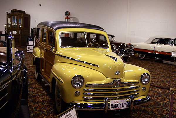 Many virtuals didn't do that. There have been some virtuals that I've visited that, in my opinion, have been downright dull and nonsensical. What was the purpose of taking me out to this neighborhood to show me a house that had medieval turrets? The WOW factor was definitely missing from that virtual. Geocaching.com realized this was happening and put a moratorium on the placement of virtuals. Unfortunately, it's hard to define the WOW factor and so this moratorium has become permanent.
Thursday, I posted about a Vexilla run that I was planning for the next day. It was a successful run, netting me all four of the virtual flags that I'd intended on finding, plus seven caches and one benchmark. All in all, it was a very good day. I also discovered a virtual cache that definitely has the WOW factor.
We'd planned on getting the virtual cache, Putt-Putt, Beep-Beep that morning. I wasn't sure what to expect at this cache outside that it was a museum showcasing classic cars. I tend to not read cache pages in depth very often and I 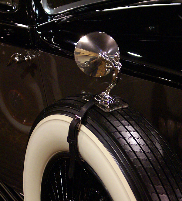 hadn't read this one, so I wasn't sure what to expect when we got here. I'd never heard of the Nethercutt Museum, so I figured it was some small collection of cars. We'd get the information for the cache find and be gone. I actually said, "WOW" when we walked in the front door of the museum.
As you can see by the pictures this place was huge and had some magnificent cars in it. There was one entire row of classic Rolls Royce's. Every car, with the exception of one had been restored to pristine condition. The attention to detail was phenomenal. There was evidence that polishing and cleaning is a never ending job in this place. Once we'd found the answers to the questions on the cache page, we could have gone on our merry way. I think we left at least an hour after we'd found the answers, the place was that fun.
One of my favorite cars in the collection was the 47 Woody with real wood paneling and a beautiful yellow paint job. The only thing missing was a surfboard. Then we entered a side room and saw the pièce de résistance. In the side room was the original 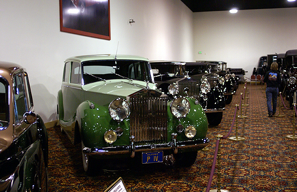 1964 ½ Ford Mustang, the first Mustang to be issued a VIN. It was immaculate. I was in serious lust at this point in time.
Eventually, we had explored every nook and cranny of the place and it was time to take our leave and continue our cache run. I'm sure that some auto fanatics could spend an entire day in there. I probably could if I knew that I didn't have any kind of agenda for that particular day. Not only that, the price is right, since it's a free admission.
It's fortunate that this particular virtual was created before the moratorium happened. Hiding a small micro in the bushes outside of the museum wouldn't necessarily get people to come inside the museum. I could see many people just stopping by, logging their find and moving on. They would lose because although the cache was a physical cache, they wouldn't necessarily explore. That's too bad and that's why sometimes, virtuals do have their place in geocaching.
The pictures on this page are just some of about a dozen or so that I posted in my log for the cache. Feel free to click on that link and see the rest of the pictures there. Oh, by the way, did I mention there's a train out in back?
Pictures were taken at or near the following geocache:
Putt-Putt, Beep-Beep - by HenryKnowsBest

Thursday, February 12, 2009
The Interstate 5 run
I'm starting a long four day weekend today. As of 2:10, the weekend had begun, but I stayed at school about an hour longer to get some paperwork done before heading out. 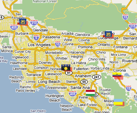 Then I made a side trip to REI to pick up a windshield mount for my Garmin eTrex Legend. Up until this year, California was one of only two states that didn't allow windshield mounts for anything. As of the first of the year, the state now allows windshield mounts for GPS units as long as they are placed in the lower left corner or the lower right corner of the windshield. I plan to use the mount tomorrow morning when I go on a virtual flag run starting near Sylmar and ending somewhere down in the OC.
If you look at the map, you can see a nice line of 4 virtual flags running in a southeasterly direction, or northwesterly direction along Interstate 5. The purpose of this game is to get to within 100 meters (325 feet) of these virtual flags and tell others what you found there. Points are scored for each flag found. I found the Ecuador flag just south of Corona on the map last week and the flag situated in what looks like the middle of Rancho Cucamonga is pretty much inaccessible to get. The red highlight around the flag indicates that it's about to expire within the week and then won't be there anymore. Not like it's there anyway, since it's just a virtual flag. I could still go to the point, but couldn't score any points for the flag after it expires.
We plan on starting at the northwest end and work our way to the southeast on this particular trip. I ran some PQs around each spot where there would be a flag present, so at each spot we'll grab a couple of caches as well. I looked over some of the caches last night and picked a couple out that I want to try and get. That's one of the reasons I got interested in GeoVexilla. The flags are randomly generated, so when flags come up near where I live, I can go out and get those flags, plus possibly cache in a new area where I haven't cached before.
There appears to be an interesting virtual cache at an automobile museum near Sylmar. I wasn't aware there was a museum up in that particular area, so I'm hoping it should be an interesting side trip for us. There are also a couple of Letterbox Hybrid caches down in Orange County that we might be able to get as well. I've been working on a Letterbox Hybrid of my own, but haven't found the right hiding spot for it as yet, so getting one of these might prove helpful. Letterbox hybrids involve using clues, not necessarily geographic coordinates to find the cache.
All of the caching will be weather dependent since we have a high chance of rain tomorrow. It's actually supposed to rain the entire weekend (who ordered this up on a four day weekend no less?), but we'll see what happens. Tomorrow looks the least likely for us to get wet, so that's a good thing. We do have one more stop that's not marked by a flag on the map and that would be lunch. Since we're going to be driving very close to corporate headquarters of In-n-Out Burger, we're planning on stopping there for lunch. There's a micro there which we hope to grab and a couple of blocks north is a cache hidden near one of the old stations to the Pacific Electric Railway, commonly called the Red Car. For those of you not from Southern California, and have never heard of the Red Car, the movie "Who Framed Roger Rabbit" deals with the eventual demise of the Red Car in a very humorous way. Whether that's actually what happened or not is beside the point. It's a very enjoyable and well done movie and had some good groundbreaking new types of animation in it, pre-Pixar.
I don't see too many obstacles to our run tomorrow. It should be an enjoyable day. I'll write more about it later in the weekend, particularly if I happened to be rained in for the rest of the weekend. I'll not complain though, since the entire state needs a few more good soakings this year and perhaps every year to keep the reservoirs filled. Drought is not a pretty thing in the state of California.

Sunday, February 8, 2009
Three stages
My photography in geocaching has taken three distinct phases. When I first started, I was still using my Minolta Maxxum, which I loved dearly, but was showing its age  having been a wedding gift to me from my wife back in July 1987. Pictures came few and far between, usually when I was at the end of the roll of film. I'd take the camera out and take some pictures, none that good in my opinion, but just enough to fill out the roll. Once processed, I'd then scan them and add them to the cache logs after the fact.
Sometime in 2002, I purchased a point an Olympus point and shoot, Camedia camera. I liked using that one a lot since it rejuvenated my portrait picture abilities. I would take it to family events and take many pictures. The built in flash was the major bonus with this camera. The Minolta had only an attached flash, that was cumbersome and needed to be remembered, which was not conducive to candid portraits that I preferred to take at family gatherings.
I was, however, still wedded to my beloved Minolta. That summer, the boys and I went camping along the coast of California. I took both cameras along, intending to use the digital camera to record caching adventures and the Maxxum for everything else. At our first stop, my son said, "Dad, why don't you just use the digital camera for everything this time and see what happens afterwards?" As most people know, there was quite a bit of lag time between taking the picture with an early digital camera and it actually imprinting on the memory card. This caused a couple of problems, but nothing that I couldn't work out. I worked on timing and it went well, although I have to admit that my son jumping the "mini" ravine in the one photo took several tries before I was satisfied with the end result. I've used the Minolta only once since that summer when my son suggested that I go totally digital and only then to empty the roll of film that was in the camera. I used the entire roll of film to take a series of pictures of my in-laws. The first picture was the best of the entire roll. I am so glad I went digital. There's not nearly as much waste as there used to be.
The third phase happened a couple of years ago when I purchased my first SLR Digital, a Sony Alpha. At first I was amazed at the quality of the images. The picture of the leaves is my first picture I took with that camera while on a caching run. This camera has combined the best of both worlds of my first two cameras, built in flash a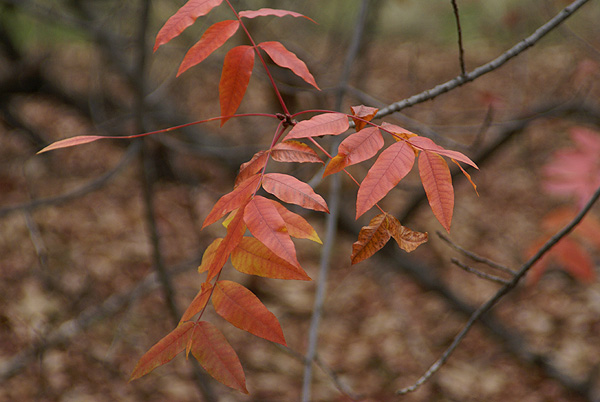 nd SLR capability. With this one, I have an excuse to bring the camera every time. I don't necessarily use it at every cache. I mean, how many pictures of lamp post skirts would I have to publish before they would get terribly redundant? I'd say, probably two. But when the opportunity presents itself, I have the camera with me to record our caching expeditions. That makes for a more complete record of our experiences out and about.
Pictures were taken at or near the following geocaches:
A cache for Mike! aka Snake belly! - by BDC
The Redwood Barely There! - by Scott, Becca, Travis, Max
Cache Out - by CARGOLAX

Thursday, February 5, 2009
Another Five Percenter
While out caching last weekend, the group that I was caching with found two very interesting and/or exceptional caches, both of which made 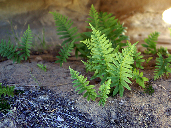 my top 5% list. This list is my bookmark of what I consider my top 5% finds. The list changes as caches are added to it or removed because they've been archived. Since this list is public and visible on cache pages I want to keep it current and up to date. There is a cache at the top of the list that is temporarily archived, but I'm hoping the owner of that cache will replace it because I thought it was a good hide.
So what does make a 5 percenter? I guess it's a combination of things for me at least. They don't have to be rugged 5 star hikes to make the list. My average terrain rating for all caches found is a modest 1.58, so I really haven't been on my really tough hides like that. I like a little whimsy when I find caches. Caches that make me chuckle and laugh are usually rated higher than a typical lamppost hide, but then I would be willing to bet that lamppost hides don't rank too highly on most people's cache ratings lists. Then again, maybe I'm just deluding myself.
The cache we found this weekend called Lizard Mouth Cache was a fun cache to find. It was a small container tucked into a small crevice of a rock with several other rocks guarding the cache site, none of which could be moved. We actually had to use a tag team approach to finding it. I could see the cache from the other side of this one rock by getting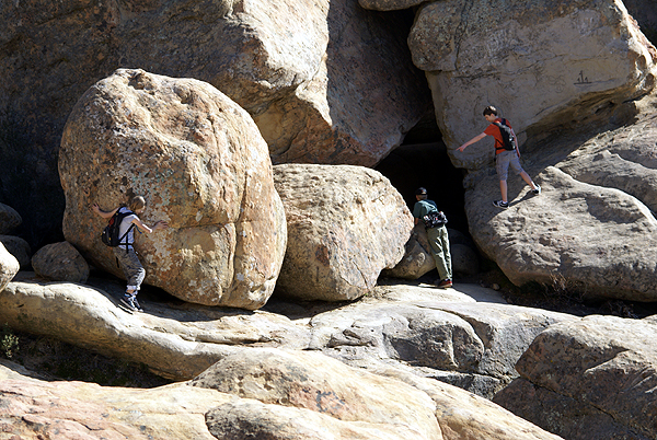 down and looking underneath it, but because of the size of the rock, I couldn't reach the cache. Cache Viking had to put his arms in between two boulders while I directed his hand movements so he could make the grab. This was point number one for an inovative way of making the grab. I suppose that a single cacher could make the grab, but it would have been tough to do.
After we found the cache, I looked it up on the cache page because I keep a record of my cache finds in my PDA, so I can remember the order of cache finds when I log them later on. I noticed this particular cache was a three digit cache, meaning it was a fairly old cache dating back to the early days of caching in 2001 or so, yet it had a hide date of 2006. Now this didn't make a whole lot of sense until we saw that the cache had been adopted. I didn't read the entire cache page at this time because I'd already gotten the information I needed at the time, so I didn't really think much of this, but something was bugging me about the cache.
The kids enjoyed this cache a lot, probably not from the same perspective as the adults did, but from the endless possibilities for scrambling that lay before them. The area looks like God just poured out his bag of 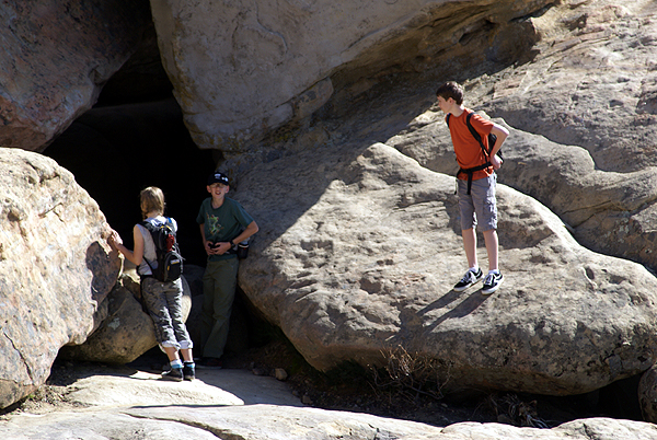 marbles on this hillside and let his rock marbles drop where they may. We watched the kids play for a good half an hour or so and eventually got sucked into their play as well. My favorite picture is one that has large boulders and small kids playing on them. I loved the contrast between the two. Cache Viking noted that the other picture looks like the kids are all saying, "Are you going in there? I'm not going in there. Why don't we wait for one of the adults and then sacrifice them?"
Because this area had also been passed through by the Gap Fire of last summer, the vegetation was thin in most spots, but there were areas where plants were already making a comeback. We found ferns growing in the shade of one boulder using nutrients from some of the ash for sustenance. Small pockets of grasses were starting to take hold and there were still plenty of spots where large patches of lichen still clung to the side of the boulders. There were endless possibilities for pictures and I took full advantage of them. That's usually a pretty good divining rod for me when I decide a cache goes on my top 5% list. If I've taken a lot of pictures, it usually means that the site was a pretty good one.
When I got home that evening, I took a longer look at the cache page and discovered that this cache was at least a second generation cache, meaning it had been muggled sometime in the past and had been replaced. The original had been hidden by Jeremy Irish, the owner of Groundspeak, the company that basically runs the Geocaching website. I found that rather interesting, even if it wasn't the original container. It almost felt like one of those 6 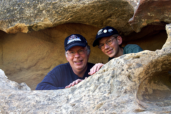 degrees of Kevin Bacon type of things.
With the kids having such a good time, great photo possibilities, a good hiding spot, great views, a short hike and the history behind the cache, I felt this one was a worthy addition to my list. As noted above, the list does change and caches get moved off the list as I find other caches that are more worthy. This cache didn't have great swag, it wasn't a large container, nor did it have a longish hike attached to it. It was the other intangibles around the cache that made it a good cache in my opinion. And, unless this cache gets muggled, I'm pretty sure this one will stay on the list for a long time.
Pictures were taken at or near the following geocache:
Lizard Mouth Cache - by MJJJFISHER (Adopted from Big Daddy)

Monday, February 2, 2009
Survival of the fittest
Saturday, I went caching with friends from a couple of places in the southland. We ended up meeting in the hills above Santa Barbara for a caching expedition of "epic" proportions. It didn't work out the way we'd planned it, but that's 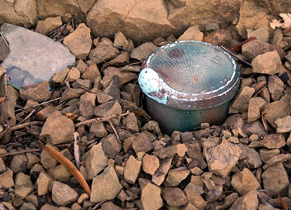 OK, because we still had an enjoyable adventure. Life gave us lemons and we made some lemonade.
When we'd planned this trip, our main goal for the day was to find C' ISMUHU, a puzzle cache by IGBAY OOBAY who is known for his challenging puzzle caches. After finding a couple of preliminary caches, we met up and then drove up to the trailhead to start our adventure. Unfortunately, the area where this cache had been placed was closed for rehabilitation of the flora due to the Gap Fire that roared through the area last July. Signs were posted everywhere stating the area was closed and would be closed until September 2009. So we punted.
The signs also stated that the Lizard's Mouth area along this road had been re-opened, so we decided to drive up there and try our luck with some of the caches up there. We got up to the end of the road and found a place to park 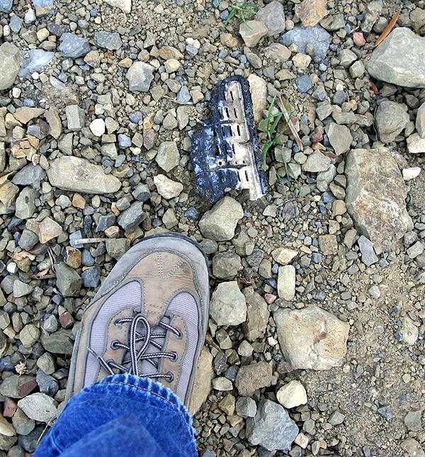 and then started a hike down to Western Skyway 3. The dirt road is apparently being let go, as it was quite rough and rocky and a 4WD vehicle would have been needed to get down it had it been open, but it was closed to vehicular traffic probably due to the fire.
Since we were hiking, it made for a pleasant walk without having to worry about traffic coming or going along the road. The distance to the cache was approximately .31 miles, but we walked over a half mile down to get to the cache because of the way the road bent around the hillside. At one point, I thought we were going to have to turn back because my GPSr was making it look like the cache was on the other side of the ridge we were walking around. Two more steps or so and the GPSr righted itself and we were in the ballpark again and on the right trail. I'll blame signal bounce for that one since we were very close to a large cliff as we were walking.
Once at ground zero, I wasn't very optimistic about finding the cache. The entire area had been burned out from the Gap Fire and there wasn't much living  plant material around. I spotted a melted piece of plastic and expressed my thoughts that we might be very lucky if we were able to find the cache due to the fire that had passed through this area. But when we looked at the cache page, we noticed the cache had been found on the 18th of January, so we knew it to be here, unless it had been muggled between then and now.
As we continued to search, I spotted something that didn't quite look right and asked the Tadpole to check it out. Sure enough, it was the cache. As you can see from the picture, the cache had suffered some fire damage, but all the contents were OK. For the most part, it was pretty much out in the open the day we found it. The picture shows exactly how we found it. I can only imagine that it had been hidden under one of those infamous geocaching SPRs (Suspicious Pile of Rocks) to have survived the fire with minimal damage. I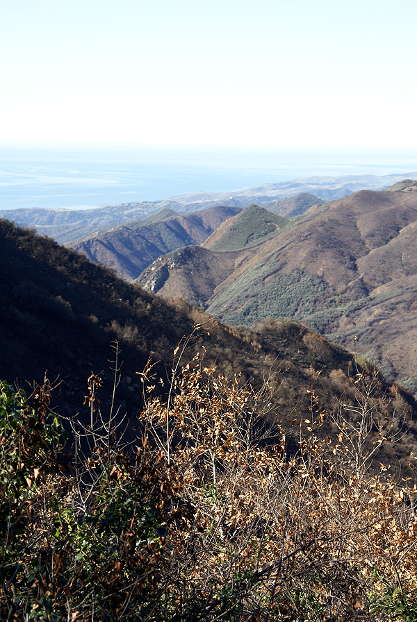 had to put this one on my 5% list, after it had survived what it had.
A similar fire passed through the Chino Hills area recently, burning 95% of Chino Hills State Park. On a ridge, just off a fire road in the park, is the cache San Juan Hill. This cache was the second cache I had ever found. It was found after a 2 and half mile hike from the Orange County side of the park. We met other geocachers on the trail that day and the cache has special meaning to me, because it was the longest surviving cache that I'd found. Unfortunately, it's probably gone due to the fire that went through the park last year. However, seeing the Western Skyway 3 cache, I feel there's still hope. Since the Chino Hills State Park is still closed, I guess we won't know for sure for a little bit. I will continue to hold out hope in the interim.
Pictures were taken at or near the following geocache:
Western Skyway 3 - by GeoBigDogs

Subscribe to:
Posts (Atom)