Back in June, I wrote about finding a benchmark in a vertical fashion, attached to the wall of a bank. Now before that time, I was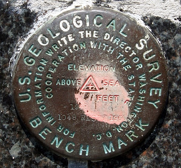 under the impression that benchmarks were disks that were found flat on the ground, either on curbs, or on structures that probably weren't going to go anywhere, like bridges. Then, I found another one on the side of a courthouse in Merced, CA last August. Hmmm. Now I had found two benchmarks that were positioned on the side of a building. I stumbled across a third one this weekend, also placed into the side of a bank.
Well, it's starting to make sense now. Placing a benchmark disk on the side of a building, is placing it on a structure that's probably not going to go anywhere, although there could be some doubt about doing that extensively in Southern California due to earthquake activity. There's at least three that I've found recently that are on the sides of buildings, so it must be more prevalent than I previously had thought. And it does make a lot of sense now that I look at some benchmark pages with this kind of placement. The settings for the benchmark are listed as "massive structures with deep foundations" and the stability of the 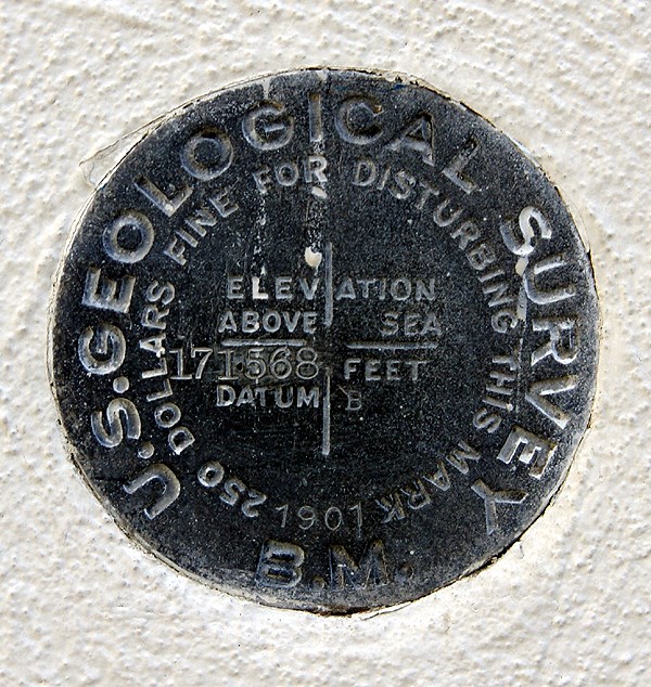 benchmarks are deemed "most reliable and expected to hold position/elevation well."
The one that I found on Saturday was one of those serendipitous finds that I just happened to stumble upon. I had been out caching with my friend 3blackcats in Azusa (the town that has everything from A to Z in the USA) and we had just finished up our day of caching. We had already passed the benchmark once heading to the cache and were making our way back to our car when I noticed this nice benchmark at chest level stuck in the side of a Wells Fargo bank building. Since it was labeled a US Geodetic benchmark, I knew instantly that it would be in the benchmark system at geocaching, so I had 3blackcats take two pictures of it for me with her Blackberry. She sent them to my via email from her phone (geez, you have to love what our technology can do today) and I logged the benchmark later on that afternoon. It was my 20th benchmark logged.
Not noticing the benchmark on the first pass by, to me is really inexcusable since it's right there. I saw it right away coming back, but I can use as an excuse that I wasn't paying attention to my GPSr or looking out ahead to see if I could figure out where the cache could be placed while we got to the cache area. I can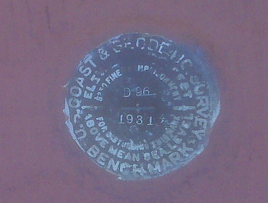 remember talking with 3blackcats, theorizing where I thought the cache might be as we walked toward it, so I have to assume that my attention was diverted enough that I didn't see the benchmark. I need to work on that in the future. Looking over some of the cache pages of other caches that I logged this weekend, I missed at least one other benchmark.
But, I also go back and forth over this all the time in my mind. I went through a period of time several years ago where I was actively seeking benchmarks. Now, if I'm in an area, I'll check out likely structures or areas where there might be benchmarks, but I haven't really gone out of my way to seek them out. The sudden finds, like this one on Saturday seem to be the most fun for me right now. That could change over time. The one thing that I want to continue to do is take a picture of each benchmark that I log. I don't understand why people would log a benchmark if they haven't taken a picture of it.
Pictures were taken at the following benchmarks:
EV9089 - San Bernardino City Anderson Building
HS1151 - Merced County Courthouse
EV2527 - Wells Fargo Bank Building - Azusa
Sunday, January 11, 2009
Changing perceptions

![]()
![]()
Subscribe to:
Post Comments (Atom)
1 comment:
I have at least a dozen logs for BMs that are vertically mounted. Several of them are on buildings - my two favorites are the one on Santa Clara High School in Oxnard, and the building on the corner of Signal Street and Highway 150 in Ojai, next to Libbey Park - but most of them are on support pillars for freeway overpasses. Hundreds of BMs in the NGS system are of this type; many are NGS, or even older CGS, disks, but far more are State or County disks. CalTrans is the predominant agency in California, but I've seen a couple of County ones that are listed.
Probably my best story for one of these was stopping on US 101 in the Salinas Valley, somewhere between Paso Robles and King City. I'd passed this particular one many times, but had never stopped, either because we were behind schedule, or because I forgot to stop for it on a particular trip. This time, Sharon and Liann were in the car - I believe we were taking her back to HSU after a break - and I slowed down and pulled over in the narrow emergency shoulder, hopped out with my camera, took three quick shots of the disk, and the overpass in both directions, then hopped back in the car and headed off again. The whole process took less than a minute, and traffic was light: I don't think I actually had to deal with a single vehicle. But I was worried that a CHP officer might come along; I wasn't eager to explain what I was doing, even though I had a valid reason, at least in some lights.
Anyway, the next time you take the 99 north to Stockton, check out the overpasses, especially for the older roads; bet you see at least two or three vertical BMs :-) In fact, if you look at your account, look at the caches you found along the 99, then look for nearby BMs to them. Bet at least a few BMs on pillars show up.
Keep up the good work on those BMs! And don't hesitate to log them with the NGS if it has been even five years since the last Recovery, especially if any details have changed. They are really pleased, overall, with the work that geocachers have done since the database was uploaded by Groundspeak. A lot of Marks have been Recovered in the past 5-6 years by amateurs who do it for fun and personal satisfaction, but it serves a Real World purpose, and they are thankful.
Post a Comment