I'm pretty sure that I've noted in other posts about one of my general likes about geocaching. When I first got involved, most of 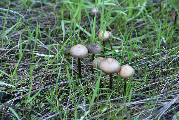 the caches hidden were on trails in the foothills which required hikes to get to them. Urban micros didn't exist yet, so you had to get out on the trail, exploring your own backyard in a way.
3blackcats and I did just that this weekend, taking a ride up into Azusa Canyon and exploring a trail that supposedly leads up to Silver Mountain. I'm not sure whether it does or not as we were relying upon the two cachers that hid 6 caches between them along this slightly strenuous trail. The trail rose gently from a road turnout, overlooking Morris Lake Reservoir and dam. The lake was low and there was a substantial bathtub ring along the lake, but I'm sure that was in preparation for spring runoff because they were 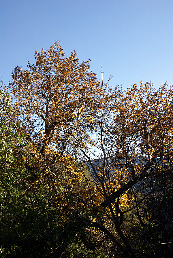 letting quite a bit of water go from the bottom of the dam.
I'd never been up in this canyon, either by just car touring, or hiking, so this was another case of geocaching getting me out to explore the gems that are hidden in my own backyard. I know in the past I've written about my first cache find which took me to a park, only seven miles away from that I'd never heard of before that day when I went hiking with my two sons to find a cache. I've explored quite a bit of that park since that time and will go back again in the near future to hide several more caches. From a geocaching perspective, I view the caches as my spot on the geocaching map and yet 8 years ago, it wasn't a blip in my mind.
With the rainy season upon us in Southern California, the area where we hiked has "greened" up tremendously, so much that we were walking in many spots on a carpet of grass as opposed to a dirt trail. I'm not much of a botanist, so I don't recognize all of the plants alongside the trail, but there were berries in profusion in one area and mushrooms growing in the shadows that hadn't seen much sunlight over the past couple of months. There were several non-native plants in the area 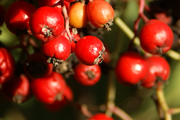 that made an impression on me as well.
At one point on the trail, we had to stop because a small breeze had picked up. It wasn't the breeze so much as it was this very tall aspen, which is definitely not native to this area, that had started quaking. The wind rustling the leaves of this tree made it sound like we were standing next to a small creek listening to the water flow gently over the rocks. I was reminded of a rain stick that I've seen in stores that sell Australian artifacts. Just as suddenly, the breeze stopped and our creek symphony stopped as well. At one of the cache sites, we noticed a very large Pampas grass plant, quite out of place, yet the position on the ridge overlooking the dam was quite stunning in my mind. I took quite a bit of time composing the picture that I finally ended up taking. I hope I did the subject justice.
The more I geocache, the more I'm drawn back to areas like this. These hidden treasures close to urban America hopefully will 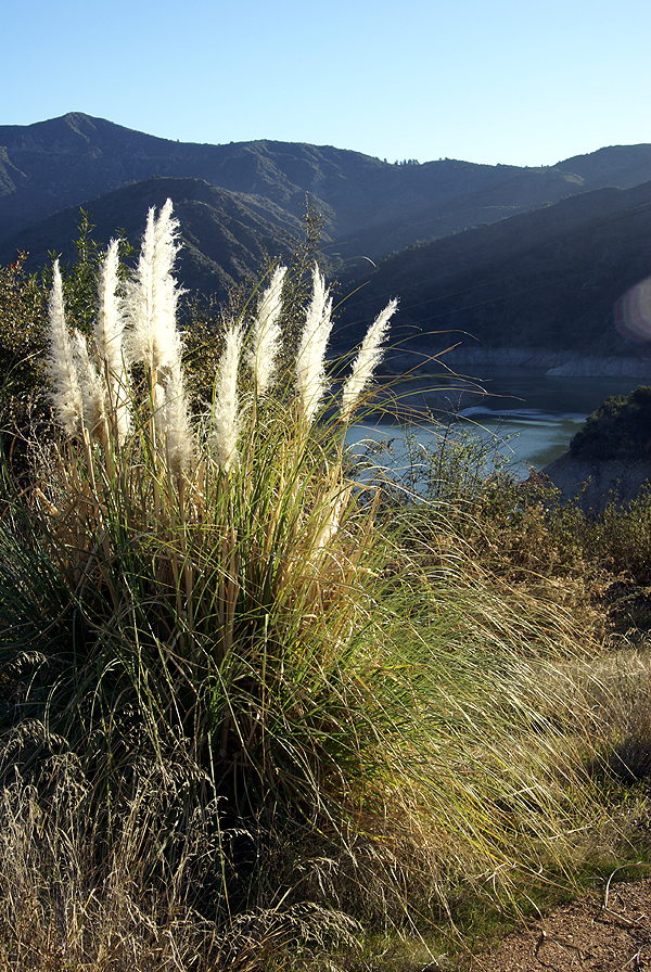 be preserved for many years to come. I would suspect that this particular trail gets more traffic on it now because of the geocaches that have been hidden nearby, but I'm not sure if this is such a bad thing. We found a couple of areas that obviously were drinking areas for people and were probably drinking areas before the caches were hidden. We carried out a couple of empty beer cans we found alongside the trail. We chose to leave the used condoms where they were. Ugh. Maybe the increased traffic will cause a reduction in some of these other types of activities.
Your "backyard" is probably different than mine, but I would be willing to bet there's still areas that you haven't explored. I encourage you to explore them a little bit more. You might be surprised by what you find out there. I'm already looking at other trails to explore in the coming months before it gets too hot out here again. This is the perfect time to walk on our trails and I intend to make the most of this time.
Pictures were taken at or near the following geocaches:
UJs SILVER MOUTIAN AMO CAN #1 - by Uncle Jon
My Silver Mtn Trail #1 - by nottom
My Silver Mtn Trail #2 - by nottom
UJs SILVER MOUTIAN AMO CAN #2 - by Uncle Jon
UJs SILVER MOUTIAN #3 - by Uncle Jon
UJs SILVER MOUTIAN #4 - by Uncle Jon
Tuesday, January 13, 2009
Exploring your own backyard

![]()
![]()
Subscribe to:
Post Comments (Atom)
2 comments:
"At one of the cache sites, we noticed a very large Pampas grass plant, quite out of place, yet the position on the ridge overlooking the dam was quite stunning in my mind. I took quite a bit of time composing the picture that I finally ended up taking. I hope I did the subject justice."
I would say, without reservation, "Yes." Definitely postcard or calendar material :-)
I do a lot of solo hiking in the Santa Monicas: lots of good trails, mostly well-maintained, many with plenty of caches on them. Much too dry and hot in August and September, but the rest of the year, this is a nice place to get in a few miles of "Communing with Nature". And there are plenty of other areas in SoCal, when we want to expand our horizons. The problem is having a plethora of options, rather than a dearth of them. What amazes me is how small a percentage of the average (i.e. geomuggle) population has ever taken even a short hike on any trail in the mountains that ring the Greater Los Angeles Metropolitan Area. Of course, it means that the trails are more open for those of us who *do* use them, but it's also a shame that more people don't see what's just a few miles from their homes, schools, churches, work, etc. Puck was more right than he knew :-(
Thank you. I would love to have one of my pictures turned into a calendar, postcard, or even a puzzle, one of those 1000 piecers.
Post a Comment