Our second day of our camping trip was pretty much dominated by a couple of very nice hikes, one 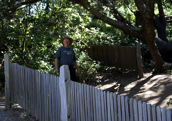 we'd planned on and one that doubled in length due to my own stupidity. We were camping in Samuel P. Taylor State Park which is adjacent to Point Reyes National Seashore. It was at Point Reyes where we made our first hike along the earthquake trail.
Just east of the visitors center, is a nicely laid out interpretive trail, which tells about earthquake activity in the local area. Point Reyes sits atop the San Andreas fault zone and was formed by the fault. To the east of the park lies Tomales Bay, which is a drowned part of the fault zone as it heads out to sea. The trail we took wound through the fault zone area south of Tomales Bay, with interpretive signs alongside the trail where we could read about earthquakes, most notably, the deadly 1906 San Francisco earthquake, which destroyed most of the city, either by shaking or by fires after the fact.
The area we were hiking through was the epicenter for that earthquake. There were fence posts that followed the fault line which was responsible for the shaking over 100 years ago. At one point we focused on a fence that had been offset 18 feet by the earthquake. Having experienced several 7.0 or larger earthquakes in my lifetime, 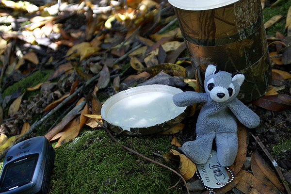 I've never seen that kind of horizontal movement of the earth. I can only imagine how terrifying that might have been. If you look at the picture of me standing behind the fence, you can see the 18 foot gap where the fence had been ripped apart. This was not the original fence, but a replica created on the site of the original.
Besides the geology, which we used to complete an earthcache in the area, we also enjoyed the diversity of animal life. At one point, I heard a rustle in the bushes to our left and spotted a newborn fawn, complete with spots. It was too dark to get an adequate picture of the fawn and I was prevented from getting any closer by trail manners and this deer's own skittishness. After this one started walking away, another arose from the bushes to follow its sibling. As we rounded another corner, we spotted what we think was the mother of these two walking along the fault line. We also saw many fence lizards enjoying the sunny day. Bumblebees were enjoying the summer flora by taking in the pollen and nectar from some poppies that we noticed in the field.
The sunny skies were an illusion for us as we traveled out to the point. There is a lighthouse out on the point which we wanted to visit. 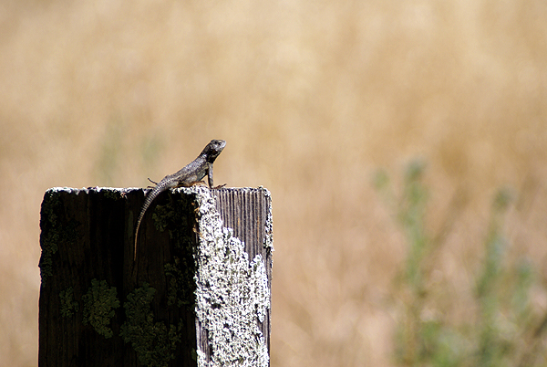 Unfortunately, due to budget cuts in the National Park Service, the lighthouse and visitors center wasn't open that day. We figured we still might be able to walk out to the point to get some perspective on what it would have been like. As we drove the 18 mile road, the weather started getting worse and worse. Finally, we were driving in fog in open range country. The seashore is home to 7 historical dairy farms and I had to drive very slowly in the fog in order not to hit any cows that might be in the roadway.
When we got to the parking area for the lighthouse, we noticed wind blowing. Hard. We got out of the car and the wind hit us with gale force intensity, probably gusting to 50mph or so. Fog was traveling horizontally over the point and we couldn't see much more than 20 feet or so in front of us. Even with coats, we would have been defeated by the weather. But it was an adventure we'll not lose the memory of, so that's a good thing.
After being stopped by the weather, we decided that we needed another hike and Tomales Bay State Park provided the spot for that. Our entrance fee was waived because we were camping in nearby Taylor State Park, so we drove down to the beach and parked. We ate a nice picnic lunch, then headed over to find a geocache where I wanted to drop off a travel bug that 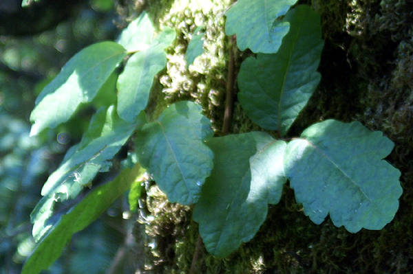 I'd brought along. We got out to the cache after a half mile hike and encountered several difficulties. One was a bee hive in a dead tree about 50 feet away from where the GPSr was saying ground zero was. This could be a problem, because the tree cover was heavy which could affect the accuracy of the GPSr. The cache could very easily have been near the bee hive. Reading over past logs on the cache page verified that it was not so that was a relief.
Our second problem was large amounts of poison oak. Along the hike in, we'd spotted it in several locations and it was flourishing along this trail. I spotted some with leaves as large as my hand. There was some around ground zero that we noted when we finally spotted the cache, but nothing that would cause a problem. However our third problem was the most idiotic. There was no pen in the cache. Why such a large cache didn't have a pen is beyond me, but I should have come prepared anyway. With no pen, we couldn't sign the log so we had two choices: sign in 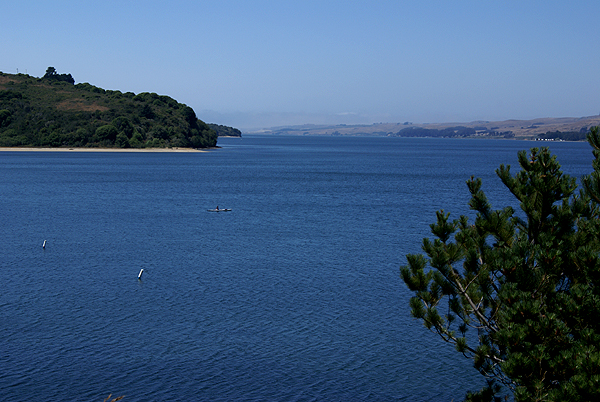 blood or hike out to the car and get a pen. We opted for the latter option thus turning a one mile round trip hike into a two mile round tripper. But then again, it's an adventure.
After dropping off Roger Racoon (sic) the travel bug, we felt we'd had a pretty successful day caching, even though we ended up finding but three caches. It wasn't about the numbers, but the experiences we had. We would have other days where we'd find more. Today was a day to stretch our muscles and get some exercise, while finding a couple of caches. We accomplished that.
Pictures were taken at or near the following geocaches:
Point Reyes EarthQuake Trail - by forman
Johnstone - by Mike P. (MPERC) adopted by forman
Sunday, August 2, 2009
18 feet

![]()
![]()
Subscribe to:
Post Comments (Atom)
No comments:
Post a Comment