I've been rethinking my geocaching goals for the year. A couple of years ago, I wanted to average at least one cache find per day for the entire year. I did that very easily and almost averaged 2 caches per day.  The next year, I slacked off a little and found 18 fewer caches than the year before. This year, probably because of the surgery, I will probably average less than that. Well, gas prices are probably helping with that as well.
I guess what I'm really coming around to is that I'm thinking about getting back to the roots and looking for better hides as opposed to just going out and caching for caching sake and having that end up being just another numbers run. I want to try and get some more hikes into my caching repertoire this year. So I'm starting to scout out some areas that I haven't been in before to look for some possible hikes with caches.
Yesterday, the Tadpole and I went out into Riverside County to look for a dashpoint, actually two dashpoints. I ran a caching PQ around the second dashpoint which was out near Menifee in Team Hick@Hearts neck of the woods. I had considered emailing him to see if he wanted to come along, but then I remembered that he was planning on hitting the Flash Mob event down in San Diego. After Saturday, we'll probably be out many more times, so another oppotunity will present itself in the near future I'm sure.
At the first dashpoint, we struck out, getting only .18 miles from the point, not nearly to the magic 100 meters needed to claim the point. The point was located in the middle of a major trucking facility and there was no way in to get close, unless we wanted to trespass and risk prosecution. Nah, I don't think so. My sense of adventure isn't that high, especially when I have the youngster with me and he's probably going to be learning some life lessons any time he's with me.
So we headed out to Menifee, where I knew the dashpoint was a drive by. I wanted to see how close we could get. It was located near a road, but on the other side of a railroad right of way. We got to 73 feet, so we scored that one. The pictures are nothing to write home about, but it was nice and quiet out there. There were a couple of nearby caches, so we got those. The second one was probably the most memorable one of the day, being the only ammo can we found. As we were walking up the short trail to the cache, the Tadpole was ahead of me and I warned him to be on the lookout for snakes.
The trail split and he went one way around a bush and I went another way. We were about at ground zero at the time, so we'd both stopped to begin our search when I hear a "Whoa!" I asked him what's up and he just nonchalantly states, "Oh nothing, just a big snake in the trail up here." For a twelve year old, seeing his first "in the wild" snake," he was really cool about the entire encounter. I told him to back up and I came around. By that time, the snake figured that two of us was probably one too many, so he slithered off into the nearby bush. He was a fast booger too. I just caught the tail end of his act, but the Tadpole saw the entire two to three foot snake in the middle of the trail.
Fortunately, it wasn't a rattl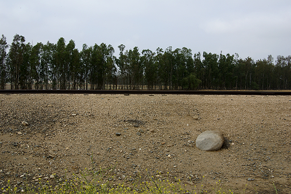 er. When we got home, I researched it a little and found what I thought it looked like based upon what I'd seen and when I pulled up the photo, the Tadpole said, "Yep, that's what I saw." Looks like he got a close encounter of a California Striped Racer. I'm still impressed at how cool he was about it. When I mentioned it to him afterward, he said, "Oh, I wasn't worried about it. I didn't hear any rattles, so I figured that it wasn't a rattlesnake or anything that would really hurt me." Yeah, well son....looks like I'll still watch out for him for awhile longer. What was really funny is the snake helped us find the cache, because it went into the bush and literally slithered right over the ammo can while on its full retreat. Oh, there it is.
We drove back home, finding several other caches in the local area, none of which were anything out of the ordinary small to micro variety of caches, but we did end up finding a nice trail that looked to have some caches up on it. It was getting toward lunch time, the Tadpole was tiring quickly and I hadn't been prepared for a hike of any magnitude, so we passed on them today, but as I look at the map, there appear to be about 23 caches spread out on a couple of hills. If the weather holds, I might convince the Tadpole to come out on Memorial Day, or possibly I can convince any of my other caching friends to either go that weekend, or possibly the next weekend. It's getting late in the season to go on something like that, but if the "May Gray" or the "June Gloom" holds, it'll work. If not, I can keep that trail in the back of my mind for a fall or winter hike. I'm sure the caches will still be there, unless a fire goes through.
Anyway, the first scouting attempt turned out fairly well. It looks like a good trail, with several good caches on it, with a nice hike to boot. Reminds me of my first caching experience - 7 miles away and a half mile hike.
Pictures were taken near the following cache:
Jack's Cache - by jeepnakd
Sunday, May 11, 2008
Scouting

Friday, May 9, 2008
A Rant
Yesterday, I went caching after work. I've been avoiding the area around where I work recently, mainly because the area's become infected with what several other cachers have called "microspew." Unfortunately, I have to agree with them. But that's not what my rant is about today and I'm not really sure it's a rant, but more of a bemoaning of the fact that crap happens like this all the time.
One of the caches that I went to find yesterday was Old Oak? by the4dirtydogs. It was less than 2 miles away from work, and supposedly, it had a geocoin in it. And this particular geocoin, was not just any geocoin, but a 2006 California Geocoin owned by my caching buddy, 3blackcats. I'd been lucky, because I'd already seen this particular coin once way back in October of 2006, and then again in November 2006 when a bunch of us got together when I found my 1000th cache. She released the coin into the wild shortly after that. As I was driving over to the cache, I was really hoping that it was in there, because I would have liked to have taken it up north with me next weekend.
But, when I got to the cache, I didn't find it there. There were two other cachers, both of whom I've met before, who had been to the cache site earlier in the day, so I figured that one of them must have taken the coin with them. Well, shoot, that's just my luck. Unfortunately, after they logged the cache, they noted in their logs that the geocoin wasn't there either. The way many log books are constructed nowadays, it's very hard to leave much impression in it outside of a quick signature, or the placement of a stamp or sticker, so I couldn't see anyone who might have taken the coin. There's only been about three or four cachers who have found the cache since the coin was placed in the cache on Sunday.
It's very disheartening, when a player puts geocoins like this out in caches for others to find and move along, only to see them disappear, because either someone is too lazy to log it out of a cache, or they don't want to log it because they don't want people to know they have it. What's the point? You have a coin that no one except yourself can see, because if you let others see it, then they might "discover" the coin and realize that it's not really yours and that you should really let it go. It almost makes me wonder whether it's worth putting some of my own geocoins out there anymore. I very rarely place my own in this area, because it seems like this type of thing is happening more often. I've found better luck outside of the Southern California area, so I'll probably take some of my own to place in caches next weekend. It's just so frustrating.
And to my friend 3blackcats, I'm sorry, but your coin isn't in there anymore.

Wednesday, May 7, 2008
Future trips
My last road trip was a three day affair back in February to visit my daughter at her school. I’m heading back up there for another shorter road trip in 10 days time, to pick her up from school. I tell you it’s not fair. 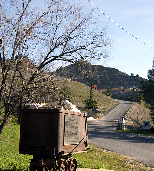 She started school the same day I did back in August and she’s going to be done a whole month before me, and she had a longer Christmas vacation too. Where’s the justice here? My older son keeps shaking his head when he found out she’s coming home next weekend. He keeps repeating the mantra, “One more year.” Yeah, well, then there’s four years of college and then all that free time ends.
 I have found two caches in
 I have no idea how many new counties I’ll add to my caching total with that trip. The return trip hasn’t been cemented in stone, so I’m not sure which ones we’ll be traveling through yet.
 I just hope that I can get some good pictures on this trip. The last road trip, I got some pretty interesting shots, some of which I’ve posted here. I would imagine that
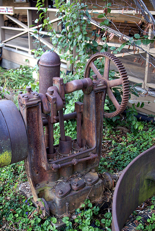
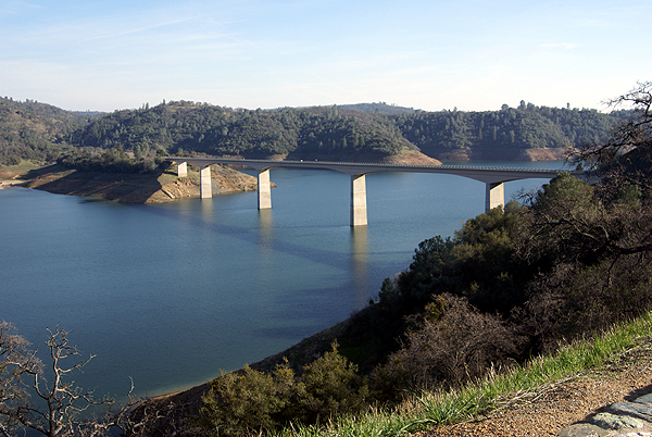
Carson Hill: A Very Historical Place - by tmkbk & olympicwannabe
Beam Me Up - by Ktquilt
Mariposa History - by halfdome and shortcircuit
Mr. Mother Lode - by Uncle Al from Sacramento

Sunday, May 4, 2008
Solitude
Yesterday, I got to experience something that rarely happens to most human beings, that rare time when you are by yourself and you're all alone as if you're the only person on the face of the earth. Granted, I was with my friend Chao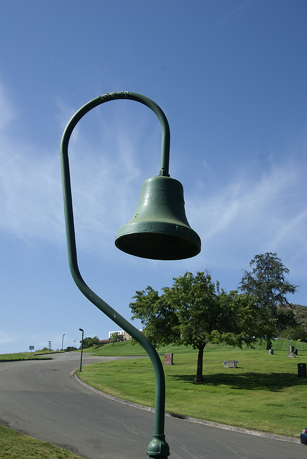 smanor, but the both of us thoroughly enjoyed the solitude, even if we weren't totally alone.
With my introduction into new GPS games, we both decided that a road trip up into the high desert north of us was in order, so we set out on a 322 mile road trip yesterday, making an entire loop around the San Gabriel mountains. We started out in Pasadena and took Highway 14 north toward Palmdale, stopping a couple of times to grab a cache, plus a couple of virtuals as well. We saw an old bell from the old El Camino Real, the King's Highway at one of the virtuals. We were also trying to get several flags in the GeoVexilla game, plus a couple of dashpoints for GeoDashing as well.
Most of the morning was spent caching. I got my 1900th find on a nice travel bug hotel just off Highway 395 which runs through the desert and east of the Sierra Nevada mountain range all the way into Washington State. I'll have to keep that particular hotel in mind the next time I head on vacation up that way as it's an easy on and off and great spot for a travel bug hotel, without any of the silly "take one only if you leave one" restrictions that some bug hotels have on them. Those are prisons, restricting the travel of the bugs, but that's an entirely different post.
After lunch at the local nationwide hamburger place, we decided to get some flags and dashpoints. Our last dashpoint of the day took us out northeast of California City, which is a huge city (land area-wise) out in that part of the desert. Google maps says that the city is east of where we were looking for the dashpoint, but in re ality, the main part of town was to the west. The part where we were was uninhabited, so we didn't have to worry about people out there.
The interesting thing about Geo Vexilla and GeoDashing is there is a certain degree of uncertainty about each hunt. It's similar to Geocaching, yet there still more uncertainty, because you never know what you might run into when you're on the ground, even if you have really good Google Satellite images to look at. The detail of those can only be so good. With Geocaching, you know that at least one other person (the hider of the cache) has already been out there. In Dashing, the likelihood is, no one has been out to this particular spot before, so it's all new territory to discover.
This is where the solitude comes in. The roads out in the desert, for the most part are dirt and you can only go so far before your smarter senses take over and you realize that you need to park the car and walk, otherwise your car and you might get stuck. I do not own a four wheel drive vehicle, although I freely admit that it's one of the many toys that I've lusted over in the past couple of years. So I was taking no  chances with my little foreign made sedan compact on this road. We found a good surface to park the car and then walked the last 2/10ths of a mile to the dashpoint ground zero spot. Once there, we both noticed that we hadn't seen any birds, nor any insects. We could see a huge dust devil spiraling out several miles to the west of us, but we were utterly alone at that point. I turned around and couldn't see our car either, although I knew it was just over that last rise we'd just walked over. It was rather pleasant to just take in the view, with little to disturb us except each other and both of us seemed to realize this and we kept our talking to a minimum at this point. It was incredible.
We knew the solitude had to end, because we had to get back to civilization. On the way back to my car, we started seeing different kinds of insects, plus a couple of birds. It was almost as if the animals wanted us to share in their solitude by being absolutely still for us on our trek out. Or was it the other way around and we were intruding on their solitude? Either way, the solitude was broken entirely by the time we got back to our car, because at about that time, a dirt biker went flying across the desert on his bike, on one of the many trails that criss cross in the area. So much for that quiet solitude, but it was nice while it lasted.
Once back in the car, we headed back toward civilization, finding a couple of other caches along the way. I spotted a partial California Desert Tortoise shell. It was a very large shell. I estimate the carapace was at least 12 inches across. I have a couple of these guys in my back yard (they are permitted as per law) and they're not nearly as la rge as this guy was when he was alive and my guys are close to 9 years old. Perhaps this guy was extremely old and had just died out there. Or maybe it had succumbed to some carnivore in the area. Either way, the desert's harshness was on display.
Caching and hiking in the desert always seems to bring out new experiences for me. The vistas are always impressive although it was disconcerting to see the Los Angeles smog creeping out there. The view was a little bit hazy as a result. It looks like we missed the peak blooming season for wildflowers out in the desert by about a month, be we were still able to catch glimpses of mesquite in bloom as well as some desert mallow. All around you, there is life, even in the most inhospitable places like out here. And in the back of your mind, 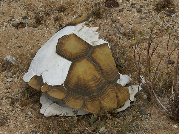 you keep thinking to yourself, how did the early pioneers do that? Even though we were alone, we were minutes away from the safety of the car. The pioneers traveling along the many trails established by others didn't have such luxuries. I don't believe that many of us would survive 150 years ago in those kinds of conditions.
We made our way down Interstate 15, through the Cajon Pass and then skirted the San Gabriels on the south heading back toward Pasadena where Chaosmanor's car was parked. The trip down was a little quieter, perhaps because we were being a little bit more introspective after our trip into the desert. I'm willing to bet that it was really because we were both tired, more than anything else. It was a good day.
The first and last photos are from the following geocaches:
Pioneer Cache - by AlphaCat with help from The Boy and CC-Cat
Ma Greens General Store (Formerly) - by Team Berge (Thanks Ma Green)
The other pictures are from the Dashpoint out in the desert near California City. Thanks to Chaosemanor for taking a picture of me at ground zero of the Dashpoint.

Wednesday, April 30, 2008
A personal bug
When I first started caching, travel bugs didn’t even exist, but they were in the making. I remember thinking that they were a good idea at the time and ordered four of them right away when they came out. At that point in time,  I didn’t know what I wanted to do with them, but decided that one of them would be my personal bug that I would take with me to every cache. I would virtually log it into each cache so I could keep track of mileage for myself when I was caching. It was also nice because it has every log that I’ve written for each and every cache that I’ve found. I’d copy and paste the log I’d write for the cache and then paste it into my retrieval log for the travel bug. I decided to call the travel bug, A Walk With Webfoot, not particularly because I walked to every cache, most I did drive to, but I wanted it to convey the message that geocaching was a walking activity, that you should get out and enjoy the outdoors.
 A couple of weeks passed and I’d long since forgotten about the trouble ticket when I got a response from Groundspeak.
Eric
Groundspeak, Inc.”
Is this his polite way of saying I’m verbose?
 So why is a personal log page different than a regular travel bug? If a travel bug ended up in a cache and then was taken by the next cacher who then wrote a story about it and then dropped it in another cache and it happened again and again, wouldn’t that cause that particular bug’s page to load more slowly? Of course it would. So I guess the next question is, did Groundspeak not anticipate travel bugs having lots of entries, or were they just expecting travel bugs to disappear quickly?

Sunday, April 27, 2008
To Dash or not to Dash...
That is the question. I’m in one of those dilemma modes where I think I’m going to enjoy GeoDashing, but not sure whether I want to start doing something else.  The more I look at the game, the more it intrigues me. It’s very similar to GeoVexilla, in that you need to get to within 100 meters of a particular point. There’s no flag, just a spot on the map, but it’s competitive, with monthly competitions. You can join teams, or you can just have fun going it alone.
 g, just in case and sure enough, another one had popped up in Oxnard, only 10 miles beyond the one in Camarillo. All were easy to get, requiring no hiking, outside of the 200 feet hike we had to do in an alleyway in
 aosmanor’s place in the hopes that he might be there, which he was. We talked geocaching shop while he ate lunch, then went out caching. Sometime during the afternoon, we also did a lot of talking about GeoDashing. I actually think it might have been during lunch, but that’s beside the point. I’d known about Dashing for quite awhile, actually seeing Chaosmanor get a dashpoint when he hid this cache over three years ago. I couldn’t quite grasp the concept at that time, but I’m now seeing the allure of it along with the other GPS games on the site. It’s something else to do while you’re geocaching.
 five people on a team.
The first two photos are from GeoVexilla Flag captures - Singapore and El Salvador. The last two pictures were taken near Spanish Hills Paradise - by Boofers

Thursday, April 24, 2008
I Gotta Ticket to the Moon
In the past, I’ve bemoaned the death of the locationless cache. Well, maybe bemoan isn’t quite the correct term, but I definitely liked the locationless cache because they made me a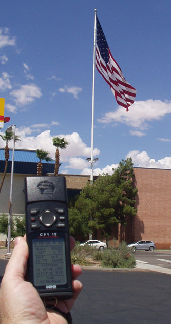 ware of the environment that I was in at the moment. I would keep a list of 10 to 12 locationless caches in my head, so if I spotted something, I’d be able to log it, as an extra bonus cache when I was out and about doing my normal routine. The one problem with locationless caches was the fact that only one person could log any one of a particular group. When I found the national flag locationless, I actually did two different flags in case the first one, had already been taken by someone else. The first flag, a gigantic banner outside the Oasis Casino in
 I guess I view it not so much as a scavenger hunt, but a way to see where some interesting places might be where you’re going to travel in the future. If you happen to like fountains, there’s a waymark category for fountains. You can search find a given area, and do a search for fountain waymarks in that particular area. I’ve found that going to the waymark site can sometimes be a little daunting, so I actually go to the Geocaching site and do my search from there.
 seeds that were taken in astronaut Stuart Roosa’s personal kit as part of an experiment between NASA and the United States Forest Service. The seeds orbited the moon with Roosa in the command module of Apollo 14. When the seeds were brought back to earth, they were germinated by the Forest Service and then distributed around the country as part of the bicentennial celebration in 1975 and 1976. Three coast redwood trees (Moon trees) are growing on the campus of
 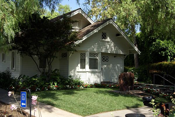 This summer, we’ll explore the area in more detail and make a waymark of those three trees since none exists at this time.
 I might actively seek one out like I plan to do this summer.
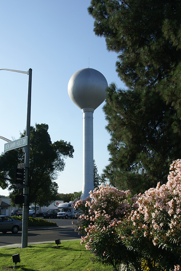
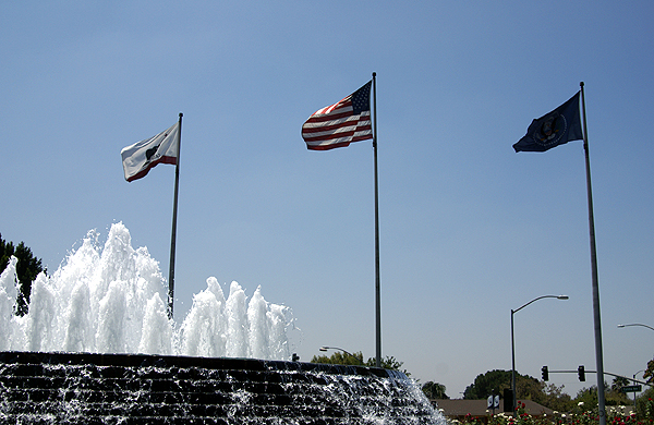
Pictures were taken at the following waymarks or locationless caches:
US FLAG - by Saundersboys
Lincoln Village Maintenance District Water Tower - by Webfoot
Richard Nixon Library Fountain, Yorba Linda, CA - by BackPak
Richard M. Nixon Birthplace - by showbizkid
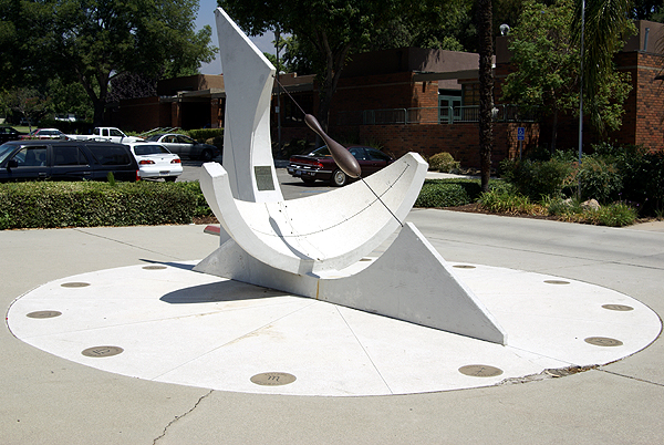
Larkin Memorial Sundial - by Webfoot

Saturday, April 19, 2008
Oddities
Every now and then, I encounter things while caching that defy an explanation. It’s either something that is really out of place, or I can’t get a handle on why it’s there in the first place, or it’s just something that seems really different. 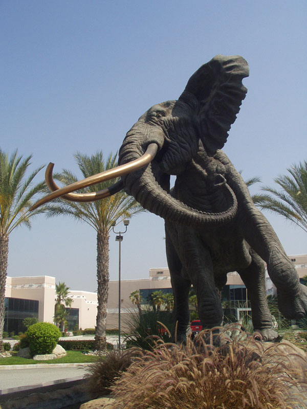 I’m used to the occasional rusted out car that can be found in a ravine somewhere. Those seem to be rather ubiquitous and not nearly as surprising as they should be if you considered how they got the car up there in the first place to then push it over the side and down into the ravine. Nor am I talking about the odd dinosaur or giant spider that sometimes can be found near cache hides. With names like Dinosaur Droppings, Arachnophobia, or Out of Africa, you’d probably expect something like that at those caches. What I’m talking about are those things that just make you scratch your head and think, Huh?
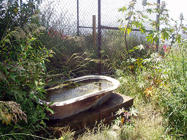 water.
 hat I get my fair share of caching in on the drive up and back. One cache outside of
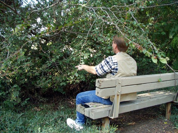 we found a bench, that didn’t have that same kind of knockout view as most of the others. Why the park hadn’t cleared the bushes and trees away, is beyond me, but there was several yeas of growth accumulated in front of that bench. It made for quite a sight gag to say the least.
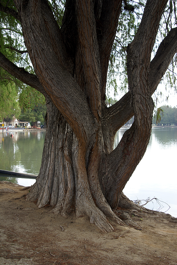 The only explanation I have for the strange shapes of these trees would be that they were over watered. I know that sounds strange, since they naturally live in a temperate rain forest, but these trees were right on the bank of the lake, not where you’d normally find them in their natural setting. It’s the only thing I can think of to explain it.
It's those strange things that you encounter from time to time that make up life stories, things that you can tell your friends about. Some of them are funny, some can be downright weird, and some are just plain interesting. And if I find other oddities in the future, I’ll probably get a chuckle out of it, or one of those huh? moments and then it will either dawn on me, or I’ll remain clueless. Knowing me, it will probably be the latter.
Pictures were taken at or near the following geocaches:
OUT OF AFRICA - by RANTAN & NineSix
Sunset at 17-A REVIVED - by The Cable Car Clan
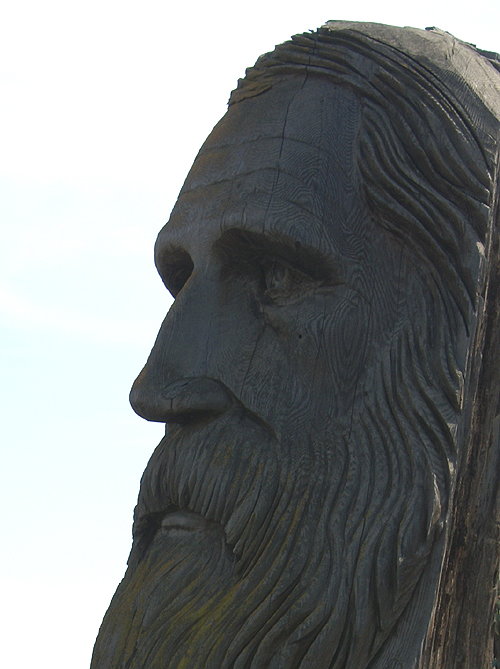
The Muirman - by redwoodcanoe
Debs Park - by GPSKitty
Water Buffalo - by Bigmouth
