Today, I was in Santa Monica meeting some friends I've made over the Internet. One was flying in from Kansas City and the four of us (two others from Southern California plus myself) 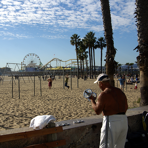 were planning on having lunch somewhere in downtown Santa Monica. This is becoming almost a ritual now as it is the third year in a row that the four of us have gotten together to enjoy each other's company in person as opposed to just on-line. Before our meet and greet, I went caching.
I got down to the Santa Monica Pier and found a virtual cache and a webcam cache. At that point it was getting late in the morning and I knew I would have to make my way over to where we were going to meet, but I wanted to find a real cache container. There was a cache just to the southeast of the pier called Lord of the Rings, so I checked that one out in my PDA. The beach front area here is very busy, so imagine my surprise when I saw that it was a regular sized cache.
As I walked over to the cache, I noticed that this area of the beach is the original Muscle Beach where Jack LaLaine and other body builders trained in the 1950s. There were all sorts of physical apparatuses there that people could use to build up their bodies. I wasn't dressed for this type of activity, so I went right for the cache. This was where it got interesting.
I'd looked at the cache page and wasn't quite sure what to expect after reading it, but once I got down there, I realized where this cache must be. Once I got near ground zero, I realized what I had to do, so I waited patiently in line for my turn. Once I got to the front of the line, I said the code words to the man behind the counter and I had the cache in hand, a nicely sized rubbermaid type of container. I took the cache over to a nearby bench and looked through it, perusing all of the travel bugs and other stuff that was in the cache.
I decided to take one travel bug mainly because I didn't have any travel bugs with me at the time. I didn't want to deplete the entire cache, but I did want to move at least one travel bug, so I settled on Pluto's Dog Tag, which wants to visit Disney themed area. I wasn't aware of this goal at the time, but I think I now need to set apart a weekend next month to get down and cache in the Anaheim area near Disneyland to get this travel bug closer to its goal.
When I was done signing the log and looking through everything, I closed it back up and walked over and handed it back to the man behind the counter. 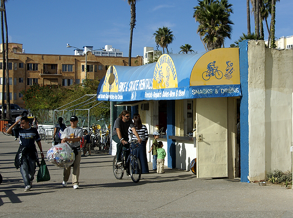 I'd heard about caches like this and have actually experienced one or two of them in the past. I actually think they are neat kinds of hides (this one has made my top 5% list) and I've often thought about creating one like it. I have a friend who owns a coffee shop near my school that I thought about approaching with this idea, but someone else has since placed a cache outside of their shop, so that's out. I also have another friend who owns a cake making business which is even closer to my school. They used to be our next door neighbors but we have since moved away.
Looking at the latest Geocaching map, the area is free of caches in the general area, so it would be possible to hide a cache in their facility. I'll have to think about this for awhile to see if it's even feasible, but I think it merits a possible thought or two. Who knows, perhaps in the near future, there might be a cache near my school entitled, Let Them Eat Cake.
Pictures were taken at or near the following geocache:
Lord of the Rings - by SpyBlade and SpySix
Monday, January 19, 2009
The Geocache flies at midnight



Sunday, January 18, 2009
More Odds and Ends
Sometimes when I go geocaching, I encounter stuff that's out of the ordinary, some of it good and some of it bad and some of it ju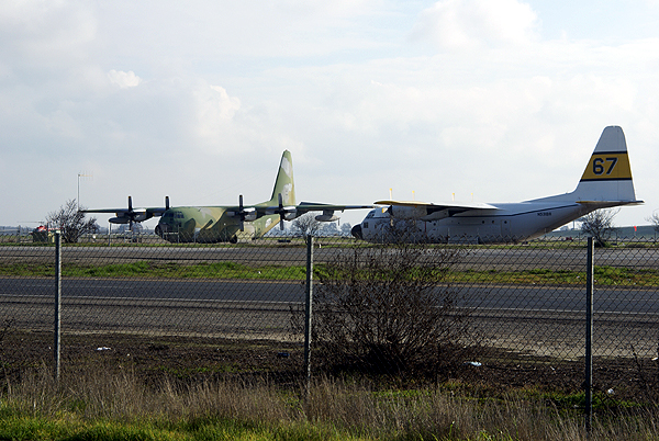 st plain different. Maybe I think it's out of the ordinary because I wasn't expecting it. When I came down from Stockton at the beginning of the month, I met a friend of mine for lunch in Visalia. He used to teach at my school, but has moved on to community college where he enjoys teaching history. He was best man at my wedding over 21 years ago. It had been about three and a half years since I'd seen him last, on a return trip from Sequoia National Park with the Tadpole in tow. We had a good lunch, talked about the kids, our aches and pains, with a little political discussion thrown in there as well. We've been in touch via email, so it wasn't like we were catching up, more just continuing our conversation that we've had for the past 10 years electronically. It was good to see him and his wife again and it reminded me that good friendships are hard to come by.
After I left, I found a couple of caches on the western edge of Visalia near the airport. The airport is right by the 99 freeway which I use to drive up and back from Stockton. I can't tell you how many times I've driven past this airport, yet have never noticed the large propeller planes sitting at the side of the airport alongside the freeway. These planes are actually located just south and alongside Hwy 198 which leads into Visalia, but the airport is also just east of the 99 where it crosses the 198, so I'm pretty sure you can see them from the 99 as well, yet I don't recall ever noticing them before this past visit. Once again, I have to blame geocaching for getting me off the highway and taking the side streets, which in turn allowed me to get a better look at my surroundings.
At another cache that I found last weekend, we ended up finding coconuts. The cache was an ammo can hidden in the far reaches of a bush near the side of a road. It was located at a viewing spot for a dam in the area so there's 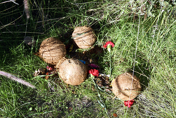 quite a bit of level land, with grasses and other types of vegetation nearby, but definitely no coconut palm trees. They probably wouldn't survive the colder nights in the winter here. Needless to say, finding the coconuts was quite a surprise. It almost appeared to me to be like a makeshift memorial that someone had created there. There were four coconuts with some red carnations lying on the ground. We actually thought we might have some problems with the cache find because the coconuts were leaking and attracting a fair amount of bees. Fortunately, the cache was far enough away that they didn't present a problem. We chose not to disturb whatever it was, mainly because we didn't want to disturb the bees, but the mystery still persists why they were there in the first place.
On the same day, we'd also found several nice caches along a trail that we'd never hiked on before. One of the final caches was hidden in the roots of a tree. I didn't pay much notice to the type of tree. Once we got there, we pretty much forgot about the tree and just marveled at the root system of the tree, which was about seven feet high or so off of the trail and running down into the ground at the base of the trail. It was like a spider web on steroids with rocks interspersed within the web pretending like they were the spider's catch for the day. I kept thinking about what this particular hillside would look like if that tree hadn't been there to hold back everything. Somewhere in that picture is a small cache container that also ended up on my 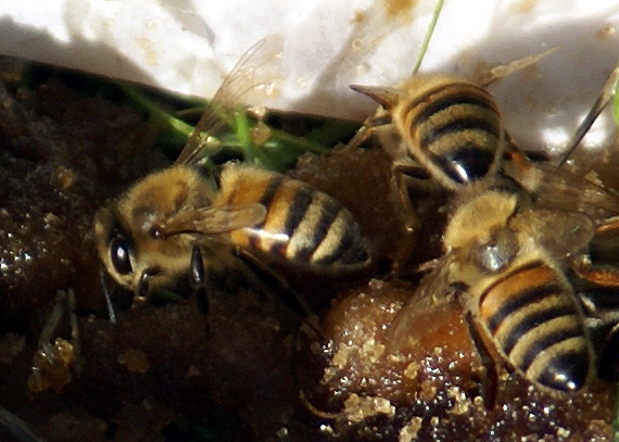 top 5% list because of the placement and the hike to get to it.
Lastly, I've been somewhat remiss in placing my next cache, so much so that I actually have enough cache "ingredients" to hide about four caches. I expect to probably hide four more caches, one ammo can, one cache that was sent to me for Christmas by the Cheeseheads and two decon containers, sometime by the end of the month. Usually, when I hide caches I have names for the caches in mind way in advance. This is partially the case with these as well. I've pretty much made up my mind that the ammo can is going to be my first letterbox hybrid type of cache. The hike to the cache will pass by several forks in the main trail, so I've decided to name this cache, Yogi Berra's Fork.
For one of the decon containers, I'm working on a puzzle cache that will have cachers using their GPSrs in more than one way. I found a cache once where I had to project a waypoint a distance away and then find the cache at the new coordinates. I thought I'd like to try something like that with this one and am planning on naming it, Exploring the Technology. The last two caches don't have names yet, but the one that Cheeseheads gave me, will probably have something in the title that will link it back to them.
With these four cache hides, I'll be up to 26 hides. Not all of those are active, but that's enough hides for me at the present time. I want to make sure that I can adequately maintain all of my cache hides for some time to come. I know my own limitatio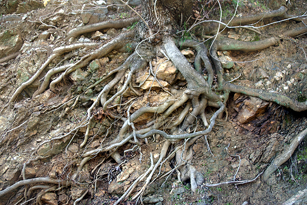 ns and know that I couldn't hide several hundred caches and be able to maintain them very well. I've found many caches that had degraded or had full log books and several cachers in the past had already alerted the cache owner of possible problems. I went to find a cache on Friday and looked at the logs posted beforehand. The last four logs were all DNFs dating back to August. It seems to me that the cache owner isn't doing his caches justice by not responding to these logs. I don't want that to happen to my caches, so I'll continue to limit my cache hides to 1 for every 100 finds that I have. It just makes more sense to me to hide quality over quantity.
Pictures were taken at or near the following caches:
ZOOM, ZOOM - by Evil Cow Pie
View of Morris Dam - by esquimaux
UJs SILVER MOUTIAN #4 - by UNCLEJON AND NOT TOM

Tuesday, January 13, 2009
Exploring your own backyard
I'm pretty sure that I've noted in other posts about one of my general likes about geocaching. When I first got involved, most of 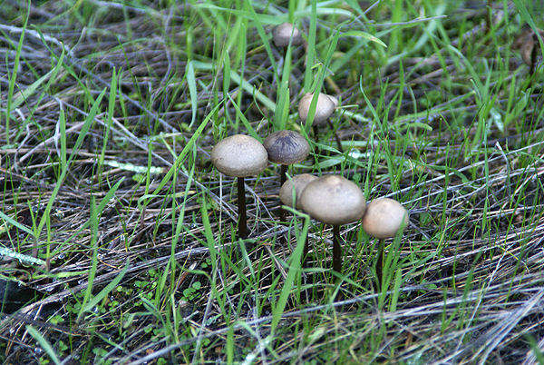 the caches hidden were on trails in the foothills which required hikes to get to them. Urban micros didn't exist yet, so you had to get out on the trail, exploring your own backyard in a way.
3blackcats and I did just that this weekend, taking a ride up into Azusa Canyon and exploring a trail that supposedly leads up to Silver Mountain. I'm not sure whether it does or not as we were relying upon the two cachers that hid 6 caches between them along this slightly strenuous trail. The trail rose gently from a road turnout, overlooking Morris Lake Reservoir and dam. The lake was low and there was a substantial bathtub ring along the lake, but I'm sure that was in preparation for spring runoff because they were 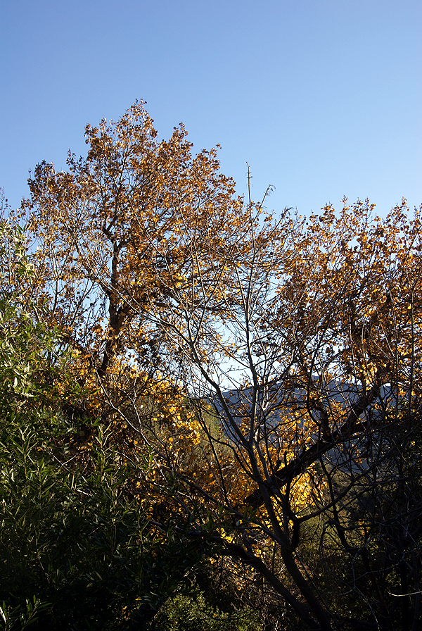 letting quite a bit of water go from the bottom of the dam.
I'd never been up in this canyon, either by just car touring, or hiking, so this was another case of geocaching getting me out to explore the gems that are hidden in my own backyard. I know in the past I've written about my first cache find which took me to a park, only seven miles away from that I'd never heard of before that day when I went hiking with my two sons to find a cache. I've explored quite a bit of that park since that time and will go back again in the near future to hide several more caches. From a geocaching perspective, I view the caches as my spot on the geocaching map and yet 8 years ago, it wasn't a blip in my mind.
With the rainy season upon us in Southern California, the area where we hiked has "greened" up tremendously, so much that we were walking in many spots on a carpet of grass as opposed to a dirt trail. I'm not much of a botanist, so I don't recognize all of the plants alongside the trail, but there were berries in profusion in one area and mushrooms growing in the shadows that hadn't seen much sunlight over the past couple of months. There were several non-native plants in the area 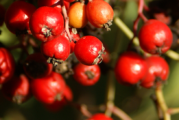 that made an impression on me as well.
At one point on the trail, we had to stop because a small breeze had picked up. It wasn't the breeze so much as it was this very tall aspen, which is definitely not native to this area, that had started quaking. The wind rustling the leaves of this tree made it sound like we were standing next to a small creek listening to the water flow gently over the rocks. I was reminded of a rain stick that I've seen in stores that sell Australian artifacts. Just as suddenly, the breeze stopped and our creek symphony stopped as well. At one of the cache sites, we noticed a very large Pampas grass plant, quite out of place, yet the position on the ridge overlooking the dam was quite stunning in my mind. I took quite a bit of time composing the picture that I finally ended up taking. I hope I did the subject justice.
The more I geocache, the more I'm drawn back to areas like this. These hidden treasures close to urban America hopefully will 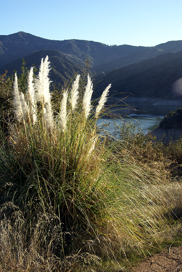 be preserved for many years to come. I would suspect that this particular trail gets more traffic on it now because of the geocaches that have been hidden nearby, but I'm not sure if this is such a bad thing. We found a couple of areas that obviously were drinking areas for people and were probably drinking areas before the caches were hidden. We carried out a couple of empty beer cans we found alongside the trail. We chose to leave the used condoms where they were. Ugh. Maybe the increased traffic will cause a reduction in some of these other types of activities.
Your "backyard" is probably different than mine, but I would be willing to bet there's still areas that you haven't explored. I encourage you to explore them a little bit more. You might be surprised by what you find out there. I'm already looking at other trails to explore in the coming months before it gets too hot out here again. This is the perfect time to walk on our trails and I intend to make the most of this time.
Pictures were taken at or near the following geocaches:
UJs SILVER MOUTIAN AMO CAN #1 - by Uncle Jon
My Silver Mtn Trail #1 - by nottom
My Silver Mtn Trail #2 - by nottom
UJs SILVER MOUTIAN AMO CAN #2 - by Uncle Jon
UJs SILVER MOUTIAN #3 - by Uncle Jon
UJs SILVER MOUTIAN #4 - by Uncle Jon

Sunday, January 11, 2009
Changing perceptions
Back in June, I wrote about finding a benchmark in a vertical fashion, attached to the wall of a bank. Now before that time, I was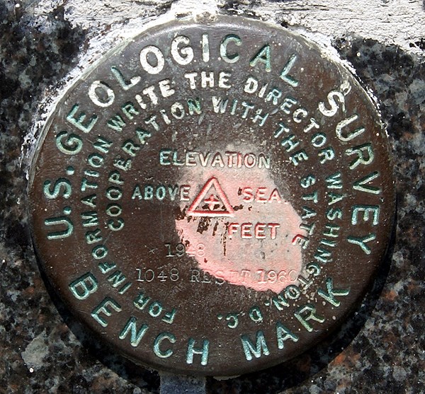 under the impression that benchmarks were disks that were found flat on the ground, either on curbs, or on structures that probably weren't going to go anywhere, like bridges. Then, I found another one on the side of a courthouse in Merced, CA last August. Hmmm. Now I had found two benchmarks that were positioned on the side of a building. I stumbled across a third one this weekend, also placed into the side of a bank.
Well, it's starting to make sense now. Placing a benchmark disk on the side of a building, is placing it on a structure that's probably not going to go anywhere, although there could be some doubt about doing that extensively in Southern California due to earthquake activity. There's at least three that I've found recently that are on the sides of buildings, so it must be more prevalent than I previously had thought. And it does make a lot of sense now that I look at some benchmark pages with this kind of placement. The settings for the benchmark are listed as "massive structures with deep foundations" and the stability of the 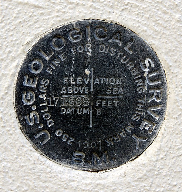 benchmarks are deemed "most reliable and expected to hold position/elevation well."
The one that I found on Saturday was one of those serendipitous finds that I just happened to stumble upon. I had been out caching with my friend 3blackcats in Azusa (the town that has everything from A to Z in the USA) and we had just finished up our day of caching. We had already passed the benchmark once heading to the cache and were making our way back to our car when I noticed this nice benchmark at chest level stuck in the side of a Wells Fargo bank building. Since it was labeled a US Geodetic benchmark, I knew instantly that it would be in the benchmark system at geocaching, so I had 3blackcats take two pictures of it for me with her Blackberry. She sent them to my via email from her phone (geez, you have to love what our technology can do today) and I logged the benchmark later on that afternoon. It was my 20th benchmark logged.
Not noticing the benchmark on the first pass by, to me is really inexcusable since it's right there. I saw it right away coming back, but I can use as an excuse that I wasn't paying attention to my GPSr or looking out ahead to see if I could figure out where the cache could be placed while we got to the cache area. I can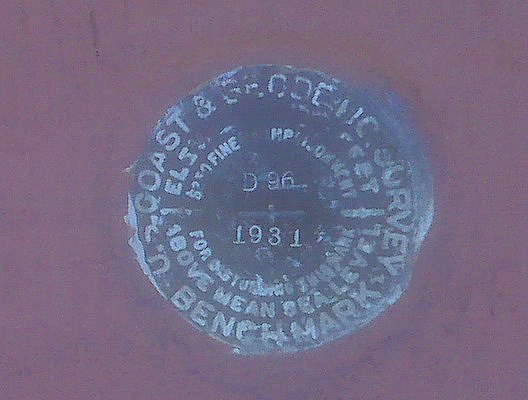 remember talking with 3blackcats, theorizing where I thought the cache might be as we walked toward it, so I have to assume that my attention was diverted enough that I didn't see the benchmark. I need to work on that in the future. Looking over some of the cache pages of other caches that I logged this weekend, I missed at least one other benchmark.
But, I also go back and forth over this all the time in my mind. I went through a period of time several years ago where I was actively seeking benchmarks. Now, if I'm in an area, I'll check out likely structures or areas where there might be benchmarks, but I haven't really gone out of my way to seek them out. The sudden finds, like this one on Saturday seem to be the most fun for me right now. That could change over time. The one thing that I want to continue to do is take a picture of each benchmark that I log. I don't understand why people would log a benchmark if they haven't taken a picture of it.
Pictures were taken at the following benchmarks:
EV9089 - San Bernardino City Anderson Building
HS1151 - Merced County Courthouse
EV2527 - Wells Fargo Bank Building - Azusa

Sunday, January 4, 2009
Billboard Jungle
The holiday season is over, yet my Christmas tree is still up and will probably be up for another week or so. This is not out of design. Usually, I take the tree 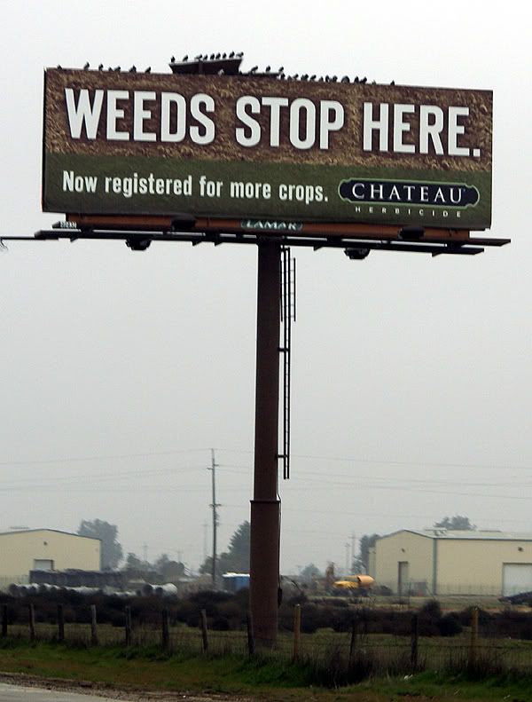 down sometime between New Year's day and the first day I have to go back to work. That didn't happen this year, mainly because of timing. My daughter went back to school this weekend. I drove her up to Stockton on Friday and then drove back home on Saturday. The drive and the lack of sleep because I was sleeping in a different environment took its toll and I ended up watching much of the Eagles win over the Vikings through the inside of my eyelids today. I woke up just when Donovan McNabb threw a nifty little screen pas to Brian Westbrook who took it 70+ yards for the deciding touchdown. So the tree didn't get taken down.
The road trip was rather uneventful. I drove, mainly because there was Tule fog in the big valley. It wasn't noteworthy or dangerous, and my daughter could have driven, but I like to drive. The last couple of hours she ended up napping in the car. What I really should have done was let her drive the middle two hours. But that didn't happen, so I was tired when we got to Stockton. She was actually amazed that I didn't stop even once to geocache. I figured since I was coming back down by myself, that I would get some caching in at that time, which is what happened.
On the drive up, I started looking at all the billboards at the side of the highway. Most of the time, I usually just tune them out, preferring to look at other things, abut there was something about this billboard that stated in no uncertain terms that "FOG KILLS" peaked my interest and I started looking at the billboards with a little more interest, at least for this trip.
America seems to have a seemingly unboundless interest in food. There were more billboards advertising restaurants than I could probably count, most of which were of the 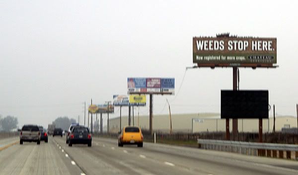 fast food variety. It makes sense to post those along the freeway. It seems like when we're driving, we always seem to be looking for a caffeine stop or a burger place to eat lunch. Have you ever noticed how many Starbucks stores there are? The joke in the movie Shrek II where one Farbucks store gets destroyed, so all the patrons run across the street to another Farbucks store seems rather appropriate. Have you also noticed when you're actually looking for a Starbucks store that you never can seem to find one? Driving down the road at 70+ mph, it becomes more difficult sometimes to determine if there is a place like that at this particular off ramp or not. So it seems that billboards indicating where a particular food product is located, or what exit to take seems to be an appropriate message.
What seems less so, is the billboards that have websites attached to them. What was the designer of that advertisement thinking when they decided to put the website of their company on a billboard knowing that almost everyone that sees it will be driving by so quickly that the entire sign is almost a blur anyway? "Oh look Martha, there's a website address on that billboard!!! We should look it up right now and see what great information it has for us!" I can't even imagine a conversation like that ever happening, but there were several billboards that had the website addresses on them for everyone traveling on Highway 99 in the central valley of California.
Now there were just as many billboards that didn't have websites posted on them, some of which are pictured here. I actually think what got this whole thing started was the Weeds Stop Here billboard. My daughter mentioned something about posting a billboard about Marijuana along a highway as being possibly inappropriate, but then she realized that it was about stopping weeds in farm crops. I'm not sure why, but I particularly liked the Apple Annies signs, plus the FOG KILLS signs. Those just stuck out in my mind as we drove along the freeway.
Just for fun, I started looking at some of the billboards and then asked my daughter to write down some of the websites for later. One of the first catch phrases I noticed, besides the FOG KILLS was one by the California Farm Water Coalition. They 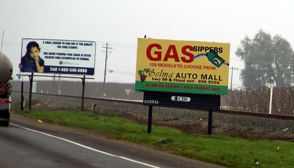 want the world to know that Food Grows Where Water Flows. I wonder who they paid and how much to someone to come up with that statement. Looking at their website, it's apparent they want everyone to be aware of possible water shortages in our state and how those shortages could affect food production in California. It even has a kids section complete with cartoons featuring Gigi Grapes, Kari Carrot, Callie Cotton and Randy Rice, not to mention Tommy Tomato and Jack Cheese.
Besides telling us all that FOG KILLS, the FOGUniversity billboards also had a website to get more information about fog. The site is still under construction so there's not really a whole lot of information there except links to places such as CalTrans and the California Highway Patrol. There is a media link that has a short video about driving in the fog. Once again, Father knows best and is driving too fast, much to the chagrin of his child who warns him that he's driving too fast. It ends with an implied collision caused because of excess speed and fog. Now if he'd just listened to his kid in the first place. Tule fog is a very dangerous thing in the central valley of California and according to Wikipedia it is the major cause of weather related accidents in California so I'm not trying to make light of this as much as I am trying to understand why an organization would go to the trouble of putting up a website and then say, "Oh come back, we're not ready for you yet." I think it would make more sense to get the website up and running, then post the information on the billboards.
Another catch phrase that had me wanting to know more about it was the Check before you Burn billboards that were placed by 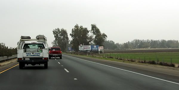 the San Joaquin Valley Air Pollution Control District. It makes sense after looking at their websites what they were talking about since the San Joaquin Valley is a major agricultural area and there is a lot of burning that takes place after crops are harvested. I just found it a rather interesting message when first viewed.
Several other billboards that contained website addresses catered to our stomachs or our palates. Cacciatorre Fine Wines has an interesting website. It has two buttons on its splash page, one for those of us who are over 21 and one for the younger set. I checked both out. The over 21 set get to go right to the main page of the website, while the younger set get directed to Disney.com. I'm wondering if Cacciatore Wines gets a kickback from Disney for this arrangement?
The second billboard that I noticed a website on that was strictly food related was the Valley Pistachio Country Store. It has a nice looking website with a variety of information about what the country store sells. It also has a Recipe of the Month section, although that appears to have just started around the holidays since there is only two recipes and both require the use of cranberries either to make Cranberry Pistachio Biscotti or Pistachio Cranberry bark.
The last two billboards that I noticed website addresses on were the Three Crowns billboard and the Pixley RV Resort billboard. I have to admit when I was reading these websites to my daughter, I knew what most of them would be, but I wasn't sure about Three 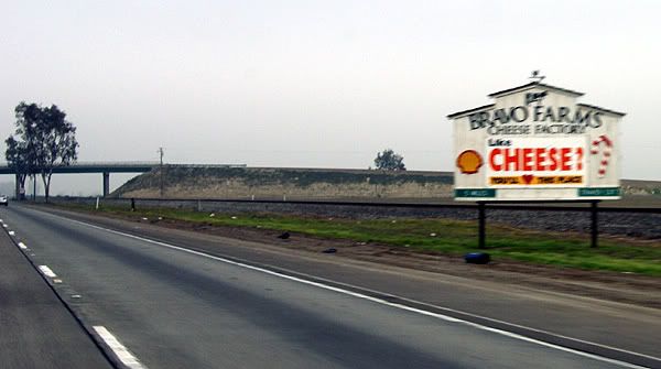 Crowns. It turns out that it's for an industrial complex located in Fresno, California. I wonder if 37 cents per square foot is a good rental price or not. The Pixley RV Resort is a recreational vehicle spot for travelers looking for a good place to park their RV for the night. Cost $29 per night, but there's a 10% discount if you come as a group and take at least 5 spots. I didn't notice how prominent the phone number was on the billboard, but in my mind, that would have made more sense to have in big numbers as opposed to the website address.
I guess the question I have for all these places is why. I realize that with all of our technology today websites are pretty much ubiquitous and a company that doesn't have a website is probably in the dark ages, but why post a website on a billboard? WiFi probably doesn't exist along the entire corridor however California does offer free WiFi at all of their rest stops. If the driver doesn't have a partner, it makes it unsafe for them to grab a pen and write down the website or even look it up on their Blackberry unless they pull over and that probably isn't the safest thing to do either along our highways as the shoulders of the road 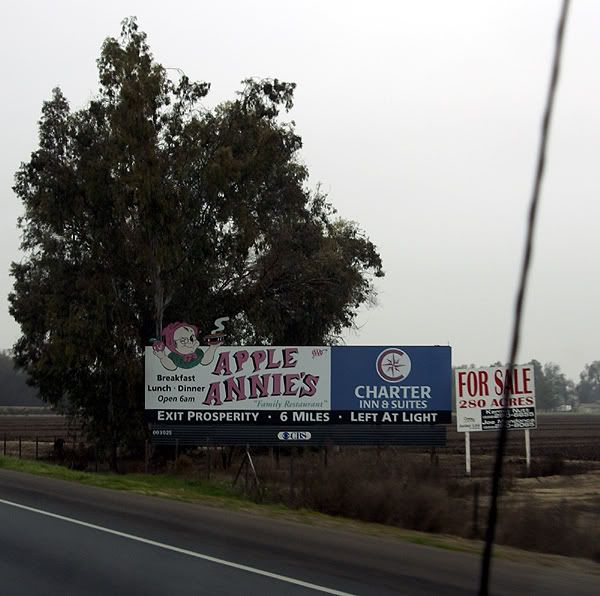 aren't always the widest.
The logical explanation to all of this is the billboards are generic, designed for areas where people can stop and write down the website addresses. It's probably cheaper overall to make one set of billboards as opposed to two different ones, one for city areas and one for highways corridors. I'm not sure if this is a good thing or not, but I can visualize in the future where cars will have receivers to grab information off of billboards. Drivers will just have to push a button on their steering wheel and the car will automatically download the website address from the billboard. At the next rest stop, the driver will be able to plug his or her computer or Blackberry into the car's USB port and upload the information. Hmmmmm. I wonder if I can market this and make my first million in the next ten years?
Pictures were taken by my daughter along Highway 99 between Bakersfield, California and Stockton, California.





Wednesday, December 31, 2008
Another planet?
I like to joke with people that I live in the state of confusion, otherwise known as California. A friend of mine suggested that  California really is another planet. In some ways, I think he's right. Most of the country is locked up with snow, and while parts of California has had a lot of snow, I went caching in shirt sleeves yesterday. Not too many places in North America when one can go geocaching for an extended period of time on December 30th and not come back without a case of frostbite.
 while the really cold stuff happens infrequently and isn't much of a bother either. I could just as easily be in Minnesota or Wisconsin as out here had my dad found a teaching job there instead of here back in 1961.
- Continue to hide at a rate of 1 to 100 finds. I have 22 hides, with 2306 finds after yesterday's excursion. I'm working on three caches right now that will keep that resolution going up through 2500 finds.
- Continue to hide, in my opinion, high quality caches. Nothing teaches more than a good example. If I hide quality caches, then hopefully, it will encourage others to hide quality caches and we won't have as many parking lot lamp post cache hides.
- Don't let the hobby interfere with what is really important in life. I have a wife who depends upon me to cook most of our meals in the non-summer months and I have three children who depend upon me to "bring home the bacon" so they can do things, like attend the college of their choice, etc. This hobby is not more important than that.
- Keep reminding myself, that it's not about the numbers, although we attach numbers to just about everything we do. Yeah, it's fun to look at how many caches I've found, but it shouldn't be the reason I go out and cache.
- Have fun with the hobby. If it becomes a chore, then is it really a hobby anymore? This should be fun and I intend to keep it that way.

Saturday, December 27, 2008
Environmental Awareness
This is not what most of you probably think it's about. When I first heard about locationless caches, it was in February 2002,  less than a year after I started caching. It was an intriguing concept; find a thing that matches a particular criteria, take a picture with your GPSr, note the coordinates and then post the log with those coordinates and the pictures. Usually, locationless caches had to be unique, so people couldn't log the same thing over and over again. Once someone logged Yosemite Fall in the Beauty of Waterfalls locationless cache, then no one else could log that particular waterfall. Other waterfalls could still be logged, so the longer the caches hung around, the more interesting some of the logs and pictures tended to be because the less famous, yet still beautiful waterfalls started appearing on the cache page.
There were several things that I liked about locationless caches. I may be wrong, but I think you had to have a picture taken at your locationless find in order to get credit for the cache. I liked that, since there was no log book to prove you'd actually 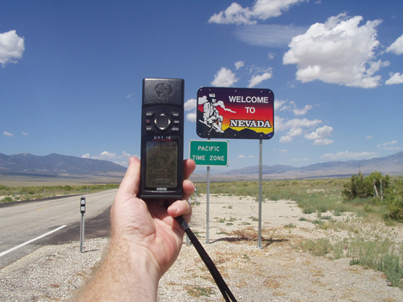 found what you were looking for, but there was at least visual evidence. The second reason I liked them was it made me more aware of the environment around me.
Probably the most famous of the locationless caches was Yellow Jeep Fever, where you had to get a picture of your GPSr with a yellow jeep. Sound easy? Not really. I can remember right after I discovered locationless caches, I was driving up to Lake Arrowhead and I passed a yellow jeep going the other way on the road. It was very frustrating to see something that you could log, yet not be able to for safety reasons. I actually saw another jeep, possibly the same one, when I was heading back down the road later that same day. I eventually found a yellow jeep in a parking lot in Upland, CA while I was out doing some other caching. I'd stopped to find a cache, looked over, and there was a nice jeep with Colorado license plates parked rigth there.
There were so many locationless caches during their heyday, that it was virtually impossible to keep track of all of them. 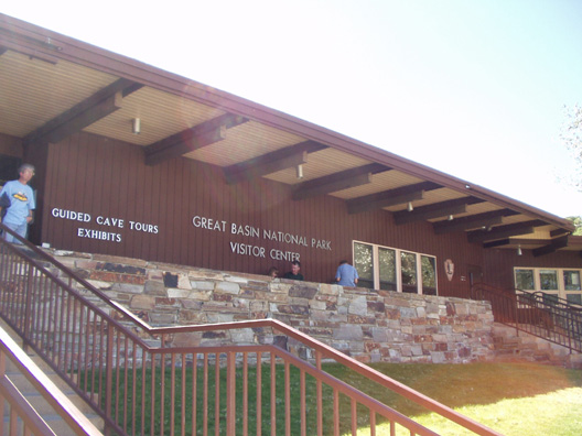 I kept a running total in the back of my head of about 20 locationless caches that I found the most interesting. I figured that was about the most I could keep track of at one time without writing them all down. Once I would find one of them, then I'd substitute another one from the main list, so the list was ever changing. I liked the little challenge associated with finding them. I'd see an American flag, take the picture, get the coordinates and then go home and attempt a log. Many times, it wouldn't happen because that particular American Flag, or waterfall had already been logged. So it was important to have back up plans as well.
Every time we'd I would make sure we'd find a couple of the locationless caches. Some are very easy, like an American Flag. Since we would always camp in national parks, it would be fairly easy to get one of the American Flags at the park headquarters or visitors center. That same trip, I also wanted to get a park headquarters locationless too, but 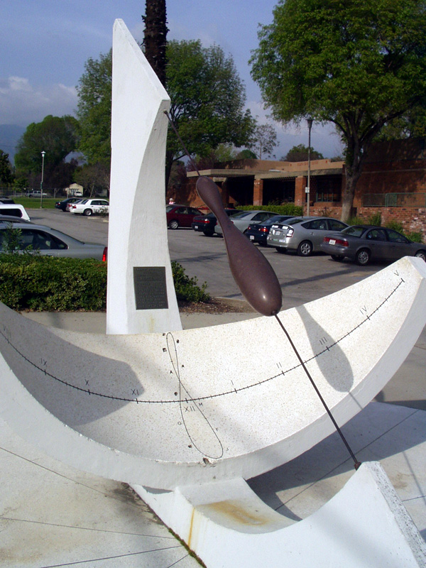 I didn't want to do the same area for both flag and headquarters. I wanted a little bit of a challenge.
That particular year we were going to be camping at Cedar Breaks National Monument in Utah and Great Basin National Park in Nevada. I figured I'd be able to get an American Flag at one park and the park headquarters at the other park. I ended up getting the national flag before we got to either park. We'd stopped for gas in Mesquite, NV, right on the border of Nevada and Arizona along I-15. Across the street from the gas station is the Oasis Hotel and Casino. Flying out in front of the casino is the largest American flag I've ever seen, so I decided to waypoint it and take a picture of it just in case. When we got home, I discovered the flag hadn't been logged as a locationless cache yet, so I decided to log it.
Locationless caches were all archived in January 2006 and have been moved over to the Waymarking site that Geocaching.com also maintains. It's basically the same thing and yet it's not. Keeping track of locationless caches on Geocaching.com was easier for me at least. I know there are some people that have embraced Waymarking. I can take it or leave it at this point. I am an officer in the Water Tower group at Waymarking, but I haven't marked a water tower in quite some time.  The thing about Waymarking that is good is the fact that you don't have to stop in a particular category after you found one. Just because I've already found a water tower, doesn't mean I have to stop looking for other water towers. With locationless caches, it was "One and Done" with a particular category. If I wanted to find more Presidential statues, I could, but I couldn't log them anywhere. So, I guess in that sense, Waymarking has taken care of that aspect of the game.
When they were around, I found 25 locationless caches. Of those 25, I think I'd still try to find 24 of them again if I could. Ironically, the one that I wouldn't find again, was the one that got me started with them. It was called Where's in a Name? and it involved getting help from someone on the other side of the world to help you log the cache. I wasn't at a particular point to take a picture and get credit for the cache. But it did get me interested in the overall pr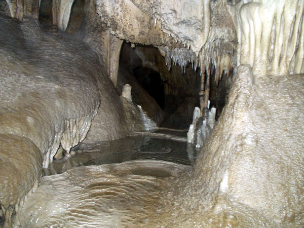 ocess and got me to look around me a little more closely as I was out and about. You never knew when you were going to run across an astronomical observatory or a Rails to Trails that you could log.
And yet, as the locationless helped me become a little more observant about what was around me, it also didn't for some reason. I know that doesn't make sense, but when I logged the observatory locationless, there was a virtual cache at the same location. For some reason, I wasn't aware of this virtual until a couple of years later when I got back up to the same area and logged the virtual. To this day, I'm not sure why I didn't log the virtual at the same time.
Pictures were taken for logging the following locationless caches:
Yellow Jeep Fever - by Team CBX2
Make a Break for the Border - by The Dam Trolls
NPS HQ - by MartyFouts, Adopted by bullit
Sundials - by outforthehunt
Observatory Quest - by Anton
Speleo - by Melak

Wednesday, December 24, 2008
Caching Types?
This was found via a friend's blog and shamelessly copied here. I very rarely inhabit the forums at geocaching.com (too much angst most of the time), so I'll post my answers here. Micro or Regular? Regular There was a time when I wouldn't hunt micros at all, but then decided that if I wanted to cache at all, I better find some of these. I will never hide a micro, unless it's part of a multi-cache with a larger sized cache at the end.
Traditional or Multi? Traditional, although a good multi-cache is worth its weight in gold in my opinion. Multi-caches are more fun to find in a group setting.
Mystery or Earth? Both. It depends upon my mood. Usually mystery caches are more work before the actual finding, whereas earthcaches are usually more work in the field.
In a group or alone? It's more fun to cache with someone else. Large groups tend to be ponderous though. It's like going to Disneyland and trying to figure out what ride to go on next. There are ten different opinions and everyone wants his/her way. That's why groups of four or less work well there and caching. The largest group I've cached in was four and even then it became problematic because one person became petulant when he didn't get his way. I haven't cached with that person since. Life's too short.
Hiding or Finding? Obviously, I find more than I hide at a 100 to 1 ratio approximately, but I do enjoy the hide, especially when I can create a challenging cache, or make some good camouflage for the cache.
Virtual or Webcam? Virtual. Both can give you that wow factor, but many webcams are street corners or such and don't really do much for me. I've found one webcam while I've found over 100 virtual caches.
Letterbox or Wherigo? Letterbox. I've never done a Wherigo cache, although a friend of mine has encouraged me to try one saying that I have the temperament or intelligence to get into that type of caching. I'll have to upgrade the GPSr before I start down that road.
Favorite GPS? Mac. I guess it's what you get introduced to first when you start out. My father in law had a Garmin, so I started with a Garmin because that was what was familiar to me. I've used a Magellan and there are some nice characteristics about them as well.
Social(event) or not? For the most part, Not. I've attended 8 events. If I don't attend another, that will be OK.
FTF'er or not? I wrote about First to Finds in the past. I haven't had a FTF since December 15th, 2007 and if I don't get another one, that's OK. 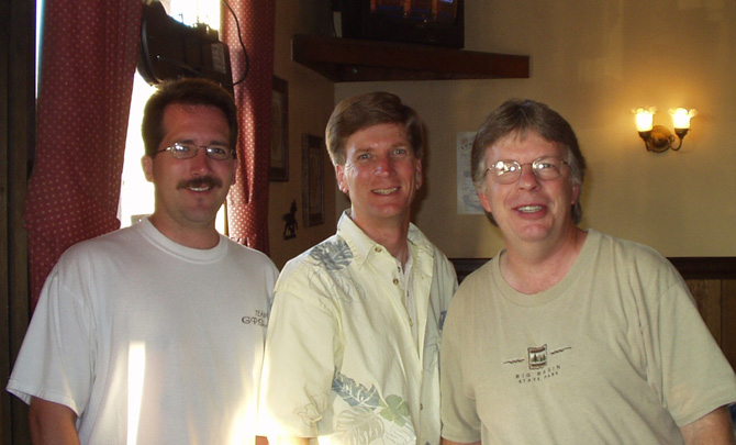 I prefer to find a seasoned cache, mainly because I feel my thought processes and geosenses work better after reading the logs on a cache page. In other words, I don't characterize myself as an expert finder, so I need all the help I can get.
Podcast listener or not? I listen on occasion. I've actually been interviewed several times for Podcacher.com's broadcasts.
Out of state or In state? California is a big state and if you live anywhere near the coast, it's a good five hours to get to another state, so it's definitely in-state. According to my stats and It's Not About the Numbers stats, I've found 39 caches in Arizona, most of which were found two summers ago on a camping trip to Flagstaff and the Grand Canyon. I've also found 3 caches in Nevada and 11 in Utah. We were set to find some in Oregon last summer, but that fell through, so we'll try again next year.
"Extreme/Hardcore" or Layed back? Although some of my friends would say I'm hardcore, I'd like to think I'm more laid back about my caching.  I enjoy getting out, but it's not my reason to live. I have a lovely wife and three children who come first.
Urban / Rural? Rural. When I first started caching, it was all about the hike. I liked geocaching because it got me to try some of those trails in "my own backyard" that I wouldn't have considered before getting into the hobby. I never knew Claremont Wilderness Park existed until I discovered geocaching. Now, most of my hides are in that park.
On a personal note - I'm pretty sure my dad doesn't read this blog, but I'd like to wish him a happy birthday today and quote a couple of lines from a favorite Dan Fogelberg song.
I thank you for the musicPictures were taken at or near the following geocaches:
And your stories of the road
I thank you for the freedom
When it came my time to go
I thank you for the kindness
And the times when you got tough
And, Papa, I don't think I said
I love you near enough
Grassy Hollow - by John, Donna and Slipper
Eye Spy Another Eye in the Sky! (Webcam Cache) - by Just a Short Walk
Pizza Night with the Sax Man - by Team GPSaxophone
Indian Rock Cache - by Trees House Clan