Just after New Year's, I'm planning a caching trip with one of my caching buddies to Vasquez Rocks Park. It's located in the foothills of the high desert off of the 14 freeway. Basically, it's in between the Lancaster/Palmdale area and the San Fernando Valley. We were out there three weeks ago and had a great time, dodging muggles and finding a variety of caches. 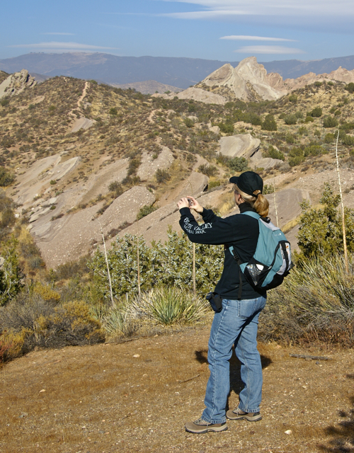 It was there I ended up breaking my PDA near the first cache we found.
When we got there, the place was teeming with muggles and we weren't sure how many caches we were going to get. I think most people, myself included, have visions of grandeur when going out caching. We figure we have this many hours and we're going to get this many caches. Vasquez Rocks Park has 18 caches in it, so I figured we'd get them all. Well, with the muggles, we only got half as many.
Part of the problem was we spent an inordinate amount of time trying to find an access to one cache which was up on the rock formations. At least I think it's up on the formation. We never did get a good fix on it. After several attempts, we gave up on that one and headed over to another one which we found. It was there I discovered the PDA malfunction and I thought our day was really going to be cut short, but we improvised a way to access cache pages, so it was all good again.
Once we had that figured out, we had a new plan of action. One of our goals was a three digit cache, Between a Rock and a Hard Place. This cache had been placed there in April 2001. It was a large ammo can and was easily found. I always enjoy finding these old caches, since they're usually large ammo cans. I often wonder how they could have survived that long. The likely reason is most are placed well off the beaten track away from muggles. This one appeared to be near a well traveled trail which made its longevity that much more surprising. Needless to say, we enjoyed finding such a "old" cache.
After finding Between a Rock and a Hard Place, we worked our way downhill away from it, making an arc curving gently from the south over to the northwest and back to our starting position. This kept us away from most of the muggles in the park who were to the west of our location for most of our hike through the park.  We discovered early on, we had stumbled upon a large orienteering workshop/convention type of gathering. The organizers said the orienteering national championships were going to be held the next day at the park.
There were several times when we ended up crossing paths with the orienteering participants, which caused us some concern as we didn't want to compromise the cache hides. One cache hide was near where some judges were stationed, but we ended up being shielded nicely by the juniper bush the cache was hidden in. One other cache was within fifty feet of one of the orienteering stations, but no one appeared to be watching us at the time we made the cache grab and I've noticed that the cache in question has been found since we found it, so apparently, none of the orienteers accidentally discovered the cache. Or if they did, they decided to leave it alone, which also speaks highly of the organization.
At one point on our hike, we ended up on what looked like a fire road. Up in the foothills and mountains of Southern California, these are quite prevalent, so it wasn't surprising to have one here on the edge of the park. As we walked along the road, heading for one of the caches, we realized that we were walking along the Pacific Crest Trail. This was a nice bonus to the day, as in my mind at least, it's always fun to walk along a 2600 mile trail. You don't find too many trails that are longer than that.
Our last cache of the day was located at the north entrance to the park and it was an earthcache. We were treated to a variety of different geological formations within the park along a geology walk at that point. 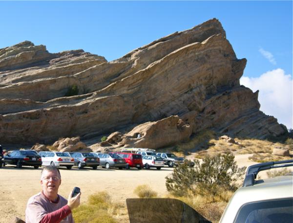 I took some pictures and we had to post a picture of us near the Vasquez Rocks identifying what kind of formation the Vasquez Rocks were. You can see from my picture the multitude of cars parked there for the orienteering gathering.
On the second we'll be back out there again, trying to get the other half of the caches we missed the last time. Hopefully, our visions of grandeur will be large enough that we'll end up getting all of the caches this time around. If not, I guess that gives us an opportunity to come back again in the future.
Pictures were taken at or near the following geocaches:
Vasquez Rocks Natura Area Park - by scott_n_roni
Vasquez Rocks Home (year:1850) - by fishingisfun
Vasquez Rocks Earthcache - by supertbone
Sunday, December 27, 2009
Vasquez Rocks

![]()
![]()
Subscribe to:
Post Comments (Atom)
2 comments:
Great views! Sounds like some awesome caching. We to ran across some orienteerers once while caching - thought I'm not ENTIRELY sure what exactly it's all about but we managed to stay out of eachothers way ;-)
2600 miles... I wonder how long that would take to hike!?
Erika,
I believe to hike the entire length of the trail, one needs to start at the Mexican border in March to finish at the Canadian border by October or so. From what I've heard, you start at the Mexican border and by the second or third day, you're hiking in snow. But that's the only way to do the entire trail in one "season."
Post a Comment