Our trip along the eastern side of the Sierra Nevada culminated in our camping at Devils Postpile National Monument. This monument, established in 1911, preserves an interesting basaltic columnar formation and an impressive 101 foot waterfall, aptly named Rainbow Falls.
Since the monument is part of the National Park Service, no container type caches can be placed in it, but virtuals (if they were already created) and earthcaches can be. 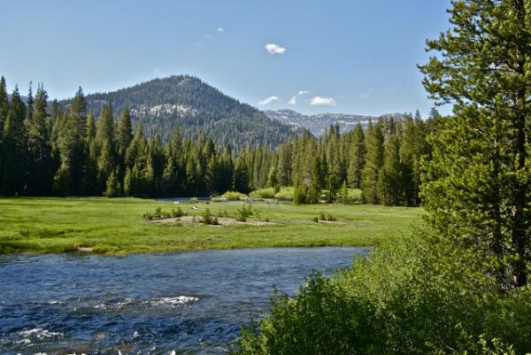 Earthcaches are a geological discovery. You learn from the cache page about a particular aspect of geology, answer some questions, based upon your observations at the cache site and thus, get credit for a cache find. It's the new type of virtual cache that Geocaching allows on its site.
In the park, we found four earthcaches, two on the first day and then two more the next day. We split them up only for convenience's sake. We could have done three on the first day, but the fourth required a substantial hike, so it was basically unavailable the first day of our camping trip.
One of the earthcaches we did on the first day was the Soda Springs earthcache. I'd been here in 1977 as part of a biology summer school class I'd taken at my local community college. Devils Postpile was one of the places we'd stopped to visit and I can remember our instructor, Dr. Bates, talking to us about the Soda Springs in the area. In August, the San Joaquin River, which runs through this glaciated valley is at a low point, with most of the winter snow melted at this point, so there isn't as much water movement where the springs are and so we could see lots of iron oxide precipitate deposited along the shoreline where the springs were.
We had a very heavy winter in the Sierra this year and even in late June, the runoff was tremendous. The San Joaquin was very close to flooding in areas. 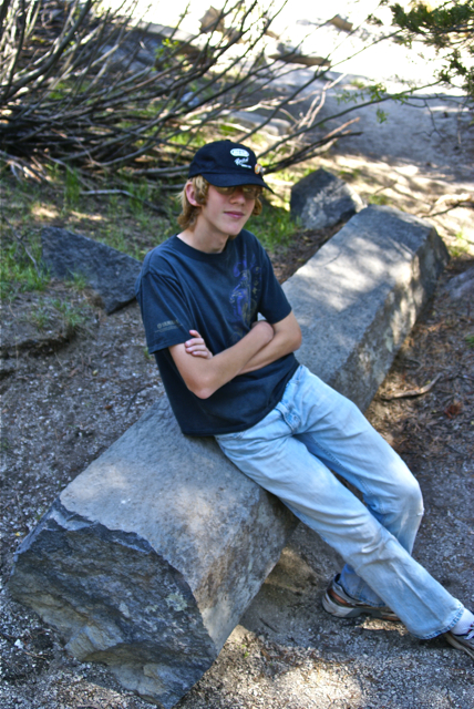 The meadows were very wet and boggy due to excess water - mosquitoes were rampant. Because the river was so high and swift moving, the iron oxide precipitate was non-existent here. It was fun to explain to the Tadpole the differences between the two time periods and why things were the way they were.
Other things we investigated while in the park were the direction the glacier moved through the park while it was polishing the top of and plucking the face of the postpile. The postpile is a series of basaltic columns that cooled a relatively even time frame. When the last ice age glacier scoured the area, the postpile was exposed for all to see. Over time, columns have eroded and fallen to the base, creating the postpile. The columns are generally smooth on the top where the glacier ground against them.
They are also large in size. At first glance, you can't really appreciate the size of the columns, but you have ample opportunities to get very close to some of the fallen columns and it's then you can truly appreciate how big they are. Earthcaches aren't for everyone, but as the Tadpole likes to say, "you get to learn something with these, so I like them." They take more time to do and so, they're not conducive to "numbers" runs, but then again, it's not really about the numbers, but the experience. You truly get to experience the surroundings with earthcaches.
Pictures were taken at or near the following earthcaches:
Soda Springs at Devils Postpile - by TerryDad2
Devils Postpile National Monument - by truckgirl2
Monday, July 12, 2010
Earthcaches Galore

![]()
![]()
Subscribe to:
Post Comments (Atom)
4 comments:
The postpiles sound very interesting. Thanks for the blog.
I'll be posting more pictures of the postpile in my next entry.
The level of the SJ River isn't because of the snow melt. They're currently increasing it's flow from reservoirs like Friant Dam to be able to restore the salmon runs.
http://www.fresnobee.com/2010/03/24/1871224/san-joaquin-river-flows-to-pacific.html
The level of the river might be up due to the increased flow from the Friant Dam, however, Devils Postpile where these pictures were taken, is upstream from the dam. The river, at that point is almost at its headwaters and subsequently only flowing due to snow melt.
Post a Comment