One of the things about camping at higher elevations is the differences in weather that we're normally used to experience at our regular altitude. 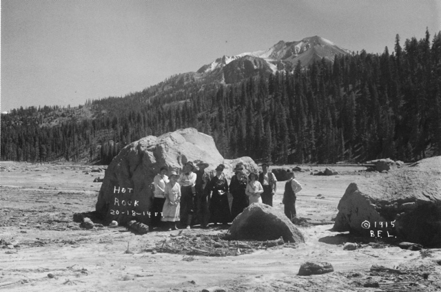 Before our camping trip, I had received an email from Chaosmanor asking what I was going to do about Lassen Volcanic National Park? I didn't know what the heck he was talking about, so I started investigating and discovered that the park road was still closed due to the high volume of snow.
I could postpone our trip, but I'm not sure if that was going to accomplish anything, so I decided to keep out timetable and leave when we had planned to leave. If there was snow, that would just add to the adventure. Besides, we had planned to meet Chaosmanor up at the GPS Maze exhibit on the 5th of July. If I postponed our trip, that visit wouldn't happen. It was something to consider, but for the most part, I didn't seriously think too long about postponing the trip. The snow could be fun.
The day we got to Lassen, we headed down the park road, which was cleared for about 10 miles into the park. The drive took us to several locations, one of which is interesting from the standpoint that we could get a feel for what Mt. St. Helens might look like in 70 years or so. Mt. Lassen erupted almost 100 years ago and today, it is a living laboratory. It's about 70 years ahead of Mt. St. Helens, which is a similar type of volcano, being in the same Cascade range.
Along the road, we stopped at the Hot Rock, a very large boulder that had been ejected from Mt. Lassen and come to rest approximately 5 miles away from where it had started in the mountain. I scanned a postcard that I purchased at the visitors center showing the rock only days after it had been ejected from the mountain. 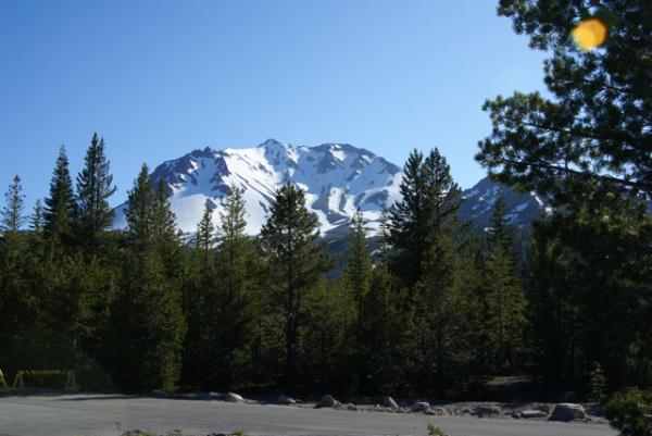 B. F. Loomis, a photographer had taken this photograph and had noted that the rock had glowed red hot for several days after it had made its final resting spot. Loomis' photos are a great historical record of the area, which can be compared with similar views today. The rock as noted on the postcard, was 20x18x14 feet, a massive rock. Today, it stands by the side of the park road, with no view of the mountain any more.
There is another area just down the road from the Hot Rock known as the Devastated Area. It has a similar view to the Hot Rock postcard picture. In the postcard, the ridge of trees to the right were spared, because of the local topography. The heat, volcanic winds and mud and landslides from that major eruption swept around or over the ridge sparing many of those trees. However, the other area to the left is clearly barren of any kind of plant life. That is what was called the Devastated Area. Compare that with the picture I took at the Devastated Area. Nature has a way of reclaiming its own eventually. This is a glimpse of what Mt. St. Helens could look like in the future.
Pictures were taken near the geocache:
Loomis - by 2dogs and mtnsteve
Friday, July 23, 2010
Hot Rock

![]()
![]()
Subscribe to:
Post Comments (Atom)
No comments:
Post a Comment