Last week, on my hike in the North Etiwanda Preserve (NEP), I tried calibrating my GPSr. 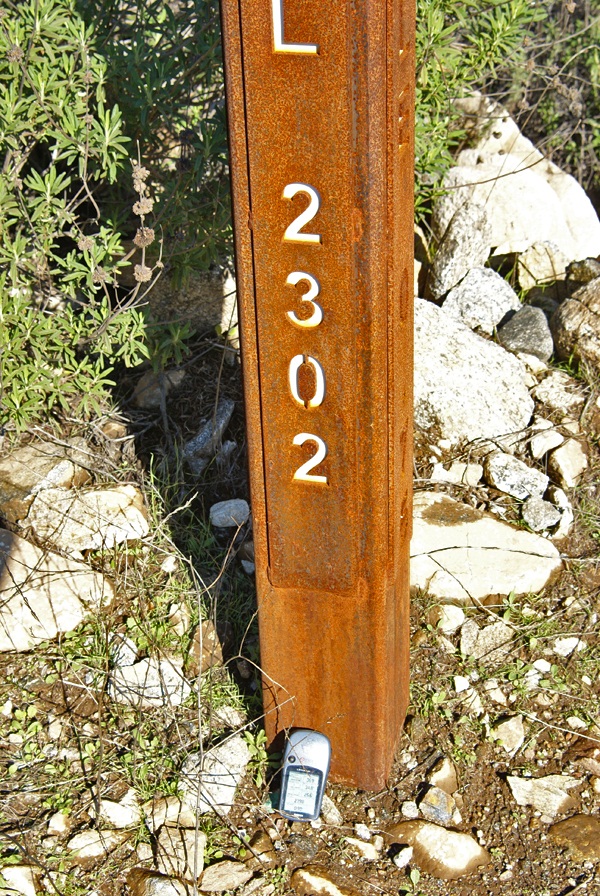 Not that I really could calibrate it accurately, but I tried to see how accurate it was compared to the adjacent signage. Usually, when I'm out geocaching, I don't need to take any kind of altitude readings with my GPSr. In my opinion, I believe that most of that handheld models are accurate to a certain degree, but not accurate enough for anything outside of fun and games.
When Chaosmanor and I hiked to the top of Simi Peak back in November, I put my GPSr on top of the bucket on the peak that held a laminated piece of paper stating the height of the peak, 2403 feet in elevation. I just wanted to see if my GPSr would register the same. It did, after a fashion. We actually watched the number start out at a lower elevation and then watched as the number climbed up to 2403 feet, which was when I snapped the picture. I suppose that if we were willing to wait several minutes of battery life, the unit would have settled down and produced a constant elevation. I might have to try that sometime, but it's not high on my list of priorities.
The NEP has mile markers every quarter of a mile. Those mile markers also indicate the elevation at the point as well. The last time I'd been hiking in the preserve, over a year ago, I did the same thing and got the exact result. This time, the result was four feet different than what the sign post said. After taking the picture, I picked my GPSr up and it immediately registered the "correct" elevation. Then again, does the elevation listed on the marker indicate the elevation at the top of the pole, or at ground level? My assumption would be that it should be a ground level.
Picking up my GPSr, actually brought it up to the top of the pole, which would have been the four feet difference, but once again, it's readily apparent that these gizmos shouldn't really be used for super accurate measurement of elevation or of latitude and longitude. And yes, I'm writing this all with tongue firmly planted in cheek this morning. After all, it's just a game we're playing out here.
Picture was taken near the following geocache:
NEP on the Rocks - by maddmaxxawr
Sunday, January 9, 2011
Calibration

![]()
![]()
Subscribe to:
Post Comments (Atom)
1 comment:
There was a cache here in Camarillo some years back - 2003 or 2004 - that was hidden across the street from a civil engineering firm: Sage Consultants. The name of the cache was something like "Sage Coordinates." In the write-up, the cache owner mentioned that there were coordinates posted on the building, directly above the door, that disagreed with the cache owner's GPSr by a few thousandths of a degree, and that it was too bad that the building's numbers weren't accurate :-o As it happens, I had had an opportunity to talk with several of the engineers employed there, and they had what was, at that time, one of the top-of-the-line surveying GPSrs. I even got to see it. They used it to get the numbers that they posted, and I was told that it was accurate to within a couple of millimeters. I brought this to the attention of the cache owner, who was suitably abashed.
The point, of course, is that our gizmos, as you stated, are not all that accurate for "serious" purposes that require high accuracy, such as building freeways and such, but they are plenty good enough for our games, or even for useful purposes such as trail cutting and measuring, search and rescue, whale-watching, fishing and so on.
I'd be willing to bet that the elevation on that sign was gotten either from a topo map (possible, but it won't be very accurate), or by using classical surveying techniques and equipment. If there is a benchmark with line-of-sight to the sign, then that's the likeliest answer.
Post a Comment