The day before appendicitis took down the Tadpole, we drove down into Orange County for GeoVexilla and some caching. 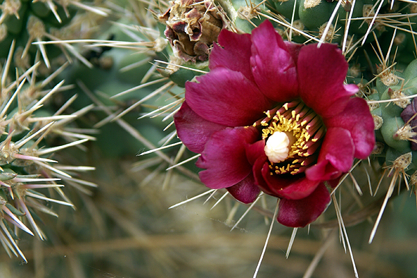 The positions of the different flags, which were actually spread out between Orange and Los Angeles Counties were such that I didn't want to pick out specific caches, so I went with a virtual PQ, to see what virtual caches were close to any of the virtual flags. The Tadpole enjoys virtuals, so we decided to make it a totally virtual day.
The first flag was found easily, in between two houses, then we drove over to Aliso Creek County Park to hike down to a virtual cache. From the parking lot, the cache was only 1.37 miles away, so it looked like it was going to be an easy walk since the trail was a paved trail designed for biking, so we didn't think it would be too strenuous. There were many wildflowers in bloom, including staghorn cholla cactus. For perspective, the blooms in the picture are about the size of a quarter.
Every now and then, I fail to look at maps that closely. I assume that most caches are placed close to roads and/or trails, so  I didn't really think that much about this one, but it just seemed as we walked that we weren't getting a whole lot closer to the cache. After a mile of walking, we were only about a third of a mile closer to the cache and walking parallel to the cache. Both of us could see the ridge that we thought the cache was on, but even that looked too close, which meant we probably had to find a way to get on the other side of the ridge.
On top of that, if we chose to bushwhack, the hillside was filled with foxtails. Anyone who is a regular here, knows that foxtails are the bane of my existence. I will venture into fields of foxtails only as a last resort. Upon further inspection, it wouldn't have worked anyway, since there were fences that we would have had to cross in order to get to where we were going. In other words, we needed to stay on the trail.
Our time was limited, because we had planned other virtual flag grabs, but I figured if we were having a good time, we could continue on. Whenever I go with the Tadpole, I like to leave it up to him, giving him some ownership into the decision making process we do with this hobby of ours. It's probably something that I learned when caching with his older brother. I wasn't quite as willing to let him make those decisions and it's probably one of the reasons why he's not enamored with the hobby in general.
With that in mind, I laid out our options to him, telling him that we'd have to go around the ridge to get to the cache. He opted to cut the hike short and 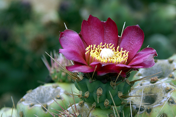 make our way back to the car because he wanted to go after the other flags. In the end, we didn't get any caches that day, mainly because I had only place virtual caches in the GPSr. We actually ended up walking right by an ammo can hide along the trail as we walked toward and then away from the virtual cache we were seeking. Our walk in the park was enjoyable even if we didn't find any caches. And after looking at the geocaching maps, there looks to be about three or four caches along this nice little trail, which means we can always go back in the fall when it cools down and walk that trail again.
Pictures were taken at or near the following geocaches:
You are cleared to land - by Quietman33
Dripping Cache - by dr.bob
Wednesday, June 10, 2009
A walk in the park

![]()
![]()
Subscribe to:
Post Comments (Atom)
No comments:
Post a Comment