A couple of days ago, I took the Tadpole and went out to find a couple of flags for GeoVexilla. As luck would have it, there were three caches near one of the flags so we attempted to get those as well. We found a  Saint Pierre and Miquelon flag which was the first flag that was worth 16 points for me as it completed my first flag set. That one was found in Inglewood, CA very near the Fabulous Forum where the Los Angeles Lakers and the Los Angeles Kings used to play their home games until the Staples Center was built in downtown L.A.
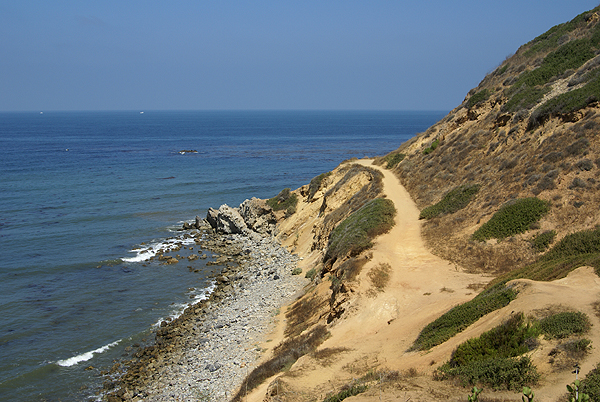
The next flag was a Uzbekistan banner located on a bluff overlooking the Pacific Ocean in Palos Verdes Estates. Most of the homes in this area ranged from $5 million to probably way over $10 million dollars even in today's depressed economy. Getting this banner looked to be pretty straightforward based upon the Google maps and satellite images. Once we got to the bluff, I realized that I might have a dilemma on my hands. I was within 325 feet (256 feet to be exact) distance horizontally from the banner, but the problem was the banner was not directly horizontal away from me, but down the bluff toward the ocean. Now, do I need to be at least 325 feet vertically as well? I hadn't run across this before on the site and I've since found that once you're within scoring distance, it doesn't matter whether you're vertically ok, as long as the GPSr says you're within scoring distance, you score the points.
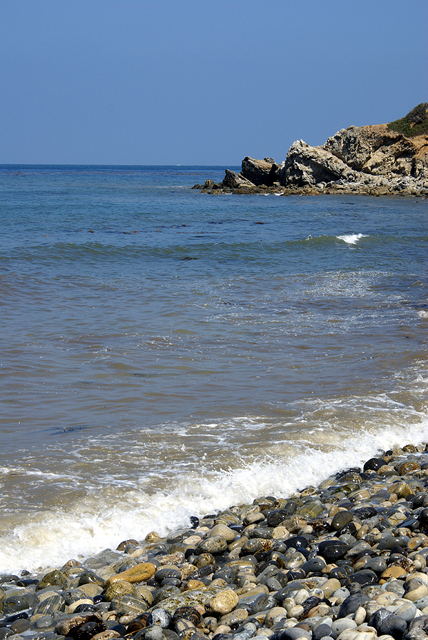
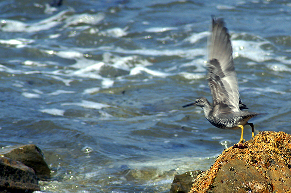
I didn't know this, so I attempted to get closer. We could see a trail down along the ocean, so we went in search of the trail head to get down there.  The trail head was only about a quarter mile away, so that worked out well. We also noticed a well concealed cache at the trail head, which we found first before heading down the trail. Just as we were replacing the cache, five or six brown pelicans riding the thermals, came soaring up the face of the bluff at that point and appeared right in front of us about 30 feet away. I wasn't quick enough with the camera to get a picture of these but the site was very impressive. The Tadpole let out an audible, "Whoa," as they came up and over us. It's probably one of those encounters that he will not soon forget. After replacing the cache in its hiding spot, we headed down the trail to the Pacific Ocean.
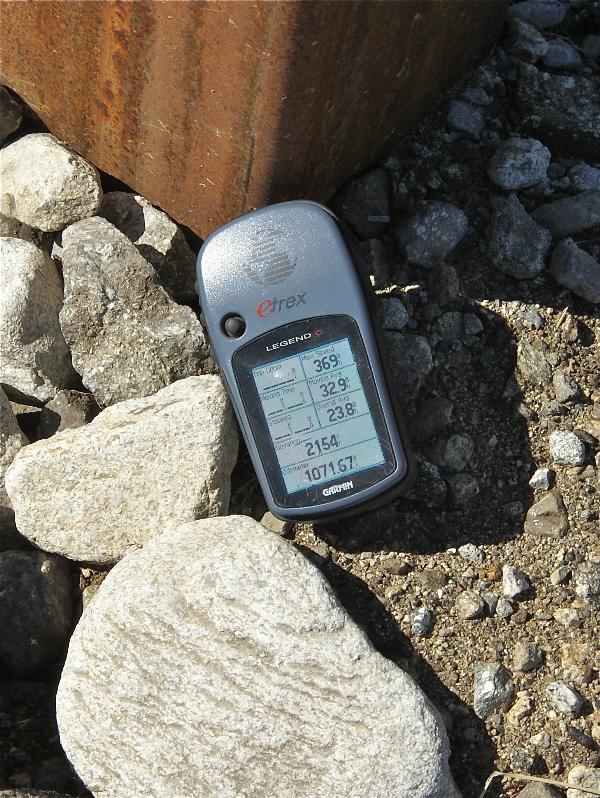
The trail became one of those teachable moments while we were looking for a way to get closer to the Uzbekistan flag as well as two other caches that were located down there. I noticed the beach was very narrow at this point, and not knowing the tide schedule, I made sure that he never put his back to the ocean while we were on the beach in case a rogue wave came or the tide starting coming in. Once down on the bluff, we found another trail that took us further up the bluff and closer to the flag. We were able to get 178 feet away from the flag at that point while being 34 feet above sea level (the bluff above was 297 feet above sea level). That was our closest approach to that flag, so I figured that I'd rely on my mathematical abilities at home to see if I would score.
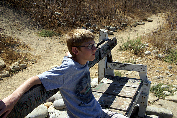
We then proceeded to look for a very nicely camoed ammo can along the bluff plus a virtual cache located down there, finding both. There was a memorial bench to a surfer who had died and had his ashes scattered down in that cove which the Tadpole used to contemplate the ocean for several minutes before  we decided to make our way back up the bluff to the car. Of course, being the 12 year old, he also insisted on throwing a couple of rocks into the ocean as well. I had forbidden him from doing that earlier up on the trail, due to the possibility of hitting someone down below that we couldn't see, another one of those teachable moments we seem to get all the time.
Once home, after a slight detour to get the last flag, I set down to figure out the math for the Uzbekistan flag. It was more mental exercise than anything else, since I figured that I was about 100 feet or so away from the flag from the lower end, just looking up the slope, but I wanted to make sure. Working out a drawing, I calculated the vertical and horizontal distance of my triangle, but I needed the hypotenuse of the triangle, which would be the line leading from the bottom point up the bluff to the top of the bluff where we had been standing previously. I found a site that helped me out with some of the math, since I'm a little rusty, having not done this type of math since probably college. When the calculations were done, I found that the flag/point I was looking for was 102 feet higher than me when we were down at the bottom and 154 at the top. The hypotenuse of the triangle yielded distances of 308 from the top and 205 from the bottom, both were within scoring distance, so I was good.
 In reality, the distances were actually closer than either of those last two figures since the bluff wasn't shaped like a triangle, but more like a parabolic curve. That would change the distances from me to the flag, but would actually decrease the distances, so I was definitely good for scoring. As I noted above, I found out later that I didn't have to do all the math because I'd already scored, but it was a fun exercise anyway to figure it out.
The day turned out quite pleasant down at the ocean. The Tadpole and I got a good hike in, we found three flags and three caches while on the hike, got to see some nice scenery and the Tadpole learned a couple of safety considerations. Not a bad day at all.
Pictures were taken at or near the following geocaches:
View to a Thrill - by seaglasspirates
Surf Refuge - by Windzombie
Flat Rock View - by Jonaz