I think I'm rather fortunate at this point in time to be back at school. Working in an air conditioned building right now is a good thing when the outside temperature is around 104˚. The heat always gets me thinking about fires since this is also our "fire" season. 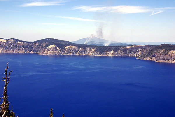
When we visited Lassen last month and also when we visited Crater Lake last summer, there were prescribed burns happening in the parks. Over the course of the last hundred years or so, we've had a policy within our country of any fire being bad, and so therefore the fire was suppressed almost immediately. I can remember reading back in the early 1970s about forest fire management and how prescribed burns were now being applied to areas to get the forest back to where it should have been all along.
Clues that helped fire management personnel figure things out were burn scars on the bark of Giant Sequoias and other trees. This indicated that the big trees had survived many fires in the past. However, after many of the trees were protected within national and state parks fires were suppressed in order to protect these same trees. Park rangers were unaware at the time that they were doing more harm than good to the forests.
My family took my camping all over the western United States during the 60s and 70s. I grew up thinking that forests were deep and dark and very difficult to traverse except on trails due to the heavy underbrush and the think canopy of trees. Very little light penetrated to the forest floor, so very few plants grew. Many forest had uniform thick trees due to all of them sprouting around the same time.
Eventually, fire management teams realized that fire is a good thing for a forest. It clears out much of the over accumulation of pine needles and other forest duff that accumulates over the years. 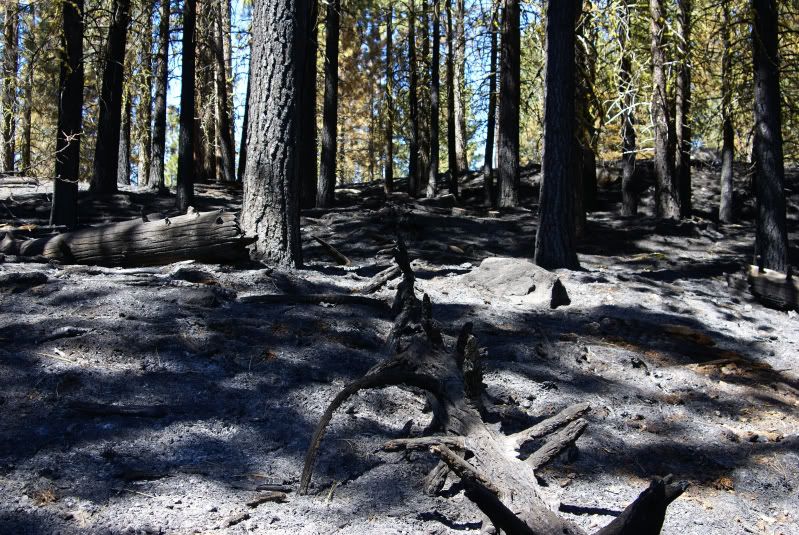
This is what happened in September 1988 in Yellowstone National Park. Several small, lightning started fires were allowed to burn. Then, the fires got out of control and much of Yellowstone burned. The fires probably helped in the long run, but it was a catastrophe at the time. I had visited the park in 1987 and I remember watching the fires come ominously close to many of the places I had been barely a year previously. It was a very sobering sight to say the least.
In Southern California, we have an entirely different ecosystem, with many bushes and a lot less trees. When we get fires, they tend to get ugly very early. We haven't had a fire in the foothills behind our house in about 7 years. I've hidden a geocache puzzle up in those hills, which was originally entitled The Dead Forest? mainly because there was very little vegetation up there following those fires, yet the question mark at the end held out for the promise of new growth. The cache is now called Cobol Canyon Cache, because the forest is definitely not dead any longer. Whether prescribed burns would work in this area is another story. If the area wasn't so urban, it probably would. Saving houses adds another layer of complexity to fire management.
The prescribed burn in Lassen was right along the Manzanita Lake trail. The fire wasn't very big, but then again, most forest fires, if they're actually allowed to burn naturally, shouldn't be that big. They're usually just enough to burn the lower branches and the pine needles without scorching the land. 
Yet here we were, walking along a trail, with little areas slowly burning. I spotted a couple of spots where I could see some tongues of flame, but none of the pictures came out where you could even see the flame. The burn had worked its way down to the lake edge. Because there was little to no breeze blowing, no hot embers were flying through the air. The fire would eventually die at the water's edge having cleared out a small patch of forest to regenerate. In fact, as we got over to the other side of the lake, I ended up taking a picture across the lake at the prescribed burn. I think most people would be hard pressed to even figure out what part was actually burning.
Yosemite National Park actually has/had a small demonstration forest in their Wawona Big tree grove to show the differences between the two different types of environments. The Wawona grove is a two tiered grove of trees, so it's easy to demarcate the boundaries and show the differences. The upper grove, which had been burned through by several prescribed burns over the course of several seasons, had lots of small bushes and grasses growing throughout. The trees were widely spaced, giving the grove a light airy feel to it. It was very easy to walk through this grove.
The lower grove had trees packed closely together and it was very dark, with very little sunlight reaching the forest floor. 
The prescribed burns keep that fuel down, taking the forest back to the way nature intended. At least that's the hope. Only time will tell whether this way of managing the forests is any better than the total fire suppression we had in the early part of last century. As it is, we still get major fires, but I think the hope is eventually, we'll not have to be so aggressive in fighting fires and allow them to burn out naturally. That will make for an better forest for all of us to enjoy.
On a side note, the National Park Service celebrates its 94th birthday today.
Pictures were taken at or near the following geocaches:
Pumice Castle and the Old Man of the Lake - by 47Dad47, KollyWobbels, Sally, and Russ
Loomis - by 2dogs and mtnsteve
Wednesday, August 25, 2010
Prescribed burns

Saturday, October 10, 2009
Southern California Rarity
When you cache in Southern California, you get used to see things a certain way and when things end up differently, you sometimes do a double take. At the minimum, you stare and try to make some sense of what your seeing.

Looking at a map, this one is fed by coastal mountain streams, which in late September would be very dry as the rainy season has been pretty much done since mid-March. Lake Nacimento reservoir also feeds this river, so either the powers that be had an abundance of excess water, or they were letting water go in anticipation of the upcoming wet season a few months down the road. Either way, it made for a very pretty pastoral picture of the Salinas Valley.
Picture was taken at or near the following geocache:
Binary Blues - Black Gold - by Just a Short Walk

Friday, November 28, 2008
St. Francis Dam
Last week, Chaosmanor and I went up into San Francisquito Canyon to do some geocaching. One of the caches we looked for was the earthcache, 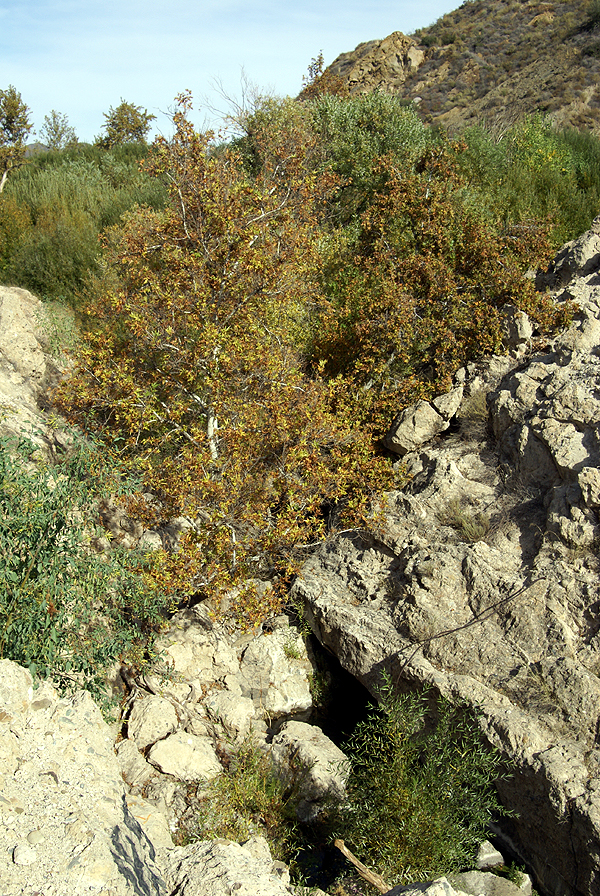
As noted previously in my last post, the road used to lead right past the dam site, but the dam, or what's left of the dam is now shielded from the new road course. I don't believe this was done intentionally, but we both noticed that you cannot see the dam either coming or going along the new course of the rive. Well, I take that back. You can see the dam as you make your way south out of the canyon, but only if you really know what you're looking for, which probably leaves most of us out.
The dam was constructed between 1925 and 1926 and then was slowly filled over the course of the next couple of years. It was designed by William Mulholland, the chief architect of the Los Angeles aqueduct that brings needed water to the city from Owens Valley along the east side of the Sierra Nevada. This reservoir was designed as one of the storage sites for that water.
As the dam slowly filled, cracks and leaks were noticed in the face of the dam, but they were pronounced normal for the dam by Mulholland. As the lake increased behind the dam and more pressure was exerted on the dam, more cracks and leaks developed, each one being dismissed by Mulholland as normal for a dam of this size. The lake was at full capacity for five days before the dam collapsed, first on the east side, then on the west side leaving a large portion of the 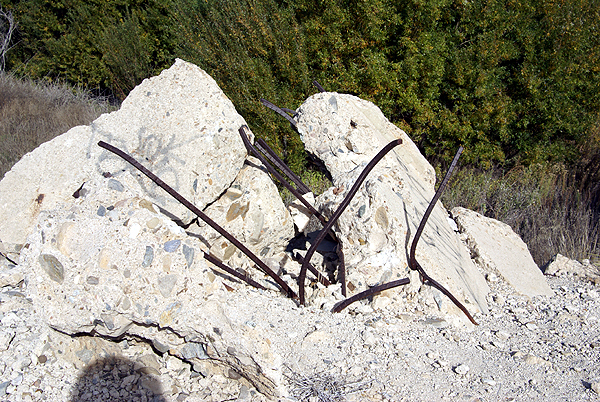
The dam pieces were pushed downstream up to a quarter mile away as the water rushed down San Francisquito Canyon. No one know for sure how many people dies in the flooding that followed. I've seen counts as low as 450 and as high as 600. Those are "official" counts and are also acknowledged as being on the low side because there was no accounting for the migrant farm workers that were living in the area. I also read a report that stated they were still finding bodies as late as the 1970s.
This disaster, obviously ended William Mulholland's career. The geology of the area known in the 1920s was not enough to prevent the dam from collapsing. Newer developments would have been able to see the flaws that led to the collapse of the dam and the dam would not have been built in that particular position in the canyon. As we stood on the top of what's left of the dam, we figured out why Mulholland chose that particular site. It was a natural site for a dam, a fairly narrow canyon that opened up onto a broad expansive valley upstream. The place where the dam was built was narrow and 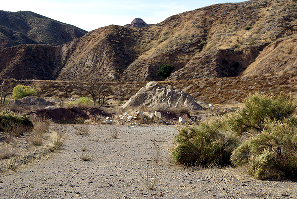
It's interesting that Mulholland admitted he made a mistake and claimed full responsibility, yet there doesn't seem to be any major lawsuits brought forth following the disaster. Perhaps it was because the inquest placed the responsibility at his agency's door, but also stated that Mulholland had no way of knowing the geologic formations where the dam was placed would cause the failure of the dam. I'm pretty sure we would not see the same kind of reaction from the general public if a similar dam were to collapse now. Lessons were learned and have been applied to other dams built afterward, similar to lessons learned when the Titanic sank.
I'll not get into the specifics of the earthcache itself. If you wish to do this earthcache, it's fairly straightforward and easy to do. 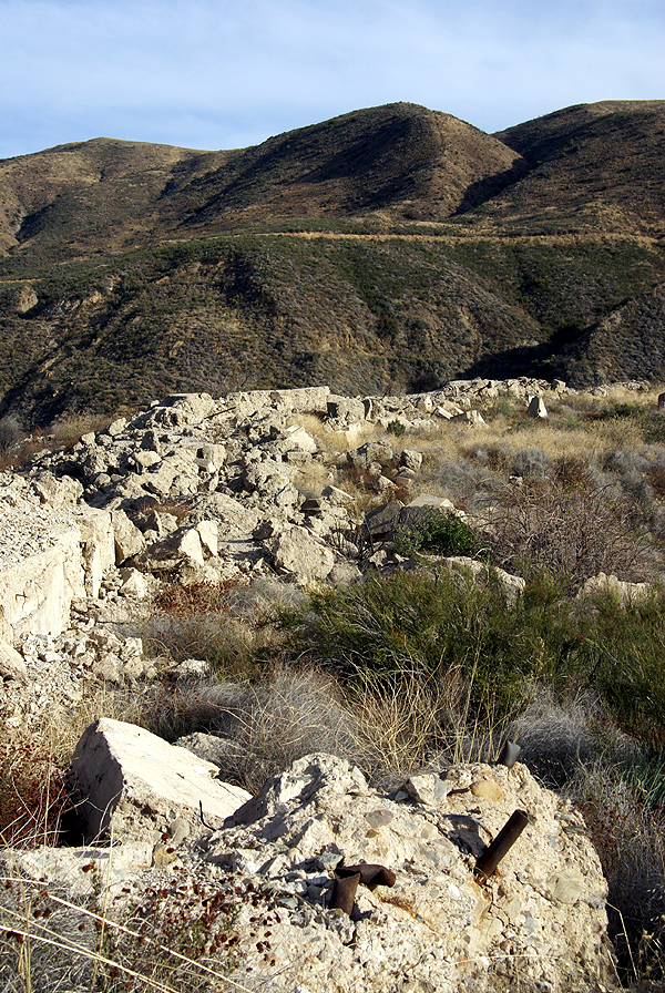
Another geocache took us up to the top of the western part of the dam that was still there. The middle part of the dam, that was left standing after the flood, was later demolished after someone was killed attempting to climb it. Standing up on top of the dam was where we got to see why the dam was placed there. The broad valley behind the dam was perfect. Had the dam not fallen, I could see where this area would be a perfect recreational area for boaters. This would have been a huge lake.
At the same time, had someone been standing up on the western side of the dam when the other part collapsed, it probably would have been mind numbing to see it happen. It took close to two years to fill the lake completely and it drained in less than two hours. I've seen pictures of people who were standing on the top of Mt. Adams when nearby Mt. St. Helens exploded back in May 1980. One woman just fell to her knees as she watched that drama unfold. I can only imagine it might have been similar here, had there been a witness who survived.
South of the actual site there is a California Historical Marker noting the disaster, but that seems to be the only official noting of the 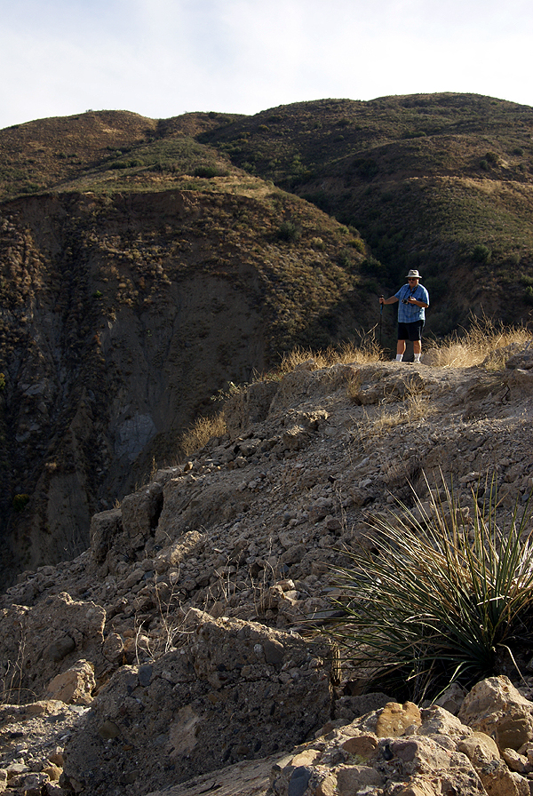
It's unfortunate that a disaster such as this has to happen to spur government officials to act in the best interests of the people. That seems to be our way of life. Fortunately, these types of incidents don't happen nearly as frequently as they did earlier in the last couple of centuries. Yes, it was an ugly incident, but some good did come of it, and that is a good thing.
Pictures were taken at or near the following geocaches:
St. Francis Dam Failure, Saugus California - by TerryDad2
In the Shadow of St. Francis Dam - by Yosemite John and Debbie
St. Francis Cache - by Tom and Tommy

Wednesday, November 26, 2008
Mother Nature Reclaiming What is Hers
Several weeks ago, we had terrible wildfires rush through several areas of Southern California. Today, with the heavy rains we've had,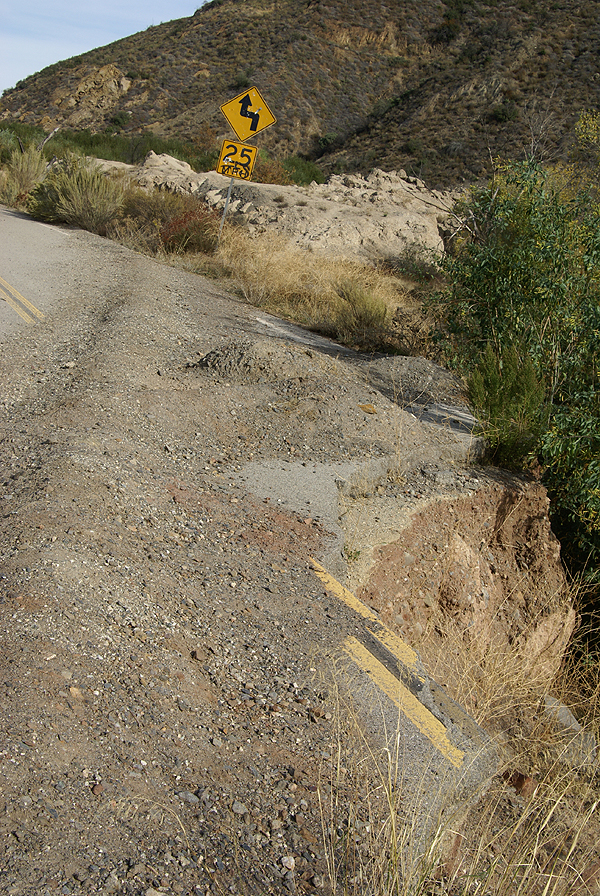
Last Saturday, I found some geocaches along a stretch of road that had been abandoned, due to flooding. The road had recently been realigned around a narrow spot in this canyon, bypassing this particular part of the road. 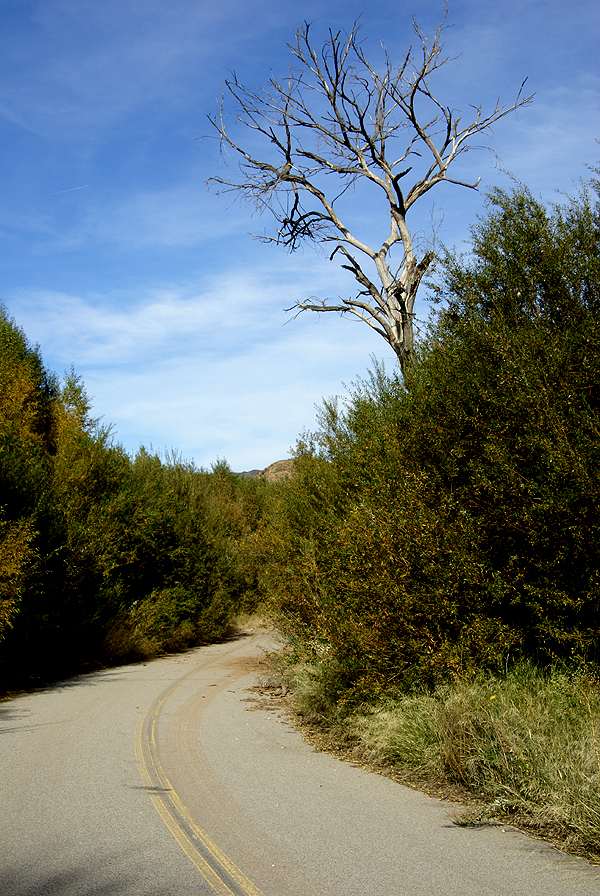
Several years ago, we'd had an El Niño year, which means lots of rain. There was plenty of evidence of that, because there were several places where the road was almost washed out completely. Eventually, this area will be reclaimed by nature and the barriers that are there now to prevent cars from driving on an unsafe road will be removed. But for now, it's a work in progress.
As we hiked through this canyon, I was struck by how powerful nature (water, wind, fire) really is. 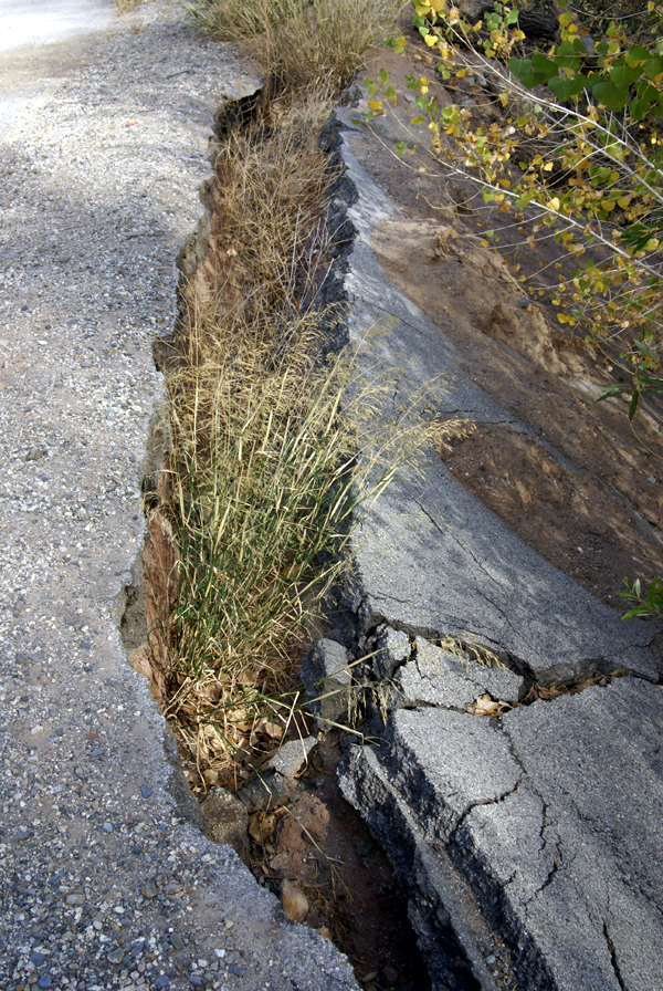
It gives me hope for the future. No matter what we end up doing with ourselves, the Earth will probably survive, rebuild and start anew. A new species will now possibly grab the top spot among the sentient beings on the Earth. But, the Earth, will heal. In fact, it's trying to heal right now. Sometimes, I think we just need to step aside and let the master work.
Pictures were taken at or near the following geocaches:
Reclaimed by Water - by Yosemite John and Debbie
St. Francis Cache - by Tom and Tommy
In the Shadow of St. Francis Dam - by Yosemite John and Debbie

