I've almost been writing this blog now for almost two years, starting in January 2008. Many of my caching partners have come and gone, but there are a couple who have decided to hang around me for a greater part of my caching career. Chaosmanor has been hanging around me in geocaching the longest. In fact, we met through Where's George? before either of us got involved in Geocaching. 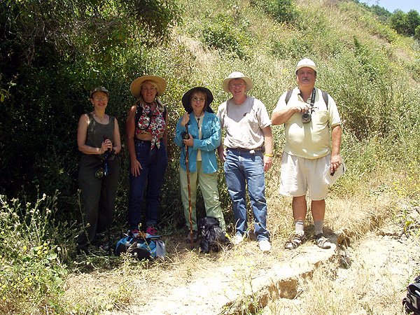
Through the years, we've been on numerous geocaching adventures together. Our first was on the western edge of Los Angeles County, where we hide a cache together near the spot where the television show The Lone Ranger, was filmed. Since that time, we usually went out caching with each other several times a year, usually when I had time off.
There, for awhile, Memorial Day weekend we usually got together to cache, and then we started meeting during my spring break. We are planning a trip down to San Diego over my spring break to find some caches as well as some virtual flags. In the past year or so, we just tend to get together when the moment strikes and both of us can get away for some caching fun.
It's really interesting to note that, although we do have different belief systems about a great many things, there are still many more things that we have in common. Many of our silly hobbies that we play, we share a common interest in, so we tend to get along very well. I enjoy his company and consider him one of my friends.
Yesterday was supposed to be a hiking day for us, but with the rain, we decided that we'd probably stay dryer by hitting some of the suburban caches around my neck of the woods. The best words to describe the two of us when we went out caching in the rain would have been, the odd couple. There I was, wearing a hooded jacket and long pants and he's walking around in shorts and not jacket. Later in the day, we ended up walking through a field, which was very damp. 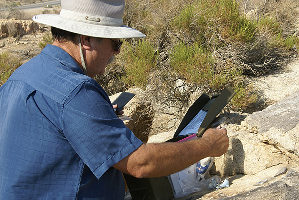
We both were working with our iTouches for the first time on a longer cache run, so we got to pick each other's brains (boy, that's loaded) for ideas on how to use this new app we'd downloaded for the iTouch. It worked well, because I think we both ended up learning some new things about the app which will help each of us as we continue to cache in 2010.
As always, I look forward to the next time I can cache with Chaosmanor. He's enjoyable company and we have a variety of different interests that always keeps the conversation running throughout the day. Happy New Year to everyone. May 2010 be better than the previous year.
Pictures were taken at the following geocaches:
SwitchBACK! - by WestwardHo
Mojave Green Travel Bug Motel - by The Dananator
Thursday, December 31, 2009
Cache Partners Redux

Monday, May 4, 2009
Nice Gneiss
When I go out geocaching, I'm always looking around for interesting subjects so I can improve my photography skills. I 
Usually, what I find interesting others might just pass by. I'm frequently at awe over the power of nature, especially the interaction between plants and the rocks and how they interact with each other. I love looking at tree roots, especially if they on the upper side of a trail, because you can see how they sought out the cracks in the rock where there might be some soil. You can also see how the tree roots hold the hillside in place and wonder how the hillside might be different looking were those trees not there.
About a month ago I was on a hike with my friend Chaosmanor and we noticed some faulting along a rock face. There were some bands of striated rock material that had been misplaced in numerous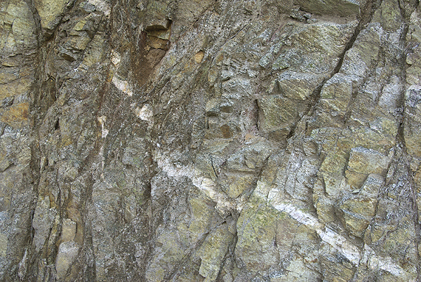
I also enjoy trying to identify different types of rock. Usually this happens when Chaosmanor is along with me, mainly because he has similar interests to my own in this area. When I try to talk about rock types with other friends, a lot of times you can see their eyes glaze over. "Geez, he's talking about rocks again." Chaosmanor and I, on the other hand, enjoy a good talk about geology. We even like to throw a pun at each 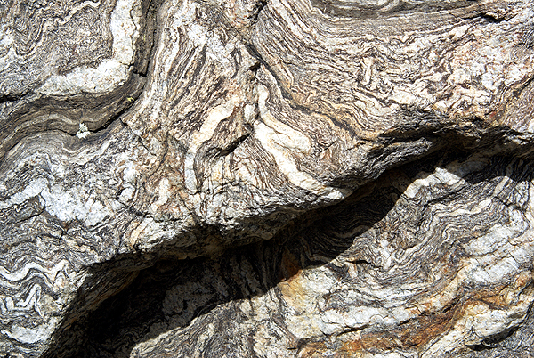
I can probably blame my father for this love of rocks. He was the one who took us to Yosemite, frequently over the course of my developing youth. I can blame him because I like to look at large rocks as opposed to tiny grains of sand along a beach. And if you don't believe me, you can always say that I'm full of schist.
Pictures were taken at or near the following geocaches:
Subterranean Homesick Blues - by Terra Girl
Micro N Post - by not tom
Tree at 4737 - by not tom

Sunday, January 27, 2008
Another diversion?
When I first started Geocaching, I was a very casual geocacher. I went caching maybe once a month and found three or four on that particular trip. My first three years (2001-2003), I found 17, 28 and 32 caches respectively. Then 
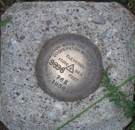
What is a benchmark? From the geocaching.com website,
“A benchmark is a point whose position is known to a high degree of accuracy and is normally marked in some way. The marker is often a metal disk made for this purpose, but it can also be a church spire, a radio tower, a mark chiseled into stone, or a metal rod driven into the ground. Over two centuries or so, many other objects of greater or lesser permanence have been used. Benchmarks can be found at various locations all over the 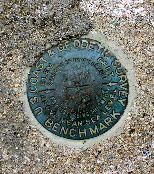
The site also goes on to state that many benchmarks are in plain sight, but mostly ignored by the general population.
Further reading on that page listed above kind of gave me a glazed over look. There’s a lot of technical information on it. I discovered that geocachers could log benchmarks, and could even fill out a form to update the benchmark with the NGS as well. There’s a FAQ page in the geocaching forums dedicated to helping people fill out recovery forms as well. I decided that I’d start small and just try to find and log one. So I printed out a couple of pages and then promptly forgot about benchmarking entirely, at least for a month or so.
Then, on a Sunday morning I was driving my daughter over to her violin lesson and we were stopped at an intersection. My gaze drifted over to the curb and there, painted on the curb, were two letters, BM with an arrow pointing up to the top of the curb. 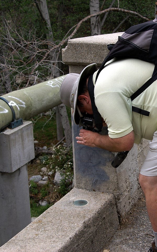
Now, I guess the big question would be, was I hooked? The next day, I went out and found two more benchmarks in the same general area, but I wouldn’t say that I was hooked. In fact, I find benchmarks interesting, but I haven’t gone out of my way to find them. One of my caching friends, chaosmanor, enjoys benchmarking and has logged over 150 benchmarks in the system. He has also logged over 80 recoveries into the NGS database as well. I’ve logged two other benchmarks since that first flurry of a weekend back in 2003, both were on a caching expedition with him and they were both found because we sort of stumbled over them while hiking as opposed to actively seeking them. In fact, we walked right by another one that was about 50 feet away. Like I said, they’re in plain sight, but usually ignored by the general population. Even two geocachers who were on the lookout for some missed it.
As I’ve continued to take my son out caching, I look for a variety of things at the same time, mostly because if they’re interesting, I like to take pictures of them.