One of America's Best Ideas has been the creation of National Parks. It started with Abraham Lincoln, back in the 1860s when he signed legislation protecting parts of Yosemite Valley and continued into the 1870s when Yellowstone National Park was created by congressional act. 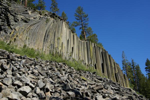
Many of the first National Monuments have been later created into National Parks, such as Katmai National Park in Alaska and Grand Canyon National Park in Arizona. Presidents Wilson and Theodore Roosevelt had the foresight to originally protect these areas until Congress got around to finishing the job. The National Park Service was created in 1916 and administers many more units than just the 58 national parks in the United States.
There are still many national monuments scattered around the United States and the Tadpole and I were fortunate to visit two of them on our latest camping trip, Devils Postpile and Lava Beds. Coupled with Lassen Volcanic National Park, which we also visited, there was a definite theme to what we saw on this latest trip. My point for all this history is I believe that many national monuments are neglected by the general populace, because they aren't national parks, they aren't the best of what America has to offer.
To this I say that most of the national monuments I've visited in my lifetime are vastly underrated. They usually are smaller than a typical national park, but have many of the scenic vistas one comes to expect at a national park, but with usually no crowds to speak of. On a hike out to Rainbow Falls in Devils Postpile National Monument, we encountered the usual number of hikers who were willing to take the fairly easy 2.5 mile hike out to the falls. 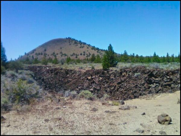
Many times, while hiking in a national park, we've encountered other hikers, but there was no practical way of getting away from them, mainly because there were so many hikers. In Devils Postpile, all we had to do is wait a couple of minutes, and we had the place to ourselves again. We took the slower route to many areas of the park and enjoyed the solitude the park had to offer to us.
The same could be said for Lava Beds National Monument. The park preserves multiple lava tubes, historical areas and beautiful landscapes we have come to expect from these kinds of areas. The small campsites at both places were clean and never filled. Contrast that to many national park areas where you have to get camping reservations 6 months in advance and there's no chance of having the campsite next to you empty.
Another enjoyable aspect of visiting national monuments is most people have gone out of there way to visit these areas, probably because they have an interest in what the monument is offering. Many times, you'll find like minded people that you can share an experience with, that might not happen in a national park, because of the many tourists who are there, to enjoy, but not necessarily immerse themselves.
We had an enjoyable evening with an older couple taking their youngest granddaughter on her first camping trip in Devils Postpile. We watched as two young men came into the campground and picked out a campsite. 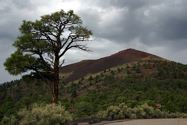
I would not have been able to enjoy their stories had we avoided Devils Postpile. It's on the route of both of those long range trails. You don't encounter backpackers on the trail that often in many of the national parks, because they're walking through remote regions of those parks. With the national monuments, many times the monument is the remote region.
The experiences I've shared in national parks and monuments have both been enjoyable and enriching. I just think the national monuments are underused treasures of the national park system. They are truly underrated. But, let's keep that our little secret. We don't want them to get too crowded.
Pictures were taken at or near the following geocaches:
Devils Postpile National Monument - by truckgirl2
Skull Cache (Lava Beds National Monument) - by ChrissySkyking + Blaze
Cinder Hills Overlook (Sunset Crater Volcano National Monument) - by TerryDad2
Monday, July 19, 2010
Underrated

Monday, July 12, 2010
Earthcaches Galore
Our trip along the eastern side of the Sierra Nevada culminated in our camping at Devils Postpile National Monument. This monument, established in 1911, preserves an interesting basaltic columnar formation and an impressive 101 foot waterfall, aptly named Rainbow Falls.
Since the monument is part of the National Park Service, no container type caches can be placed in it, but virtuals (if they were already created) and earthcaches can be. 
In the park, we found four earthcaches, two on the first day and then two more the next day. We split them up only for convenience's sake. We could have done three on the first day, but the fourth required a substantial hike, so it was basically unavailable the first day of our camping trip.
One of the earthcaches we did on the first day was the Soda Springs earthcache. I'd been here in 1977 as part of a biology summer school class I'd taken at my local community college. Devils Postpile was one of the places we'd stopped to visit and I can remember our instructor, Dr. Bates, talking to us about the Soda Springs in the area. In August, the San Joaquin River, which runs through this glaciated valley is at a low point, with most of the winter snow melted at this point, so there isn't as much water movement where the springs are and so we could see lots of iron oxide precipitate deposited along the shoreline where the springs were.
We had a very heavy winter in the Sierra this year and even in late June, the runoff was tremendous. The San Joaquin was very close to flooding in areas. 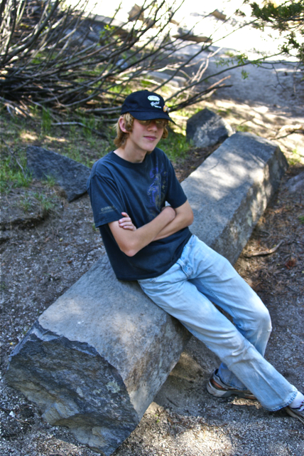
Other things we investigated while in the park were the direction the glacier moved through the park while it was polishing the top of and plucking the face of the postpile. The postpile is a series of basaltic columns that cooled a relatively even time frame. When the last ice age glacier scoured the area, the postpile was exposed for all to see. Over time, columns have eroded and fallen to the base, creating the postpile. The columns are generally smooth on the top where the glacier ground against them.
They are also large in size. At first glance, you can't really appreciate the size of the columns, but you have ample opportunities to get very close to some of the fallen columns and it's then you can truly appreciate how big they are. Earthcaches aren't for everyone, but as the Tadpole likes to say, "you get to learn something with these, so I like them." They take more time to do and so, they're not conducive to "numbers" runs, but then again, it's not really about the numbers, but the experience. You truly get to experience the surroundings with earthcaches.
Pictures were taken at or near the following earthcaches:
Soda Springs at Devils Postpile - by TerryDad2
Devils Postpile National Monument - by truckgirl2

Friday, July 9, 2010
Owens Valley
The Tadpole and I just got back on Wednesday from one of our more satisfying camping trips in a couple of years. Camping trips in general seem to be fraught with could'ves and should'ves. This one didn't have that feel at all, with a couple of minor exceptions. We did what we wanted to do and only once, really got caught up in the, "No, we can't do that cache because we have to be somewhere else" mode.
That is a good thing in my opinion. 
As we drove north we kept a look out for interesting things to see. I wanted to make sure my son got to see Mt. Whitney. We talked about the John Muir Trail that stretches from Whitney's peak to Yosemite Valley. We ended up walking along part of the trail while in Devils Postpile later in the day.
Once you get into the Owens Valley part of California, the scenery pretty much speaks for itself. Owens Valley is on the eastern side of the Sierra Nevada and sits around 4000 feet of elevation. Directly to the west sit the Sierra Nevada, towering over the valley. At points there is a quick elevation gain of nearly 10,000 feet between the valley and the mountains.
The mountains, created by a fault block were uplifted and create a major rain shadow. Owens Valley is in the rain shadow and doesn't get much rainfall over the course of a given year, because the mountains trap the moisture from the clouds as they rise to go over them. This year was a particularly wet winter and there was a lot of snow in the high mountain passes and peaks. So much so that it would affect our camping trip down the road.
One spot we chose to stop was at Manzanar National Historic Site. Manzanar was one of several relocation centers for Japanese Americans during World War II. Many Japanese Americans were rounded up during the early stages of the war and sent to live in these relocations centers for, as the government put it at the time, "the safety of the Japanese people." Ironic that the guard towers posted at these relocation centers had their guns pointed inward as opposed to outward to protect from an external threat to the Japanese American people living there.
After touring the newly created visitors center at the old gymnasium, we were back on the road again, heading toward Devils Tower. We stopped for one more cache north of Manzanar and reveled in the beauty of the cache location. The disparity between the two locations was striking. 
Sixty miles to the north, the beauty of the place overwhelmed us, much like the starkness of Manzanar tried to do earlier. This time, we let it.
Pictures were taken at or near the following geocaches:
Manzanar Virtual Cache - by GoodDogSD
Cache with a View - by Rallye

Monday, June 28, 2010
Camping this summer
Tomorrow, the Tadpole and I will head out for our annual summer vacation camping trip. 
This year, our trip is going to take us all the way to Northern California, not as far as last year when we got all the way to the panhandle of Idaho and into Montana, but still a good distance. Our first stop is Devils Postpile National Monument on the eastern side of the Sierra Nevada. The last time I was at the Postpile was the week Elvis died (1977 for those of you who aren't old enough to remember). We'd been backpacking in the area and had stopped at the Postpile at the beginning of our trek. At the end, we stopped in Bishop, California for lunch which is when we found out that Elvis had died.
I can remember taking a picture of a pine tree about a foot tall growing out of a crack in the top of the postpile. One of the things I'd like to see is how tall that tree has grown if it's survived. There are also extensive hiking trails in the area and we plan on taking advantage of these while we geocache.
From there, we will head up to Lassen Volcanic National Park. 
There are also thermal areas in the park, one near the south entrance and one further in along the southern entrance. If the snow is still blocking the road, we may have to drive around to get to these areas, but it's something that's fairly unique to the park and I'd like him to see at least one of these. One day while we're camping there, we also plan on driving up to Lava Beds National Monument.
This area has more volcanic activity, similar to Lassen, yet different. If you were to look on a map of the United States, you could trace a line from Lava Beds, up to Yellowstone in Wyoming. The line would also run through Craters of the Moon in Idaho. All three areas are volcanic and are theorized to be created by a hot spot in the mantle of the earth. As the North American tectonic plate moved over this hot spot, lava oozed to the surface or nearly to the surface, and caused many of the features that can be seen in these three parks.

Lava Beds National Monument, besides the geologic history, also has some cultural history. It is the site of the Modoc Wars between Federal Cavalry troops and the Modoc Indian. Outnumbered 5 to 1, the Modocs managed to hold out for over five months in this region during 1872-73 because they knew the lay of the land much better than the cavalry that was trying to remove them from the area.
In all of the years I've been camping, I don't believe we've ever been away from home for the 4th of July. The town where we currently live has an annual parade down the main street, followed by speeches in the park and a fireworks show that evening. We'll probably drive near Redding, California just west of Lassen to view their fireworks display.
The next day, we plan to drive into town and visit the Turtle Bay Museum, where a GPS Maze exhibit will be this entire summer. When we discovered that this maze was going to be in Redding, we both decided that we wanted to go and see it. 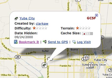
The last two days of our trip will be spent driving home, with a stop in Stockton, about midway between Lassen and home to visit my daughter, Tadpole's sister. On the way, we plan at least one detour in Yuba City to find this cache. Yuba City cache is the second oldest active cache in California, hidden in September 2000, almost 10 years ago. It's so old that it only carries two digits after it's GC designation symbol. It will definitely be the oldest cache I've ever found since starting this hobby.
This will be my last post for about a week, unless I can find a WiFi hotspot somewhere in Redding and can make a quick post, but I seriously doubt that will happen. Besides, I will be on vacation, so I'm not really planning on checking in until after I get home. Have fun in the meantime.

Sunday, May 9, 2010
Winter's last gasp
Every now and then I just marvel at the diversity of life in California. You can be at the beach in the morning and on top of a fairly tall mountain within in a couple of hours, or out in the desert rock hounding. It has an amazing array of scenery. This late in May, it's also extremely rare to see much snow on top of the mountains, unless they are the Sierra Nevada. Those mountains, which create the geographic backbone of California run as high as 14,000 feet. 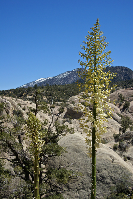
Still, in May, we usually only see a sprinkling of snow in few spots on our local mountains. Not this year, because we received several very cold storms in April. The storms dumped snow at around the 5000 foot level and it's still there, not in copious amounts, but enough to notice if your hiking in view of them. That sometimes lends itself well to interesting pictures. While on a hike in the Devils Punchbowl, I ended up getting, what I think is a pretty decent shot of a yucca in bloom with the snow covered mountains in the background.
In a month, the snow will be gone, although based upon today's weather, which was cold and dreary, but with no rain, it's not out of the realm of possibility to see more rain storms. We have been having warmer, rather than colder weather over the last week or so and I ran the sprinkler system on the lawn for the first time last night, so I think we only have two chances of getting more snow on the mountains this season and that would be slim and none.
I'm now trying to figure out when to take my camping vacation this summer. The plan is to camp at Lassen Volcanic National Park this year. I've been to Lassen probably 3 or 4 times, but I've never been able to get to the top of the mountain. It's not a real tough climb, but it is 11,000 feet and because the park is much farther north, there will be more snow on the peak, especially this year. Because of when work starts in August, I don't have the luxury of waiting until then when it's quite warm and probably snow free, so we'll have to take our chances with the snow. But, as my son says, "It's an adventure." Snow, or no snow, we'll be there sometime this summer.
Picture was taken at or near the following geocache:
Devil's Punchbowl - by Kit Fox

Monday, July 13, 2009
On the road again
In about 10 hours or so, I shall be on the road again with the Tadpole, heading for Marin County north of San Francisco for our annual camping trip. If you recall from last year, our trip was cut short because the Tadpole became ill the first night. We're planning on doing much the same trip as before, but then heading north through Crater Lake in Oregon and finally up to Couer d'Alene, Idaho. I will probably be without Internet access for much of the trip, so don't expect much, especially in the next week. Once I start home, I'll probably be able to post, but without any pictures. Eh. It's only 1000 words here and there.
Friday, July 3, 2009
Camping Trip
Planning has begun for our annual summer camping trip. This year there is a little bit of a twist to the entire trip, which is going to elongate it by about a week. Because of that, this will be the
 The pressing engagement on the far side of the camping trip was my older son's freshman orientation at UC Santa Cruz, scheduled for the 28. No matter what, if my dad came with us, we'd have to turn around about five days after getting up to Idaho.


Wednesday, August 6, 2008
Best laid plans
"The best laid plans of mice and men often go awry." This line, adapted from To a Mouse by Robert Burns best describes our camping trip. Yes, we're home already. Monday morning broke cloudy and humid as the monsoon season that we so typically get in Southern  California seemed to have arrive. I thought to myself as I went to get the paper, great, we'll be getting out of this and moving to a little bit cooler climes. We ate our breakfast, gathered up our last minute incidentals that still needed to be in the car, said our goodbyes and were on the road before 8:15 in the morning. We encountered some traffic along the 210, so we decided that we would forgo our first Vexillum flag of Haiti that was located in the San Fernando Valley and just headed off toward the Grapevine.
The rest of the drive up the I-5 was rather uneventful, although there were clues to what lay ahead. For lunch, my wife had prepared a nice sandwich for each of us. The tadpole took about three bites of his sandwich and about two sips from his juice can. I should have thought about that since he's starting to eat like a horse, but I've seen other trips where he doesn't eat much on that first lunch, so I really didn't think much about it.
After crossing over to the coastal valleys via Hwy 152, we reached our first waypoint, another Vexilla flag, this time of Barbados. The farm land was typical for the area around Gilroay and Hollister, alternating with groves of trees, most likely almonds, with corn and then pasture lands for cattle. The flag we were seeking happened to be located in a cattle pastureland. We couldn't go all the way to ground zero, but we were close enough to score the point for the flag. Being close to Gilroy, which bills itself as the "Garlic Capital of the World," we couldn't help but notice the pervasive smell of garlic in the air. However, even my son, who loves garlic, balked at the advertisement on the famer's market stand on the road which advertised Garlic Ice Cream.
We then made our way north along Hwy 101 towards San Mateo County. Once entereing San Mateo County we started actively looking at the GPSr to find a cache that we could find and log. We eventually found a very nice ammo can on a ridge overlooking I-280 on one side and the San Andreas fault zone on the other side. We then got back on the freeway and made our way to the very next exit which was a rest stop. As I got out of the van , I noticed another cache here, so we found that virtual as well, learning a couple of nice things about some of the missions in California.
Then we headed up to San Francisco, getting a dashpoint near the San Francisco zoo and a virtual in the heart of the city. The city's finest elements appeared in all there glory while on this trip through the city and the Tadpole marveled at the different kinds of people there were in the world. In a car in front of us at one point, there was a passenger who had, at minimum, an 8 inch Mohawk hairstyle. I'm not sure either one of us were ever able to determine whether this said individual was male or female. Not that it mattered, it just added to the overall story.
San Francisco was living up to its reputation weatherwise, being very cold and cloudy. The tops of the highest skyscrapers were shrouded in fog as were the tops of bother towers of the Golden Gate Bridge, yet you could look across the bay and see Alcatraz Island, basking in sunlight. We continued north, making a turn at Hwy 1 to get out to the coast on the Marin County side of the Golden Gate. That's when I started noticing more problems.
The Tapdpole, who rarely gets headaches had one and was rather pale. When we got to camp, he perked up a little bit and I attributed it to the winding road and a little car sickness. After a hearty dinner, which he wolfed down and setting up camp, we decided to try and find our first cache in Marin County. The closest one to our campground, we ended up not finding after two tries at it. The night was upon us and we headed off to sleep.
I awoke with a start around midnight trying to figure out why. The Tadpole was moaning and I was able to get out of him that  he didn't feel good. I went to get a bucket, just in case and his response was, "Hurry." A couple of minutes later, dinner made a resverse entry from him. Four hours later, he finally had heaved the last amounts of dinner out of his system and was finally asleep. The morning didn't seem to bring much relief to him. He insisted that he wanted to go out to the Point Reyes lighthouse, but as we made our way out there, I could see him fading fast. We both made the decision that it would be best to come home, because it didn't look like he was going to get much better over the next day or so and it's miserble enough being sick when you're at home, let alone in a strange place. So, we're home. He's probably about 90% or so right now and another good night's rest at home will probably bring him back up to full speed.
So that's why we're home and not still out in the woods somewhere. Point Reyes is beautiful, and both of us agreed that we'd like to go back there again next year. So that's what the plans are at this time. Like a proverbial baseball team that has fallen short, "We'll get 'em next year."
Pictures were taken near Gilroy, CA, Samuel P. Taylor State Park and Point Reyes National Seashore.

Sunday, August 3, 2008
Happy Trails
And away we go. The van is packed and except for a few incidentals that we need to pack in the morning, we're set to go on our week long camping trip up the coast of California. After looking at the GeoDashing site and the  GeoVexilla site we have the possibility of getting upwards of 16 flags and dashpoints on this trip. Although the flags are a one time shot for this trip, I will be heading back up to the Stockton area about a week after I get home from this camping trip, so if I miss a couple of those dashpoints due to time factors, I can always get them when I take my daughter back up to school.
For Geocaching, I ran the PQ on Saturday. After looking over the puzzles I solved 6 of them very quickly. There are three others that will have to be solved in the field because they depend upon signs and plaques to get information from to solve them. As you can see by the map, the route is a little convoluted, but it's pretty much the way we'll be traveling, heading up the coast on Monday, then further north on Wednesday after a stop near Point Reyes National Seashore. I have a geocoin that commemorates the Cape Hatteras Lighthouse and it wants to visit other lighthouses, so I have a good opportunity to help it toward its goal. There's also another lighthouse up near Crescent City where we'll be camping that I could take it to as well. After visiting the Point Reyes area, it's on to Redwood National Park. All in all, it looks to be a fun trip for the two of us.
One of the caches that we definitely want to find is Rabbit Eye View. If you look at the graphic, I have it highlighted. You can also see it highlighted on the map in a semi-pink color just north of the San Francisco area. It's one of the four caches with only a two digit GC number, meaning it's a very old cache, one of the few caches that have been around longer than I've been caching. The other reason for us to get that one is there is a special cache inside that cache. The Fly....Mars Rover moving cache is inside the Rabbit Eye View cache. Moving caches aren't allowed anymore by  Geocaching, but there are a couple that are grandfathered into the system, this one being one of them. I've had this particular one on my watchlist for a very long time. It's been all over the place, then found its way to California, then back east and then was brought back out here to the GeoWoodstock Event in May where it's been seen in many caches around the Bay Area in California. Now it's up in Bodega Bay, where we'll be on Tuesday. I posted a note on the Mars Rover page that hopefully will keep it there long enough for us to grab it, or at least find it and log it. That would be a really cool find.
One last goal that we have on this trip is try and find at least one cache in each county along that mapped route. If that happens, we'll add 16 or 17 new counties cached in for California. That will put us that much closer to reaching the goal of having cached in all 58 counties in California, which will help us also find the California County Challenge cache. That won't happen this year, but we might finish that goal by next summer.
I don't expect to be able to post any followups while on the road. I am taking my mini lap top with me, but I'm not going out of my way to find a WiFi hot spot so I can log caches or post to the blog, etc. What happens is what happens on this trip. We're expecting to commune with nature, find some ammo cans and tupperware in the woods and go on some nice hikes. Until the 11th or so, I'll see you later.

Friday, August 1, 2008
Traditions
Next week, the Tadpole and I will be taking our annual camping trip. I have taken some of all of the kids camping every year since the summer of 1993. It was  usually a summer trip somewhere, either up to the local mountains, or to one of the national parks in California. As they got older, we became a little bit more adventurous and would travel to Utah or Southern Arizona. We would always take a trip in the summertime and could usually squeeze a short trip during my spring break to the local deserts. As the older children grew, their interest in camping waned and so they stopped coming on the trips although my older daughter has expressed an interest in trying it out again.
One of the traditions we established over the time was taking a picture of our tent at our campsite. I usually wanted the kids in the pictures as well so to keep a record of them as they grew up. Most of the time they complied, but as they got older less so, so the last picture  I have with all three kids in the frame is from our 2001 camping trip to Bryce Canyon National Park and Cedar Breaks National Monument. Coincidentally, that was the first camping trip where we did some geocaching while out on the trip.
Having not been on the site for more than a couple of months when we made that trip, I had one printout for a cache in Cedar City, Utah that I wanted to try for, so we drove down from Cedar Breaks and went to find the cache. I hadn't thought ahead very well and it never dawned on me that we might get a DNF on West of Work (#4). The thought of finding a virtual at the time hadn't entered into my thinking either. Interestingly, the first virtual that I can see in Bryce  Canyon wasn't published until 2002, so there weren't any virtuals in the park to "find" anyway nor were there many real caches outside the park to find at that time either. Geocaching was in its infancy back then, just over a year old.
For our latest trip, which we begin on Monday, we have a bookmark set up that has over 350 possible caches to find. We know that we won't find them all. Last year, we had 429 caches in the GPSr and we found just slightly over 10%, 43 caches in all. If we find 10% this year, I will be happy, as I'm sure the Tadpole will be as well. In fact, I'll be happy if we only find 5%. The numbers aren't as important as the time spent with each other hiking and doing the things that we enjoy doing.  One of the things you can be sure that we'll do this year, will be to take a picture of our tent at our three campsites. I'll see if I can coax the Tadpole to be in at least one of them.
In my next post, probably on Sunday, I'll go into a little bit more detail about our upcoming camping trip.
The pictures were taken at the following campsites.
#1 - Joshua Tree National Monument- Black Rock Canyon Campground
#2 - Joshua Tree National Park - Black Rock Canyon Campground
 #3 - Sequoia National Park - Lodgepole Campground
#4 - Kings Canyon National Park, Grant Grove - Azalea Campground
#5 - Bryce Canyon National Park - Sunset Campground

Tuesday, June 17, 2008
A Spectacular DNF
There are some Did Not Finds (DNFs) that are just routine, run of the mill, you just can’t find them and then there are other DNFs that can be blamed because you had a cold or your geosenses weren’t sufficiently working. 
One particular cache stands out as a spectacular DNF and it’s one that my sons and I tried to find while on a camping trip, not once, but twice. Interestingly, this particular cache is the only cache that makes my top 5% bookmarked list that I haven’t found. Why is it in my top 5% if I haven’t found it? I feel this cache is what geocaching was all about when the hobby first got started. It involved a hike, some puzzles to solve to gain all the coordinates, plus heavy tree cover that places your GPS’s ability to work properly in jeopardy as well. In short, it’s a fine cache that I just haven’t been able to find yet. In fact, had I known ahead of time that a friend of mine was going to go camping up in the same area last month I would have recommended that particular cache for him to attempt as well because I believe he would have enjoyed the hunt.
I originally picked IXL back in 2002 as one of the caches we would attempt because it was near where we were camping at Big Basin State Park just north of Santa Cruz, California. The cache is actually in Henry Cowell State Park, but they’re fairly close to each other. There’s a nice parking lot that you start out in where the trailhead can be found. You then have to find the missing coordinates by reading interpretive signs along the trail and doing some (GASP!) math. Eventually you end up near ground zero. I should add that I’d only been geocaching for about a year and a half the first time I attempted this cache and probably only had 20 finds at the time. Yep, I’m making excuses already for this one.
Once we got near ground zero, the fun began. At that time, I had a Garmin 12 (I can already hear the argument of Garmin vs Magellan and it’s sort of like Mac vs PC – each person has their own preferences). The batteries were losing strength, but I had extra in my backpack, so I wasn’t worried. The tree cover was heavy, due to the large Redwood trees and heavy forest cover, so my GPSr kept losing signal from time to time. Finally, the batteries died, so I pulled out two new batteries that I needed and opened up the unit to put the new ones in and take the old ones out. 
Taking the two good ones, I put them in with two of the dead batteries and tried to get a signal. It took awhile under the tree cover to acquire a signal, but we got one eventually, but soon the unit went dead again. I tried this method again using the other two dead batteries and the fresh ones, but that didn’t work any better. Eventually, we were forced to give up, not finding it. When we got back home, I was too embarrassed to even write a DNF log on the page. But then again, I didn’t write DNF logs at the time. I usually will write a DNF if I’ve given a cache a good enough search and I feel I’ve exhausted all possibilities. Back then, I just didn't write them.
The following summer, we were back in the same area, so we tried this one again. Did I mention that the cache is 317 miles away from our house? Not only was this cache going to be a spectacular DNF, but it was going to be a long distance DNF as well. I’d thrown away all of the clues for the puzzle so we did the puzzle over again. Long term memory kicked in to help us down the trail and it went more quickly, but when we got to ground zero, we still couldn’t locate the cache. We searched for about an hour before giving up this second time.
This second camping trip was starting to turn into a DNF trip all the way around, because we’d DNFed "Red My Lips... I'm Not a Crook" up in Big Basin State Park, but we were pretty sure that it had been muggled. We were now 0-2 and heading for The Redwood Barely There! in the area. We spent a great deal of time looking for that one as well and gave up on it as well. As we were hiking out from that particular cache, I saw the cache alongside the trail. Based upon the name of the cache, that’s where it was supposed to be, so I can only assume that the tree cover was playing havoc with the GPS again. At least we found that one. Afterwards, we ended up driving down to Santa Cruz and got our one and only Webcam cache.

Should I go back again, and I’m sure I will sometime in the future, we’ll try for IXL again. I have a new GPSr, so it will be interesting to see if the new one helps us out. My youngest has the older model, so we’ll be able to compare notes on the cache to see how accurate we are. Or maybe, just maybe, my experience will kick in. Like I said before, I had only about 20 cache finds at the time of my first attempt, and not many more than that a year later, so experience at finding caches might help this third time. If we end up posting another DNF, then it will make this one even more spectacular. Even DNFs can be fun if you have the right attitude about geocaching. But I think the third time will be the charm, won’t it?
Pictures were taken at or near the following caches:
"Red My Lips... I'm Not a Crook" - Kaveh, Team Bench Leader
The Redwood Barely There! - by Scott, Becca, Travis, Max
Eye Spy Another Eye in the Sky! (Webcam Cache) - by Just a Short Walk

Saturday, June 7, 2008
Explorations
For whatever reason, I'm getting excited about this camping/caching trip we will be taking this summer. I'm not sure if it's because the price of gas is rising so steeply that this might be the last extended driving vacation  I take with any of my kids, or it's because of the added GPS games I've added to my repertoire. Maybe it's because I'm headed back to Redwood country, the place where I went to college, the place that I hold near and dear to my heart, the last place where I would just leave my place of residence and just disappear for a couple of hours, just to be away from it all, without anyone know where I was. At those times, I was truly alone with my thoughts and alone in the world. With today's technology advancements, unless you deliberately leave your communication devices at home, it's harder to do. Of course, with the extra responsibilities that I've added to my life, I wouldn't even consider not taking my communication devices with me, even though they probably wouldn't work.
There are other possibilities as well. For the first time in about five years, I'm also heading to a place that I've never been before, Point Reyes and Muir Woods. When I was in high school two of my school friends and I planned a graduation trip through California with the purpose to explore as much of California as possible. We drove up the coast and spent a couple of days camping at San Simeon State Beach along the central coast of California. This particular campground is just south of Hearst Castle, so naturally we toured the castle. That was the second time I'd seen the castle, having seen it when I was four on our first extensive trip my dad took us on, in his explorations of California.
After that we continued out drive up the coast to Santa Cruz to visit with one of my friend's sister who was attending UC Santa Cruz at the time. We paid a customary visit, crashed at her apartment and then decided the the boardwalk had to be explored. Once on the Boardwalk, the Giant Dipper was beckoning to us. If you've ever been to Santa Cruz, you really do need to take a walk on the Boardwalk. It's probably not the same as it is on the some of the east coast boardwalks, but it's still a lot of fun to explore and enjoy. The Giant Dipper, a 2,640 foot "woodie" type rollercoaster is neither the biggest, nor longest at all, but it still rocks and usually ranks up there in the top ten of classic wooden rollercoasters when these types of lists come out from time to time. I think we rode it 5 or 6 times that evening. I haven't been on it since, but I will sometime.
We continued up the coast, stopping just north of San Francisco, very near where we will be camping this summer at Mt. Tamalpais State Park. Interestingly, this is just over the hill from Muir Woods and just down the road from Point Reyes, yet we didn't visit either one of these places, choosing instead to take in the sights of San Francisco, walking the hills (don't ask why, I'm still not sure myself), taking in Chinatown and exploring the city's main tourist areas. We had also resolved to take in a baseball game and got lucky because it was family day at Candlestick Park, so we got to see a double header against the San Diego Padres. Both games were decided in the ninth inning with the home team winning both.
While the first half of our trip seemed to be dedicated to more cultural aspects of the state, the second half definitely leaned towards the natural beauty of the state. We camped in Redwood National Park. It had been a national park for less than a decade when we visited. We hiked the Lady Bird Johnson Grove and in the Jedidiah Smith Wilderness area of the park. We got pulled over just south of Crescent City by the Crescent City Police, the Del Norte County Sheriff and the California Highway patrol. I'd crossed the solid white line on the right hand side of Highway 101 once too often according to them, so they decided that since it was a slow Saturday night in Crescent City, we were the likely entertainment for that evening. After checking us all out, running license and registration, they let us go.
Our trip eventually took us over to Lassen National Park and then down to Yosemite National Park as well. This was in the days before they had campground reservations in Yosemite, so  we literally drove all night to make it to the park early in the morning so we could grab someone's campsite as they were pulling out in the morning. The entire trip lasted close to two weeks and I came home with 2 dollars in my pocket, having spent everything else that I had brought along for the trip. I can imagine that I'll probably spend more, on just gas, during this upcoming summer trip.
The interesting thing about that trip is there are so many memories that are etched into my brain, some of which might seem strange now, but it's all of those collective memories that help me to relive the trip any time I want. One of my friends had never been camping before in his life. He'd never cooked before either so was amazed that I, his contemporary could. I think he might have believed that we were going to survive on cold cereal morning, noon and night, but we ate really well.
Different silly things make up that trip. The flat tire south of Laytonville, the notion that I might root for the Padres at Candlestick and the realization, that even at 18, both young and naive, I was able to recognize the reality that I might get hurt if I openly rooted against the Giants that day. I have to hand it to San Franciscoans. They, at least, rabidly support their team, much like what I've seen happen in sports venues in the east. I can't say that I've ever seen that with Angels or Dodgers sports fans.
As noted above, getting pulled over by all three major law enforcements agencies of the region could be considered a highlight by some. I wasn't thrilled about it, but I understand why. 101 was, at the time, a two lane road, with speed around 55 mph and the possibility of accidents probably caused them to think that we were three teenagers already on a liquor induced bender and so they decided to stop us and check. They were doing their job. The Crescent City policeman who did all the inquiries was very young and he had a partner that reminded me the entire time of a George Kennedy character. They partner even stuck his head in the window of the car and bellowed, "You've been drinking there son?" I smile today with the memory, but didn't then.
Another memory that flashes into my mind is the Baskin-Robbins Ice Cream store in Chinatown, complete with Chinese writing on the sign. One of the big selling items that many stores in Yosemite Valley sold for many years during the 70s was the famous "Go Climb a Rock" tee shirt. In San Francisco, I found a store that sold a "Go Climb a Street" shirt and found one in Lassen that stated "Go Climb a Volcano." I came home with both of these plus another one from Yosemite to add to my bright orange one that I had purchased the year before.
While driving into Yosemite, I saw my first and only badger. It ran out on the road and I almost hit it before it realized that our station wagon would probably do it much more damage that it could probably inflict on it, so it turned around and scurried back into the scrub on the side of the road. About an hour later, I hit and killed a blue jay that had been feeding on road kill in the road. I can still picture in my mind's eye, the bird as it hopped and then seeing it fly over the windshield after I'd hit it and land in the middle of the road behind the car. Like I said before, it's those silly little memories that make up an entire story and keep the trip alive.
I can remember picking Salmon berries which were growing wild around our campground in the Redwoods and having fresh berries in my cereal for breakfast. I can remember opening up the tent one morning and staring right into the face of a small gray bunny rabbit. We stared at each other for about a minute before it got bored and hopped off. I love those kinds of encounters.
As I look back on this entry, it appears as if it rambles quite a bit and I'm not sure exactly what the point of it is, other than to re-emphasize that I'm looking forward to this trip. It will recreate much of that senior trip the three of us took way back when. It will allow me to share these memories with my son. There it is. Sharing those memories with my son is what it's about. I'll be able to tell him about these things and we'll be able to create new memories in the process. He's turning 13 at the end of the summer. There's not too many more of these memory building trips left. I want to make them count.

Tuesday, June 3, 2008
Two digit GC numbers
The planning has already begun for the annual summer camping trip. Last year, our adventures took us east of

Tuesday, May 27, 2008
Guilty
When I was looking over the pictures for the Jeep post, it struck me as kind of odd that I didn't have any pictures of any of the green jeeps that 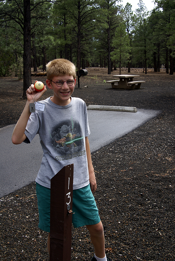
Sometimes, I think I get so involved in getting caches that I forget about the little things. Almost all of my travel bugs that I've released have something on the order of, "please take pictures of the bug where you take him." And yet, when I've moved bugs, more often than not, I don't take pictures of where the bug or geocoin is going. I've found that during our summer camping trips, I'm much more tempted to take pictures of travel bugs that I've brought along for the ride, trying to get more of a story for each bug. Yet I'm still puzzled by my lack of pictures of all the bugs I've helped move. As of this post, I've helped move along 188 travel bugs and numerous geocoins. I'm leaving the geocoins out of the equation, because I know some of those are just "discoveries" and not actual movements. I don't discover travel bugs, so I know that I've actually had those guys in my inventory.
So with 188 travel bugs, one would expect for me to have at least 188 travel bug pictures, but I know that's not the case. Some bugs I have picked up, only to drop at a later cache on the same caching trip, so a picture really didn't happen. But even that is a pretty lame excuse since I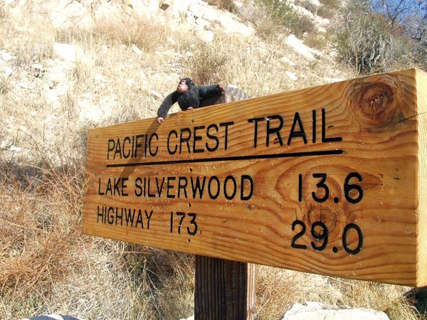
Now, granted, sometimes the goal of a bug is just to move it along from cache to cache. OK, I can say I've done that. I could have done more though. It wouldn't have required that much extra effort to squeeze off a picture or two of a travel bug near the location where it was. When I've done that in the past with some bugs, I've actually gotten some pretty interesting pictures. I thoroughly enjoyed the time I had with the Billiard Bug #13. I took it to an event cache and got a picture taken of it with 13 event attendees. I also got a picture of it at campsite #13 with an almost 13 year old. The creativity was part of the fun.
I think what I'm trying to say is I need, at least for myself, to step back and slow down a little bit. 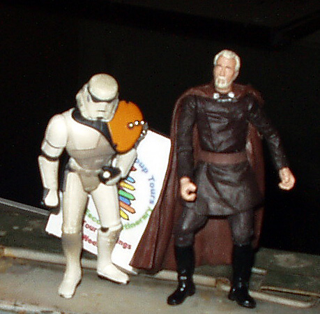
I think that's what I need to do from now on. I picked up two travel bugs on my last cache run up in the high desert this weekend. Lisa the Dinosaur is a five year old girl's first travel bug. I think the least I could do is to make a fun picture of the dinosaur terrorizing the dog, or something along that line. In fact, one of the goals is to post interesting pictures. I'm the 15th person to have Lisa in my hand. No one has taken a picture of her and she's traveled clear across the country from Maine to California. 
The other bug that I got this weekend was Monster Car. 9 cachers have seen Monster Car since it was released and not a single picture has been taken. Monster Car's travel is a lot more modest than Lisa, only a mere 123 miles, but he's been out in the low desert of California. Surely there could have been an opportunity for a off roading kind of picture to have happened. Well, I'm going to come up with something for it before I release it.
Last week, I took a beautiful road and found several caches along that road. I took a much slower pace and enjoyed the trip. I need to remember to do that with all things caching. I think I will appreciate it more, because it's not really a race, but more of a journey. I need to remember that.
Pictures were taken at or near the following caches of the following travel bugs:
Billiard Bug #13 seen near Sunset Crater by wolfb8 (libby)
Team Rainbow Apes - Black seen near The Mystery of Crowder Canyon by Tevis Clan
Storm Trooper seen near Star Wars TB Cantina by jeepnakd
Olaf's Search Party - Sven seen at RESERVOIR VIEW by w6lax

Tuesday, May 13, 2008
Caching Across the Border
This summer, I expect to garner another first in my geocaching career. First cache in 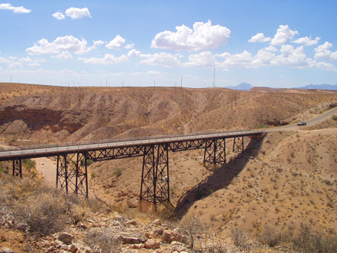
Pictures were taken at or near the following geocaches:
Bridge View - by V=Brats
Who waxed Mr. Ed? - by fooshfoosh and family

