This is not what most of you probably think it's about. When I first heard about locationless caches, it was in February 2002, 
There were several things that I liked about locationless caches. I may be wrong, but I think you had to have a picture taken at your locationless find in order to get credit for the cache. I liked that, since there was no log book to prove you'd actually 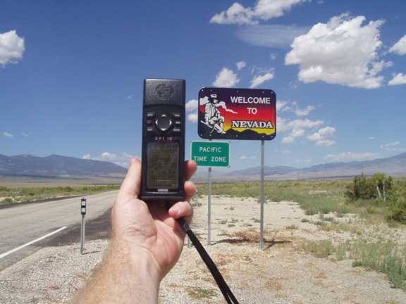
Probably the most famous of the locationless caches was Yellow Jeep Fever, where you had to get a picture of your GPSr with a yellow jeep. Sound easy? Not really. I can remember right after I discovered locationless caches, I was driving up to Lake Arrowhead and I passed a yellow jeep going the other way on the road. It was very frustrating to see something that you could log, yet not be able to for safety reasons. I actually saw another jeep, possibly the same one, when I was heading back down the road later that same day. I eventually found a yellow jeep in a parking lot in Upland, CA while I was out doing some other caching. I'd stopped to find a cache, looked over, and there was a nice jeep with Colorado license plates parked rigth there.
There were so many locationless caches during their heyday, that it was virtually impossible to keep track of all of them. 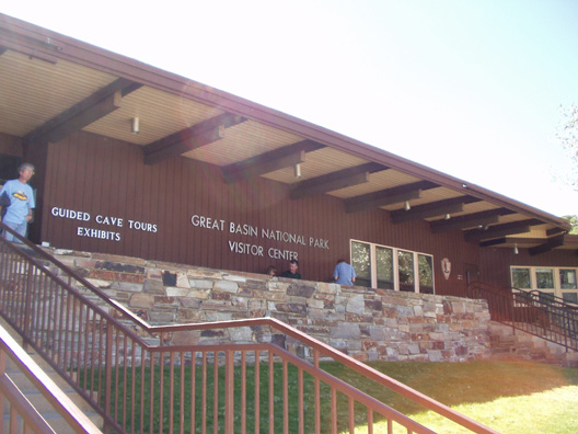
Every time we'd I would make sure we'd find a couple of the locationless caches. Some are very easy, like an American Flag. Since we would always camp in national parks, it would be fairly easy to get one of the American Flags at the park headquarters or visitors center. That same trip, I also wanted to get a park headquarters locationless too, but 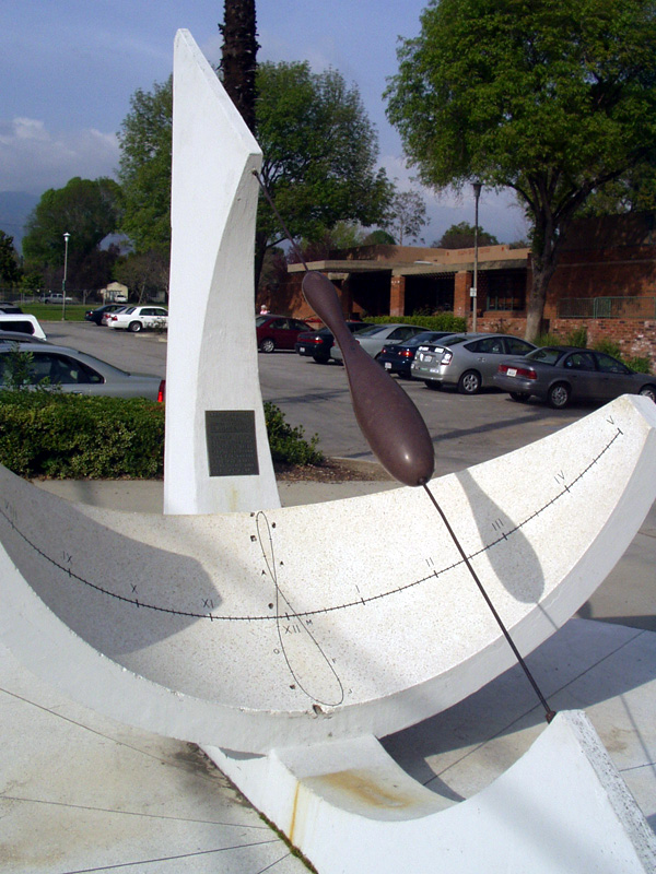
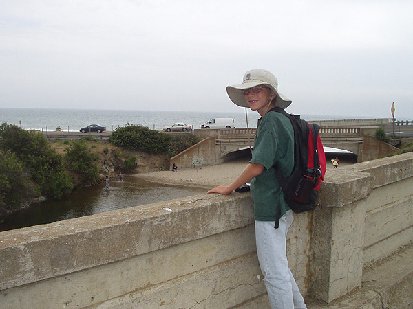
That particular year we were going to be camping at Cedar Breaks National Monument in Utah and Great Basin National Park in Nevada. I figured I'd be able to get an American Flag at one park and the park headquarters at the other park. I ended up getting the national flag before we got to either park. We'd stopped for gas in Mesquite, NV, right on the border of Nevada and Arizona along I-15. Across the street from the gas station is the Oasis Hotel and Casino. Flying out in front of the casino is the largest American flag I've ever seen, so I decided to waypoint it and take a picture of it just in case. When we got home, I discovered the flag hadn't been logged as a locationless cache yet, so I decided to log it.
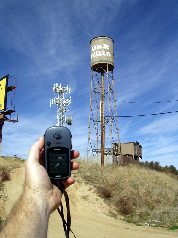
Locationless caches were all archived in January 2006 and have been moved over to the Waymarking site that Geocaching.com also maintains. It's basically the same thing and yet it's not. Keeping track of locationless caches on Geocaching.com was easier for me at least. I know there are some people that have embraced Waymarking. I can take it or leave it at this point. I am an officer in the Water Tower group at Waymarking, but I haven't marked a water tower in quite some time. 
When they were around, I found 25 locationless caches. Of those 25, I think I'd still try to find 24 of them again if I could. Ironically, the one that I wouldn't find again, was the one that got me started with them. It was called Where's in a Name? and it involved getting help from someone on the other side of the world to help you log the cache. I wasn't at a particular point to take a picture and get credit for the cache. But it did get me interested in the overall pr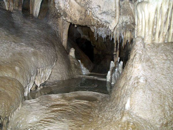
And yet, as the locationless helped me become a little more observant about what was around me, it also didn't for some reason. I know that doesn't make sense, but when I logged the observatory locationless, there was a virtual cache at the same location. For some reason, I wasn't aware of this virtual until a couple of years later when I got back up to the same area and logged the virtual. To this day, I'm not sure why I didn't log the virtual at the same time.
Pictures were taken for logging the following locationless caches:
Yellow Jeep Fever - by Team CBX2
Make a Break for the Border - by The Dam Trolls
NPS HQ - by MartyFouts, Adopted by bullit
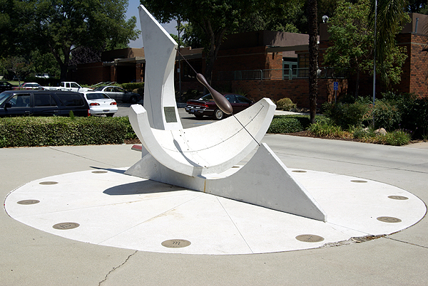
Sundials - by outforthehunt
Observatory Quest - by Anton
Speleo - by Melak
Saturday, December 27, 2008
Environmental Awareness

Thursday, April 24, 2008
I Gotta Ticket to the Moon
In the past, I’ve bemoaned the death of the locationless cache. Well, maybe bemoan isn’t quite the correct term, but I definitely liked the locationless cache because they made me a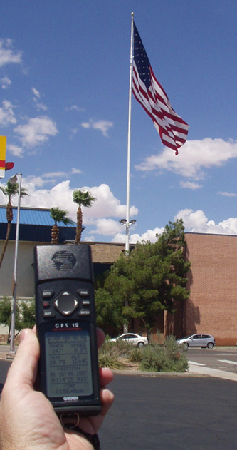
Pictures were taken at the following waymarks or locationless caches:
US FLAG - by Saundersboys
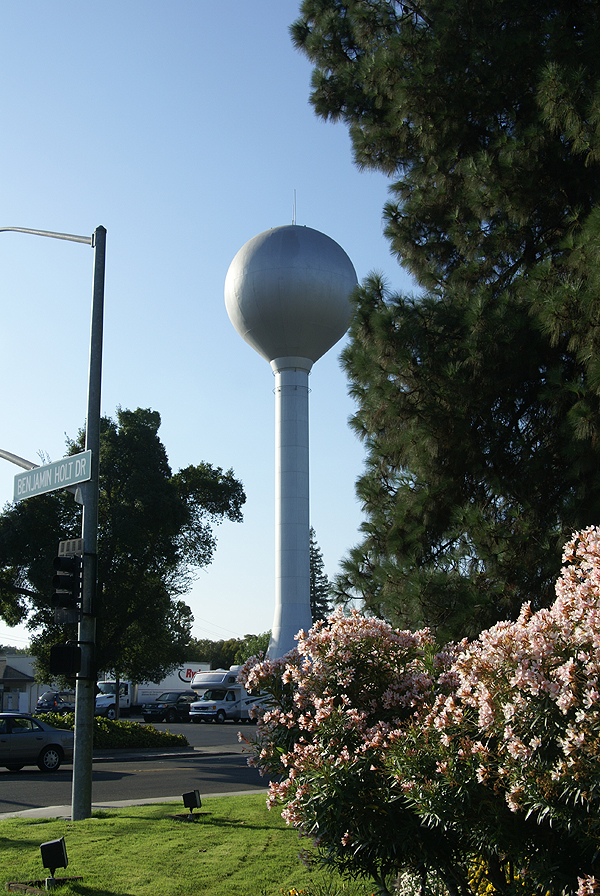
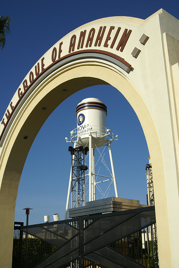
Lincoln Village Maintenance District Water Tower - by Webfoot
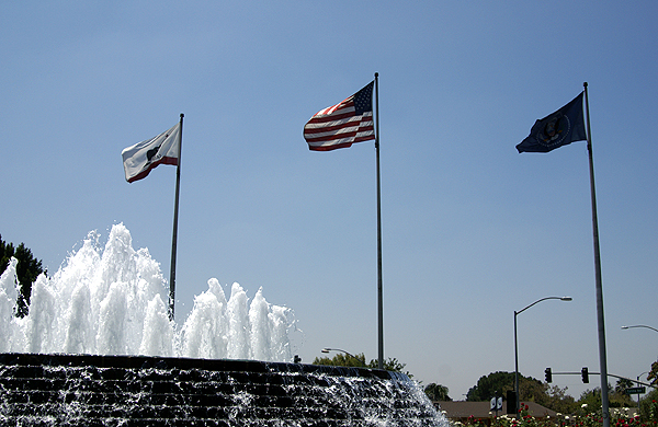
Richard Nixon Library Fountain, Yorba Linda, CA - by BackPak
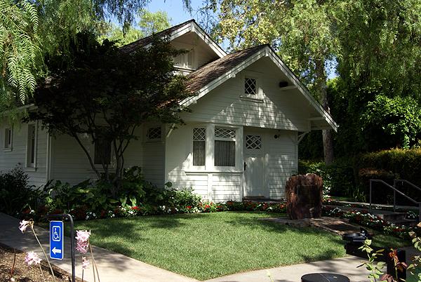
Richard M. Nixon Birthplace - by showbizkid
Larkin Memorial Sundial - by Webfoot
Wednesday, March 12, 2008
A Different Kind of Locationless Cache
I went caching last Saturday down in the O.C. My daughter was coming home from college and was going to be dropped off in


Friday, February 22, 2008
1000 words
If you’ve been paying attention at all, it’s rather obvious that I like to take pictures. When I go caching, I like to take my camera along. 

A picture really is worth a 1000 words. Right now I’m averaging 114 words per log according to INATN. I can’t imagine how long my logs would be if I hadn’t brought my camera along for the ride.
Pictures were taken at or near the following geocaches:
Hofert's Walls #1 - by bookishblondie and LegoIan
Carpe Diem! - by HaZzMaTt
Bridge of Sighs - by TRUROKR
Walk of Fame - by Dru Morgan
A Slanted View with a Gentle Breeze - by TheDeviousMaxPower

Sunday, January 20, 2008
Virtually yours

 I have found 67 virtual caches since I started caching back in 2001. Not a lot, but it represents 3.8% of all of my cache finds. Count the couple of Mystery caches which were really virtuals, the one webcam cache that I’ve logged, the earth caches that I’ve found and those pesky locationless caches and some folks would say that about 5% of my cache finds aren’t “real.” And those people would be right, when you consider that you’re supposed to find a cache container when you go out geocaching.
Does that make virtuals non-caches? It seems that Geocaching.com appears to believe it since they don’t allow virtuals to be listed any more. They have allowed ones that were already created to be grandfathered in to the system. The same holds true for webcam caches. I know, because I own the Blue Jay Webcam cache. I don’t own any virtual caches, mainly because I couldn’t find, what I thought was a suitable location for a virtual. And I think there is where the problem lies with virtual caches. I’m not trying to pat myself on the back for this one, but I think if people had been a little bit more discriminating when they set out to create virtual caches, we might still be allowed to post virtual caches today.
Some of these virtuals I’ve found, were just plain lacking. The information could have been easily transmitted on the cache page and a real cache could have been hidden at the site. One virtual I found was about an oak tree that wasn’t there anymore. All the history of the tree was on the cache page, so why didn’t the hider just hide a cache there and leave the history on the cache page? Another was a shrine to frogs. Now I love frogs probably just as much as the next cacher, maybe even more, but couldn't the person have found a good sized plastic frog and created a cache with it and then placed it at the frog shrine? That might have been quite a tough cache to find. 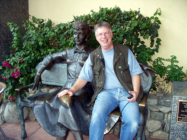
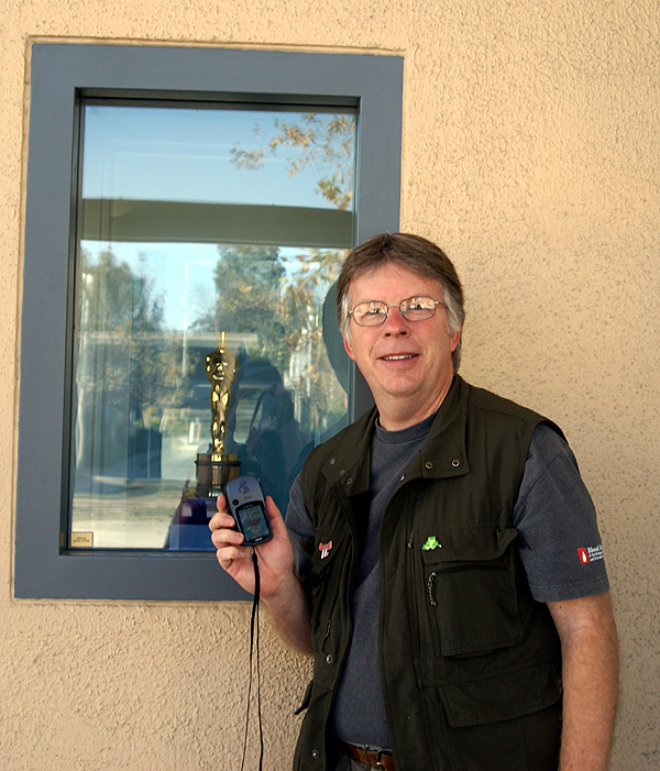
And the Oscar® Goes To...
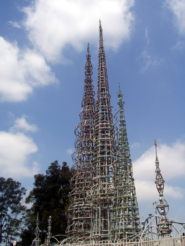
Simon Rodia's Dream
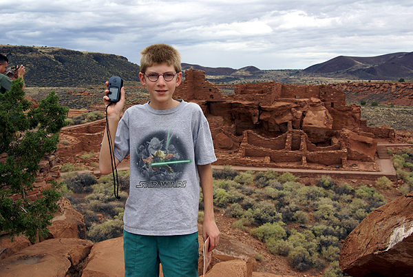
Wupatki
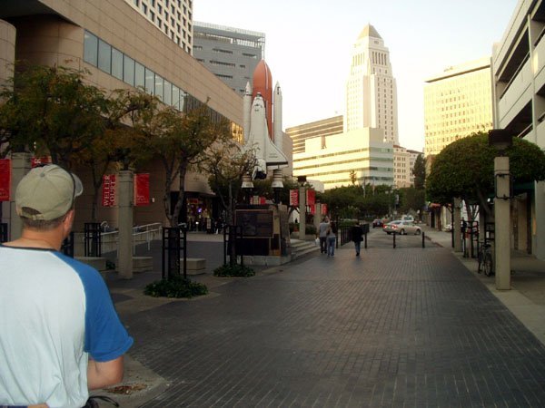
Challenger Shuttle Memorial
Luv'n Lucy
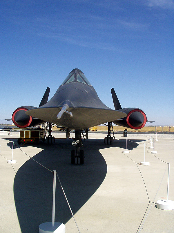
Bye Bye Blackbird

