Part of the game of geocaching is hiding caches. If no one were to hide any caches, how would anyone find any? As noted in this post from earlier in the month, I had several caches 
About 2 miles north of my house is a large plot of land known locally as Johnson's Pasture which was purchased by the city to remain open space for the enjoyment of everyone in the city. It is adjacent to the Claremont Wilderness Park which abuts the pasture to the east. There are a series of fire roads which can be used as walking trails through both parks. Inside the wilderness park is a five mile loop trail that is quite strenuous and used quite frequently. There are side spur fire roads leading from Johnson's Pasture over to the wilderness park. There is not loop within Johnson's Pasture, but when geocaching friends come to visit, we usually end up taking two cars and creating a shuttle. We park over by the wilderness park, then drive everyone over to the Johnson's Pasture area and then hike from there over and down to the parking lot at the wilderness park. It's about a five and half mil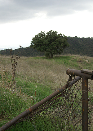
Most of the caches up in these two parks were hidden by me. I enjoy roaming around the two areas and whenever I feel the need to hide a cache, that's usually where I end up going first. This weekend was not exception. The Tadpole and I loaded up our backpacks with four caches, took our GPSrs and hit the trail. As long as we were up there, we might as well find some of the caches that my son hadn't found yet. He found the first one as we entered into Johnson's Pasture. Then we hiked up to a mystery cache of mine to do a maintenance check on it. After the Tadpole found that one, we tried to find a spot in between these two caches that would work, but they were too close together to hide another one, so we moved on to where I wanted to hide the cache the Cheeseheads sent to me at Christmas.
There is a microwave tower that dominates this area, since it's on one of the high hills in the two parks. It serves as a benchmark for surveyors as well and I thought it would make an excellent spot for a cache hide. We hiked up there and found several spots where a nice sized cache could be hidden. Once we chose the site, we got coordinates for it and then started back down. As we had been hiking up, we'd been taking coordinate readings for a letterbox cache that I wanted to hide up here, but couldn't find a good spot. I may have to look along another trail for a spot to hide that one. But on our way down, we found a perfect spot for a small decon container and hid that one as well.
We'd also been working on a multi-cache. I had already scouted out the final location. That wasn't a problem, but we needed to check out possible sites for the first stage of the multi. Once we agreed on a good spot for the first part it was time to make our way back home. We came back the next day to take some final readings for the multi-cache as well as tak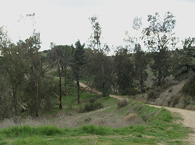
The first two, Melted Cheese and Rusted Gate have already been approved and I would expect the third, Exploring the Technology to be approved sometime this week. That will bring me up to 25 hides. The Tadpole and I also discussed how we should list these. We agreed that we should list them under my geocaching account, but we should come up with some kind of name that would let people know that it was both of us that worked out the hide. We both like what we decided as a moniker for the two of us.
Pictures were taken at or near the following caches:
Melted Cheese - by The Swamp Things
Rusted Gate - by The Swamp Things
Exploring the Technology - by The Swamp Things
Sunday, January 25, 2009
Hidden weekend

Sunday, March 16, 2008
There's a balance out there
I have some down time over the next couple of weeks, so I’m thinking about hiding a couple of caches. With surgery scheduled tomorrow

Hotel Devore
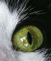
The Cats Made Me Do It
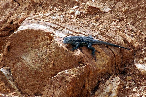
Today, I Saw a Lizard
7 Miles Away and a Half Mile Hike

Wednesday, February 20, 2008
Road Trip, the Finale
Now that all the logs have been written, it’s time to do a recap on the road trip from this past weekend. All in all, I’d say it was a successful trip, one that had a couple of surprises, and some interesting caches mixed in with the standard fare that one normally finds when out caching.
I got off to an early start on Saturday morning, but it didn’t really help me much because of a major accident on I-5 right at Gorman at the start of my PQ. That caused a major slowdown as the freeway was shut down to one lane going in my direction. I’d intended on bypassing those caches near there in the hopes of getting up to the Central Valley as quickly as I could, but the delay just ate into my time, and plans started being altered as I drove.
Once I got off of I-5 south of Coalinga, I worked my way up there getting a couple of caches along the way. The area is pretty rural and thus pretty bereft of a lot of caches, but I got a few on the way. I was hoping to be in Coalinga around ten in the morning, but didn’t get there until noon. After a quick stop for lunch, I had a major decision to make: make the run into San Benito County, or skip it so I could get up and see my daughter in Stockton. San Benito beckoned and I started that way, only to turn around when I found myself behind a truck on a road where there wasn’t going to be any turnouts or passing lanes. So I came back, cut over to the Interstate and headed north to Stockton.
Sunday, was another type of day. I got some caching done in the morning, then went over to the university to bid farewell to my daughter, then headed north to Sacramento. The goals for the trip were as follows:
Find caches in 6 new counties – I got five counties, missing San Benito.
Have fun – that was a definite.
Get at least one cache for each year I’d been alive. After getting only 9 on the first day, that one seemed a little harder to achieve since I had miles to go and caches to find to get to fifty.
Soon after getting to Sacramento, I turned east toward Gold Country and the foothills of the Sierra Nevada. As I left the Sacramento area, the first new county I encountered was Amador County, the  only county in the entire state of California that I'd never traveled in before so I now have been in every county in California. I cached all the way down Highway 49 to Mariposa where I spent the night. Mariposa is one of the gateway communities leading into Yosemite National Park. The area is filled with historical markers recounting the Gold Rush era of California, plus spectacular scenery mixed in for good measure. The most memorable cache I found on that day would be the Altaville School House cache, not for the cache, but for the experience.
When I found the cache, it was buried under a rock and some leaves, so I removed the rock and brushed away the leaves. At that point I thought that the cache must be loaded with swag because the cacher before me had left one of the toys on top of the cache. So I picked up the cache with one hand and removed the rubber snake with the other hand. It was at that point that I realized that I had a freakin’ live snake in my hand, which I quickly dropped. As I watched it slowly slither away, I’m not sure what I was thinking but it probably had the “S” word involved in it attached to the word Holy. Anyway, Sunday’s total of 26 caches found, gave me reason to believe that I could make my third goal of 50 caches.
Monday morning broke bright and cold at 36 degrees. I drove back down out of the foothills toward Merced, once again caching along the way and then headed home through the Central Valley. I got one new county (Mariposa) on Monday, added to Sacramento, Amador, Calaveras and Tuolomne Counties on Sunday for 5 new counties added to my county map. I’m now two short of the halfway mark. 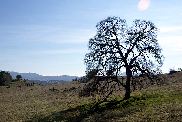
As I made my way down toward home, I’d stop every half an hour or so to get a cache near the freeway. I was also on the lookout for special caches, mainly puzzles or intriguing virtuals that I wanted to do. At the end of the day, I took stock and found that I had found 16 caches on Monday, bringing the grand total found to 51, one for each year, plus one extra for good luck.
I found 35 traditional caches. 9 virtual caches and 7 mystery caches, five of which were TRAKD’s county line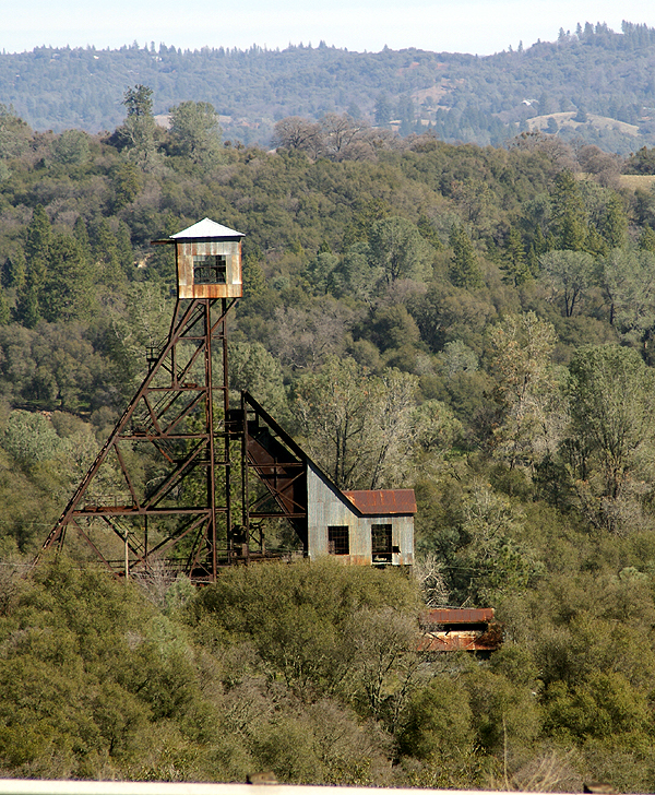
Pictures were taken at or near the following geocaches:
Plane View #2 - by tmkbk & olymbicwannabe
Argonaut and Kennedy Mines - by whitetail39&travler13

Wednesday, January 30, 2008
Road Trip
I graduated from college with a degree in geography, so I love maps. I’ve always loved getting out the atlas and pour over the individual state maps and see where I might want to go next on a vacation. Where was our next road trip going to take us? Should we take this road, or that one? I wonder what this town is like? Next month, I’m planning a road trip to
There is a mystery cache in  of the summer. Anyway, this series of articles is just designed the document the road trip.
This particular road trip took some advanced planning. I decided that this one was going to take the scenic route, so I’m going to be traveling on a lot of back roads this time, which is fine with me, but making the route queries for this one took a little bit longer. After searching the geocaching data base, I was only able to find this one route that fit my needs for any part of the trip. All the other routes, I had to create. In the end, I have 8 different route queries that I’m going to have to run right before I take off on my road trip. That also is going to take some planning since I can only run five per day. I need to remember to run at least three of them two days before I leave, otherwise I’m screwed.
My next step has been to go through each route and check out the mystery/puzzle caches to see if I can solve some of the puzzles and get those. Interestingly, there don’t seem to be a whole lot of puzzle caches, but I have gone through and solved 12 puzzles for the upcoming road trip. Several of them are right along county lines and involved looking up local history for each county. Right now, I’m a little bit more knowledgeable about Calaveras, Amador,
There was a puzzle cache that used Pig Latin, one that used the symbols from a computer keyboard, one that had me investigating a certain government agency within Kern County and two cipher puzzles. All of these puzzles have been solved, now my next step is probably going to be to whittle down the list. I have over 500 caches right now, and since my GPSr doesn’t have a memory card slot, I need to get that down to under 500 waypoints for them to all fit in the unit. Once I load all the queries into GSAK I’ll start by eliminating the puzzles that I haven’t solved. That will probably do the trick, but if it doesn’t I’ll then probably drop the multi-caches. I like multi-caches, but they tend to take a little bit longer to find than regular caches and I do have some time constraints so it makes sense to drop them next.
Tick, tick, tick, tick, tick, tick, tick, tick, tick, tick, tick, tick, tick, tick, tick.

