Showing posts with label museums. Show all posts

Sunday, April 10, 2011

Unusual things to see near a geocache

Every now and then, while out geocaching, I'll come across things that are out of place.  In this case, these things aren't really out of place, mainly because the geocache is hidden near a museum.  So perhaps the geocache was out of place, but it really wasn't either.  It's just a way to link the two things together somehow.  A couple of weeks ago, my two older children and I took a day and visited the Los Angeles County Museum of Art (LACMA).  It's located near downtown Los Angeles, adjacent to the La Brea Tar Pits.

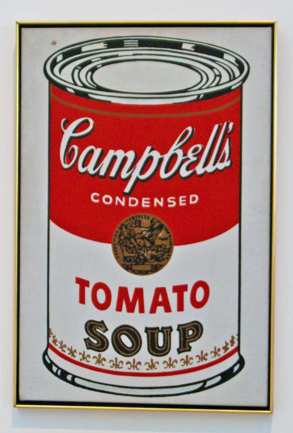
LACMA is a complex of buildings housing a multitude of artwork.  I believe there are 9 buildings in all, but we were only able to go through half of them.  All the better because we'll be able to come back again in the future, possibly enjoying the same exhibits, plus new ones which we were unable to enjoy in our first go around.  The contemporary art building was a favorite of mine, because I was familiar with several of the pieces of art.  There were several of Andy Warhol's iconic paintings, plus a Stuart Davis painting that I recognized while still several paintings away.  I'd done a research report on Davis in high school and was very aware of his style.

Several years ago, I'd found a cache overlooking the main tar pit area of the La Brea Tar Pits, but it had since been muggled.  There was also an earthcache located in the same general spot, so I was familiar with the area.  After we spent a good five hours at the museum, we walked across the street to a burger place and had dinner.  After that, my kids indulged their good old dad and "allowed" him to find a couple of geocaches.

I'd like to offer my apologies for not writing much these past couple of months.  Being busy isn't the word to describe what this year has been like, but that's the best that I can conjure up at the moment.  Adding new projects to my life, most notably the 365 project, has impacted other areas, including this part.  I shall endeavor to write more often here.

Pictures were taken near the following geocaches:
That Black Gooey Smelly Stuff - by carlosguerrera
The La Brea Tar Pits - by GeoCraig

Profile for Webfoot


Sunday, August 15, 2010

The Sundial Bridge

The Turtle Bay Museum in Redding, CA had a lot of nifty features about it that make it stand out as a high quality museum, one that a person would want to come back to often.  The Tadpole and I explored a large quantity of the museum, but didn't even scratch the surface of the arboretum which was north of the museum, across the Sacramento River.

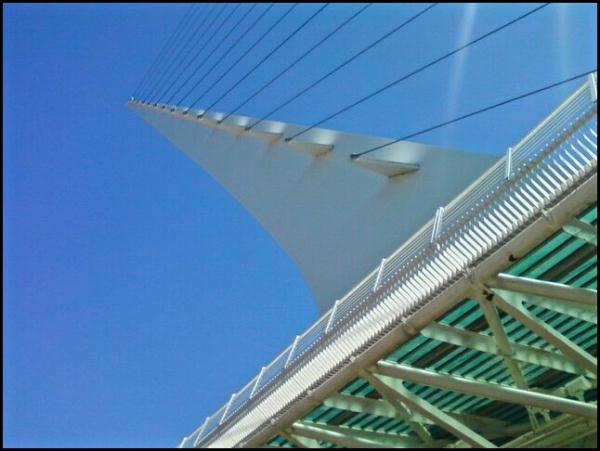
The arboretum is connected to the museum by way of a bridge.  However, this bridge isn't just any bridge, but a sundial as well.  Yes, you read that right.  The bridge is also a sundial.  If you're driving along Interstate 5, you might think it's just a white spire, perhaps a sculpture.  But when you get close to it, you can see it's a sundial.  It definitely gives the city an identity.

This bridge is a pedestrian and bike bridge.  There were plenty of people out on a warm Monday enjoying the sites the museum had to offer as well as the arboretum.  There were some dog walkers as well as a couple of geocachers thrown into the mix as well.  In my original bookmark I created for our trip up here, I noted many geocaches on the arboretum side of the museum grounds.  We ended up getting the one nearest the sundial on the far side of the bridge.  It was close to noon, neither of us work well when we're hungry and we didn't want to get too far afield when Chaosmanor called telling us they were there.  It wasn't a problem, as it really gives us a built in excuse to come back and visit again.

The bridge, itself, is a marvel of engineering.  It appears to be a suspension bridge, with the gnomon (the shadow caster) being used to support the bridge.  The sundial is large enough, plus it's close enough to the Sacramento River, that it's only good for about four hours worth of time telling, from about 10 in the morning, to 2 in the afternoon, PDT.  We were there at 11:48 and it was keeping remarkable time, with the shadow slightly past the 11:45 mark.   We were able to get underneath the bridge and it resembles a cruise ship's mast from that particular angle.

While we were crossing the bridge, I happened to look to the west.  The Sacramento River, at this point runs west to east and then bends around to the south just beyond this point as it flows toward the Pacific Ocean.  Looking to the west, I spotted a large bird come up out of the water.  Obviously, I'd just missed it going into the water, but it was just close enough to the bridge that I could make out the fish it had just caught in its talons.  Then it made a sweeping left hand turn, probably heading back toward its nest with food for dinner.  The unmistakeable white head identified this beauty as a bald eagle, the first I've ever seen in the wild.

Having grown up in a time period when the eagle was in danger of extinction, it was very heartening to see this beautiful creature living in a semi-urban environment and not just in the woodsy backcountry where so few could enjoy its majesty.  I looked it up and found that it has been removed from the endangered list in 1995, moving to the "Threatened" category, and in 2007, it was delisted from the "Threatened" category.  This is a remarkable achievement for a bird that was on the verge of extinction in the lower 48 during my lifetime.

I would have to say seeing the bald eagle was definitely one of the highlights of the trip.  I have a geocaching friend in Nebraska, who is a serious birder and keeps life lists of birds she's seen.  I hope she's already experienced.

While the GPS Maze exhibit won't always be at the museum (it's scheduled to close on Labor Day), the bridge and arboretum will be there for a long time.  Next time you're driving north or south along Interstate 5, take the time to spend a day exploring this area of the northern Sacramento Valley.  I seriously doubt you'll regret the decision.

Pictures were taken at or near the following geocaches:
GPS Adventures Maze Exhibit-Turtle Bay Park - by Groundspeak
Quality Time - by BlueBoyDavid

Profile for Webfoot

Wednesday, August 4, 2010

A "Maze" ing

Long before we'd planned our summer camping trip, we knew the GPS Maze exhibit was going to be in Redding throughout this summer.  After I pointed this out to the Tadpole early in the springtime, he stated he wanted to visit it, so I started planning our vacation around Redding.  With Lassen National Park, just an hour or so to the east, it was a no brainer to figure out where we were going to camp, and at that point, things started to fall into place.

Later one, I found out that Chaosmanor was going to be up in the area sometime during the summer as well.  Their youngest daughter was getting married in late June along the coast of California, and so we plotted to see whether we could meet up at the Maze at the same time.  There was also an outside possibility that the maze could be their 4000th cache find as well, so it would be fun to share that with them.

Chaosmanor was coming from Klamath Falls, OR, and were farther away.  We didn't know exactly when they'd get there, but we planned on meeting and having lunch at the Turtle Bay Museum and either going through the maze beforehand, or afterwards depending upon arrival times of both of us.  The Tadpole and I headed out in the morning, grabbing a couple of caches along the way, including a nice benchmark virtual cache just east of Redding.

We got to the museum and paid our admission and then walked around the grounds.  The Turtle Bay Exploration Park is a science museum and much more.  It appears to be built upon an estuary of the Sacramento River.  There were walkways from the entrance/gift shop over to the main building of the museum which sat on the bank of the Sacramento River.  Surprisingly, the wetland area was relatively dry, considering how moist the winter had been.

We decided to wait on the museum, opting for the butterfly exhibit, where they had multitudes of different kinds of butterflies flying freely.  We had to watch our step so as to not crush the butterflies that might be on the path.  I've experienced one of these houses at the San Diego Zoo about 30 years ago, but this was a first for the Tadpole.  Still, I'm not sure who was more excited about this little side excursion, he or me.

After an abortive attempt on a geocache just outside the fence to the park, we decided to head over to the museum and view some of the exhibits.  The science museum is centered around the ecology of the Sacramento River, so there were many different exhibits with live fish from the river, as well as other exhibits about the Native American population that used to inhabit the area.  We spent the better part of an hour enjoying ourselves with the different exhibits offered.  There was also a photograph gallery, with some very good amateur photographs on display.

The only thing that we hadn't explored yet, was the GPS Maze.  We walked into the entrance area for the maze, looked at some of the stuff available for sale at the gift kiosk located outside the maze, then decided to walk across the river on the bridge behind the museum (more on this in a later post).  There were people out and about, enjoying the warm day with their family, friends and animals.  We walked to the far side of the bridge, then decided to find a cache on that side.  There were other caches further down, but we didn't take advantage of those, since we were both starting to get hungry and neither of us is a good cacher when we're hungry.

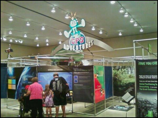
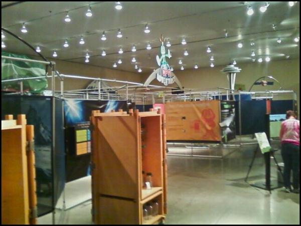
Fortunately, Chaosmanor called at that time saying they were outside and to expect them shortly, so we headed back across the bridge and met them in the museum foyer.  After a hearty lunch, we headed over to the GPS Maze exhibit.  The maze exhibit, is just that, a maze, with partitions and displays along almost all of the walls of the exhibit.  The purpose is to explain GPS technology and the hobby of geocaching.  While in the maze, we had to find four different geocaches, which contained clues that allowed us to enter locked rooms within the maze that held special areas.  One entire locked room was dedicated to travel bugs and geocoins.

Almost immediately, we were separated from Chaosmanor as they chose a different path in the maze.  We eventually met up with them and discovered that we'd each solved three of the locked areas and had but the same locked area to solve before we were able to get out of the maze.  We did that last section together and it took all of us a fairly long time to find that last geocache.  I think I had my fingers on it at one point, but didn't realize what I was touching.  Eventually, we worked our way through the maze and back into the main area, where we both spent, probably more money than we should have on geocaching paraphernalia.

The overall construction of the maze was probably the highlight point of the maze.  It had been made in such a way so as to not frustrate novice museum goers, who just wanted to experience the maze.  It wasn't too difficult for them, yet it wasn't easy and possibly boring for experienced geocachers.  It was truly well done.

We decided to walk the museum again with Chaosmanor, then went over to the butterfly exhibit again as well.  We also went outside the park, and found that geocache I had been unable to find earlier in the day.  One of the reasons I enjoy caching with others, is it gives one or more sets of eyes looking at the same things.  I couldn't find it earlier, yet I was the one who came up with the find when all three of us were out there.  Sometimes I think there is more pressure when you're by yourself to find the cache, and so the obvious doesn't always jump out at you.  I seem, for whatever reason, to be able to make the geosensing jumps better when caching with others.

The maze is there until Labor Day.  I'm actually hoping that as it hopscotches around the country, it makes an appearance in Southern California.  I wouldn't mind taking a tour of it again.  It was a fun day, exploring both the maze and the museum grounds.

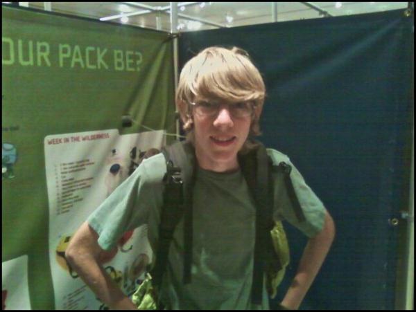
My apologies for the poor quality pictures.  My main camera's battery died the day before, so these were all taken with my cell phone.

Pictures were taken at or near the following geocache:
GPS Adventures Maze Exhibit-Turtle Bay Park - by Groundspeak

Profile for Webfoot

Friday, July 4, 2008

The Mother Road

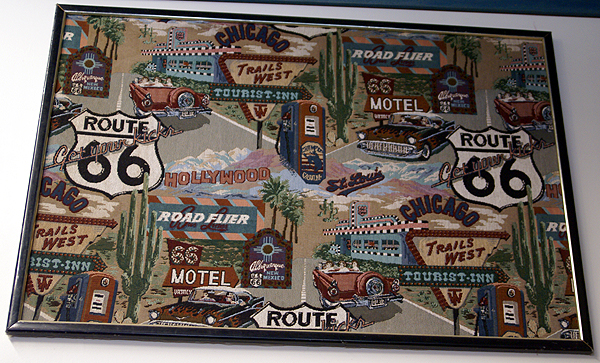
Yesterday, while caching in Victorville, I had the opportunity to log a virtual entitled, Route 66 - The California Route 66 Museum. The cache itself isn't much, being a simple, "answer this question and email me the answer before you log it" type of cache, but the museum that is at ground zero is absolutely amazing. My caching buddy, 3blackcats, had already been to this cache, but she encouraged us to go and see the museum. It's definitely worth the trip here.

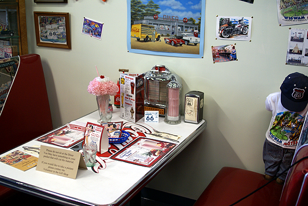
The museum used to be a restaurant called the Red Rooster and was the filming spot for the 1980 film, "The Jazz Singer" starring Neil Diamond. I might have to rent that one now, just to see if I can recognize some of it. The inside is one gigantic tribute to Route 66, the Mother Road. I had been to another Route 66 museum down in San Bernardino about a week ago when I visited the first McDonald's, but this one is by far and away much classier and better organized.

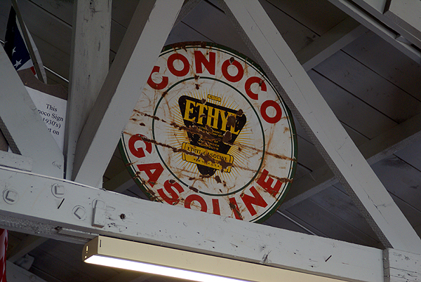
This museum serves up a large slice of Americana that many of us probably got first hand on many long road trips to parts unknown. You don't have to have driven part of the Mother Road to appreciate what this was like, but if you have, you can look at many of the exhibits and think to yourself, "Oh man, do I remember that." I remember the many different kinds of gas stations that were out there. The one that I always looked for was the Sinclair Dino Gasoline. After we'd left the museum, we spotted an old Mohawk gas station, boarded up now, but still able to evoke strong memories of the road. Most of these old station signs were represented in some form at the museum, but most today are gone except in places like this or in our memories, to be replaced by the giant gas companies that consolidated everything in the early 70s.

I saw a gas sign that was selling gas for 31 cents per gallon. I can remember one time my dad taking us to get gas in the car. Sometime that day, the price had gone up from 27 cents per gallon to 31 cents per gallon. Whoever had reset the pump had reset the 7 to a 1, but had neglected to change the 2 to a 3, so we were buying gas at 21 cents per gallon. I thought my dad was going to have a kitten. He filled up the car, raced home and got the other car and every available gas can we had in the garage at the time and went back and filled all of those up at the gas station that evening. What a bargain.

There was an interesting trailer on display in the museum as you walked in the front door. It was a very small, about 10 foot long trailer, big enough for a double bed inside. On the back was a kitchen that opened up complete with two burner stove. It would be perfect for a young couple working their way across the country, camping in spots along the way. It brought back memories of some of our camping trips, especially the 1968 trip where we literally drove almost the entire length of Route 66 getting back to Indiana for my grandmother's funeral. After the sadness, we spent the better part of 6 week enjoying family and slowly making our way back home on a more northerly route. Even though it started our poorly, it ranks right up there with one of my fondest memories of camping with my family.

Knowing that my dad liked to travel through the desert at night, we started at 7 in the evening, getting to Needles, CA at midnight to gas up. The temp was 100 degrees. Three hours later we were in Flagstaff, AZ looking for another fillup or perhaps a potty break. We were cocooned inside our air conditioned station wagen and here comes the gas attendant wearing a heavy coat and mittens? Something wasn't quite right here. When we emerged from the car, we understood immediately because the outside temperature in Flagstaff at 3 in the morning in the middle of July was 39 degrees.

We later made it to Amarillo, TX and had dinner there on this same trip. The wind was howling and it looked like thunderstorms were in the offing. I can remember another gas attendant stating that it looked like possible tornado weather. I've never seen my dad get so frightened, nor move so quickly to get everyone done with dinner so we could get back on the road to get ahead of the storm. We never did get rained upon, but that was another side of my dad I had never seen before.

After touring through the museum and taking several pictures of some very interesting things, we stopped by the gift shop. I bought an obligatory Route 66 t-shirt, plus a postcard that I will be sending to another geocacher. Later in the day, we made our way home by way of the Interstate 15. Just north of where the 15 divides into itself and the 215 you can see the old Mother Road down in the canyon and watch it as it parallels the Interstate, getting closer and closer. At the junction of the two interstates, right at Devore, CA, they overrun the Mother Road and obliterate it entirely. Just south of there, it comes back into being once again. Fortunately for me, I see reminders of the old Route 66 all the time because I only live three blocks from the road as it makes its way through my town.

By clicking on the link above, you can get the coordiates that will take you directly to the museum. For those of you who aren't geocachers, you can get to the museum here:

California Route 66 Museum
16825 D. St
Victorville, CA 92392-2151
Telephone (760) 951-0436

It's well worth the visit. Oh, and that first picture at the top? It's a needlepoint design.

Pictures were taken at or near the following geocache:
Route 66 - The California Route 66 Museum - by Parsa

Profile for Webfoot