Showing posts with label Route queries. Show all posts

Thursday, October 9, 2008

Surprising Results

Going to be heading down to Orange County to grab this particular Dash Point. We got lucky when the computer program for this month set that one up. It's in Ronald W. Caspers Wilderness Park very near a fire road trail, so it should be easily reached after about a two mile hike or so.

I ran a PQ centered around that point and got the strangest looking PQ map I've seen in awhile. This is a pretty rural area but I was still expecting to see more caches along the Ortega Hwy. The arc to the west is in urban Orange County, but the nothingness to the east of the center of the PQ was surprising until I thought about it. The area to the east is pretty rugged and mountainous. I think I was surprised that there weren't more caches hidden along the Hwy. I guess we'll find out when we get there on Saturday. It could be that it's not safe to stop along most of the road. If you're not from this area, the grey area to the south is Camp Pendelton Marine Corp Base.

The Dash Point is in the center of the map and we'll be going for the caches located there. Most of them are along the trail and so they're not micros, but good sized caches. When the Tadpole found out about that, his immediate reaction was, "Score!" I have to agree with him. I'll be sure to take the camera along to get some pictures.

Another surprise was I couldn't find a public route query for the highway either, so I had to create my own. That wasn't too much of a problem. Just opened up Google Earth and asked for directions between San Juan Capistrano and Lake Elsinore. That gave me a route that I saved to my computer which I then uploaded to Geocaching.com. I put in some parameters for the route and came up with 69 caches along the route, most of which are centered around San Juan Capistrano and up around Lake Elsinore. There really aren't that many caches along that route. I've made the route public. You can search for it using keywords, Ortega, Elsinore or Capistrano.

Profile for Webfoot

Tuesday, June 3, 2008

Two digit GC numbers

The planning has already begun for the annual summer camping trip. Last year, our adventures took us east of Flagstaff, AZ to Wupatki, Sunset Crater and Walnut Canyon National Monuments, and then north to the Grand Canyon. In 6 days, we found 43 caches, just slightly more than 10% of the total caches that were in all the route queries and spot queries that I had loaded into the PDA and GPSr right before the trip. Weather was the determining factor, especially the lightning part, which prevented the numbers from being slightly higher than that. All in all, it was a very fun trip and very enjoyable.

This year, the Tadpole and I have decided that we want to explore the north coast of California, so we’re going to be camping near Point Reyes National Seashore and in Redwood National Park. We’ll actually be camping in two of California’s many state parks, Samuel P. Taylor State Park which is near Point Reyes, and Del Norte Coast Redwoods State Park. As always, the goal is to have fun in the process. If we’re not having fun caching, we stop. One of the main goals this year is to find caches in some new counties to get us closer to the 58 County Challenge that I’ve written about in the past. This trip will get us closer, but not get all of our missing counties.

The route that I’ve chosen to take this year, is not a very direct route like it was last year to the Grand Canyon, so I’m using a different method for figuring out what caches we want to find. Last year, four route queries and two spot queries were enough to get all the areas that we were going to travel through. This year, I estimate that the route queries alone would number in the double digits, two many probably in my estimation to make a lot of sense to them. Add the fact that I would only be able to run five per day and it’s starts to become a logistical nightmare to make sure all the queries get run.

I decided that it would be better to use the Geocaching Google map feature and trace our intended route, manually moving the map and checking out the caches that pop up on the map. We’re probably not going to be going too far off the main roads that we travel, except for hikes that we’ve planned, so this seemed to be the best solution. The next step was to methodically start moving northward and check out the caches. The Tadpole can take or leave micro caches, and in fact, if push came to shove, he rather leave them altogether, so I decided that we wouldn’t look for too many of those. The nice thing about where we’re going is that it’s fairly rural, so micros are fewer and far between, so that made it easy.

Now the question that arose was how to keep track of all the caches? I could write all of them down, but then I remembered the bookmark feature. Why write them down, when I can keep track of them electronically on the computer? Once a bookmark is created, a list of caches can be added to it. In this case, our bookmark is listed as 2008 camping trip. Once all the caches are added to the bookmark, I can easily run one PQ for the entire trip.

The next thing that we wanted was a couple of hikes. I found a cache that looks to be on a nice fire road near our campground at Samuel P. Taylor. Checking out the trail, there are about three or four other good sized caches along it, so I started at that point adding those. A bonus was that one of the caches, Firestone, has only a two digit GC number. That means it’s a very old cache, predating my finding out about geocaching. This particular cache was hidden in the fall of 2000. It’s one of the oldest active caches in California, so that will be one of our goals as well, to find it. That also got me to thinking and I looked up other old caches in California. You can do it for any state. Just do a state search on Geocaching. The first page lists all of the newest caches in the state. Logic dictates at this point that the oldest caches would probably be on the last page, so it’s just a click away to get there. On page 2593 of all the California caches, there are the old ones. Some of the ones listed on that page were hidden in 2001, but it doesn’t take too long to see the ones that were hidden in September and October of 2000, less than 6 months after the first cache ever was hidden.

There are three of these that we will be near on our trip, so we’ll, at least, try and make an attempt of them. The oldest caches I’ve ever found were hidden in February 2001, but they had only been hidden a couple of months when I found them. These caches that we’ll attempt to find have been out there for close to 8 years. That’s durability. As one of my own caches attest, back then, most caches were a hike to get to their location. The Tadpole is pretty excited about finding a cache that’s only about 5 years younger than he is. It will be interesting to see how this all turns out.

There are other aspects of this trip that I want to write about which will take up more space than necessary, so I’ll stop here for now. I’ll revisit this as I continue to develop the bookmark for the trip.

Profile for Webfoot

Wednesday, May 21, 2008

Backroads

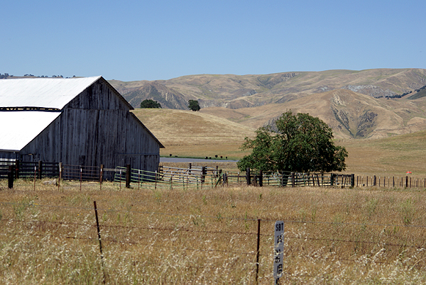
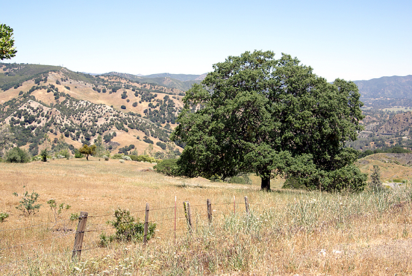
This past weekend I drove up to Stockton to pick up my daughter from college after a very successful first year of school. Hey, she held on to her scholarships, made new friends, grew musically and over all, had a great time this year, so it sounds pretty successful to me. I’m starting to have problems separating the trips up since I’ve made so many in the last couple of years, first when we were checking out the school and now either fetching her for holidays or just visiting.

I have noticed that whenever I’m with someone else in the car, I will take the most direct route up to Stockton, or the almost most direct route, since there are two routes, one which is about 20 minutes faster than the other. The slower route is more scenic, however. When I’m not with anyone, I’ll take my time and just enjoy the scenic route, or even get off either of the main routes I’m taking and take a back road, something that Robert Frost writes about in his poem, “The Road Not Taken.”

I did that in February on my planned three day roadtrip when I took several back roads, some that might not even be classified as back roads considering the amount of traffic that was on them. This weekend, I definitely took a back road to get to Stockton.

I started off from home Saturday morning early, figuring that I’d be making the normal 6 and a half hour drive in about 9 hours or so. I took I-5 north, getting a couple of caches in Kern County and depositing a couple of geocoins and travel bugs that I brought along for the ride. I left the Interstate near Coalinga, California for two reasons. The first reason was a dash point near Coalinga that I wanted to get and the other was I wanted to complete the run I’d planned in February to get San Benito County off of my “Counties that I haven’t cached in yet” list. It was a hot day out with temperatures approaching triple digits, which kept most people inside as I drove through Coalinga, but I stopped just to get gas and find one cache in a nice little park. I then headed out of town on HWY 198.

198 is a very winding two lane road with occasional places to pass other slow moving vehicles, but I wasn’t in a hurry, because the rolling hillsides of the area were enjoyable to look at and this was more of a pleasure cruise, than a “numbers run” for caches. I kept glancing at the GPSr screen from time to time and would stop when necessary to find a cache. I figured I’d get a couple of caches in San Benito County, then move further north and get a couple of caches in Alameda County and then Contra Costa County as well. As any cacher knows, things happened and plans were changed on the fly. The further I went along 198 and then HWY 25 into San Benito County, the further I became entranced by the beauty of the place.

San Benito County is located east of Monterey County in the central portion of the state. It’s very rural and has lots of rolling hills and farms that seem to have a lot of cattle grazing on the land there, as well as some flat valleys where the predominant crop seemed to be alfalfa. The contrast between the bright green fields, the amber hillsides and the dark green scrub oak trees was a photographer’s delight and this might sound sappy, but at one point on the drive, I actually found myself humming America the Beautiful. This seemed like where the author had been when the song or lyrics had been written. But enough of waxing poetically, since I’ll do that further down below.

As I continued to cache along the road, I kept thinking to myself, I was getting behind, but I kept justifying it by also thinking, but you’re getting some great pictures and you’re enjoying yourself. Fortunately, that part of me won out hands down. At every cache location, at every bend in the road, the scenery just improved. There was no way I was going to rush this little drive. Had the particular caches been in more rural settings, they most likely would have been rated substandard by most people, but that’s what caching is all about in my opinion. The journey is part of the adventure. There were micros, mixed in with larger containers that were big enough to hold travel bugs and other swag. It was a good mix of different sorts of caches, with the scenery helping everything along.

As I started entering back into suburbia, just south of Hollister, I looked at the clock on the dashboard of my car and realized that it was 3:30. Having left at 7 AM, I was already 8+ hours into my trip and still had a ways to go to get to Stockton. There was no way I was going to head up into Alameda County at this point in time, so I decided to forego those two other counties and head back over to the Interstate and get up to Stockton, because we still had to pack my daughter’s dorm room into the van for the journey home the next day.

My daughter had a music gig the following morning, which meant that I had some free time to myself and I had one of two options. Watch the hotel’s free cable TV, or go out and explore some more back roads and do some more caching. Well, that was a no brainer.

Because I’d originally created a Router PQ for this trip, the end of the route ended about a mile beyond my hotel room, so I decided to start caching at this end and work myself back along my original route and see how far I could go. This route took me through the delta region of central California, lush farmlands, narrow bridges and very flat vistas. There was one point where one of the bridges that I crossed had gates on either end and stop lights, because it was meant to rotate in the middle to allow boats to travel on the waterway it crossed. I can’t remember ever seeing another bridge like that before in California, yet here it was on the border of San Joaquin and Contra Costa County.

Yep, I’d driven far enough on this other back road, that I’d made it to Contra Costa County, where I found two more caches before deciding that I needed to get back to Stockton so I could await my daughter’s return from her gig. We came home via a more direct route, although we did do a side trip in the Fresno area to grab a couple of virtual flags and another dash point.

Overall, the trip was a wonderful excursion, although a bit exhausting. I wished I’d had one more day. It still feels like I’m behind on my sleep and as if I need a weekend to recover from my weekend. Still, it was worth taking those back roads. I’ll leave you today with Robert Frost’s poem

The Road Not Taken by Robert Frost (1915)

Two roads diverged in a yellow wood,
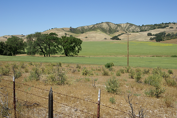
And sorry I could not travel both
And be one traveler, long I stood
And looked down one as far as I could
To where it bent in the undergrowth.

Then took the other, as just as fair,
And having perhaps the better claim,
Because it was grassy and wanted wear;
Though as for that the passing there
Had worn them really about the same.

And both that morning equally lay
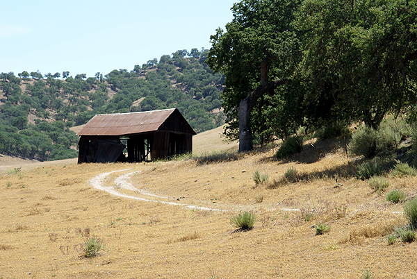
In leaves no step had trodden black.
Oh, I kept the first for another day!
Yet knowing how way leads on to way,
I doubted if I should ever come back.

I shall be telling this with a sigh
Somewhere ages and ages hence:
Two roads diverged in a wood, and I--
I took the one less traveled by,
And that has made all the difference.

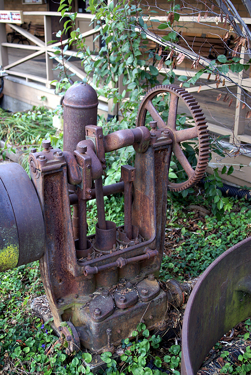
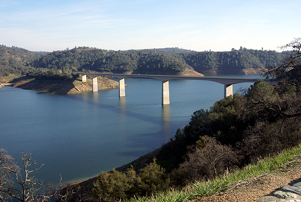
Pictures were taken at or near the following caches:

A Green Valley View by Sloigo
Old School by Pal_Al
Stop Staring at Me! by Momaqna
Take a Sit by Scooterman
Are we there Yet III? by Sloigo

Profile for Webfoot

Tuesday, May 20, 2008

Halfway there...

This weekend, I put over 1000 miles on my van driving up to Stockton to pick up the Musicmaker from her first year of college. I made it a little bit of a road trip and took a more scenic route going up to try and bag a few more counties that I hadn't cached in before. The route I'd planned was going to net me three more counties, which would have put me over the halfway point for Discovering & Logging California's 58 Counties.

As anyone knows who caches on a regular basis, things happen. And actually, this was a good thing. The first new county that I encountered on this trip was San Benito County. It's a smallish county located on the eastern side of the coastal ranges in California. The biggest town I believe is Hollister, which is probably fairly well known these days because of a brand of clothing. Anyway, the scenery in San Benito County was spectacular and I ended up spending way more time caching and taking pictures there than I had intended to, so I didn't get the other two counties. Except, the next day I had more time to kill, so I started caching from the other end of my Route PQ and found myself in Contra Costa County. I found two caches there, bringing my total of counties cached in to 29, exactly halfway to the 58 County Challenge. Now I just need to get to Northern California.

Profile for Webfoot

Wednesday, May 7, 2008

Future trips

My last road trip was a three day affair back in February to visit my daughter at her school. I’m heading back up there for another shorter road trip in 10 days time, to pick her up from school. I tell you it’s not fair. She started school the same day I did back in August and she’s going to be done a whole month before me, and she had a longer Christmas vacation too. Where’s the justice here? My older son keeps shaking his head when he found out she’s coming home next weekend. He keeps repeating the mantra, “One more year.” Yeah, well, then there’s four years of college and then all that free time ends.

But anyway, the road trip back then, took me into Gold Country in the foothills of the Sierra Nevada, with some pretty nice caching. I don’t expect to find nearly as many caches as I found on that last trip, but the focus isn’t entirely on caching anymore. There are several dashpoints that I’ll be passing on the way and several GeoVexillum as well. Time is also a factor, since I'm not taking as many days as last time either.

The route I’m planning on taking this time is similar to one that I was going to go with last time. If you recall, I was a little behind on the front end and truncated my trip through San Benito County. This time, the intended route is going to be through San Benito County, then through Santa Clara, Alameda and Contra Costa Counties on the east bay side before heading due east to Stockton. I have found two caches in Santa Clara County, but the other three are virgin territory for me. If I do find caches in those three counties, I’ll be over the halfway mark to logging the 58 California County Challenge cache. I’m fortunate that the final for that one is down near where I live, so it won’t require an extra trip to log it. But I’m getting ahead of myself as to when I’ll log that cache, because it’s probably going to be at least another year or two before I get all of the northern counties of California.

It’s too bad that Geocaching didn’t happen sooner in my lifetime. I’ve now been to every county in the state, but many of them were before the advent of Geocaching. Ah, well, I guess that just means I’m going to have to make return visits. This summer will afford some more revisits when my son and I go camping along the northern coast of the state. I have no idea how many new counties I’ll add to my caching total with that trip. The return trip hasn’t been cemented in stone, so I’m not sure which ones we’ll be traveling through yet.

Anyway, this trip should be fun, but it’s going to be a little bit of a whirlwind. I’m planning on taking off on the 17th early in the morning, getting to Stockton sometime in the evening hours. Then we’ll pack the car with all of her stuff in her dorm room and come home on Sunday the 18th. We usually take Hwy 99 coming home, mainly because the view is much nicer than going down Interstate 5. About the only exciting thing along the I-5 is the Coalinga stockyards and I’ll have seen those on the trip up and I’m pretty sure my daughter, being the vegetarian that she is, won't want to see them either. Besides, there are more caching opportunities along the 99 as well. Having traversed the 5 several times, I’ve pretty much found all of the major caches along that stretch of road, but the 99 still has many areas that I haven't even come close to denting the surface yet.

I’ve got the route planned, and have already set up the Route PQs for the trip up. I’m not sure if I’ll do a route PQ, or just a couple of spot PQs for the return trip. I know I won’t be spending nearly as much time caching coming down, mainly because my daughter isn’t much of a cacher. She’ll tolerate it, but more than a couple of stops for a couple of caches and she’s done. And that’s ok, because I’ll probably want to be getting home sooner as opposed to later since I’ll have work to go to the next day anyway.

I just hope that I can get some good pictures on this trip. The last road trip, I got some pretty interesting shots, some of which I’ve posted here. I would imagine that San Benito County will probably make for some better picture taking spots than any of the other counties that I listed above, mainly because most of that route will be more urban and suburban as opposed to rural, although one never can tell. Something might surprise me. I guess I’m just going to have to wait until that time.

Pictures were taken near the following geocaches:
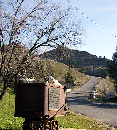
Carson Hill: A Very Historical Place - by tmkbk & olympicwannabe
Beam Me Up - by Ktquilt
Mariposa History - by halfdome and shortcircuit
Mr. Mother Lode - by Uncle Al from Sacramento

Profile for Webfoot

Monday, February 11, 2008

Road Trip Part II

Now that the route queries have been set, the puzzles have been solved and the reservations made for the first night’s stay in Stockton, the next step for this would be to make some travel bug and geocoin grabs. The nice thing about the area that I live in is there are two nice travel bug hotels close by. The Ontario Bug Hotel is to the east of me and close to where I work, which makes it easy to stop by and get some bugs. I just found the Kellogg Hill TB Hotel - Just up from "My Town" a week ago or so. It’s a rather audacious hide to say the least, whereas the Ontario Bug Hotel, is a more subtle hide, making it a much easier grab.

My last road trip, I took a travel bug and a geocoin from the Ontario Hotel to take north with me. I left both in the Fresno TB Convention Center, one that I’ve used several times as I travel north and south along Highway 99 through the Central Valley of California. I’ll probably use that as a last resort this time, not that it’s a bad hide or anything, but I hope to find some larger sized caches on this trip and hopefully will have dropped all of the travel bugs I have in my possession by the time I get there, although, Bright Idea might be tough to drop. I’m going to need a larger container for that one.

That’s what’s nice about geocoins. At least they’re small and compact. Most geocoins can fit into small Altoids containers, which makes them easier to drop in a cache than say something like Cindy, the Cinderblock mentioned in another post last month. After hitting a couple of caches in the last couple of days and attending an event on Sunday evening, I now have enough to keep me busy dropping off next weekend. The ones that are going traveling with me are listed below.

Bright Idea
England Needs Geocachers Geocoin – this one is a non-trackable geocoin, with a travel
bug tag attached to it.

Yellow Fish
Team Ace Personal Geocoin

"Yantongshan, China" Unite for Diabetes Travel Bug – Funny, but I had this one late last year and placed it in a cache on New Year’s Day, only to find it in another cache. I guess it’s meant to be for me to take this one north.
Robin's Wildlife Muggles Red Wacker Geocoin
frotu33's Humane Society Geocoin
RShetley's WMA Vest Geocoin - I met the owner of this coin at the event on Sunday and realized that I've known his dad for about 20 years or so, as he teaches in the school district just north of me. Small World.
Nickell Geocoin
Proximity Guideline Geocoin – I was given this geocoin by the owner to take north with me.
Photogal64's Jailbreak Geocoin

All will get some nice mileage bumps before their final placement. I also know of a couple of caches in the Coalinga area that I’ll be traveling by that have some geocoins dropped by a friend of mine. I plan on grabbing those and moving them further north to other caches.

The one drawback to taking geocoins and travel bugs on a trip like this is the possibility that they’ll get taken from a cache before I’ve had a chance to log them into the cache in the first place. Once on a camping/caching trip to Utah, I attached little notes to each travel bug that I dropped saying that if they were picked up, please wait until such and such a date so I could successfully log them once we got back from our camping trip. One person didn’t heed that advice, while two others did. The one person who didn’t follow the note, dropped the travel bug into the cache that I’d put it in anyway, so it still got the mileage credit which was my purpose for the notes in the first place.

This time, I’ll probably be taking a lap top with me, to make my logs at the end of each day and possibly post something here as well on a nightly basis. Hopefully, there will be some hot WiFi spots that I can take advantage of from my motel room, so I’ll be able to log the day’s finds. I know there’s a hot spot at my first night’s stay, but I’ll be staying in a new place on the second night and so won’t really know until I get there. I guess, I’ll just have to play that one by ear.

Profile for Webfoot

Wednesday, January 30, 2008

Road Trip

I graduated from college with a degree in geography, so I love maps. I’ve always loved getting out the atlas and pour over the individual state maps and see where I might want to go next on a vacation. Where was our next road trip going to take us? Should we take this road, or that one? I wonder what this town is like? Next month, I’m planning a road trip to Stockton, CA, ostensibly to listen to my daughter sing in a concert with her college choir. But we all know that the real reason for road trips is to go caching and this one is no exception.

There is a mystery cache in Southern California called Discovering & Logging California's 58 Counties. The requirements to find that cache is to first find a cache in all 58 counties in California. It’s similar to the DeLorme challenge caches that have been set up in several states across the country. As of this writing, I have a paltry 22 counties with cache finds in them. I figure if I plan this road trip correctly, I can knock a couple more counties off the list. Next summer, we’re planning a camping trip in Northern California, which will also help, so my county map will be more colorful by the end of the summer. Anyway, this series of articles is just designed the document the road trip.

This particular road trip took some advanced planning. I decided that this one was going to take the scenic route, so I’m going to be traveling on a lot of back roads this time, which is fine with me, but making the route queries for this one took a little bit longer. After searching the geocaching data base, I was only able to find this one route that fit my needs for any part of the trip. All the other routes, I had to create. In the end, I have 8 different route queries that I’m going to have to run right before I take off on my road trip. That also is going to take some planning since I can only run five per day. I need to remember to run at least three of them two days before I leave, otherwise I’m screwed.

My next step has been to go through each route and check out the mystery/puzzle caches to see if I can solve some of the puzzles and get those. Interestingly, there don’t seem to be a whole lot of puzzle caches, but I have gone through and solved 12 puzzles for the upcoming road trip. Several of them are right along county lines and involved looking up local history for each county. Right now, I’m a little bit more knowledgeable about Calaveras, Amador, Madera and Tulare Counties. Of those four, I have already found caches in two, Amador and Calaveras being the non found ones in that list. What’s even more interesting is Amador County is the only county that I have not traveled through in California during my life span on earth. I plan to change that on this trip.

There was a puzzle cache that used Pig Latin, one that used the symbols from a computer keyboard, one that had me investigating a certain government agency within Kern County and two cipher puzzles. All of these puzzles have been solved, now my next step is probably going to be to whittle down the list. I have over 500 caches right now, and since my GPSr doesn’t have a memory card slot, I need to get that down to under 500 waypoints for them to all fit in the unit. Once I load all the queries into GSAK I’ll start by eliminating the puzzles that I haven’t solved. That will probably do the trick, but if it doesn’t I’ll then probably drop the multi-caches. I like multi-caches, but they tend to take a little bit longer to find than regular caches and I do have some time constraints so it makes sense to drop them next.

Ok. Now as I look over my check list, I see that I have my routes planned and I have puzzles solved. I still need to run the queries and then reduce the size of the queries down to under 500 caches. Then I need to upload them into my GPSr and my PDA and I’m then set. If all goes well, I should add 6 new counties (San Benito, Sacramento, Amador, Calaveras, Tuolumne, and Mariposa) to my found list for the 58 county challenge. That will leave me just one county short of being halfway to the County Challenge goal. Since there are three basic legs to this trip, I’ll make separate posts on each leg. For now, it’s just a process of waiting.

Tick, tick, tick, tick, tick, tick, tick, tick, tick, tick, tick, tick, tick, tick, tick.

Profile for Webfoot

Monday, January 14, 2008

To route, or not to route, that is the question

When I first started geocaching, I was strictly a paper kind of guy, since I had an old school GPSr Garmin 12. No computer connection with that one, so every coordinate had to be entered by hand. Make one mistake and your searching far away from your intended cache.

Once I got the new GPSr - yeah it's still a Garmin - and a PDA, I went paperless. It was great having the nearest 500 caches in your GPSr all the time. Going out on an errand? Oh look! There's a cache over there. I took my daughter to a music audition and she "gave" me permission to find a cache before we came home. That was assuming that I had my GPSr with me she asked. I gave her a wry look and off we went, to find a really nifty lamppost cache. Well, the cache wasn't nifty perhaps, but the surrounding landscape was very cool, a sculpture made from some of the remnants from the Northridge earthquake from about ten years ago. The power of Mother Nature is awesome.

Now where was this going? My youngest is the only one who caches with me on a regular basis. Every summer, we'd pick a place to go camping and then we'd start plotting out which caches looked good to get. Then, I'd print out the cache pages and we'd have a stack of 15 to 25 cache pages that we would attempt to find. It was not a very efficient way of caching. If we couldn't find the cache, that was one cache we couldn't find and we wouldn't necessarily have any other close caches to find because of our paper stack. Throwing away those printed pages, was almost like throwing away a friend. Our best trip was a camping trip we took to Utah and Nevada where we ended up finding 18 caches, many of those were locationless caches (before they'd been archived out of the system) and virtuals.

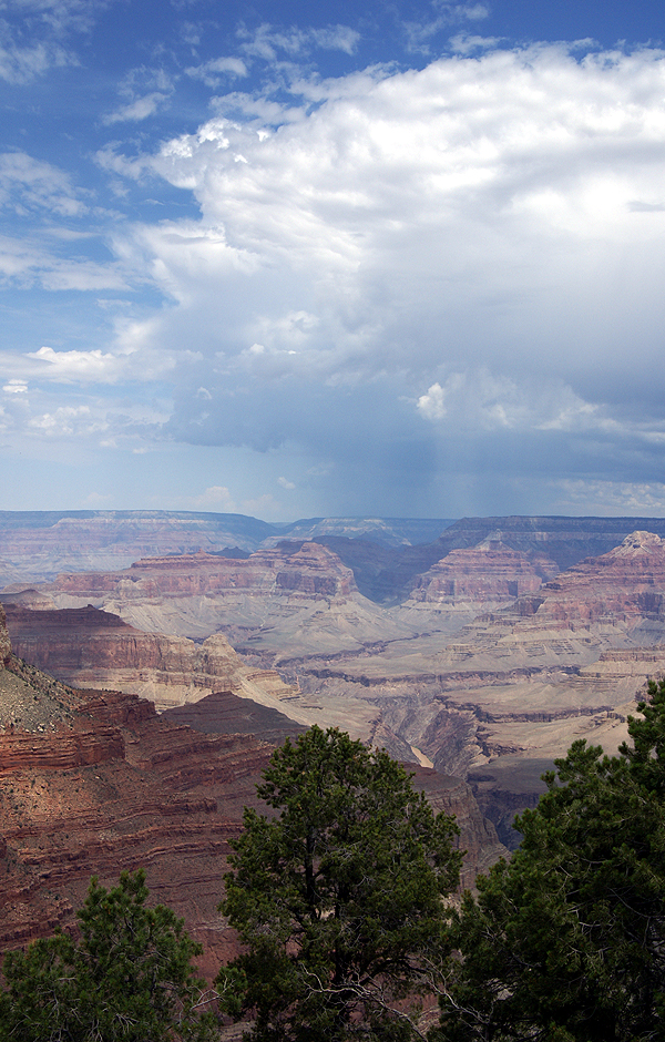
This past summer, we decided that we'd be camping at the Grand Canyon and surrounding areas down near Flagstaff. I'd played around with the Google Routes in the past, but this was the first time I actually put the route query into play. From our area in Southern California, I ran my first route from Barstow, CA to Cameron, AZ, which is north of Flagstaff. I'd originally thought of just sending it to Flagstaff, but I couldn't get Google to create a route the way I wanted to go if I stopped the first route in Flagstaff, so I had to make the route a little longer, so it would go the correct way.

From there, I created a second route from Cameron to Grand Canyon and then I created a third from the Grand Canyon to Williams, AZ creating a large backwards shaped P lying on its back across the Arizona landscape following Interstate 40 and other Arizona Highways with the footing of the P in the eastern California Mojave desert.

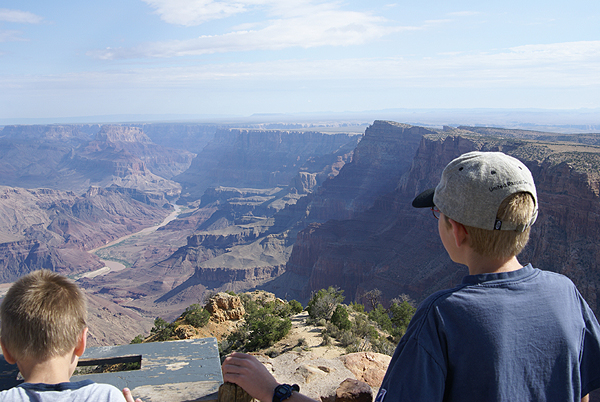
I then saved the routes from Google, uploaded them to Geocaching.com and then ran the queries. With the route, I was able to set parameters, like how far off the route do you want to search? What kind of caches? I set the width at 2 miles figuring we wouldn't be doing off roading and also figuring that some towns that had been bypassed by the Interstate, might have some interesting caches, but might be more than a mile from the Interstate.

Once that was done, I then did some spot queries to fill in gaps. I ran one around Flagstaff, since we'd be spending some time there and one around Grand Canyon since I noticed that the route didn't pull in the four virtuals that were in the western part of the park, more than 2 miles from the route. With that done, I then loaded all the queries into GSAK and found I had 429 caches for this seven day trip. I knew we wouldn't be able to find all of those, but it was nice to know we had those available to look for depending upon where we ended up going. I figured that if we found 5% of the ones in the GPSr, we'd be doing pretty well.

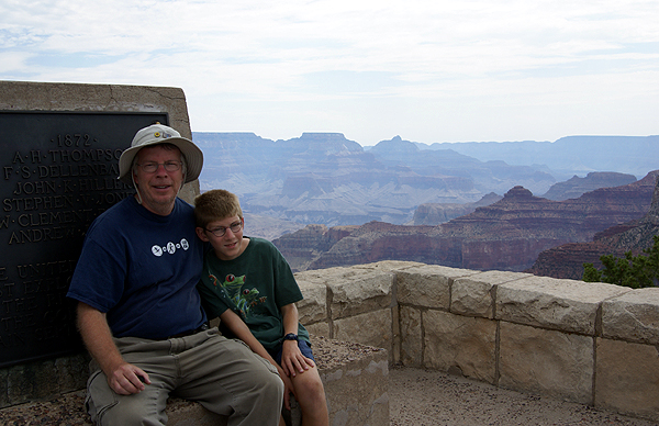
Once we started on our trip, it became evident that we'd find a lot more than that. We found four on the first day without any difficulty at all, just stopping at rest areas along the way. Using the old way of searching Geocaching.com, we might not have even noticed all of those caches along the road. This way, all we had to do was watch the GPSr and let it do the work for us as opposed to the other way around. "Oh, look Dad, there's a rest area up ahead with a geocache. PDA cache page says it's an ammo can!" Yep, we're going for this one.

In the end, we ended up finding a variety of caches of nearly all types - some puzzles, some virtuals and a lot of traditionals - for a grand total of 43 caches in six days. That was double my original estimate and a pretty good average of 7 cache finds per day. Yeah, we probably could have had more, but we also took in the views as well. This was the first time I'd ever used a route query and I was hooked. One of the nice aspects of the route, was you had a full set of caches at your disposal, not just a couple that you'd printed out. If you couldn't find a particular cache, it wasn't going to be the end of the world, because you knew there were others close by. Just do a search with your GPSr for closest caches and pick another. That was especially handy when I had the kid in tow. He wanted to find caches. This made it much easier.

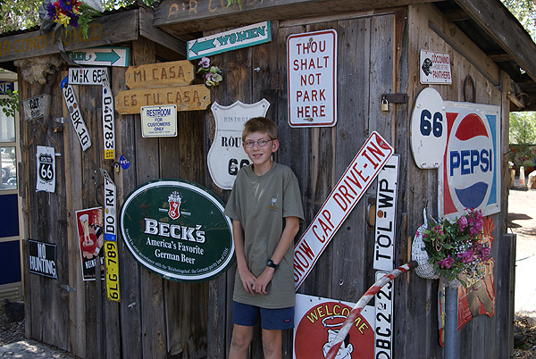
I've used a route query now four more times, with varying degrees of success, but always with better success than just picking caches that "look good" while looking at areas that you might be near. My last trip, this past weekend, I was able to find 5% of the caches that I uploaded into the GPSr and if I'd been a little bit more patient in my search techniques, the results would have been higher. Getting back to the title of this article - I know what the answer will be for me in the future.