One of the things about camping at higher elevations is the differences in weather that we're normally used to experience at our regular altitude. 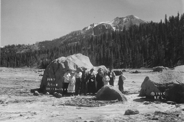
I could postpone our trip, but I'm not sure if that was going to accomplish anything, so I decided to keep out timetable and leave when we had planned to leave. If there was snow, that would just add to the adventure. Besides, we had planned to meet Chaosmanor up at the GPS Maze exhibit on the 5th of July. If I postponed our trip, that visit wouldn't happen. It was something to consider, but for the most part, I didn't seriously think too long about postponing the trip. The snow could be fun.
The day we got to Lassen, we headed down the park road, which was cleared for about 10 miles into the park. The drive took us to several locations, one of which is interesting from the standpoint that we could get a feel for what Mt. St. Helens might look like in 70 years or so. Mt. Lassen erupted almost 100 years ago and today, it is a living laboratory. It's about 70 years ahead of Mt. St. Helens, which is a similar type of volcano, being in the same Cascade range.
Along the road, we stopped at the Hot Rock, a very large boulder that had been ejected from Mt. Lassen and come to rest approximately 5 miles away from where it had started in the mountain. I scanned a postcard that I purchased at the visitors center showing the rock only days after it had been ejected from the mountain. 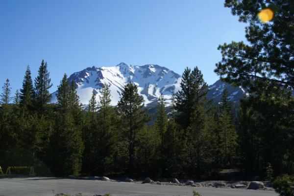
There is another area just down the road from the Hot Rock known as the Devastated Area. It has a similar view to the Hot Rock postcard picture. In the postcard, the ridge of trees to the right were spared, because of the local topography. The heat, volcanic winds and mud and landslides from that major eruption swept around or over the ridge sparing many of those trees. However, the other area to the left is clearly barren of any kind of plant life. That is what was called the Devastated Area. Compare that with the picture I took at the Devastated Area. Nature has a way of reclaiming its own eventually. This is a glimpse of what Mt. St. Helens could look like in the future.
Pictures were taken near the geocache:
Loomis - by 2dogs and mtnsteve
Friday, July 23, 2010
Hot Rock

Monday, July 12, 2010
Earthcaches Galore
Our trip along the eastern side of the Sierra Nevada culminated in our camping at Devils Postpile National Monument. This monument, established in 1911, preserves an interesting basaltic columnar formation and an impressive 101 foot waterfall, aptly named Rainbow Falls.
Since the monument is part of the National Park Service, no container type caches can be placed in it, but virtuals (if they were already created) and earthcaches can be. 
In the park, we found four earthcaches, two on the first day and then two more the next day. We split them up only for convenience's sake. We could have done three on the first day, but the fourth required a substantial hike, so it was basically unavailable the first day of our camping trip.
One of the earthcaches we did on the first day was the Soda Springs earthcache. I'd been here in 1977 as part of a biology summer school class I'd taken at my local community college. Devils Postpile was one of the places we'd stopped to visit and I can remember our instructor, Dr. Bates, talking to us about the Soda Springs in the area. In August, the San Joaquin River, which runs through this glaciated valley is at a low point, with most of the winter snow melted at this point, so there isn't as much water movement where the springs are and so we could see lots of iron oxide precipitate deposited along the shoreline where the springs were.
We had a very heavy winter in the Sierra this year and even in late June, the runoff was tremendous. The San Joaquin was very close to flooding in areas. 
Other things we investigated while in the park were the direction the glacier moved through the park while it was polishing the top of and plucking the face of the postpile. The postpile is a series of basaltic columns that cooled a relatively even time frame. When the last ice age glacier scoured the area, the postpile was exposed for all to see. Over time, columns have eroded and fallen to the base, creating the postpile. The columns are generally smooth on the top where the glacier ground against them.
They are also large in size. At first glance, you can't really appreciate the size of the columns, but you have ample opportunities to get very close to some of the fallen columns and it's then you can truly appreciate how big they are. Earthcaches aren't for everyone, but as the Tadpole likes to say, "you get to learn something with these, so I like them." They take more time to do and so, they're not conducive to "numbers" runs, but then again, it's not really about the numbers, but the experience. You truly get to experience the surroundings with earthcaches.
Pictures were taken at or near the following earthcaches:
Soda Springs at Devils Postpile - by TerryDad2
Devils Postpile National Monument - by truckgirl2

Friday, July 9, 2010
Owens Valley
The Tadpole and I just got back on Wednesday from one of our more satisfying camping trips in a couple of years. Camping trips in general seem to be fraught with could'ves and should'ves. This one didn't have that feel at all, with a couple of minor exceptions. We did what we wanted to do and only once, really got caught up in the, "No, we can't do that cache because we have to be somewhere else" mode.
That is a good thing in my opinion. 
As we drove north we kept a look out for interesting things to see. I wanted to make sure my son got to see Mt. Whitney. We talked about the John Muir Trail that stretches from Whitney's peak to Yosemite Valley. We ended up walking along part of the trail while in Devils Postpile later in the day.
Once you get into the Owens Valley part of California, the scenery pretty much speaks for itself. Owens Valley is on the eastern side of the Sierra Nevada and sits around 4000 feet of elevation. Directly to the west sit the Sierra Nevada, towering over the valley. At points there is a quick elevation gain of nearly 10,000 feet between the valley and the mountains.
The mountains, created by a fault block were uplifted and create a major rain shadow. Owens Valley is in the rain shadow and doesn't get much rainfall over the course of a given year, because the mountains trap the moisture from the clouds as they rise to go over them. This year was a particularly wet winter and there was a lot of snow in the high mountain passes and peaks. So much so that it would affect our camping trip down the road.
One spot we chose to stop was at Manzanar National Historic Site. Manzanar was one of several relocation centers for Japanese Americans during World War II. Many Japanese Americans were rounded up during the early stages of the war and sent to live in these relocations centers for, as the government put it at the time, "the safety of the Japanese people." Ironic that the guard towers posted at these relocation centers had their guns pointed inward as opposed to outward to protect from an external threat to the Japanese American people living there.
After touring the newly created visitors center at the old gymnasium, we were back on the road again, heading toward Devils Tower. We stopped for one more cache north of Manzanar and reveled in the beauty of the cache location. The disparity between the two locations was striking. 
Sixty miles to the north, the beauty of the place overwhelmed us, much like the starkness of Manzanar tried to do earlier. This time, we let it.
Pictures were taken at or near the following geocaches:
Manzanar Virtual Cache - by GoodDogSD
Cache with a View - by Rallye

Saturday, June 12, 2010
A rose by any other name...
This past week, I went on a short road trip to Northern California. I know short is a relative term, but it was short for me in time, as opposed to distance since I put slightly over 1000 miles on the van, plus added two new front tires during the trip.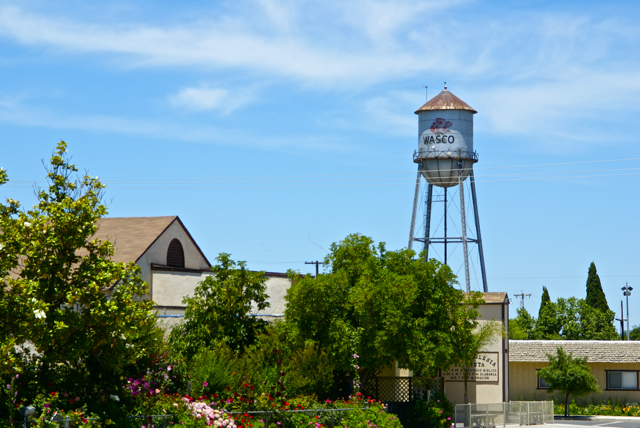
I drove up to Stockton, mainly to deliver extra "stuff" to my daughter, including a couch that she'd gotten from her grandmother, but couldn't fit in her car. There would be a side trip to Santa Cruz to pick up my son as well. Since he wanted to visit with his sister for a little bit, I picked him up, then drove back over to Stockton. This should have been a 4 hour round trip, but it ended up being over 8 hours because a problem developed on one of the front tires and I had to get that fixed before we could head back. Things happen and there's not much I could do about that.
Each time I drive up there, I try to take different routes. I look at the different virtual flags that can be captured, as well as any possible dashpoints, plus geocaches and then I plan my route accordingly. Waymarks and benchmarks are side possibilities, but for those, I just let them happen as opposed to me actively search for them.
If you've followed this blog for any length of time, you know that my most active waymark category is water towers. I love driving into small towns and seeing their town advertised for miles by the large water tower in the center of town. We have few water towers in Southern California, as most municipalities build large storage tanks in the hills above town which provides the same purpose of creating water pressure for the town's water supply.
Towns in the Central Valley of California and elsewhere where no hills are present create their town's water pressure by building water towers. Usually, these water towers promote the city, but some support advertisements for local businesses. The main water tower in Merced, California promotes the newest university in the UC system, UC Merced.
As I drove through the Central Valley this week, I happened to drive through the town of Wasco, CA. I've seen signs pointing to Wasco while driving both Hwy 99 and I-5, but have never gotten off, mainly because the town is out of the way. 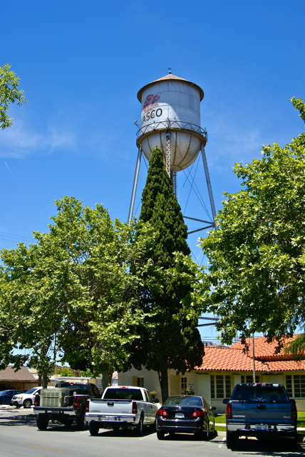
Had I known a little bit about the town, I might have been tempted to stop there sooner. Wasco bills itself as the Rose Capital of the World. Every year it has a rose festival the weekend after Labor Day weekend and the water tower in the middle of town is plastered with a large red rose. After getting home, I discovered that 55% of all roses grown in the United States are grown in and around Wasco by nine major rose companies. It was a pleasant experience to drive through the fields around town and see rows and rows of red roses, then rows of yellow roses. I know I've never seen so many roses in one place before.
If not for the GPS games that I play, I probably would have never passed through this quaint little town. I feel, I'm richer in spirit because of this hobby. If you happen to be in the area on the weekend after Labor Day some year, I think you could do worse than to make a stop in Wasco and take in their Rose Festival.
Pictures taken at the Wasco Water Tower:

Tuesday, February 9, 2010
It's that time of year again
February rolls around every year and because of the holidays attached to that month, I usually get to do a nice long road trip north to visit my children. My district this year decided that we would take one long 4 day weekend as opposed to two 3 day weekends as we have in other years. This Friday, I'm going to be taking the youngest out of school a little bit early and we'll head north to visit both of his siblings who are matriculating in college.
Our first stop will be Stockton where my daughter has been attending school at the University of the Pacific, majoring in violin performance and music education. 
Following our visit to the Stockton area, we'll head over late Saturday night to Santa Cruz. My older son is in his first year at University of California at Santa Cruz. He hasn't declared his major yet, but as noted above, he's still a freshman so he has some time to make that decision. Right now, he's just enjoying the experience. Most of Sunday will be spent visiting with him and touring the campus for the Tadpole.
Monday, we'll head home, geocaching along the way. We have 9 travel bugs in our possession that we've picked up over the last couple of weeks, so we'll be distributing them freely across the trek we plan to take as well. For those who are interested, I've created a bookmark of the cache route we might take. The bookmark list has just about 300 caches in it, so I'll probably do two spot PQs for this trip, one centered on Stockton and the other centered on Santa Cruz.
It will definitely be a whirlwind trip, but it should be fun. This will be the first road trip that I'll be taking the Tadpole on that doesn't involve camping. We'll see how he adjusts to motel life.

Wednesday, April 8, 2009
College road trip
Tomorrow marks the first road trip of the season. My older son (the Runner) and I will be embarking on a road trip to visit UC Santa Cruz, where he will be
Our trip begins as soon as I can get off from school on Thursday. Then it will be a rush to try and beat the traffic in the Los Angeles basin. If we're lucky, we should be in the central valley before 5 o'clock.
Our route will take us up Interstate 5. I don't have much caching planned for the first leg of our trip, mainly because the daylight hours will be spent getting out of the area. I figure we'll eat on the way at a burger place where I know there is a cache waiting to be found. That may be out only cache of the day.
Friday, we have a tour scheduled on campus which should last us a couple of hours. Looking at the map of the campus, it looks large and hilly. My son will get lots of exercise up there, but he's used to that. After the tour, we have much of the day left to enjoy the city of Santa Cruz. Part of our tour will include a walk on the Boardwalk.
Saturday morning, we'll head northeast to Stockton to visit with my daughter at the University of the Pacific. We plan to spend part of the morning driving and caching up there. If things go well, I'll be able to get Alameda County off of my "to do" lists in California, leaving me one county closer to the county challenge cache. The rest of the day will be spent visiting with her, enjoying her campus and going to Easter Vigil service that evening. On Easter Sunday, we drive and cache homeward, traveling down the much friendlier Hwy 99. All in all, it should be a very good trip.
Picture was taken at the University of the Pacific at the following geocache:
Smell the Roses - by PuzzlesRUs

Wednesday, March 25, 2009
Some like it hot
I wasn't sure how I was going to title this particular entry. I thought about calling it, "I touched the Thermometer" but wasn't sure how that would go over, so I 
About two years ago, I decided to run a Pocket Query (PQ) looking for all the virtuals in my local area. I didn't know where they all were and just wanted a general idea on the whereabouts of them. As I searched the map, I came across a virtual in Baker. Baker is located along Interstate 15 about two hours south of Las Vegas, Nevada. It also bills itself as the gateway to Death Valley, because the main road that runs along the edge of the park and eventually into the park starts in Baker.
Baker is also home the World's Tallest Thermometer. It's 134 feet high, which is also the highest temperature ever recorded at nearby Death Valley. It stands as a beacon day or night. It's been standing in Baker since 1991, so there's at least six different occasions that I've driven by it and noticed the temperature on the thermometer. Since all of the times I've driven by, it was during the summer, it was probably registering in triple digit mode. But the catch is, outside of yesterday, I'd never stopped and investigated it further, mainly because there wasn't any need to stop. I remember one springtime taking my two older children on a camping trip to Death Valley and we ended up stopping in Baker to eat lunch but didn't go over and check out the thermometer.
Once again, geocaching has gotten me out of my cocoon of a car to investigate and explore something a little bit more in detail. Not that this is anything spectacular; it's just a tall tower that also happens to display the temperature at the moment. But it's the kind of kitsch like this that has always made road trips by Americans memorable. Motels shaped like Indian Tee Pees, Bedrock City, where the entire place is devoted to the Flintstones, or the Trees of Mystery in northern California are all what we would probably call tourist traps. They are places that wouldn't hesitate back in earlier days to strap a bumper sticker on to the front bumper of your car so you could advertise for them.
Well, yesterday, I fell for the tourist trap. I got out of my car and walked up and touched the thermometer. 
Pictures were taken at Some like it Hot - by AquaDyne

Sunday, January 4, 2009
Billboard Jungle
The holiday season is over, yet my Christmas tree is still up and will probably be up for another week or so. This is not out of design. Usually, I take the tree 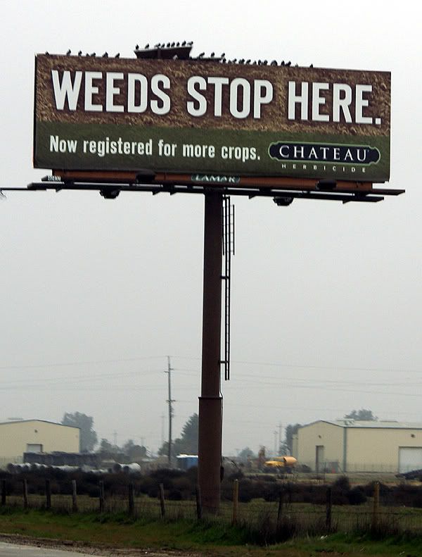
The road trip was rather uneventful. I drove, mainly because there was Tule fog in the big valley. It wasn't noteworthy or dangerous, and my daughter could have driven, but I like to drive. The last couple of hours she ended up napping in the car. What I really should have done was let her drive the middle two hours. But that didn't happen, so I was tired when we got to Stockton. She was actually amazed that I didn't stop even once to geocache. I figured since I was coming back down by myself, that I would get some caching in at that time, which is what happened.
On the drive up, I started looking at all the billboards at the side of the highway. Most of the time, I usually just tune them out, preferring to look at other things, abut there was something about this billboard that stated in no uncertain terms that "FOG KILLS" peaked my interest and I started looking at the billboards with a little more interest, at least for this trip.
America seems to have a seemingly unboundless interest in food. There were more billboards advertising restaurants than I could probably count, most of which were of the 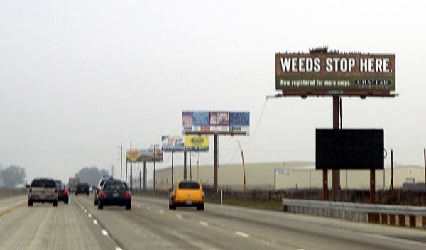
What seems less so, is the billboards that have websites attached to them. What was the designer of that advertisement thinking when they decided to put the website of their company on a billboard knowing that almost everyone that sees it will be driving by so quickly that the entire sign is almost a blur anyway? "Oh look Martha, there's a website address on that billboard!!! We should look it up right now and see what great information it has for us!" I can't even imagine a conversation like that ever happening, but there were several billboards that had the website addresses on them for everyone traveling on Highway 99 in the central valley of California.
Now there were just as many billboards that didn't have websites posted on them, some of which are pictured here. I actually think what got this whole thing started was the Weeds Stop Here billboard. My daughter mentioned something about posting a billboard about Marijuana along a highway as being possibly inappropriate, but then she realized that it was about stopping weeds in farm crops. I'm not sure why, but I particularly liked the Apple Annies signs, plus the FOG KILLS signs. Those just stuck out in my mind as we drove along the freeway.
Just for fun, I started looking at some of the billboards and then asked my daughter to write down some of the websites for later. One of the first catch phrases I noticed, besides the FOG KILLS was one by the California Farm Water Coalition. They 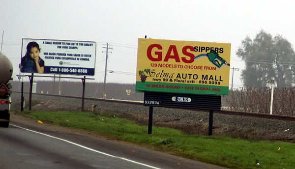
Besides telling us all that FOG KILLS, the FOGUniversity billboards also had a website to get more information about fog. The site is still under construction so there's not really a whole lot of information there except links to places such as CalTrans and the California Highway Patrol. There is a media link that has a short video about driving in the fog. Once again, Father knows best and is driving too fast, much to the chagrin of his child who warns him that he's driving too fast. It ends with an implied collision caused because of excess speed and fog. Now if he'd just listened to his kid in the first place. Tule fog is a very dangerous thing in the central valley of California and according to Wikipedia it is the major cause of weather related accidents in California so I'm not trying to make light of this as much as I am trying to understand why an organization would go to the trouble of putting up a website and then say, "Oh come back, we're not ready for you yet." I think it would make more sense to get the website up and running, then post the information on the billboards.
Another catch phrase that had me wanting to know more about it was the Check before you Burn billboards that were placed by 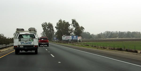
Several other billboards that contained website addresses catered to our stomachs or our palates. Cacciatorre Fine Wines has an interesting website. It has two buttons on its splash page, one for those of us who are over 21 and one for the younger set. I checked both out. The over 21 set get to go right to the main page of the website, while the younger set get directed to Disney.com. I'm wondering if Cacciatore Wines gets a kickback from Disney for this arrangement?
The second billboard that I noticed a website on that was strictly food related was the Valley Pistachio Country Store. It has a nice looking website with a variety of information about what the country store sells. It also has a Recipe of the Month section, although that appears to have just started around the holidays since there is only two recipes and both require the use of cranberries either to make Cranberry Pistachio Biscotti or Pistachio Cranberry bark.
The last two billboards that I noticed website addresses on were the Three Crowns billboard and the Pixley RV Resort billboard. I have to admit when I was reading these websites to my daughter, I knew what most of them would be, but I wasn't sure about Three 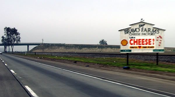
I guess the question I have for all these places is why. I realize that with all of our technology today websites are pretty much ubiquitous and a company that doesn't have a website is probably in the dark ages, but why post a website on a billboard? WiFi probably doesn't exist along the entire corridor however California does offer free WiFi at all of their rest stops. If the driver doesn't have a partner, it makes it unsafe for them to grab a pen and write down the website or even look it up on their Blackberry unless they pull over and that probably isn't the safest thing to do either along our highways as the shoulders of the road 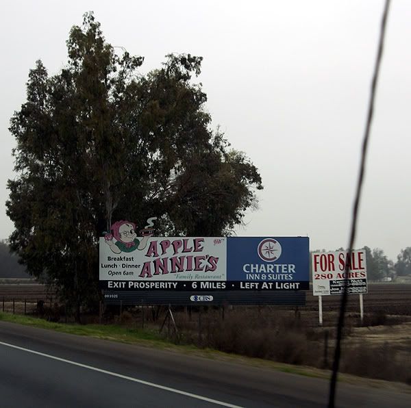
The logical explanation to all of this is the billboards are generic, designed for areas where people can stop and write down the website addresses. It's probably cheaper overall to make one set of billboards as opposed to two different ones, one for city areas and one for highways corridors. I'm not sure if this is a good thing or not, but I can visualize in the future where cars will have receivers to grab information off of billboards. Drivers will just have to push a button on their steering wheel and the car will automatically download the website address from the billboard. At the next rest stop, the driver will be able to plug his or her computer or Blackberry into the car's USB port and upload the information. Hmmmmm. I wonder if I can market this and make my first million in the next ten years?
Pictures were taken by my daughter along Highway 99 between Bakersfield, California and Stockton, California.


Monday, December 22, 2008
This and that
It's been a wet day today. Not much rain accumulated from this storm that passed through, but it was just enough to make everything wet and gloppy. Last week's storm was huge in comparison as we actually had snow patches on the back patio. 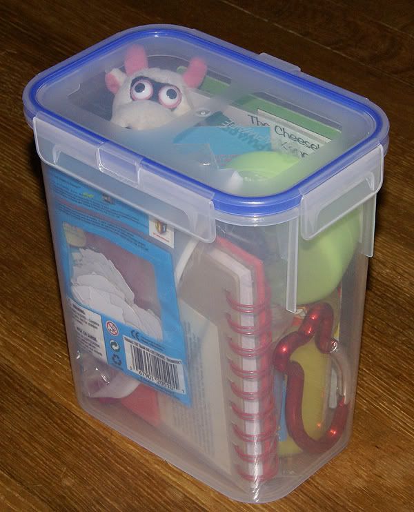
With the rain, I need to think about alternatives to finding caches, so I'm now working on a couple of caches that I want to try some things out with, including a letterbox. I was part of a Christmas gift exchange with some friends that I've met through geocaching.com. I sent a gift to a friend of mine in Montana, while receiving a very nice ready made cache from a friend in Wisconsin. I'm still amazed how he was able to squeeze all of that swag into that container, which stands about 8 inches high. 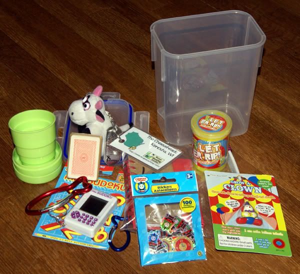

Thursday, November 20, 2008
Anticipation...
Christmas is just around the corner. I turned on my favorite oldies station this afternoon and they were playing 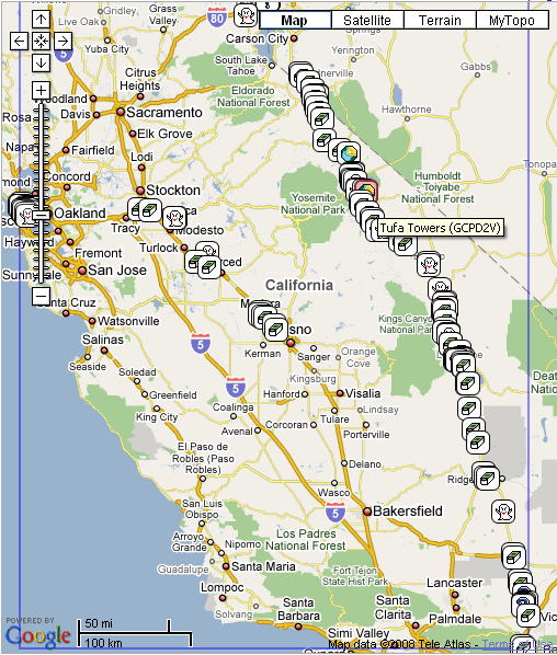
Part of the fun of anything, whether it be Christmas, your birthday, or a trip of some kind is the anticipation before hand. There's planning to do and things to buy. With a trip, there's the anticipation of seeing new sights, doing new and different things, or possibly visiting places you've been to before and thinking about all the new memories that will happen.
When I went to visit my daughter earlier this month, we broached the subject of me coming up again to visit in February. I have a four day weekend, so I thought it would be a great time to come up and visit, maybe go somewhere and of course, do some caching. We talked about possible day trips we could do that weekend, and we came up with a day trip into San Francisco, with a possible stop at Alcatraz Island, going down Lombard St., touring Pier 39, and maybe visiting Fort Point under the Golden Gate Bridge.
Once I got home, I started to think about this. Usually I go up through the Big Valley, then come home the same way, getting caches both ways. I thought this trip might be fun if I varied my route, to include heading over to Reno, then coming down Hwy 395 through the Owens Valley. This one is pretty much weather dependent and could get snowed out, but I decided that I might as well start the planning process.
There are several caches that I'd like to find on this trip. I could probably make a list that would go on for several pages, but I'll try to limit it to the ones that have some kind of meaning. I guess you could call this adding to my bucket list.
Mazanar Waterworks Virtual Cache is obviously in Manzanar National Historic Site. The place preserves an era of our history that I'm sure many would like us to 
The Monoville "Hunters" Cache was hidden by Snoogans, a friend that I know only through the Geocaching forums. He lives in Texas, but regularly visits this eastern part of the Sierra. This allows him to hide caches that are outside of his normal range, so as to not be a "vacation" type of cache. I think it would be fun to find a cache of someone that I've known for several years. He hasn't found any of my caches yet, but he's found several of my geocoins and travel bugs that have made it to his neck of the woods.
Since I'll be driving by Mono Lake, it would be criminal not to stop and view the Tufa Towers and get the earthcache of the same name. These towers are mineral deposits left over when the lake was at a higher level. The city of Los Angeles bought up the water rights in this area and has siphoned a great part of the water off for its own thirst, but laws are in place that will hopefully prevent the total desecration of this lake. This should be an interesting cache to find. For you cinematic buffs out there, this episode of Los Angeles history is chronicled well in the movie, "Chinatown" staring Jack Nicholson and Faye Dunaway.
Since 395 goes into Nevada, I'd have to get at least a couple of caches in that state as well. 12 Resting Trees, is one of many I could choose from, since it's large and apparently in a good spot to find.
If we do get over to Alcatraz, then we'll have to Escape from Alcataz just to say we have.
At the moment, there are 129 caches on that map that can be found. They won't all be found. I know that, but it's still fun to think about it. As I've gone over the maps, I've looked at many of the cache pages and thought that a particular cache looked interesting and I'd like to find it. Many on this list are like that. We'll see. Snow could close the I-80 and I'll have to come back down by way of Hwy 99. That's OK too. It's a journey, no matter which way I go.
Pictures were taken at or near the following geocache:
Manzanar Virtual Cache - by GoodDogSD

Wednesday, November 5, 2008
A Great Excuse for Caching
As previously noted below, I'm heading out on the road this weekend. I plan on leaving Saturday morning which will get me up to Stockton in plenty of time to hear my 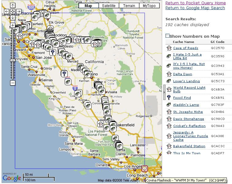
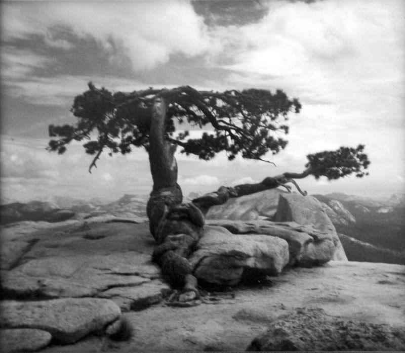
Sunday will be devoted to a day trip to Yosemite National Park. There are quite a few virtuals there and we'll get many of them on this trip. We're hoping the snow level is still high enough that the road to Glacier Point  hasn't been closed yet. As of last Friday it was still open, but that could change on a daily basis. There's a hike there up to the top of Sentinel Dome that we'd like to take, not to mention the view from Glacier Point should be spectacular this time of year with all the snow in the high country. The Yosemite Sentinel Dome Virtual Cache plus this benchmark are obviously at the top of Sentinel Dome. There used to be a gnarled Jeffrey Pine tree growing at the top of Sentinel Dome, but it died during the drought years of the late 70s. A couple of years ago, the dead tree finally came tumbling down. On my wall in my bedroom, I have a black and white picture of this tree that I took in 1975 when it was still alive. I went back with my three children in 2000 to pay a visit to it and it was a very sad reunion, since only the trunk and a few branches were all that was left of the tree. Now those remnants aren't there anymore, so the view should be a little different this time if we get up there.
The benchmark is also interesting because the tree is one of the main reference points for the benchmark. The benchmark also refers to a road that leads you to the base of the dome. That road hasn't been there in decades. Every time I've been to the Sentinel Dome, I've had to hike about a mile and a half to get to the dome's summit. There are still areas on that hike where you can encounter the old road, but I have to assume the road was taken out for environmental reasons, probably to reduce the strain on the Jeffrey Pine living up there as well as the other plants living around the base of the dome. Either way, I'll be taking some good notes for this particular benchmark so I can post a log with the National Geodetic Society.
On Monday, I plan on making my way north to Sacramento, getting a dashpoint southeast of the city. Since I'm going to be up there,  I figured that I might be able to get some caching done in some counties that I've never cached in before, like Yolo, Solano, Napa, Sonoma, Marin and Alamede Counties. The route I plan to take is the circular route around the top of San Pablo Bay northeast of San Francisco. Some of the caches there are ones that I'd planned to find this summer but wasn't able to so that will be kind of nice. Once I get back to the 5, I'll probably take it quickly home since I figure that detour around the bay might take up most of my morning.
Over the past couple of years, I've been taking more of these kinds of road trips, mainly because the kids are getting older and they've wanted to start looking at colleges, but also it's been a great excuse to visit my daughter now that she's away at school. Next year, my son starts his road to college, so I'll probably get to go on more of these kinds of trips. Visiting my children is always topmost on my mind on these trips, but they're also a great excuse to get some caching in as well.
Friday, October 31, 2008
Meetings and Greetings
I've been following the travels of Elemental Jay via his blog EJ Rider. He's in the process of taking a cross country road trip from Indiana to the west coast and 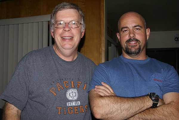
Jay was waiting for me in the parking lot of my school this afternoon when I got off of work. We drove to a nearby coffee shop where both of us had fruit smoothies. We talked geocaching for a little bit and I think I convinced him that driving all the way to Kingman, AZ this afternoon wouldn't be a good idea since he was going to hit major traffic along the way, so he came back to my house for some dinner and some geekiness of posting in the forums and talking to each other on line while we sat in the same room together. We've both been certified as 100% geek by someone else who is near and dear to us.
He caught up on his latest blog postings while I cooked dinner of salmon, angel hair pasta and peas topped off by some homemade cookies and cream ice cream. The food was good, the company was excellent, a nice way to spend Halloween. There was a Haunted House going on across the street from us, but for some reason, we didn't have many trick or 
Jack, our dog, on the other hand was easily distracted and barked at anything that seemed out of the ordinary, which was quite a lot this evening. Eventually, he settled down and made a friend of Jay. He was quite content to stay right by Jay's side for most of the evening, in between barking at all the strange people that kept walking by the house. Eventually, Jay decided that he needed to continue his road trip. The plan was now to drive an hour up the I 15 and get to Barstow for the night, a ride of about an hour or so from my house. It would probably be a pleasant enough ride since the temperatures here have been hovering in the 80s and 90s for most of the month. All in all, I have to say it was a pleasant evening and it's always nice to finally meet a fellow cacher who you've only known via postings in the forums in the past. God Speed Jay on your trip home.

Wednesday, October 22, 2008
Odds and Ends
This one is more of a quickie than anything else. In a couple of weeks, I'm going on another road trip to Stockton to visit with my daughter. She's the concertmaster of her college orchestra and the orchestra will be performing on the 8th of November. I'll be leaving in the morning and getting up there in time for the concert. I emailed her yesterday asking her what she wanted to do the next day, since I wasn't going to be leaving until Monday the 10th. I suggested a road trip to Yosemite National Park, which is about an hour and a half to the east. She's pretty excited about that and is planning on asking a couple of her friends along for the ride.
Now, I've started checking out the possible caches along route 120 into Yosemite Valley. There's lots of virtuals, but also several regulars just outside the boundary of the park, including a travel bug and geocoin hotel. Right now, I have two bugs and a geocoin that I'll be bringing along on the trip. I plan on writing about this particular trip a little more in detail in the coming week.
Last, but certainly not least, there's a new link on the right hand side of the of the blog page. It's a spot to allow readers to follow along. Something different just to see who's reading this on a semi-regular basis. Feel free to add yourself, or not.

Wednesday, August 20, 2008
Melancholy Road Trip
This past Sunday through Tuesday I was on a road trip. Knowing me, road trips cannot be a sad time, yet this one was a little bit, since 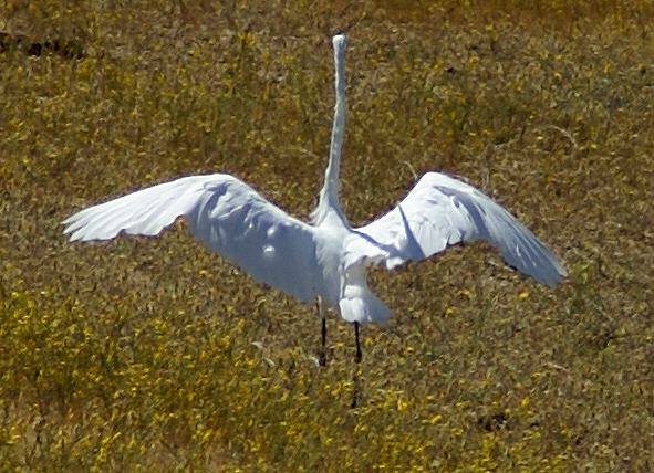
We found four caches on Sunday, plus a virtual United States flag just west of Visalia. The PQ I'd run for this trip was heavy into larger sized caches because I had a dozen travel bugs that I wanted to distribute. Micros don't work well when you're dealing with travel bugs although I did find a micro on Monday that was large enough to hold a small travel bug. One cache was a virtual near the old city courthouse in Merced, CA but in all of the other caches we found, we dropped travel bugs. My daughter even found one of the caches. Now she would be the first to admit that she's not much of a cacher. She says she likes the idea, but doesn't have enough time to go out and look for them. But she was very excited when she spotted Preferred Cache and every time we mentioned to others on this trip we went caching, she made sure it was known that SHE found that cache.
Monday morning was devoted to unpacking the van. Why is it when ever you're moving someone, that person always has the room that is farthest from the staircase and is on the third floor of the building? 11 trips later, we had the van unpacked. My work was done. So I just sat in her room and logged my caches from Sunday while she unpacked all of her boxes and made her room a home. After lunch, I went caching while she decided that she needed to hang out with some friends.
The caching on Monday was very good. I found several large ammo cans in which I deposited more travel bugs and I also nabbed two more virtual flags, getting Argentina in the back yard of a farm near Wilton, CA and the red and white banner of Canada which was virtually placed on the top of a red and white storage shed in the garden center of a nearby 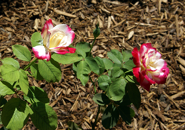
Tuesday, it was time to start my travels home. I woke up, showered, went to breakfast, then dropped by her room again, said good bye to her and went back to my hotel, packed and drove home. Although we view this house as home, it dawned on me yesterday that Pacific is her home. She was in her element there and it was really fun to see the change from last year where she really clung to us and hung back, not wanting to get too far away from either of us during parent/student orientation. T
So the trip home was sad, but I enjoyed the solitude. The caching was enjoyable Tuesday as well. I chose a different route going home because there were a couple of dash points that I wanted to get, so I took Hwy 99 for the first leg, but diverted to Hwy 41 south of Fresno, connecting eventually back up with Interstate 5 at Kettleman City. I got the two dashpoints plus some more caches along this route. It was a good day to be alone with my thoughts as I pondered what it will be like next year, when I help two kids off to college. I listened to a CD that she burned of oldies and some of her music on the ride. 
Pictures were taken at or near the following geocaches:
Fig Tree View - by Oldhippy & Granny
A Walk to Remember - by George and Mary
Wilton Memorial Rose Garden - by DiaU
Red & Green's Travel Bug Hotel - by Delawares Blue Hen Chicken
The Grangeville Zoo - by Great Scott!

