Fifty five years ago today, James Dean died. I was reminded of that by an editorial on the Op-Ed page of the Los Angeles Times today. I actually already knew about it, but the editorial nudged me a little. 
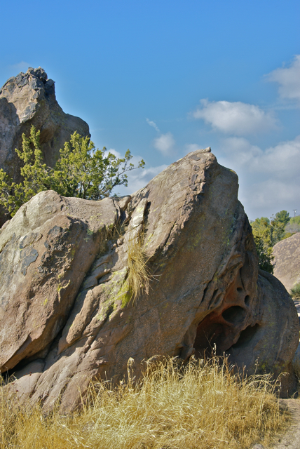
Two weeks ago, I passed near the spot where he died coming home from Santa Cruz after dropping my son off for another year at college. Hwy 46 is littered with all sorts of James Dean memorabilia. The interchange where the crash occurred is called the James Dean Memorial junction. There's a James Dean memorial and virtual cache just east of there. The highway is called the James Dean Memorial Highway.
We in America have an interesting fixation about stars who die before their time. Marylyn Monroe, Elvis, Michael Jackson and James Dean all seem to fit this bill. It's hard to know where James Dean fits into this mix. He made three films, died before two of them were released. Most people, I think will remember his role in Rebel Without a Cause, staring two other young actors, both of whom died premature deaths, Natalie Wood and Sal Mineo. If you've never seen this film, it's a good one to watch, especially if you want to learn about teenage angst of the 1950s.
Giant gives you a glimpse of Dean and how he might have looked had he survived. Giant is a big set piece set in Texas during the oil rush. Rock Hudson and Elizabeth Taylor fill out the cast of stars. Dennis Hopper also makes an appearance. However, I think Dean's best work, is in the film East of Eden. I can remember seeing this one in college, after having seen the other two several times while in high school. East of Eden hardly ever gets shown, but it's a very fine film both from an acting standpoint by Dean and others and the cinematography. 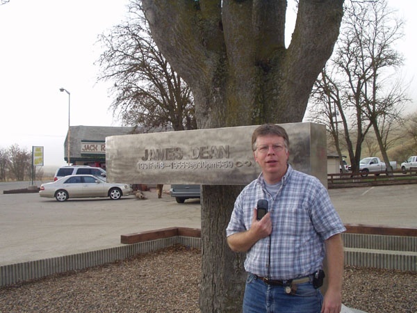
I bring all of this up mainly because as I was driving on Hwy 46, I ended up geocaching along the road. One cache took me off the main highway to an old bridge which paralleled the highway. Little used, the bridge is in a state of decay and will eventually be replaced. It's interesting to think about, but it's a bridge that James Dean probably traveled over on his ill fated last trip. Over the years, the highway has been realigned several times to make it wider and straighter and thus, safer for motorists. Much of the old road is probably gone entirely and the exact spot where the car crash took place isn't on the highway anymore.
I'm actually surprised that some preservation society hasn't come along and decided that this little piece of history deserves to be preserved. It's probable that this might happen in the future, when the wrecking ball comes into play, but it's also just as likely that this old bridge will slowly drift into obscurity. Or then again, maybe this is just an old side road with no link to what happened so long ago.
Pictures were taken at the following geocaches:
This Old Bridge - by Scooterman
James Dean - by TahoeTeach
Thursday, September 30, 2010
James Dean passed this way?

Friday, July 23, 2010
Hot Rock
One of the things about camping at higher elevations is the differences in weather that we're normally used to experience at our regular altitude. 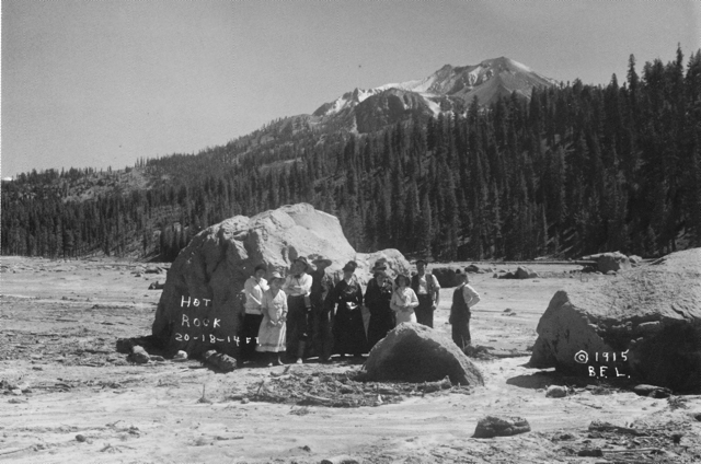
I could postpone our trip, but I'm not sure if that was going to accomplish anything, so I decided to keep out timetable and leave when we had planned to leave. If there was snow, that would just add to the adventure. Besides, we had planned to meet Chaosmanor up at the GPS Maze exhibit on the 5th of July. If I postponed our trip, that visit wouldn't happen. It was something to consider, but for the most part, I didn't seriously think too long about postponing the trip. The snow could be fun.
The day we got to Lassen, we headed down the park road, which was cleared for about 10 miles into the park. The drive took us to several locations, one of which is interesting from the standpoint that we could get a feel for what Mt. St. Helens might look like in 70 years or so. Mt. Lassen erupted almost 100 years ago and today, it is a living laboratory. It's about 70 years ahead of Mt. St. Helens, which is a similar type of volcano, being in the same Cascade range.
Along the road, we stopped at the Hot Rock, a very large boulder that had been ejected from Mt. Lassen and come to rest approximately 5 miles away from where it had started in the mountain. I scanned a postcard that I purchased at the visitors center showing the rock only days after it had been ejected from the mountain. 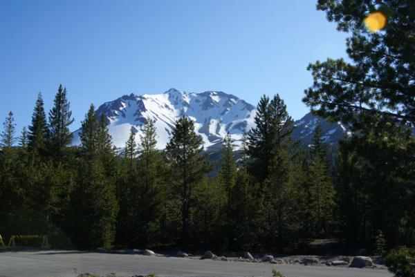
There is another area just down the road from the Hot Rock known as the Devastated Area. It has a similar view to the Hot Rock postcard picture. In the postcard, the ridge of trees to the right were spared, because of the local topography. The heat, volcanic winds and mud and landslides from that major eruption swept around or over the ridge sparing many of those trees. However, the other area to the left is clearly barren of any kind of plant life. That is what was called the Devastated Area. Compare that with the picture I took at the Devastated Area. Nature has a way of reclaiming its own eventually. This is a glimpse of what Mt. St. Helens could look like in the future.
Pictures were taken near the geocache:
Loomis - by 2dogs and mtnsteve

Friday, July 9, 2010
Owens Valley
The Tadpole and I just got back on Wednesday from one of our more satisfying camping trips in a couple of years. Camping trips in general seem to be fraught with could'ves and should'ves. This one didn't have that feel at all, with a couple of minor exceptions. We did what we wanted to do and only once, really got caught up in the, "No, we can't do that cache because we have to be somewhere else" mode.
That is a good thing in my opinion. 
As we drove north we kept a look out for interesting things to see. I wanted to make sure my son got to see Mt. Whitney. We talked about the John Muir Trail that stretches from Whitney's peak to Yosemite Valley. We ended up walking along part of the trail while in Devils Postpile later in the day.
Once you get into the Owens Valley part of California, the scenery pretty much speaks for itself. Owens Valley is on the eastern side of the Sierra Nevada and sits around 4000 feet of elevation. Directly to the west sit the Sierra Nevada, towering over the valley. At points there is a quick elevation gain of nearly 10,000 feet between the valley and the mountains.
The mountains, created by a fault block were uplifted and create a major rain shadow. Owens Valley is in the rain shadow and doesn't get much rainfall over the course of a given year, because the mountains trap the moisture from the clouds as they rise to go over them. This year was a particularly wet winter and there was a lot of snow in the high mountain passes and peaks. So much so that it would affect our camping trip down the road.
One spot we chose to stop was at Manzanar National Historic Site. Manzanar was one of several relocation centers for Japanese Americans during World War II. Many Japanese Americans were rounded up during the early stages of the war and sent to live in these relocations centers for, as the government put it at the time, "the safety of the Japanese people." Ironic that the guard towers posted at these relocation centers had their guns pointed inward as opposed to outward to protect from an external threat to the Japanese American people living there.
After touring the newly created visitors center at the old gymnasium, we were back on the road again, heading toward Devils Tower. We stopped for one more cache north of Manzanar and reveled in the beauty of the cache location. The disparity between the two locations was striking. 
Sixty miles to the north, the beauty of the place overwhelmed us, much like the starkness of Manzanar tried to do earlier. This time, we let it.
Pictures were taken at or near the following geocaches:
Manzanar Virtual Cache - by GoodDogSD
Cache with a View - by Rallye

Sunday, May 2, 2010
Thanks Dave
In the spring of 2000, President Clinton signed an executive order allowing for the removal of selective availability of GPS satellites. The implications of this meant that hand held GPS receivers would be more accurate and navigation systems would start to become standard features in many cars. 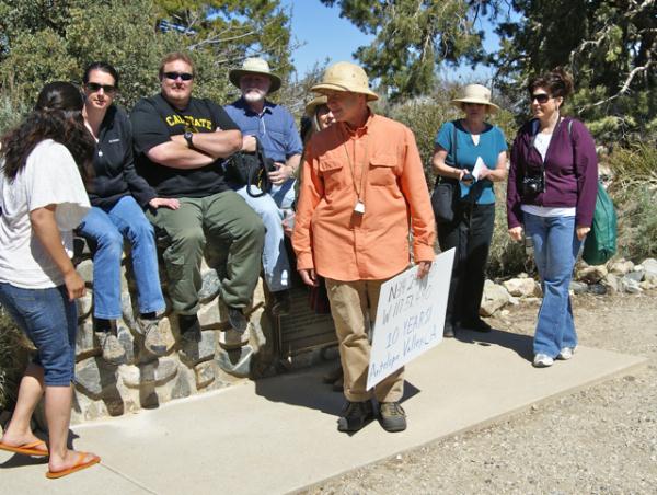
On May 3, 2000 Dave Ulmer hid a black painted container in the state of Oregon and challenged an on-line community at sci.geo.satellite-nav to go and find it. The first geocache was born, although at the time it was called the First GPS Stash. Within days, that first stash had been found. Contained within that five gallon bucket were a Delorme Topo USA and 2 CD Roms, a cassette recorder, a "George of the Jungle" VHS tape, a Ross Perot book, 4 $1 bills, a slingshot handle, and a can of beans. The original cache is no longer there, but the spot can still be visited where there is a plaque placed commemorating the original stash. The can of beans, heavily rusted but preserved, is now a travel bug.
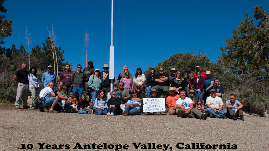
This weekend, I traveled to the Devils Punchbowl to celebrate ten years of geocaching. Events were held all over the world, but I found myself in a void, with the nearest event more than 30 miles away driving distance. I decided to attend the event in the Antelope Valley mainly because it's a very scenic spot, plus there were going to be opportunities for some hiking after the event. After all, when I started geocaching back in 2001, that's what it was all about. The requirements for a 10 year event, as posted by Geocaching.com were that the event needed to have a picture posted showing at least 10 people at the event plus a sign indicating the coordinates of the event in the picture. Our event picture is here.
This was my 9th event in just over 9 years since starting this silly game. I don't know why I don't attend many events. I could probably go to at least one event a month if I so choose, I just don't and there's not really a reason why I don't. This event, hosted by Kit Fox, was a lot of fun. I met one of the hiders of the Groundspeak Series and Smiley Series, Bigdaddygrc. I had a very pleasant conversation with him about geocaching and other things. I also spent a good deal of time with a fairly new cacher, HD-MsTree. I got to meet mcattk again, after bumping into him out at the Groundspeak Series a couple of months ago. Time was also spent with Yosemite John and Debbie and Tevis Clan. Several of us got a great review of Tevis Clan's new Lowrance GPSr. 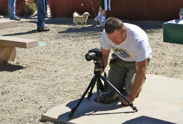
While on the hike we ended up bumping into several other cachers that had been at the event. W_bovine was walking down the trail from a multi-cache as we were heading up to it. That's w_bovine holding the sign in the picture. We had a pleasant conversation and I encouraged him to head over to my neck of the woods if he wanted to do some more hiking and caching. There aren't many hikers in my area, so my caches don't get found very often, so any new finders is a bonus in my mind. He said he would check it out. While on the hike, Chaosmanor and I discussed the different rock strata of the rocks in the Punchbowl, while figuring out the requirements of an earthcache along the trail. We also watched rock climbers playing their game. I'd tried that once when I was in college and made the mistake of looking down about halfway up a pitch. Never again. But then again, I would suspect that those rock climbers might think the game we were playing a little too mundane for them. To each his own.
At the end of the day, I counted my finds. Including the event, I found 8 - an event, a multi-cache, a mystery cache, two earthcaches and three traditional caches. It was a very modest day numbers-wise, but a very good geocaching day. It's not about the numbers of caches you find, but about the experiences you have as you play the game. I think I played the game well yesterday. Thanks Dave.
Pictures were taken at or near the following geocaches:
10 Years! Antelope Valley, California - by Kit Fox
Devil's Punchbowl - by Yosemite John and Debbie

Sunday, March 28, 2010
Old School
Yesterday, Chaosmanor and I found an "Old School" cache. We found a rather longish trail that started in Topanga Canyon near Malibu. In the link, our caching trip started with the cache right near Topanga Canyon Blvd., went east, then south paralleling Topanga Canyon Blvd. 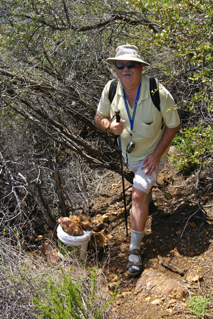
We found a variety of different sized caches from hidden bison tube micros to full scale ammo cans. The variety of the caches is what makes any kind of trail like this very interesting, although this one didn't need many caches to keep it interesting. Hiking along the ridge above Topanga Canyon afforded us with views of Los Angeles, as well as Santa Monica and the Pacific Ocean. It was a good hike.
Now, get out your flux capacitor, get it up to 88 miles per hour and go back in time to December 2001. At that time, there was one cache along that entire trail. But that's the way it was back then. You hiked in, usually several miles in the process, you found one cache, and then you hiked back out.
My very first cache find was a large 5 gallon bucket painted black. Most of the cache containers were like that. They usually contained log books, real log books with large pages where one could write down what they had experienced during the hike. Usually, the view was decent to good and you sat, perhaps ate your sack lunch and contemplated the day. Geocaching was like that.
As Chaosmanor and I walked along, we realized that we had an older cache situated along the trail. In fact, he'd tried to get it four years ago, but had missed an important side trail and wasn't able to find it at that time. Coming at it from the north, we had a do or die decision to make. There was a trail leading up to the ridge where we knew the cache to be. Should we take it, or continue on and try to find a back door to this cache?
We chose the back door route and as we walked along the fire road, we realized we might have made a mistake as we kept getting closer and closer. My GPSr, at one point, read only 235 feet away. However, there was probably 75 to 100 feet of vertical elevation to deal with as well. As we started to go away from the cache, we looked ahead and realized the fire road went around a bend up ahead and it was there that we found the access trail that led up to The Pit Stop.
The trail walked along a ridge with plenty of vertical drop off on both sides. 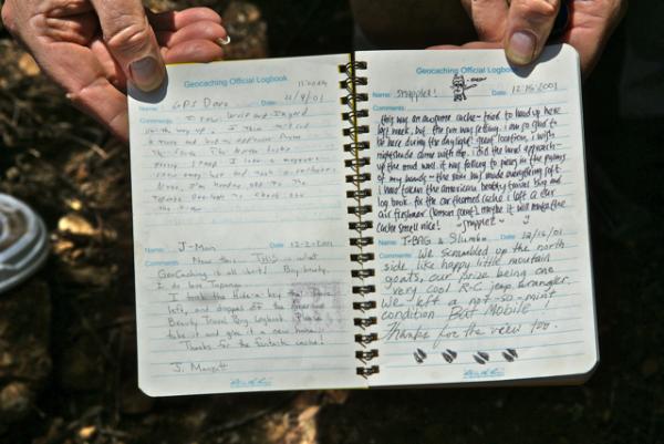
I went one way and Chaosmanor went the other and he ended up finding the cache first. Being in that remote of an area, it didn't really need any camouflage and as you can see from the pictures, it didn't. The log book didn't disappoint either. Full pages, complete with full descriptions of experiences in the beginning, diminishing down to single line entries in the later years, or perhaps just signatures.
We spotted some old time cachers from the Southern California area, names that everyone knew because there were so few of us back then that we would literally follow each other to new caches every weekend. I recognized names, such as gpsdave, sr.hikers, erik, and PezCachers. Of those four, only PezCachers do I predate as far as geocaching longevity. Erik has been geocaching since October 2000, sr.hikers since February 2001. Gpsdave signed up two days before me in March 2001. All appear to be still active in geocaching, based upon activity on their profiles.
Chaosmanor and I spent much more time here than we did at some of the other caches we found on Saturday. 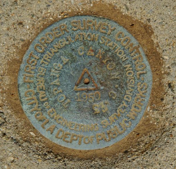
There was no doubt that this cache would make my top 5% list. I also decided to use this one as my qualifying cache for the LA County Quadrangle Challenge cache. I only need 10 more quadrangles to qualify for that cache. I suspect that I will be doing some more hiking, particularly in the fall when it cools down, to get some of the rest of those quadrangles. Most of the ones I have left are fairly remote and will require some hiking to get.
At the end of the day, both of us were extremely tired. Looking at a trail map, it looks like we walked about 6 miles. I would suspect that it was over 7, because many of the caches were not placed directly on the trail. Many you had to hike off the trail quite a ways to get to the cache. The Pit Stop was an extra .15 mile each way off of the main trail. That doesn't seem like much, but add a quarter mile to half a dozen caches and you have an extra mile and a half. That's OK. We were doing some Old School caching yesterday.
Pictures were taken at or near the following geocache:
The Pit Stop - by DahMooser and MsPea

Tuesday, March 9, 2010
Carry a big stick or a big stick carries.....
This past Saturday, two of the teachers I work with and I took 13 middle school kids to a Science Olympiad. Over the course of the day, the kids, in groups of twos and threes, competed in various science competitions. 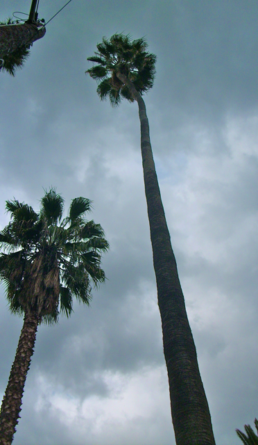
During part of the day, I also introduced about 11 of the kids to geocaching. The high school where the competition took place is Riverside Poly High. Those of you who are basketball fans, might recognize the high school as the one where professionals Reggie and Cheryl Miller played their high school basketball in the early 80s. I wasn't aware of this until the evening awards ceremony was held in the gym, which is like a shrine to the two of them.
The high school is located off the 91 freeway and Victoria Avenue runs the length of the high school on its western side. Victoria Avenue has been around as a graded road for almost 120 years, which in California years is ancient history. There is a large middle median section in the road, with a dirt trail on it and lines of trees, most notably palm trees, especially at its northern end, just north of the school.
It was this northern end of the road that one student and I head to right after lunch. He was one of the kids that didn't have a competition at this time and there were two geocaches, one about a third of a mile north of the school and the other about a third of a mile south of the school. I figured in the time I had between the competition and the actual awards ceremony, we couldn't get all of the kids to both of them, so I went for the northerly one with only one student.
The cache was a small micro cache, one of those mini, log only, type of caches no bigger than your finger. It was hidden on the side of a palm tree. When we got over to the cache, we started looking around it and I spotted the cache pretty quickly, but decided to let my student also find it. The startled look he gave was one of, "Oh my, is that really it?" The cache itself wasn't really notable, but what made the site interesting was the history surrounding the site.
The palm tree had been planted in 1903, making it at least 107 years old, because the plaque at the base of the tree didn't indicate that it had been planted as a seed. I was unaware that palm trees were that long lived. What was also notable was the palm tree had been planted by our 26th President, Theodore Roosevelt. This was probably on the same trip where he had visited the Grand Canyon and Yosemite National Parks. 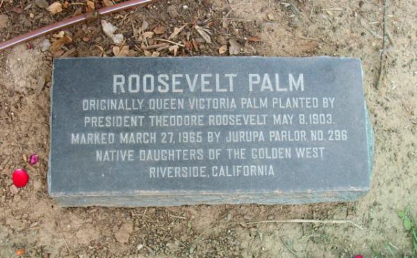
A couple of hours later, I took 11 of the students south of the school in search of the other geocache hidden nearby. I knew this one would be an easier find and would provide a good introduction to the hobby. As we followed the GPSr toward ground zero, I got to explain geocaching to one of the parents who went on our walk plus several of the kids who happened to be close by. Once we got to within 50 feet, I showed everyone where the geocache would probably be and explained our ethics that if one of us should find it, then he or she would just walk away and stand in the middle of the trail, so that others would have the chance.
It worked well, all the way until the end. Several of the kids got a kick out of the last kid, who appeared to be staring right at the cache, yet didn't see it hanging on a branch or stick right at head level until he stepped back about a foot. 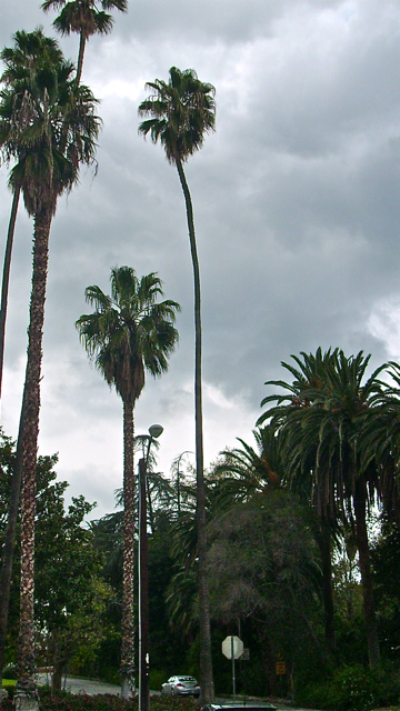
We took the cache out in the open so that all could see the contents, none of which interested anyone which didn't surprise me, but I was able to explain again the ethics of leaving more than you take. They all seemed to get that part. The cache was a small decon container, so I was able to drop a geocoin and a travel bug that I got on our trip to Stockton and Santa Cruz last month, so that worked out well too.
Several of the kids expressed an interest in doing this again, so I'll probably have the GPSr loaded with caches surrounding where we'll be competing come the beginning of next month.
Pictures were taken at the geocache:
Rushmore's Hand - by wife&mom

Wednesday, March 3, 2010
Salinas
One of the fun aspects of geocaching is when you get to explore a new area and learn something from that area. When I went to college, a friend of mine was from Salinas. I didn't really think much of this except when I would come home along the 101 and drive by Salinas and think, "Oh, that's where so and so lives." 
Stopping? Heck, we'd stop once for lunch, and a couple of times for gas and that was about it. Today, I don't have the stamina for that kind of driving and although I probably stop less for gas, I do stop more occasionally to smell the roses, enjoy the air and to just plain stretch. That's where geocaching come in. It clears my head on those long drives.
Now that I have a reason to drive up the 101 again, Salinas comes into view every time we drive to or from Santa Cruz. There's also a couple of interesting spots in town that deserved our scrutiny and we stopped this last time to check out some of the architecture and history of Salinas, CA.
Salinas is at the juncture where we leave the 101 to cut over to the coast if we're heading up to Santa Cruz. On our way back, it's obviously, just the opposite. We were heading south, toward home and driving through the edge of Salinas when I noticed a couple of caches just west of our intended route pop up on my GPS's screen. I knew there were a couple of virtual caches near here and was delighted to see that both of them were right here.
This particular virtual had us examining some historic homes along a two block stretch of road in the old town part of Salinas. The second house was the one that I particularly enjoyed the most because it was the birthplace of John Steinbeck, author of The Grapes of Wrath and The Red Pony, plus many other stories. I can remember reading The Red Pony in junior high and I believe I ended up reading The Grapes of Wrath in either high school or college, but my memory is a little shaky on that second point.
Unfortunately, the house which is open for tours was closed that early in the morning when we were there, so we couldn't tour the inside of the house, but that will give us another excuse to come back through and stop. 
Salinas is obviously very proud of Steinbeck's roots as they have the John Steinbeck Library in town and the National Steinbeck Center which houses the largest collection of John Steinbeck archives in the world. They should be proud. Not many cities can be claimed as the hometown of a Pulitzer Prize winner and a Nobel Prize winner. The other virtual in town we ended up deciding to save for another day. I'm sure we'll get a similar set of stories from those historic building as well. Perhaps we'll have more time to explore the Steinbeck Center as well.
Pictures were taken at or near the following geocache:
Historic Homes - by The Plunketts

Saturday, February 27, 2010
The King's Highway
Growing up in Orange County, California, I was constantly reminded about local history during school, plus my parents took us to many historical locations around where we lived so that we knew about the local history of both Orange County and of California. Local history, no matter where you happen to be can be quite fascinating. When we went on camping trips in summer to other states, my dad would always make sure that if we were near a state capital building, that we'd get a picture taken near it, or try to arrange a tour of the building.
I've eaten a picnic lunch on the grounds of the state capital building in Cheyenne, Wyoming. 
Part of the history of California is El Camino Real, the King's Highway, which stretches from San Diego to Sonoma where the Bear Flag Revolt happened, that started California on its way to independence from Mexico and eventual statehood in 1850. El Camino Real was a road developed over time to link up the missions established by Father Junipero Serra. Fr. Serra helped establish 21 missions in the late 1700s and early 1800s along the coast of California and there became a need to link them together for transportation and economic purposes. Thus became, El Camino Real.
The actual road today is, for the most part, gone, but there are bell markers along the side of Hwy 101 for most of its length between Sonoma and San Diego indicating where the original road had been. Other highways are also incorporated into the King's Highway, but the 101 is the main artery north and south of the central coast of California where most of the missions were constructed. As we were driving down the 101 from our trip north a couple of weeks ago, I noticed several of the bell markers. There is a Waymarking category for the bells and since I'm going to be using the 101 on a frequent basis over the next several years because of my son's choice of schools, it makes sense to put this one on my waymarking list of things to watch out for in the future.
As is our custom, we found several geocaches on the way down from Santa Cruz, including two at Mission Nuestra Señora de la Soledad, which was established in 1791, the 11th of the 21 missions to be so created. 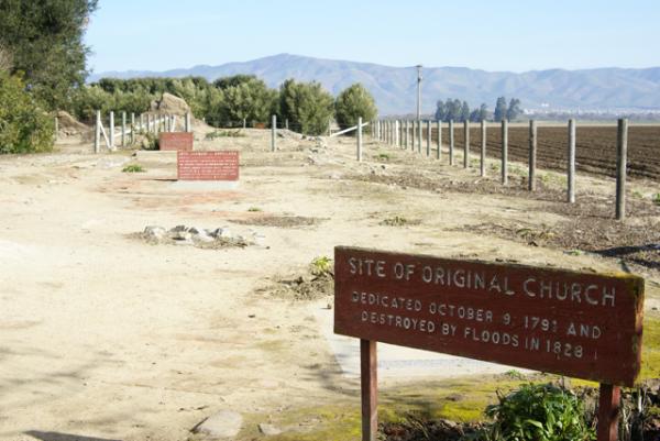
There also appeared to be some archeological digs going on behind several of the main buildings at the mission and it's probably a work in process. The mission is 2 miles away from Highway 101, and probably doesn't get many visitors, which probably means that funding for projects are not nearly as plentiful as they would be in Orange County where San Juan Capistrano is located.
We toured the two buildings, which included the church and chapel of the mission, looking at the exhibits first before heading out to get the information needed for the virtual cache there or finding the regular cache hidden by the entrance to the grounds. It was a nice quiet spot to get out and stretch our legs and learn a little bit more about California. I have now visited 6 of the 21 missions, with Soledad being the farthest north. I'm sure there will be more opportunities in the next couple of years to visit other missions along the King's Highway.
Pictures were taken at or near the following geocaches:
Mission Possible - by needlepointone and zieber
Mission: Soledad - by Great Scott!

Sunday, January 10, 2010
The Gorn and other spots
The second time 3blackcats and I went out to Vasquez Rocks Park, we hit much of the other side of the park. After completing the southwestern part of the park, we only have about 3 or four more caches inside the park that haven't been found.
The area around Vasquez Rocks was used as the outdoor setting for the fight sequences of the episode. Looking at some of the images on the web, it appears as if the principle filming was done near the main parking lot, about a mile away from where the cache was placed. I hadn't realized that the filming for this particular episode had happened here, but it does make sense that film companies would come out here to film outdoor episodes such as that one.
The area is probably not as quiet as it once was, due to the heavier traffic flow on the nearby freeway. But it still has a desolate look about it. I could picture R2D2 moving down a slope heading toward electrical short out by the Jawas in a scene that was actually filmed in Tunisia. I would be willing to bet that the freeway noise probably keeps many companies away today, although I'm sure there's enough filtering technology out there today, that it might not be as much of a problem as it might have been twenty years ago.
Living in Southern California like I do, it affords me plenty of opportunities to see spots that have been used in movies and television. I've visited the spot where the Lone Ranger used to rear up on his horse at the beginning or the end of this television show. The area where this famous rock formation is, now has condominiums surrounding it. You can still get a feel for what it was like back fifty years or so, but still, civilization has encroached around it.
Even in Central California, there are glimpses of other shows. Several times, I've visited the Monterey Bay Aquarium. This aquarium was used for several outside shots from Star Trek - the Voyage Home. 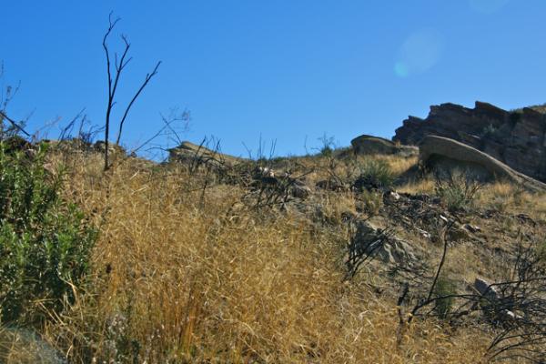
The LA Times posts areas where filming occurs on a regular basis. It's pretty common place here, so seeing a spot that's been featured in a film, or series or even a commercial can happen on a regular basis. In other areas, it's not as common, although my daughter has experienced it in Austria when she was there a couple of years ago. There is even a "Sound of Music" tour where tourists can visit spots in and around Salzburg, Austria where the movie was filmed. My daughter, although not part of any of those tours did enjoy spending time at the fountain where the Van Trapp family sang Do Re Mi.
Next time you're out caching and the area gives you that Déjà vu feeling, maybe it's because you really have seen it somewhere else.
Pictures were taken at or near the following geocaches:
Vasquez Rocks Earthcache - by supertbone
The Gorn's Lair - by EMC of Northridge, CA

Friday, November 6, 2009
Cache Partners
I haven't been caching as much lately. Work has kept me busy, and with the Tadpole now in high school and running cross country there have been fewer opportunities to go out on a regular basis. 
Tomorrow, the Tadpole and I will be doing some local caching. It's the first time he and I have been out caching together since summer vacation I think. It will be nice to get out and enjoy the outdoors a little with one of my caching partners.
My first caching partner was my other son. When we first discovered caching, he was 10 years old. He's now away at UC Santa Cruz enjoying his first year of college. I have to assume he's enjoying it, since we've not heard much from him. 
When we started geocaching, back in 2001, caches were hidden along trails away from civilization. Hikes of 2 miles or more for one cache were common at the time. I believe that's what appealed to him. When we'd go camping, he was always the first one who suggested going on a hike somewhere. Geocaching was a way to get us out on the trail around here. We hiked in Chino Hills State Park and up into a canyon behind Jet Propulsion Laboratory (JPL) in Pasadena. We climbed to the top of a smallish hill in San Dimas to find a cache as well as in Schabarum Regional Park to the southwest of our house.
He enjoyed trading things at the caches. Squirt guns, slime, whoopie cushions and anything else that you can imagine a boy would like, 
Somewhere down the road, however, he grew up and put away those childish things. His last camping trip was after his 7th grade year. At the end of his 8th grade year, he decided that he wanted to go out for the cross country team in high school. They practiced all summer and although the coach made allowances for family vacations, my son didn't want to miss any practice. Running became his focus and so camping and geocaching were pushed to the wayside.
In fact, his thoughts on geocaching are, "that dorky thing that Dad does." Perhaps in the the future, he'll change his mind about camping and caching. Perhaps not, but I'll leave the door open anyway. My daughter has expressed and interest in going camping with us again, so it's always possible he will too. That would be nice. This particular blog entry is dedicated to my middle son.
Pictures were taken at the following geocaches:
Old Mossy Cache - by OtisPug
THE LOST AMADEUS - by Lizard
ONT Travel Bug Ground Central - by Crims0ngh0st & AcjLady

Sunday, July 5, 2009
How in the heck....?
Every now and then when I'm geocaching, I stumble across something that just asks that questions, how in the heck did that get out there? You stand 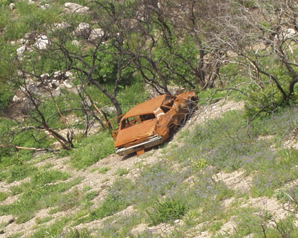
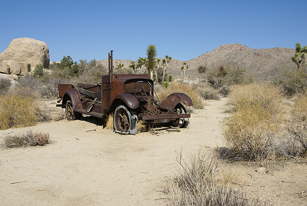 old prospector died. It's still junk, but because it's inside a national park now, it's "historic" junk and thus it stays rusting away. It tells an interesting story about the early history of the area in and around Joshua Tree. Old prospectors and homesteaders laid claims to lands everywhere in the west and some of their claims get documented in areas like this.
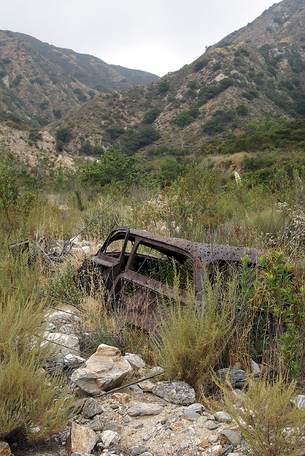 within the stream bed and had a difficult time getting up to the cache. How in the heck did that car get up there? At least it was serving some purpose up there, being a nice target, out of the way for gun toting individuals who needed some practice. We really couldn't tell, but it actually looked like a classic woody station wagon from the 1940s, one of those vintage cars that many of us drool over if we see them in museums or on the road. This one had definitely seen better days.
The hiders of these caches obviously knew about these abandoned automobiles. Names like Shades, Long Term Parking, and Dead Man's Truck, as well as Who Waxed Mr. Ed? give clues to where the cache might be, or what might be near the cache site. You still have to wonder sometimes how those things got out there.
Pictures were taken at or near the following geocaches:
Double Barrel Super-Soaker - by ohgr
Dead Man's Truck - by Land Snoopers [GC Charter Member]
Shades - by SHot70

Wednesday, July 1, 2009
More History
Today the Tadpole and I decided to visit the Nixon Library. One of the draws was the "World's Largest 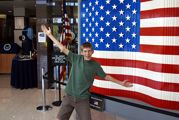
We paid the admission price, spoke with a docent for a little bit to plan our day and then we were off to explore. Being early on a weekday, the place wasn't crowded at all so we decided to visit the President and Mrs. Nixon's graves first. I decided to take a couple of pictures, being fairly certain that Mrs. Nixon's grave hadn't been waymarked in the Grave of a Famous Person waymark category. I'm still waiting for approval on that particular waymark.
After paying our respects, we then headed over to his home where he was born and toured that and then it was off to walk through Marine One, the helicopter that 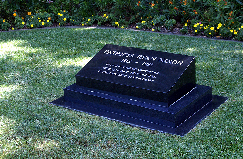
Then it was time to tour the museum. The museum has most of the factual parts of Nixon's life down and there are some interesting displays throughout. My favorite part is the hall of world leaders. In this room, there are life sized models of the world's leaders from Nixon's time as Vice President and President. This was the third time I'd been to the Library. The first time was a month after Nixon had died and the crowds were huge, so they had the area roped off, so you could only view them from afar.
Two years ago, my daughter and I revisited the library and that time we got to walk among the leaders. 
The first thing that stands out is how short Nikita Khrushchev was. He was one of the most powerful men in the world and yet stood only 5 foot 4 inches tall, proving that size doesn't really matter. As you can see in the picture, he's several inches shorter than the Tadpole who stands 5 foot 7 inches tall. The next thing that stands out was how massive Charles DeGaulle was. Once again, compare his statue with the Tadpole standing right next to him. I estimate DeGaulle to be almost a foot taller than my son. DeGaulle was truly bigger than life.
Leaving this exhibit, we entered another exhibit that had several international exhibits including a segment of the Berlin 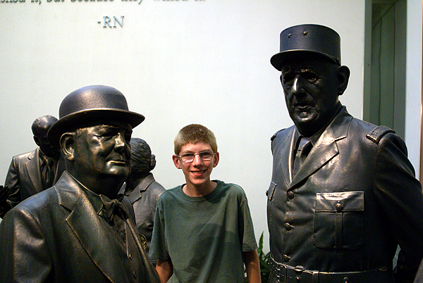
So today, I saw a second segment of the Berlin Wall, just about 10 days after seeing one at the Reagan Library. I knew for a fact that this segment at the Nixon Library hadn't been waymarked, so I took a picture. I'm not sure the picture is the best since I had to hand hold the camera as the library doesn't allow flash photography inside the building. But I now own two waymarks concerning the Berlin Wall, the Reagan segment which I waymarked last month and now the Nixon segment which was approved today in the Preserved Architectural Remnants and Ruins category.
At the moment, we have 12 Presidential libraries, one for every President from Hoover through Clinton. 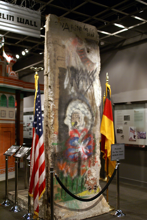
Before the National Archives took over the Nixon Library in 2007, there wasn't a lot of information on Watergate in the Nixon library. They'd started changing this when I was there two years ago with my daughter, but they still have a lot to do before it's complete. One piece of paper in this part of museum was very striking in its simplicity and that was Nixon's resignation letter to the Secretary of State, Henry Kissinger. It simply stated, " I hereby resign the office of President of the United States." Dated August 9th, 1974, it was received and initialed by the Secretary of State at 11:35 AM. Interesting how simple the transfer of power can happen in our country.
Pictures were taken at or near the following waymarks:
Berlin Wall Segment - Richard Nixon Presidential Library

Wednesday, February 6, 2008
Lost and now found
Whenever I find new sites that I like, I always register as Webfoot. People usually ask me why and I tell them a story about this project I created over 10 years ago called Operation Webfoot. The link is to a shell of what the site was originally, but it tells some of the story.  The rest is here.
Operation Webfoot originated as an idea to help my 8th grade U.S. History students learn about geography and history in a unique way. I used stuffed animals which traveled around the United States, Australia, Belgium, Canada, Germany, Guam and Israel. Host families would take the stuffed animals to their local areas and report back to my school in Southern California. Students would use this information to publish a geographic travelogue for our stuffed "fuzzies."
Operation Webfoot started out from an idea I got from the National Geographic magazine. There was an article about a stuffed bear that had traveled all over the world just by being passed on by airline travelers. With this in mind, I found three stuffed animals to send on the airlines in the fall of 1995. We hoped that if people would send postcards to us, we would be able to track the animals as they traveled around the world.  The biggest concern my students had was if we would get the animals back at the end of the year. The answer to that was no, but they thought it was cool they might have the possibility to meet up with one of our travelers on a trip of their own someday.
We decided to send the animals first with someone we knew, so we found parents who were going on business trips and the three animals took off. One went to Santa Cruz, California and was never heard from again. The second one went to Malaysia and then to India and we received postcards from Malaysia but we also never heard from that one either. The last animal racked up some serious frequent flyer mileage. He went to Boston, Massachusetts and back and then went to Las Vegas, Nevada and back. His third trip took him to Texas and then to Florida, North Carolina, Cleveland, Ohio and Newark, New Jersey. The school even got a telephone call from the airplane from a flight attendant while en route to Newark saying they had the animal and the most likely destination would be Denver, Colorado. After that we lost contact and the animal was never heard from again.
During the spring of that year, I heard about a similar project being done by the kindergarten teachers at Valle Vista School which is part of our school district. They were mailing the animals and tracking them via email. I took this one step farther and decided to create a webpage to track the animals. Our original webfeet were Huey, Louie and Dewey Duck (hence the name, Operation Webfoot).
Huey and Louie were mailed to Maryland and Canada while Dewey was picked up in person by a host family from Utah. All of the host families I contacted through parent bulletin boards on the Internet. The only requ irement was they have email so we could be in contact with them at any time.
In October, we added Donald after a student got in contact with the White House about hosting an animal. After his stay in the White House, Donald became our international traveler. In November, Huey became lost for the first of many times and we decided to get a couple more webfeet so Michigan J. Frog and Kermit joined the troupe. The host families sent us a lot of great information and pictures. These pictures are just some of many that were sent to us either via snail mail or by email.
Near the end of the year Huey became lost in the mail permanently. It was a major disappointment not to be able to see all of the information and souvenirs he had accumulated over the course of the year but with email, we were still able to learn quite a bit about the areas of the country to which he had traveled. The picture at the top right shows Huey, with then Governor of South Carolina, David Beasley.
Kermit came back the week before school let out and the Monday of the last week of school, Michigan J. arrived. No other ducks made it home before school was let out for summer vacation. Donald arrived home on June 28 and was returned to the student who con tacted the White House in the fall. Louie and Dewey never returned home to the disappointment of us all.
These setbacks did not stop us from continuing the project the following year. Michigan J. and Kermit were veterans at this and were ready to go again. The problem was to find another couple of stuffed animals to round out our collection of webfeet for the 97/98 school year. At the end of the school year, one of my students gave me another animal to add to my collection: a Miss Piggy. Even though she wasn't a "webfoot," we let her represent the project anyway. We decided to branch out and add other fuzzy creatures since Miss Piggy had already set a precedent by being a "non-webfoot." We added Gumby, Peggy Platypus, and later, Tweety Bird, who started his travels by flying to Belgium. Unfortunately, several problems happened again. Michigan J. Frog disappeared in Dallas, Texas but was replaced by a similar Michigan J. Frog given to me by a generous student. Gumby was lost in the mail and Tweety Bird disappeared in Mississippi. But the rest of the animals continued their journey and returned safely at the end of that school year. I worked with this project one more year, but because I wasn’t teaching history anymore, it was decided that the project would be shut down and the animals returned via mail to us at school.
Now comes the really interesting part. On Tuesday of this week, I walked into the faculty room at my school. It was a standard Tuesday, but I had a package, that was lumpy, in fact, it was lumpy and sort of felt like a stuffed animal. I was thinking to myself, "self, what company in Texas (that's where the postmark said it was from, as well as the return address) is sending me some sort of promotional stuffed animal?"
So I opened it up. It was a frog. The Warner Brothers cartoon Michigan J. Frog. But it was not just any frog. It was one of my original stuffed animals when I was doing Operation Webfoot over 10 years ago!!! Unfreakinbelievable.
Also inside were his National Park passport, which I purchased in 1997, and his journal. The first journal entry was written in a very nice script and signed by an email friend of mine and her husband. They took him and several others to Alaska on a cruise in August 1997. They then sent it to Lynn in Sacramento. Lynn was a freelance writer who took them to the California State Fair that year and then wrote an article about them in the Sacramento Bee and the Army Times. My email friends are quoted in the Army Times article.
Then, Michigan J. Frog went to Georgia - there's a stamp in his passport from Kennesaw National Historic Park. He then went to Maple Shade, New Jersey. The last journal entry is dated September 24th, 1997. As noted above, I remember him disappearing in Dallas, TX and that we replaced him with another Michigan J. Frog.  This week, the original Michigan J. returned. This was a complete shock. There was no note, nothing to let us know what happened in the last ten years. At least the person left a return address, as I plan to write a thank you note to them and ask for some kind of story. As you can see from the picture, he’s now resting comfortably on my computer desk with some of the other original Operation Webfoot animals.
I told my two history classes about the project. They thought it was pretty cool, but were more interested to see the newspaper article from about 11 years ago that showed me with a mustache and beard. Supposedly, I look like Chuck Norris. As someone said, I started some of the first travel bugs, way before Groundspeak was even a company. I wonder if I could get some royalties from that? I’m now anxiously waiting and hoping that I get a response to my thank you letter, so I can fill in the 10 year gap in the history of Michigan J. Frog.

