Showing posts with label virtuals. Show all posts

Monday, December 20, 2010

Here I go, There I go, Where I go

Last month, while on a road trip to Stockton, Chaosmanor and I were fortunate to attempt a couple of Wherigo caches.  A Wherigo cache is similar to a multi-cache in that you have to find clues as you walk along a route planned out by the cache hider.  You need a Wherigo enabled GPS unit in order to complete a Wherigo cache.  The Geocaching website explains a Wherigo cache this way:
Wherigo is a toolset for creating and playing GPS-enabled adventures in the real world. By integrating a Wherigo experience, called a cartridge, with finding a cache, the geocaching hunt can be an even richer experience. Among other uses, Wherigo allows geocachers to interact with physical and virtual elements such as objects or characters while still finding a physical geocache container. A Wherigo-enabled GPS device is required to play a cartridge.
Since I don't have a Wherigo enabled GPS, I haven't been able to find one until now.  In fact, the closest Wherigo caches is 20 miles away from me.  Chaosmanor recently purchased a Garmin Oregon GPS unit and it is one of the ones that are Wherigo enabled, so when we were planning out this route, I spotted a couple of Wherigo caches in Lemoore, CA and decided to put them in our bookmarked route.

As I noted above, doing a Wherigo is similar to a multi-cache, only the clues are given to you on your GPS unit.  You load the cartridge form the Wherigo website into your GPS unit, then head out to the starting coordinates and play the cartridge.   There are several ways to play the game.

One way is to play locationless cartridges.  These cartridges can be played anywhere.  There's a tutorial at the Wherigo site that allows you to try a Wherigo out before actually doing an actual physical Wherigo cache.  When we got to Lemoore, Chaosmanor let me have his GPS and I tried the tutorial out in a little park south of the first cache we were going to attempt.  If you're familiar with GPS units, the learning curve for these isn't that tough, although it took five to ten minutes for me to get the hang of it.  Once I solved the relatively easy tutorial, we walked across the street and tried the physical Wherigo.

This second cache was a relatively easy cache to do.  It was located in a large park, with very little tree cover, giving us ample signal strength to our GPS.  We picked up the clues by answering questions, then headed to the second waypoint.  Each waypoint is located in a zone, which is the way the Wherigo cartridge works.  Once you get to the next zone (which can be a variety of sizes), you then can get your next clue.  Eventually, the clues and cartridge took us over to where the cache was actually hidden allowing us to log our find.
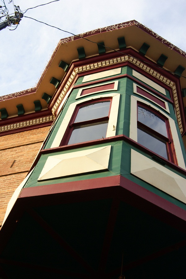
We then headed into downtown Lemoore to attempt the other Wherigo cache.  We parked near the starting point, opened the cartridge and began.  This one was a little trickier since we were walking through the old town section of town.  Tall buildings cause signal bounce, so we didn't always get as close as we could to the center of the zone in order to answer the questions which would lead us on to the next waypoint.  This could be because the zone may have been too large.  I'm not sure on this, but it's something to consider if you're going to attempt a Wherigo in a city environment.

I enjoyed the second Wherigo more than the first probably for a couple of reasons.  One, the first one was in a park, where any kind of cache could have been hidden.  There wasn't much interest generated outside of going through the steps and finding the cache.  I also was new, it being only my second attempt following the tutorial.  The downtown Wherigo, I had a little bit more experience utilizing the cartridge and the buildings in the downtown area had some local history attached to them, which made the walk more interesting in my opinion.  Your mileage may vary depending upon your own experiences.

I enjoyed walking through the downtown area.   I'd been there previously, finding a virtual cache in one of the areas we walked through on this caching experience.  Looking at some of the turn of the 20th century buildings was enjoyable to me, especially looking at some of the Victorian architecture.  It gave me an idea for a Wherigo cache in my local area, although I'm not sure how I'll be able to set it up, since I don't have a Wherigo enabled GPS at the moment.

I'll have to download the Wherigo builder onto my other computer and try it out.  Perhaps I will be able to create one, without the need of a Wherigo enabled GPS.  We'll have to see about that.

There are quite a few Wherigo caches in California.  I noticed one in Yosemite Valley near Yosemite Fall.  I found this interesting because the National Park Service doesn't allow physical caches, but when I investigated it further, I discovered that the physical part of this Wherigo is outside the park in nearby El Portal.  I've heard rumors about Geocaching possibly bringing back the virtual cache.  If this does become a reality, I can see where some very interesting Wherigo virtuals could be created, especially in a National Park environ.

The upshot of all of this was it was a new experience for me to try, using my GPS.  They probably aren't for geocachers who are numbers runners.  They take more time than the regular cache.  I would estimate the first cache we found in the park took us 15 minutes to complete and the second one in downtown took us closer to 45 minutes.  We might have been able to solve the second one more quickly but we did get sidetracked.  All in all, they were enjoyable experiences, something that I'd like to try again in the future.  I'd also like to create one.

Pictures were taken at or near the following geocache:
Lemoore's First Wherigo! - by JohnE5

Profile for Webfoot

Friday, December 17, 2010

Night caching and photography

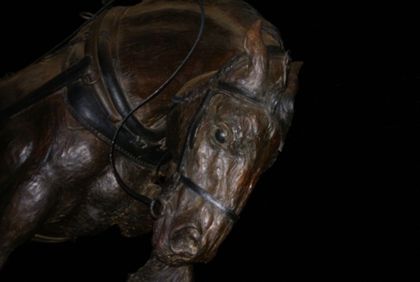
Every now and then there are surprises that show up while you're out.  Chaosmanor and I, while on our road trip last month, stumbled upon a cache at night.  Now, I don't do much night caching and we weren't really going to do any night caching on this trip, but we were on our way back to our hotel room and I spotted this cache just off the freeway, so we thought we'd attempt it.

Once we got there, we discovered this particular cache was a virtual cache.  After we got the requirements for the cache, I went back to the van to get the camera to get some shots of this statue.  Had I had my tripod, I might have been tempted to try some long exposures, but I figured some flash shots would work this time.

This leads me to another topic, that of the 365 project.  Chaosmanor showed this to me, so I thought I'd look into this as well.  I'm going to try and do a literal 365 day project, starting on January 1st, 2011 and work through the year.  I probably won't get anything really earth shattering on some days, maybe even just the top of my foot or something along that line, but I do take a lot of photos and I think I'd like to try something like this.  I keep seeing the 12 on 12 projects, taking 12 photos on the 12th, but for some reason, I always seem to forget about the day until after the fact.  Perhaps with this, since I know I'll need to take at least one photo each day, I'll persevere.  We shall see.

Picture was taken at the following geocache:
Worthy Steed - by Original owner gallahad Adopted by Pamelot 7-2007

Profile for Webfoot

Monday, August 2, 2010

Lava Beds

As noted in my last post, a straight line is not always the shortest distance between two points.  That could not be more apparent than the route we took to get from Lassen Volcanic National Park up to Lava Beds National Monument.
Although the monument is almost exactly due north from Lassen, the route to get there takes you northwest, then northeast, then northwest again.  That's just the way the roads go up there.  Finally, there's that little decision about which entrance to take, the north or the south?

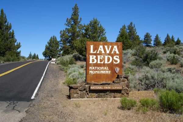
Because of the distance involved, we chose to drive straight up to Lava Beds, foregoing any caching along the way.  We figured, we wanted to optimize our time, and there was only one objective as far as caching went.  So, without caching, we drove, then came in through the southern entrance.  You can't really see much, but if you look at the entrance sign post, you can definitely tell where the county road ends and the federal road begins.  The county road was a lot worse in spots and not well maintained.

Lava Beds is a very interesting spot.  The park protects an area of former volcanic activity.  If you look at a map of the United States, you could draw a line, stretching from Lava Beds, up to Yellowstone.  That line would also pass through or be near Craters of the Moon National Monument, another area of volcanic activity.  The present theory is there is a hot spot of magma underneath Yellowstone, fueling the thermal and volcanic activity there.  This hot spot used to be underneath Craters of the Moon and then previously Lava Beds as the earthen plates moved over the magma.

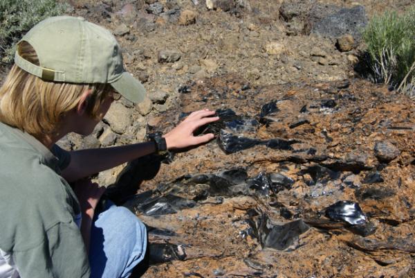
Lava Beds is an area of volcanic flows and a great amount of lava tubes, places where lava flowed, then as the lava subsided, large empty tubes, or caves were left behind.  Several of these tubes are available for exploring and we brought out flashlights along just for this occasion. The park also rents hard hats out, but we weren't going to be exploring some of the low ceiling caves, so we didn't take advantage of that.  There were large amounts of lava rock alongside the trail and we spotted one of the largest pieces of obsidian, known as volcanic glass, that I'd ever seen.

Because the area is dry, these caves are not what most people typically expect caves to be, full of fanciful formations.  They have mostly a rough interior, but there are very few formations of any kind, no stalactites, no stalagmites or flow curtains.  They are, nonetheless, impressive to see with some being over thirty feet in diameter.  We explored several, including Mushpot Cave, Skull Cave and Valentine Cave, so named because it was discovered on that ever important day.

Skull Cave, where the only virtual cache is located in the park, is particularly interesting.  Named because of skeletons found in the cave, it descends down into the earth.  There are metal staircases going down and at the bottom there can be found ice year round.  It's not one of those caves you'd want to stay in for very long, especially if you were dressed as we were, for the 90˚ weather topside.  We walked down, felt the ice on the floor of the cave and then retreated to the surface.

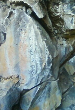
There were several caves in the park that had Native American petroglyph drawings on the cave walls.  We hiked out to this cave and viewed those.  Once again, I was struck by the toughness of life.  At the entrance to one of these caves, there was a large tree growing out of the roof of the cave.  We could not see any of the roots coming through the roof, yet the roof was probably only about 10 feet thick.  The tree was probably twenty to thirty feet tall.  Just amazing that it had been able to grow that large with such poor soil possibilities for it.

We ended up driving through the park and exiting via the northern entrance, then headed back to Lassen.  The park is located in Siskiyou County, a county that I had already found a cache, but we had yet to find a cache in Modoc County.  Once outside the park, we were in Modoc County, so it was just a matter of driving down the road and finding some caches before leaving the county to get that particular county checked off for the 58 California County Challenge Cache.

Because of the time driving to and from, we probably didn't spend as much time as we could have there.  I think if I were to do this trip over again, I would have decided to move camp and camp up at Lava Beds for a night or two, but the day trip worked well for what we wanted to do this trip.  As always, the caching and the companionship were excellent, so it was a good day.

Pictures were taken at or near the following geocaches and waymarks:
Lava Beds National Monument - by Webfoot
Skull Cache - by ChrissySkyking + Blaze

Profile for Webfoot

Wednesday, March 3, 2010

Salinas

One of the fun aspects of geocaching is when you get to explore a new area and learn something from that area.  When I went to college, a friend of mine was from Salinas.  I didn't really think much of this except when I would come home along the 101 and drive by Salinas and think, "Oh, that's where so and so lives."  I had the stamina of a college student, but then again, I was, so it was easy to make a 12 hour drive, and be as fresh as a daisy when I was done.

Stopping?  Heck, we'd stop once for lunch, and a couple of times for gas and that was about it.  Today, I don't have the stamina for that kind of driving and although I probably stop less for gas, I do stop more occasionally to smell the roses, enjoy the air and to just plain stretch.  That's where geocaching come in.  It clears my head on those long drives.

Now that I have a reason to drive up the 101 again, Salinas comes into view every time we drive to or from Santa Cruz.  There's also a couple of interesting spots in town that deserved our scrutiny and we stopped this last time to check out some of the architecture and history of Salinas, CA.

Salinas is at the juncture where we leave the 101 to cut over to the coast if we're heading up to Santa Cruz.  On our way back, it's obviously, just the opposite.  We were heading south, toward home and driving through the edge of Salinas when I noticed a couple of caches just west of our intended route pop up on my GPS's screen.  I knew there were a couple of virtual caches near here and was delighted to see that both of them were right here.

This particular virtual had us examining some historic homes along a two block stretch of road in the old town part of Salinas.  The second house was the one that I particularly enjoyed the most because it was the birthplace of John Steinbeck, author of The Grapes of Wrath and The Red Pony, plus many other stories.  I can remember reading The Red Pony in junior high and I believe I ended up reading The Grapes of Wrath in either high school or college, but my memory is a little shaky on that second point.

Unfortunately, the house which is open for tours was closed that early in the morning when we were there, so we couldn't tour the inside of the house, but that will give us another excuse to come back through and stop.  While on this walking tour near Steinbeck's house we also ended up seeing a house that was home to the first female butcher of Salinas and another house where one of the first pharmacists in town lived.  The Tadpole also learned what a "dormer" was when we had to count them on one of the house that this virtual cache took us too.  As he has stated previously, he likes virtuals because you usually learn something while finding them.  I have to concur.

Salinas is obviously very proud of Steinbeck's roots as they have the John Steinbeck Library in town and the National Steinbeck Center which houses the largest collection of John Steinbeck archives in the world.  They should be proud.  Not many cities can be claimed as the hometown of a Pulitzer Prize winner and a Nobel Prize winner.  The other virtual in town we ended up deciding to save for another day.  I'm sure we'll get a similar set of stories from those historic building as well.  Perhaps we'll have more time to explore the Steinbeck Center as well.

Pictures were taken at or near the following geocache:
Historic Homes - by The Plunketts

Profile for Webfoot

Saturday, February 27, 2010

The King's Highway

Growing up in Orange County, California, I was constantly reminded about local history during school, plus my parents took us to many historical locations around where we lived so that we knew about the local history of both Orange County and of California.  Local history, no matter where you happen to be can be quite fascinating.  When we went on camping trips in summer to other states, my dad would always make sure that if we were near a state capital building, that we'd get a picture taken near it, or try to arrange a tour of the building.

I've eaten a picnic lunch on the grounds of the state capital building in Cheyenne, Wyoming.  I've also toured the capital buildings in Olympia, WA, Salt Lake City, UT, and Denver, CO.  Curiously, though we did this for other states, we never visited the state capital.  I know one of my sisters took a field trip to Sacramento to visit the capital, but for some reason, I never have been.  This summer, I intend to remedy this with the Tadpole in tow.

Part of the history of California is El Camino Real, the King's Highway, which stretches from San Diego to Sonoma where the Bear Flag Revolt happened, that started California on its way to independence from Mexico and eventual statehood in 1850.  El Camino Real was a road developed over time to link up the missions established by Father Junipero Serra.  Fr. Serra helped establish 21 missions in the late 1700s and early 1800s along the coast of  California and there became a need to link them together for transportation and economic purposes.  Thus became, El Camino Real.  

The actual road today is, for the most part, gone, but there are bell markers along the side of Hwy 101 for most of its length between Sonoma and San Diego indicating where the original road had been.  Other highways are also incorporated into the King's Highway, but the 101 is the main artery north and south of the central coast of California where most of the missions were constructed.  As we were driving down the 101 from our trip north a couple of weeks ago, I noticed several of the bell markers.  There is a Waymarking category for the bells and since I'm going to be using the 101 on a frequent basis over the next several years because of my son's choice of schools, it makes sense to put this one on my waymarking list of things to watch out for in the future.

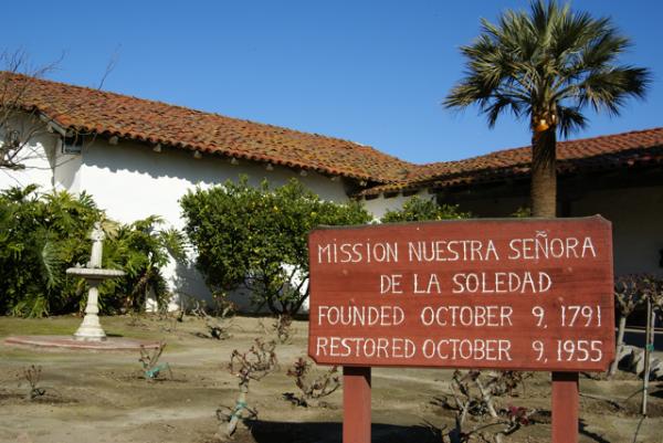
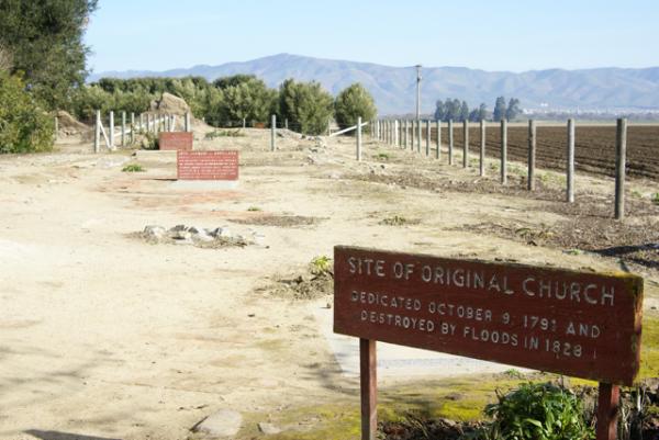
As is our custom, we found several geocaches on the way down from Santa Cruz, including two at Mission Nuestra SeƱora de la Soledad, which was established in 1791, the 11th of the 21 missions to be so created.  Most of this particular mission appeared to be recreated.  There were several original adobe walls near the entrance and I found it very curious that these original walls weren't protected in some way from the weather.  At San Juan Capistrano, there are some original walls and they are enclosed in acrylic forms so they are protected from the elements, yet still visible to people visiting the museum.

There also appeared to be some archeological digs going on behind several of the main buildings at the mission and it's probably a work in process.  The mission is 2 miles away from Highway 101, and probably doesn't get many visitors, which probably means that funding for projects are not nearly as plentiful as they would be in Orange County where San Juan Capistrano is located.

We toured the two buildings, which included the church and chapel of the mission, looking at the exhibits first before heading out to get the information needed for the virtual cache there or finding the regular cache hidden by the entrance to the grounds.  It was a nice quiet spot to get out and stretch our legs and learn a little bit more about California.  I have now visited 6 of the 21 missions, with Soledad being the farthest north.  I'm sure there will be more opportunities in the next couple of years to visit other missions along the King's Highway.

Pictures were taken at or near the following geocaches:
Mission Possible - by needlepointone and zieber
Mission: Soledad - by Great Scott!

Profile for Webfoot

Thursday, January 28, 2010

None but the Brave

Last Saturday, after visiting my mom in the hospital, we headed east out to Riverside National Cemetery.  A little over a year ago, I'd been out in the same general area, getting a virtual near March ARB.  The National Cemetery, was just to the west of the Air Base, on the other side of the 215 freeway in Riverside.  I had to cut my caching trip short that day, because of extenuating circumstances, so I wasn't able to go after another virtual cache at the Cemetery.  Fortunately, the Tadpole and I were able to get that particular cache on Saturday.

When we went out there, I was basically unaware of what we were going to be looking for, so I just followed the GPSr to ground zero.  It became rather apparent the closer we got.  There were signs pointing the way to the Medal of Honor Memorial.  This particular memorial, is one of the four official Medal of Honor Memorials located in the United States, which honor all 3000+ Medal of Honor award winners since the inception of the award in 1862.

For the uninitiated, the Medal of Honor is the highest award that can be achieved by any person employed in the armed services for the United States.  It is sometimes called the Congressional Medal of Honor, but that is a misnomer.  The correct term is just Medal of Honor.  There are three different medals, depending upon which branch of service the soldier/sailor is a part.  I'm not sure, but I think one of the attributes of the "official" designation of these memorials is that every person awarded the medal has their named engraved in the memorial.

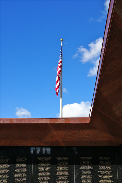
The other three memorials are located in Pueblo, Colorado, Indianapolis, Indiana and Charleston, South Carolina aboard the U.S.S. Yorktown, which is moored in Charleston Harbor.  The layout of the memorial in Riverside is in the form of a cross, when viewed from satellite images.  Walking up to the memorial takes you past the seals of the different branches of the armed services.  The entrance is guarded by two large reddish brown granite monoliths, which introduce the visitor to the Medal of Honor Memorial, with the western monolith giving the basic criteria for earning a Medal of Honor, that of "conspicuous gallantry and interpidity at the risk of life above and beyond the call of duty."

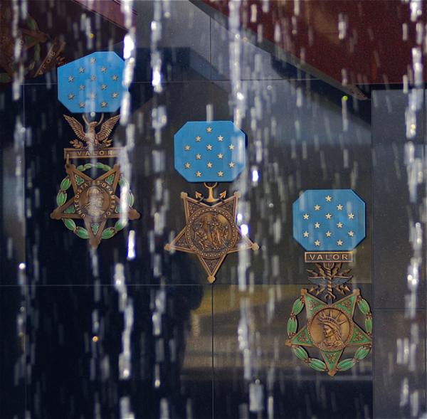
The center of the memorial is a pool with cascading water.  The water is pumped into a steel rail that is over the top of the pool and water drops from that rail into the pool.  I was so engrossed in other aspects of the memorial, that I failed to even look at how the rail was supported over the pool.  From the entrance, we could look through the water dripping down and see large replicas of the Medal of Honor for each branch of service, from left to right in the picture: Army, Navy, Air Force.

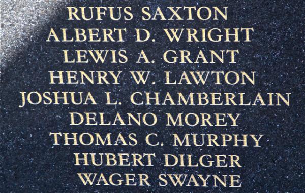
Once inside, the litany of names were engraved on granite walls all around the fountain, starting with winners from the Civil War, all the way around to the two latest from the conflict in Afghanistan.  Due to the nature and criteria of the award, 60% of the award receivers are awarded their medal posthumously.

While getting the information needed for the virtual cache, we ended up going all around the memorial.  We'd have done this anyway and I think we spent a good half hour just in awe of all these brave men, many of whom gave their life for their country.  There were more Civil War veterans listed than any other war, mostly due to looser conditions for the awarding of the medal in the first place.  I'll not quibble with anyone who is on that wall.

As we walked around, I looked for certain people that I was pretty sure were on the wall.   I missed Audie Murphy's name, he being the most decorated soldier in American History, but I was able to find Joshua Chamberlain's name.  Chamberlain commanded the 20th Main Infantry which prevented the Confederate troops from flanking the Union line at Little Round Top during the Battle of Gettysburg on July 2nd, 1863.  Chamberlain later went on to serve 4 one-year terms as Governor of Maine and would later serve as President of Bowdoin College, his alma mater.  He is featured prominently in the movie, Gettysburg, played by Jeff Daniels.

We also found several servicemen with our surname, plus one of my admired Presidents, Theodore Roosevelt.  On another panel, in another war, was Roosevelt's son, Theodore Jr.    The stories on those walls were endless.  I left thinking that I was glad that I hadn't been able to get this virtual a year ago because the Tadpole would have missed the experience.  Although, I'm pretty sure that I would have taken him back here because he needed to see this.  I'm hoping he'll understand what this was all about in the future.

The encouraging thing about these four memorials is they are spread across the country in a way that almost all Americans living in the contiguous United States are only about a day's drive away from one of the memorials.  Unlike many of the memorials in a city like Washington D.C., where there is only one, people don't have to travel long distances to appreciate the sacrifices made by these men.  In my opinion, that's a good thing.

Pictures were taken at or near the following geocache:
Bravest of the Brave - by SlowMover

Profile for Webfoot

Wednesday, December 2, 2009

Monarch's Rest

In addition to rectifying an old DNF, chaosmanor and I found several very interesting caches.  One of the ones that will stick out in my mind will be Monarch's Rest.  When we were planning our route, we were basing the route around getting some of the virtual flags that both of us like to collect at GeoVexilla.

Because we were headed towards Cambria, along California's central coast, we would be traveling along either the 101 or Hwy 1 depending upon where we were going to be in any particular segment.  We'd been traveling along the 101 for awhile and were headed over to Pismo State Beach which fronts along Hwy 1, sort of where the two roads join up.  Pismo State Beach is one of the major wintering grounds for the Monarch butterflies.  What better spot for the Monarch's to rest than along the El Camino Real, The King's Highway.

There's a virtual cache at the spot that you're only supposed to be able to log during the winter months because that's when the Monarchs are there.  When I was planning this route, I happened to see this cache on the map and thought it would be interesting to visit.  It was also wintering season, so there was the bonus of getting one of those yellow smileys that we geocachers love to get.

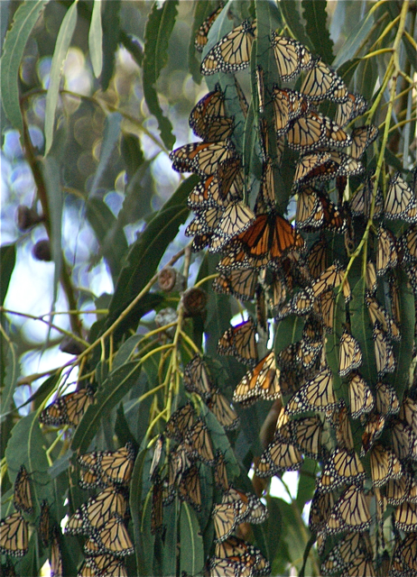
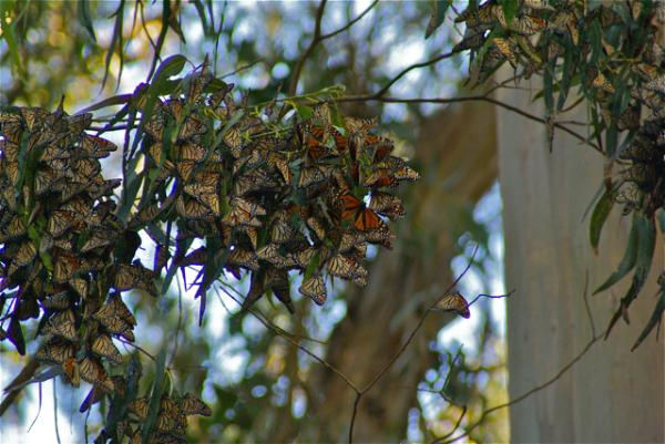
When we got there, there was an interpretive session going on by one of the docents, but we chose to wander the paths, to discover the Monarchs all by ourselves.  Immediately, we spotted one sitting by itself on a eucalyptus tree.  As we walked, I could see one flying through the trees, but we weren't seeing a large clusters that I'd heard about so I was a little disappointed.  I'd seen a Monarch once in Kings Canyon National Park, but I was hoping to see some of the wintering behavior.

As we hiked along the backside trail, we didn't see anything other butterflies, so we decided to go back up and walk along the main trail.  Both of us enjoyed the solitude of the lower trail as there weren't any other people along that trail.  And for good reason because we realized our error as soon as we got up to the main trail where the multitudes of other people were.  Hundreds upon hundreds of butterflies were clustered in the eucalyptus trees.

I think what was really impressive about the display was not the butterflies, but the quietness of the people in the grove.  It was almost like they were entering a shrine or church of some kind.  Even small children, upon seeing the butterflies, opened their mouths in wonder, but there wasn't a lot of the screaming and inconsiderate behavior that we commonly find in other areas where it really should be quieter.  It was refreshing to see and hear.

Geocaching continues to bring me to these kinds of places, places that I either didn't know about, or were possibly off the beaten track where I would normally go.  I very rarely get to travel in the fall or winter due to my work, but because my school was off the entire week of Thanksgiving, I had the opportunity to discover this area.  I'm glad that I saw this particular cache on one of the geocaching maps.

Pictures were taken at or near the following geocache:

Monarch's Rest - by Jon & Miki (Adopted by Scooterman)

Profile for Webfoot

Sunday, November 22, 2009

Walk of Honor

The Tadpole and I headed up into the high desert again yesterday.  It was the first day of a 9 day vacation for me, and I wanted to get the last couple of quads in the desert that had still eluded me for the Los Angeles County Quadrangle Challenge cache.  We also stopped and found a very nice virtual in the city of Lancaster.  Although, this one wasn't in any quadrangle that I needed, it was a stop well spent.

I'd been here three years ago in the exact same spot with some other caching friends of mine. It was August and I remember it being hot, but that didn't stop us from enjoying the day.  We solved a mystery cache involving the Lancaster Public Library and found that cache.  One of the stops on the virtual we found yesterday is right outside the library entrance.  I'm at a loss as to why we didn't do this virtual back then, but for some strange reason, we didn't.

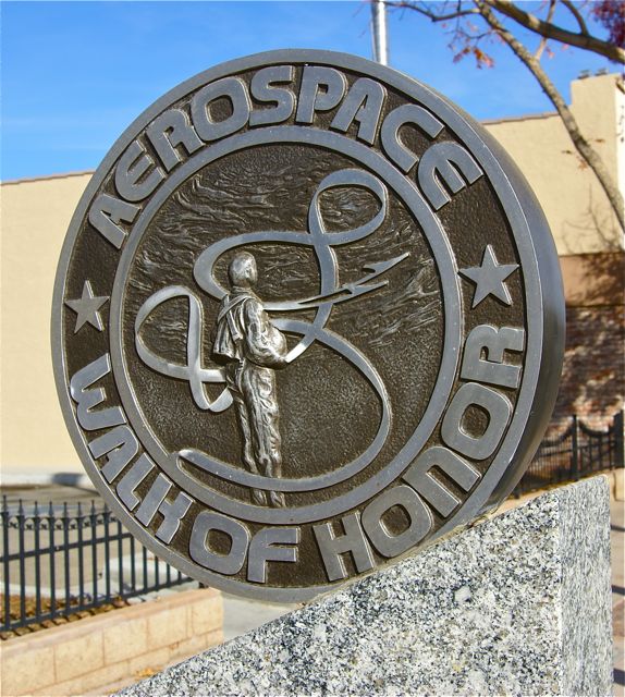
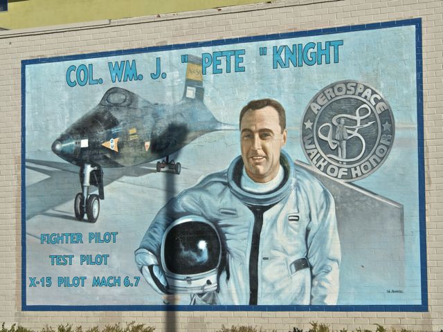
In actuality, that worked out for the good, since I was able to take my astronomy loving son up here where he could learn about some of the pioneers in the aviation industry as well as the early pioneers of NASA, probably before it was even called NASA.  Monuments to different pioneers line Lancaster Blvd. on both sides of the street, with information about various people who were instrumental in the testing of different aircraft.  Neil Armstrong was highlighted, as was Fred Haise one of the astronauts on Apollo 13.  Chuck Yeager and Jimmy Doolittle were both highlighted with monuments and murals on the sides of buildings along the street.

As we gathered the information needed to qualify for the find of the virtual cache, there was one monument that stood out.  This particular pilot shared our last name.  I pointed it out to the Tadpole and we both got a "Wow, that's cool" moment.  I wondered whether we could have been possibly related to the man, but most of my relatives came from the northern Indiana and Ohio area.  We were the first in my dad's family to move west.

The cache needed 7 specific bits of information.  After we'd walked the entire route, on both sides of the street, we realized that we missed the first bit of information.  Based upon where we'd found the other bits of information, we figured where that information should have been, so we walked back down there to check out the monuments again.

I told the Tadpole that we needed to be systematic on our approach to this one, so we started on one side and read through each monument.  It didn't take long to get the correct information this time.  We found it on the pilot who had the same last name as us.  We'd been both so interested in thinking about that aspect of the pilot, that we hadn't looked close enough at the rest of the information on the monument.  Needless to say, we got a good laugh out of that.

There was a bonus in all of this as well.  Because of our trip to get that last bit of information, we took a slightly different route to get back to the car.  At the base of a building near the entrance of an alley, we found a very nice looking benchmark.  We'd walked by it one other time, but for some reason, I spotted it this time.  That was a nice addition to an already enjoyable day with my son.

Pictures were taken at or near the following geocaches:
Aerospace Walk of Honor - by DoeWalking
Book Worm - by Team Perks

Profile for Webfoot

Thursday, October 8, 2009

Travel Bug Pictures

A year and a half ago, I made a confession that I haven't been very good about maintaining even to this day.  I feel I've done a much better job about taking pictures of the different travel bugs that I've had in my possession, but I'm still not at 100%.  At this point, I'm not sure that's possible.  In my opinion, some travelers don't lend themselves well to photographs.  I think this is especially true with geocoins.  Geocoins area small and difficult to get into focus with the other aspects of an area that the coin is going to be placed.

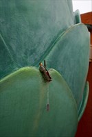
Many travel bugs are the same way, however, I've found some larger ones are much easier to photograph than others.  I found Arthur up in the high desert this summer and took him up to Santa Cruz with me last month.  I got a good picture of him holding another travel bug when I first found him in the desert and also got a nice photo of him standing in the leaves of the World's Largest Artichoke.

I'd seen this particular virtual on our drive up, so I made it a point to stop on the way down. I got there too early in the morning to partake in some of the nearby restaurant's finer artichoke cuisine, but I was able to stop at a local farmer's market and buy some artichokes to bring home.  10 for a dollar was a bargain price, even for some on the small side.  I think back now and I should have purchased 20 at that price.  Although I suspect the season will be over by the time I get up to Santa Cruz again, probably in late November, but if they have them available then, I'll buy some more.

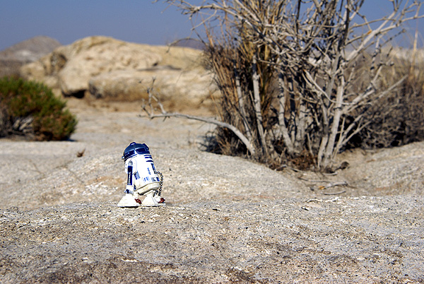
Getting back to travel bugs.  During that desert run, I also took, what I thought, was a rather whimsical picture of the R2D2 travel bug that I found near Point Reyes National Seashore in July.  The spot where we found a nice travel bug hotel had some rock formations similar to what one might find on the fictional planet of Tatooine in the STAR WARS movies.  Those kinds of pictures are the kind that trigger musical responses in my head.  When I look at that picture, I can hear John Williams theme of the robots walking through the desert on their way to capture by the Jawas.

At the moment, I have three travel bugs sitting on my desk.  I have a geocoin in the shape of a head of lettuce.  "Lettuce go caching."  There's also a Triceratops and a bison tube that I thought was a traveling cache when I first picked it up, since it had a log sheet in it. It's particular goal is to travel to different countries and have the person who placed it in a cache write the name of the country on the log sheet inside.  I'm not sure where this one is going to end up, cache-wise, but at least it's closer to another country here than where it used to be farther north along the 101.

Pictures were taken at or near the following geocaches:
The World's Largest Artichoke - by ynots4
Mojave Green Travel Bug Motel - by The Dananator

Profile for Webfoot

Saturday, August 29, 2009

Benchmark Buttes

After leaving Crater Lake, we headed up to Bend, Oregon where we were planning on spending the night with friends of ours. A real mattress and a hot shower were looking really good after tent camping it for the past week. We cached at several places along Hwy 97 and got up to Bend around 5:00 in the afternoon.


We freshened up and then went out to dinner and my friend took us to see
some of the sites of Bend. Bend is one of those towns that has grown a lot in the past 20 years or so. It seems to draw from the surrounding area, but also draws people from other areas of the country. Two teachers with whom I've worked in the past have since moved to Bend and gotten teaching jobs up there. The urban planning of the town seems to have worked and it was a pleasant place to drive around.

Eventually, we ended up on the top of Pilot Butte. Pilot Butte is a cinder cone volcano, pretty much perfectly symmetrical that juts up several hundred feet above the surrounding terrain in the middle of Bend. From the top, you can
get a 360˚ view of the city. To the west,
the views are dominated by the Cascades, with Mt. Bachelor, Mt. Jefferson and the Three Sisters taking center stage for the view. They were hard to see, because of the setting sun.

As we walked around the top of the Butte, I kept saying to my friend that there should be some kind of cache at the top of this butte. It was too good a spot not to have a cache. So we checked out a couple of areas in the hopes of getting a serendipitous find, but couldn't find one. While looking for a cache, I spotted a benchmark. That should have been a no brainer to find up on the top of this hill. I didn't have my camera with me, so I was a little disappointed that I wouldn't be able to log the benchmark, but I still enjoyed the views.

When we got back to my friend's house, I checked on-line to see if there was a cache up there and discovered there was a virtual cache on the top, one that I actually had in my GPSr ready to be found. Now,
I was really kicking myself. Not only had I neglected to bring my camera along, but I also hadn't brought the GPSr or PDA along for any needed information that I might have to get. In reality, when looking at the cache page, I also realized that we'd looked right at the thing that we needed to get information off of to get the cache. It was at that point in time that we decided that we'd got back there the next morning and get the cache and also take pictures of the benchmark.

The butte has a road that you can drive all the way to the top of it. We took that road the evening before, but in the morning, the gate was fenced up, so we decided that we we would hike to the top. We had a little trouble finding the parking lot for the trail head, but once we found that we were off. The hike can go one of two ways, either taking a paved road, or take the spiral
dirt trail that literally encircles the butte while taking you to the top. We opted for the dirtier path and were rewarded with much less people than had we taken the paved path which followed the road and then became the road midway up the hill.

There were several wildflowers alongside the trail, both of which I was unfamiliar with. The trail also appeared to be more shady than the paved path, another bonus and had regular benches to rest along the way. The steady climb got my heart pumping, but I need something like that more often than not, so it was a good workout. The top of the hill being the prize was worth the climb. Plus, we both felt we'd earned this benchmark and virtual.

I took several pictures of the mountains, plus a couple of the benchmark. We got the information off of the monument at the top and then we started back down the hill. It was an hour an a half longer than what I'd planned on being there, but it was well worth the side trip. I'm glad my friend had taken us up there the night before. Once back down to the van, we hopped in and headed to Idaho.

Pictures were taken at or near the following geocache:
Virtually Pilot Butte - by Baron Max and Mrs. Max

Profile for Webfoot

Tuesday, August 25, 2009

Crater Lake

It seems odd that I'm still writing about our camping trip almost a month later, but we ended up doing a variety of things on this trip which kept us busy. Once we'd finished our camping trip at Redwoods National Park, we headed north to Idaho to meet up with my dad at my parent's place at Couer d'Alene. They've owned this cabin for over 20 years and it's a nice spot to relax, while watching the boats go by. We haven't been able to go up there much, mainly because it's a three day drive of at least 8 hours a day. That's a long time for a kid to be strapped into a car seat with not a whole lot to do except look out the window. So both of the boys got to experience Idaho for the first time and they loved it.


Before we got to Idaho, there was this little thing about the drive. The Tadpole and I left Crescent City and headed north toward Bend, Oregon. There's a friend of mine in Bend who
I met on the Internet about 10 years ago and we've met one other time down at Disneyland. She'd offered her place for us to spend the night on our trip north and it worked out well, since Bend is about the halfway point between Crescent City and Couer d'Alene.
On the way, we drove through Crater Lake National Park.

For those of you who are unaware, Crater Lake is a
dormant volcano.
Not too many volcanoes are
considered extinct anymore. I recall Mt St. Helens
being called extinct at one time in the 1960s. Most are now called dormant for obvious reasons. Crater Lake was formed when the former Mt. Mazama blew so much material into the atmosphere, that the mountain literally collapsed upon itself. Over time, the caldera filled with rain and snow melt forming the
deepest lake in North America and one of the jewels of our national park system.

There were several virtual and earthcaches in the park and we attempted all but two. One of the ones we didn't get was a virtual cache that was extremely close to another earthcache. When I was looking at the geocaching map,
I missed that one, so it never showed up in PQ that I ran for the route we traveled.
The other one we missed was an earthcache on the north side of the park. We missed that one due to some fire activity of a controlled burn along the northern edge of the park. They were using the parking lot where the earthcache was located as a staging area for the firefighters. The parking lot was closed off, so we couldn't get it. The Tadpole has expressed interest in coming back and actually
camping in the park, so that means we'll probably be able to get these two on a return visit.

The last time I was at Crater Lake was on my honeymoon twenty two years ago. It was July and we were snow bound. The night before we arrived, a
storm had rolled through the western
US and dumped over a foot of snow on the rim at Crater Lake. We were
confined to a very small area of the park and the rim drive was closed, so many of the viewpoints were out of our reach on that trip. This time, there was a lot less snow, so the Tadpole and I were able to explore quite a bit of the park.

We traveled down to the Pinnacles area, a spot where I'd never been before.
These interesting features were created as fumaroles, which hardened over time and then had the surrounding material eroded away. We also got to see
the
Phantom Ship and got some great views of Wizard Island, a volcano growing inside a volcano. The blue of the water is pretty much indescribable. The water is very clear and from what I understand, you can see fairly deeply into the waters. The reflection of the sky creates an incredible blue that has to be seen to really be appreciated. I'll let the pictures do most of the talking.

Pictures were taken at or near the following geocaches:
Ode to a Lake - by LooneyTunes
Mt. Mazama - by Lost Scouts
The Pinnacles - by Chod
Pumice Castle and the Old Man of the Lake - by 47Dad47, KollyWobbels, Sally, and Russ

Profile for Webfoot

Monday, August 3, 2009

Rats

The third day of our camping trip was devoted to breaking camp and moving northward. Our plan was to spend two days in the Point Reyes area, then move north to Redwoods National Park where we'd camp for the rest of the week, so Thursday morning, we had a quick breakfast, broke camp and moved out.

This particular trip really was the first trip where the Tadpole and I had made geocaching the primary focus. In other times, we'd spent time geocaching, but it wasn't primary like it was this trip. That created a little bit of a problem on this particular day. With another goal being to get caches in each county we passed through, we had to find at four or five caches spread out over several hundred miles. We had thoughts of looking for one of the oldest caches hidden in California, but that didn't pan out either due to muggle activity in close proximity to the cache.

We had one side trip to Lake County along Hwy 20, but for the most part, we just headed up Hwy 101. Every time we crossed a county boundary line, we started looking for caches to find. Once we got into Humboldt County, I knew we were good since we were going to end up spending a lot of time in Humboldt and Del Norte Counties over the next couple of days, so those two weren't as critical on this driving day.

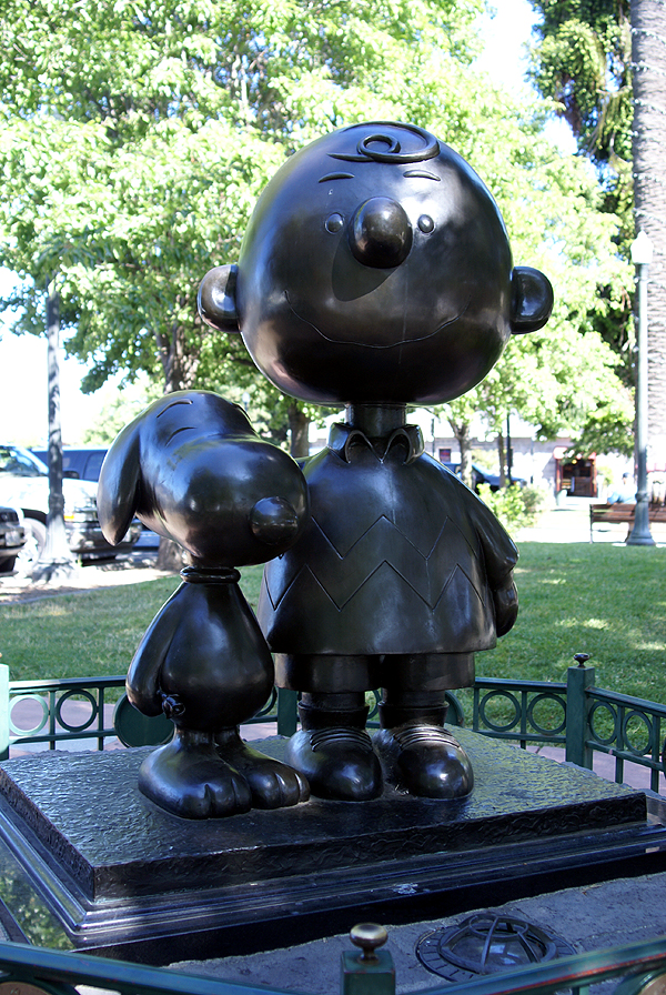
I ended up taking pictures at two different caches. One was a tribute virtual cache to Charles Schulz the author of the Peanuts comic strip. As a boy, Peanuts was one of the first strips I'd always look for in the Sunday comics as well as the daily strips. The Tadpole reads the re-runs found in our paper, so he's well versed in the mannerisms of the different characters.

Santa Rosa, California, in Sonoma County is where Schulz made his home. There is a museum celebrating his life and legacy and several monuments including a small sculpture near the city's information center. Unfortunately, there wasn't any free parking in the surrounding area, so we felt rushed as we walked through this small park to the sculpture. The meter was running syndrome caught up to us with this one, but we still had a good time getting the answers for the virtual.

The other cache that stood out in our minds was the last cache we found in Mendocino County. This particular cache we had decided that we were going to bypass to save some time. We'd already found another cache in Mendocino County, so we didn't need another, but as we came around the bend, I happened to look at the GPSr, saw the name of the cache and made a quick stop. The Tadpole, obviously wanted to know why we were stopping so I told him the name of the cache and he blurted out, "Are you serious?!?" We used teamwork to make the grab on this one, had a good chuckle while we signed the log and then used teamwork again to replace the cache.

It's these kinds of caches that usually strike my fancy and end up on my 5% best cache list. They might not be really great in many ways, but they made me laugh or bring back fond memories. Both of these caches certainly did.

Pictures were taken at or near the following geocaches:
Oh Nuts! - by Bryce and Laura Powers
Pit Stop - by Huntnlady...Adopted by 007BigD

Profile for Webfoot

Friday, July 31, 2009

First Day

The first day of most trips is usually a lot of driving. That was the case on our first day as well, but we tried to break it up into some shorter chunks with some geocaching here and there. We ended up finding five caches on the first day, which was actually more than I expected to find. We found three in the central valley of California as we drove up Interstate 5. We found two others later in the day, a virtual in Oakland and one near our campsite which would be our first find in Marin County.

When driving in California, you have to plan accordingly. If you're ending up traveling through either the Bay Area or the LA Basin during rush hour, you're going to be sitting in traffic for awhile. We'd left our house at 8:45 in the morning which allowed us to miss the Los Angeles traffic. The problem was as we approached the Bay Area, we were entering that during the afternoon rush hour. Fortunately, some peripheral freeways allowed us to miss most of the traffic, so it really wasn't bad, except we missed part of our caching route. Well, as noted above, we'd already found three for the first day, so it was a good start.

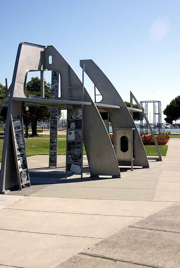
As we got through Oakland, I noticed a cache showing up just off the freeway near the marina in Oakland. I pulled it up and realized it was a virtual. The Tadpole enjoys virtuals because he finds them very educational, so we stopped and learned about Rosie the Riveter's important role during World War II at the Rosie the Riveter/World War II Homefront National Historic Park. This was a self guided park through a mock up of a ship under construction. Along the ship's lines were historical pictures telling the reader about the role women played in the war effort. We followed the partial skeleton of the ship all the way down to the water's edge. Most of the information was not new to me, but the Tadpole was fascinated with the exhibit and I think we stayed longer because of that. After getting the necessary information for the virtual cache, we got back in the van and headed toward the Richmond/San Rafael Bridge and to our campground.

After setting up camp and eating dinner, we walked through the campground. We attempted to find a couple of caches that had eluded us last year, but were defeated again. So we satisfied ourselves with one more cache attached to a gate on a Rails to Trails trail. After that, we pretty much went back to our campsite and hit the hay. It had been a long first day, yet also rewarding at the same time. We would have many more over the next two weeks.

Pictures were taken at or near the following geocache:
Bay Area History - Rosie - by Jean&Jim

Profile for Webfoot

Tuesday, May 19, 2009

The Answer My Friend.....

This past weekend, I did a quick turnaround trip up to Stockton to pick up my daughter from college. I'm just recovering from the trip, but then again, most of us who are slightly older know what a 1000 mile round trip can do to the body, especially if it's done in only two days. I definitely know that I'm not as young as I used to be and can't just hop in the car and drive 12 hours or so without feeling the side effects.

Driving up, I decided to take the back roads, although they weren't necessarily the most scenic. There were several virtual flags just off the Interstate that it appeared that I could get close enough to, so I routed to those and also did some caching. Consequently the trip up took about four hours longer than usual, but it was an enjoyable extra time. Driving, then getting out and caching for a little bit tends to help keep me refreshed for the drive to come.

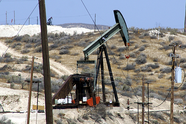
The side trips took me through the oil fields in the southern central valley around the town of Taft. Nothing really spectacular about this area, although I did get a little bit of a jolt at one cache. It's definitely heating up in the central valley and summer is upon us. The drive home, I noticed a time and temperature sign in Bakersfield that read 106°. Granted those you always take with a grain of salt, but even at 10 degrees off, that's plenty hot for May.

The cache that I found near Taft hadn't been found in over a month. Apparently, the seal on this particular ammo can was a really good seal. With the heat of the sun beating down on it, the insides were very warm and I have to theorize that the air pressure inside it was slightly higher than the outside. When I popped the handle on the ammo can, the cache hissed at me giving me a little bit of a start. This was one of those moments that I was glad that I had been caching by myself, because I know I jumped, which would have probably caused some laughter from any caching buddies that would have been along for the hunt.

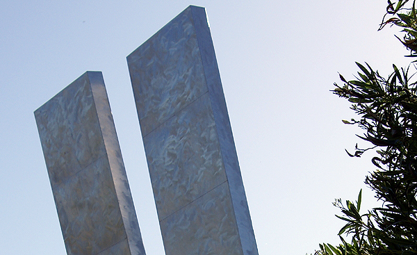
Later on in the day, after getting back over to the Interstate, I took my second side trip, this time into the San Jose area, which is near the southern part of San Francisco Bay. Once again, I was looking for a couple of virtual flags and a couple of caches. The one cache that stood out in this area was a kinetic sculpture. While waiting at the light to turn into a business complex, I noticed the sculpture from a couple hundred feet away.

A quick glance gave me one of those, Oh, OK. That's kind of interesting. When I looked again, I noticed the sculpture had changed. Now this was interesting. Once I got up close to it and had parked the car, I realized the sculpture was two large panels that swiveled at their midpoints. They would wave back and forth with the wind, not a lot, but enough to get a different look every time you looked at sculpture. I took a couple of pictures, one while flat on my back so I could get it and the buildings behind it in the same shot. The metal had an interesting texture to it as well.

There wasn't any explanation, except who created it and what the name of it was, but I would have liked to know how much the panels actually fluctuated in the breeze. There was a gentle breeze blowing that day, but I wonder what the panels would do in a brisker breeze. We get gale force winds down in Southern California from time to time and I would imagine that can happen in the Bay Area as well. I guess, I'll just have to come back up here some time when the winds are really blowing to find out.

Pictures were taken at or near the following geocaches:
California's Other Gold - by feedle
Silver Gyrations - by N2Books2

Profile for Webfoot