Wednesday, July 21, 2010

Rainbow Falls

A friend of mine, who I introduced to geocaching, described geocaching as "Hiking with a purpose."  I would respectfully have to disagree with him.  I guess it's probably because I grew up with camping and hiking.  My first camping trip (to Yosemite National Park) was with my parents when I was four years old.  Everywhere we camped, we hiked.  If you didn't want to hike, you stayed in camp, unless Mom decided to go on a hike too, which was many the time, so we learned to hike.

When we go camping today, we hike.  If it weren't for geocaching, we'd still hike, but I think geocaching has expanded those hikes to new and different places.  As a travel enthusiast, I like to take new roads when I go somewhere.  Driving the same road, back and forth to the same locale isn't what I'd like to do, although I know people who enjoy that.  It's just not for me.

That's probably why we end up going to so many different spots when we camp.  Camping in the same place is OK, but different locales afford us new and different experiences.  And, obviously, it also gives us more chances to geocache.  The hiking aspect of geocaching comes into play, but it's not the reason we geocache, nor is geocaching the reason we hike.  We hike, because we like to be outdoors.  I like to watch the scenery go by.

When we hiked to Rainbow Falls south of Devils Postpile, we took the shuttle bus from our campground to the trail head.  We could have just hiked from the campground up and back, but that would have been the same route.  We also had other things to accomplish that day, so by taking the shuttle to the trail head, it shortened what would have been a five mile round trip hike into a 3.8 mile hike.  It was still a significant hike, but a little less strenuous and thus gave our legs a little more energy for later in the day.

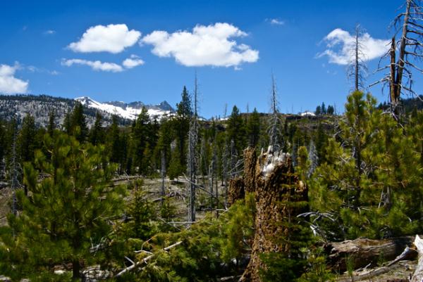
The hike down to the falls took us through a major burn area from a lightning strike fire that started at the southern end of the park and burned through a major part of the park in 1992.  The area, almost 20 years beyond that fire still shows the scars but is slowly rebounding.  There were many old snags standing as sentinels over the landscape and just as many fallen trees.  We could see evidence on the downed logs of recent bear activity as the bears looked for grubs and termites in their quest for food.  The animals were helping with the decomposition, which was further enhancing the soil, allowing the new growth of plants to flourish.

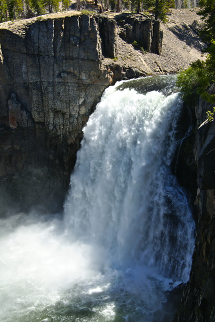
The falls were spectacular and we got there at a good time.  The sun was overhead and because of the large amount of water in the San Joaquin River, the water was plunging over the 101 foot precipice at a high rate, causing a lot of mist to spray up at the bottom, creating the signature rainbow for which the falls are named.  Actually, if you look closely in one of the pictures, you'll see a double rainbow.
We then took our time, lingering around the viewpoint, as well as taking in the other views that had been built.  The third viewpoint, a staircase down to the river below the falls was the most strenuous and the least traveled.  We ended up seeing the waterfall through the water droplets on our glasses down there, but it was well worth the extra time.  Were there any geocaches down there?  Nope.  We hiked there for the experience.

Afterwards, we hiked down to the lower falls, a smaller waterfall further down the trail and outside the park boundary.  Apparently, there were only two other people who took advantage of that trail while we were there, because we saw them at the brink of the lower falls.  We didn't see anyone else on that portion of the trail the entire time we were on it.  Alone in the wilderness.

The return trip was via the main trail that runs along the eastern edge of the park from the falls back to the postpile and beyond to the campground at the northern end of the park.  While on that trail, I kept watching the mountains to the west of me.  Trees would obscure them for awhile and then allow me different glimpses of them further down the trail.  I kept watching this one ridge as it slowly blocked the view.  Eventually I had to stop and take a couple of pictures, otherwise I figured I might lose the view entirely.

Every time I stopped, it seemed like there was another group of hikers heading out to the falls.  The trail is very level, and thus, a very easy trail for all age groups, even if it is 2.5 miles long one way.  I would think that most people could do this trail, even if they weren't in the best of shape.  It would be a good workout for those not in tip top shape and a stroll in the park for those that were.  I probably fit into the former as opposed to the latter.

The common question I ended up getting by most of the groups was "How much farther are the falls?"  Since I had an earthcache at the falls in my GPSr, I was able to give them "crow fly" mileage at least, but since the trail went relatively straight to the falls at that point, the GPSr mileage wasn't that far off.  The interactions with other hikers were pleasant and didn't detract from the overall experience I had on the trail.
It was a great hike.  And yes, there was an earthcache at the falls location.  Did we hike out there to get the earthcache?  Yes we did.  But I think the more important question is, would we have hiked out there had there not been an earthcache out there?  Yes we would.  As President Kennedy stated in a speech in 1961, "And they may well ask why climb the highest mountain? Why, 35 years ago, fly the Atlantic? Why does Rice play Texas?"  The answer is self evident.  In reality, I don't feel geocaching is hiking with a purpose.  I think, rather, it's another reason to get out and hike.

Pictures were taken at or near the following geocache:
Rainbow Falls - Devil’s Postpile NM - by TerryDad2

Profile for Webfoot

Monday, July 19, 2010

Underrated

One of America's Best Ideas has been the creation of National Parks.  It started with Abraham Lincoln, back in the 1860s when he signed legislation protecting parts of Yosemite Valley and continued into the 1870s when Yellowstone National Park was created by congressional act.  In 1906, Congress passed the Antiquities Act of 1906, which allowed presidents the power to set aside tracts of land as national monuments, kind of a step lower than a national park, which can only be created by an act of Congress.  Today, there are national parks all around the world protecting areas of scientific interest, or scenic beauty for generations to come.

Many of the first National Monuments have been later created into National Parks, such as Katmai National Park in Alaska and Grand Canyon National Park in Arizona.  Presidents Wilson and Theodore Roosevelt had the foresight to originally protect these areas until Congress got around to finishing the job.  The National Park Service was created in 1916 and administers many more units than just the 58 national parks in the United States.

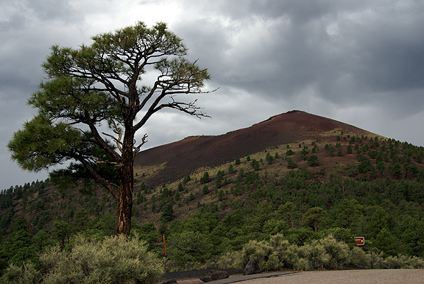
There are still many national monuments scattered around the United States and the Tadpole and I were fortunate to visit two of them on our latest camping trip, Devils Postpile and Lava Beds.  Coupled with Lassen Volcanic National Park, which we also visited, there was a definite theme to what we saw on this latest trip.  My point for all this history is I believe that many national monuments are neglected by the general populace, because they aren't national parks, they aren't the best of what America has to offer.

To this I say that most of the national monuments I've visited in my lifetime are vastly underrated.  They usually are smaller than a typical national park, but have many of the scenic vistas one comes to expect at a national park, but with usually no crowds to speak of.  On a hike out to Rainbow Falls in Devils Postpile National Monument, we encountered the usual number of hikers who were willing to take the fairly easy 2.5 mile hike out to the falls.  However, once there, they took their pictures, and then made the return trek.  There were many times when we had the views all to ourselves.

Many times, while hiking in a national park, we've encountered other hikers, but there was no practical way of getting away from them, mainly because there were so many hikers.  In Devils Postpile, all we had to do is wait a couple of minutes, and we had the place to ourselves again.  We took the slower route to many areas of the park and enjoyed the solitude the park had to offer to us.

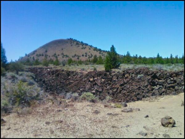
The same could be said for Lava Beds National Monument.  The park preserves multiple lava tubes, historical areas and beautiful landscapes we have come to expect from these kinds of areas.  The small campsites at both places were clean and never filled.  Contrast that to many national park areas where you have to get camping reservations 6 months in advance and there's no chance of having the campsite next to you empty.

Another enjoyable aspect of visiting national monuments is most people have gone out of there way to visit these areas, probably because they have an interest in what the monument is offering.  Many times, you'll find like minded people that you can share an experience with, that might not happen in a national park, because of the many tourists who are there, to enjoy, but not necessarily immerse themselves.

We had an enjoyable evening with an older couple taking their youngest granddaughter on her first camping trip in Devils Postpile.  We watched as two young men came into the campground and picked out a campsite.  I made a comment that I believed that these two young men were probably either walking the Pacific Crest Trail or the John Muir Trail based upon their backpacks.  Sure enough that had been walking for the past five days from Toulomne Meadows in Yosemite National Park to the Postpile, a distance of 34 miles.  That doesn't seem like they were walking very quickly, but the snow had slowed them down tremendously over many of the mountain passes.

I would not have been able to enjoy their stories had we avoided Devils Postpile.  It's on the route of both of those long range trails.  You don't encounter backpackers on the trail that often in many of the national parks, because they're walking through remote regions of those parks.  With the national monuments, many times the monument is the remote region.

The experiences I've shared in national parks and monuments have both been enjoyable and enriching.  I just think the national monuments are underused treasures of the national park system.  They are truly underrated.  But, let's keep that our little secret.  We don't want them to get too crowded.

Pictures were taken at or near the following geocaches:
Devils Postpile National Monument - by truckgirl2
Skull Cache (Lava Beds National Monument) - by ChrissySkyking + Blaze
Cinder Hills Overlook (Sunset Crater Volcano National Monument) - by TerryDad2
Profile for Webfoot

Friday, July 16, 2010

A tree grows in Brooklyn

Well, the tree doesn't really grow in Brooklyn, but actually grows on the top of Devils Postpile.  The first time I was at Devils Postpile, we climbed up to the top of the postpile.  It's like being on top of a large patio terrace in someone's back yard, with the major difference being if you take a wrong step, you're falling a long way.

10 years ago, I took all three kids camping in Yosemite National Park.  On one of our hikes, we hiked up to the top of Vernal Fall.  The hike is strenuous, with lots of stair steps rocks to negotiate.  There is a guardrail along that part of the trail, and once you get to the top, the guardrail had a screen wire grate along the bottom portion of the rail to prevent anyone from slipping out and falling over the waterfall.  The viewpoint is right on the edge of the waterfall as you can see by the picture.

The Tadpole, at the time was four years old and when we climbed to the top of the fall, he dutifully held my hand, mainly for safety, but also because he wanted to feel the support of Dad as he made his ascent.  It was at the top when all hell almost broke loose.  In every parent's worst nightmare, he broke free of my hand, just as we crested the trail and the viewpoint.  I hadn't seen the wire mesh grate, but even if I had, I probably would have freaked a little bit.  Because I didn't see the wire mesh, needless to say I freaked a lot.  Suffice to say, nothing happened that day and the Tadpole is still around, as am I.

One of the things I noticed about the Tadpole on this past trip was his willingness to just take over things that I normally did when we camped.  He decided to be in charge of the food storage box.  In California, most campgrounds in bear country are outfitted with metal storage lockers to prevent bears from raiding your supplies and also to keep bears away from populated areas.  Bears that feed on people food, as opposed to what they're supposed to be eating isn't good for either bears or people.  The Tadpole decided that the storage box was his territory on this trip.  He organized it, he got the supplies out when it was time to cook dinner, and he put the supplies away at the end of the meal.  It was nice to not have to do everything this time around.

I think I might have been more nervous on the top of Devils Postpile back then had we gone there.  There is no guardrail and not anything to remind people of a steep drop.  Everyone knows it's there.  I didn't even think twice about walking around up there nor did I worry about the Tadpole.  His maturity, at almost 15 now, is showing big time and he's turning into that responsible young man that we all hope our sons turn into when they reach that age.

One of the things that I wanted to show the Tadpole at the top was a small tree.  I'd photographed this tree back in 1977.  As you may have noticed if you're a regular reader, I enjoy seeing the struggles of like, especially when plants grow where you don't think they should grow.  The tree that used to grow on the top of Sentinel Dome is one good example.  When I took that photo, I figured this tree might be something along that line and I hoped that someday I might get back to see it.  As you can see, the tree hasn't grown much.  By comparing the two pictures, I think it's safe to say there's about a foot of growth on the tree.

I guess I was overly optimistic when we came back this summer.  I think I was expecting the tree to be several feet higher.  After all, it had 33 years in which to grow.  I forgot about where it was growing.  It had two major disadvantages going against it.  The first, and probably the most important was the fact that it was growing in very shallow soil.  There were a lot of nutrients at the top of the postpile and so it's growth would probably be microscopic.  Because it's so readily accessible during the summer months, I'm sure it gets beaten around by all the people that make the short trek to the top of the postpile as well.

Still, the tree had grown a little and that was promising.  It also showed, that it would be a long time before this little tree towered over anything else in the forest.  It has its foothold.  Now, hopefully, it will continue to send down roots and continue to thrive.  The Jeffrey pine tree on the top of Sentinel Dome is no more, but it lived a good long life and never got more than about 12 feet tall at best.  The living conditions up there were probably harsher.  I have hopes for this little tree.

Pictures were taken at or near the following geocaches:
Mist Trail Cache - by V-man
Devils Postpile Glacial Polish - by TerryDad2

Profile for Webfoot

Monday, July 12, 2010

Earthcaches Galore

Our trip along the eastern side of the Sierra Nevada culminated in our camping at Devils Postpile National Monument.  This monument, established in 1911, preserves an interesting basaltic columnar formation and an impressive 101 foot waterfall, aptly named Rainbow Falls.

Since the monument is part of the National Park Service, no container type caches can be placed in it, but virtuals (if they were already created) and earthcaches can be.  Earthcaches are a geological discovery.  You learn from the cache page about a particular aspect of geology, answer some questions, based upon your observations at the cache site and thus, get credit for a cache find.  It's the new type of virtual cache that Geocaching allows on its site.

In the park, we found four earthcaches, two on the first day and then two more the next day.  We split them up only for convenience's sake. We could have done three on the first day, but the fourth required a substantial hike, so it was basically unavailable the first day of our camping trip.

One of the earthcaches we did on the first day was the Soda Springs earthcache.  I'd been here in 1977 as part of a biology summer school class I'd taken at my local community college.  Devils Postpile was one of the places we'd stopped to visit and I can remember our instructor, Dr. Bates, talking to us about the Soda Springs in the area.  In August, the San Joaquin River, which runs through this glaciated valley is at a low point, with most of the winter snow melted at this point, so there isn't as much water movement where the springs are and so we could see lots of iron oxide precipitate deposited along the shoreline where the springs were.

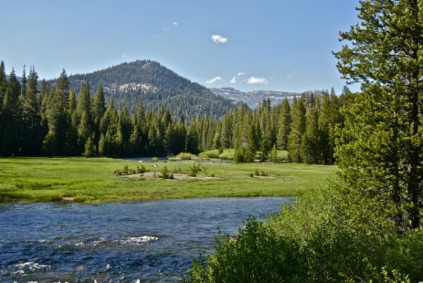
We had a very heavy winter in the Sierra this year and even in late June, the runoff was tremendous.  The San Joaquin was very close to flooding in areas.  The meadows were very wet and boggy due to excess water - mosquitoes were rampant.   Because the river was so high and swift moving, the iron oxide precipitate was non-existent here.  It was fun to explain to the Tadpole the differences between the two time periods and why things were the way they were.

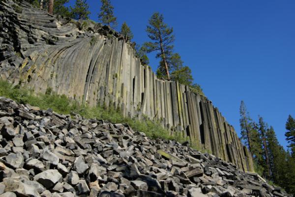
 Other things we investigated while in the park were the direction the glacier moved through the park while it was polishing the top of and plucking the face of the postpile.  The postpile is a series of basaltic columns that cooled a relatively even time frame.  When the last ice age glacier scoured the area, the postpile was exposed for all to see.  Over time, columns have eroded and fallen to the base, creating the postpile.  The columns are generally smooth on the top where the glacier ground against them.

They are also large in size.  At first glance, you can't really appreciate the size of the columns, but you have ample opportunities to get very close to some of the fallen columns and it's then you can truly appreciate how big they are.  Earthcaches aren't for everyone, but as the Tadpole likes to say, "you get to learn something with these, so I like them."  They take more time to do and so, they're not conducive to "numbers" runs, but then again, it's not really about the numbers, but the experience.  You truly get to experience the surroundings with earthcaches.

Pictures were taken at or near the following earthcaches:
Soda Springs at Devils Postpile - by TerryDad2
Devils Postpile National Monument - by truckgirl2

Profile for Webfoot

Friday, July 9, 2010

Owens Valley

The Tadpole and I just got back on Wednesday from one of our more satisfying camping trips in a couple of years.  Camping trips in general seem to be fraught with could'ves and should'ves.  This one didn't have that feel at all, with a couple of minor exceptions.  We did what we wanted to do and only once, really got caught up in the, "No, we can't do that cache because we have to be somewhere else" mode.

That is a good thing in my opinion.  There were lots of things to do, lots of things to explore and we both had a really good time.  Our first day out was, obviously, a driving day.  We managed to get a virtual flag near Red Mountain and about five caches on the drive up, including a couple after we established camp at Devils Postpile.

As we drove north we kept a look out for interesting things to see.  I wanted to make sure my son got to see Mt. Whitney.  We talked about the John Muir Trail that stretches from Whitney's peak to Yosemite Valley.  We ended up walking along part of the trail while in Devils Postpile later in the day.

Once you get into the Owens Valley part of California, the scenery pretty much speaks for itself.  Owens Valley is on the eastern side of the Sierra Nevada and sits around 4000 feet of elevation.  Directly to the west sit the Sierra Nevada, towering over the valley.  At points there is a quick elevation gain of nearly 10,000 feet between the valley and the mountains.

The mountains, created by a fault block were uplifted and create a major rain shadow.  Owens Valley is in the rain shadow and doesn't get much rainfall over the course of a given year, because the mountains trap the moisture from the clouds as they rise to go over them.  This year was a particularly wet winter and there was a lot of snow in the high mountain passes and peaks.  So much so that it would affect our camping trip down the road.

One spot we chose to stop was at Manzanar National Historic Site.  Manzanar was one of several relocation centers for Japanese Americans during World War II.  Many Japanese Americans were rounded up during the early stages of the war and sent to live in these relocations centers for, as the government put it at the time, "the safety of the Japanese people."  Ironic that the guard towers posted at these relocation centers had their guns pointed inward as opposed to outward to protect from an external threat to the Japanese American people living there.

After touring the newly created visitors center at the old gymnasium, we were back on the road again, heading toward Devils Tower.  We stopped for one more cache north of Manzanar and reveled in the beauty of the cache location.  The disparity between the two locations was striking.  Manzanar was a harsh and unforgiving place back then and is still, for the most part the same today.  The National Park Service is slowly recreating it so that the visitor's experience will reflect the day to day life the Japanese Americans had during that time period.

Sixty miles to the north, the beauty of the place overwhelmed us, much like the starkness of Manzanar tried to do earlier.  This time, we let it.

Pictures were taken at or near the following geocaches:
Manzanar Virtual Cache - by GoodDogSD
Cache with a View - by Rallye

Profile for Webfoot

Monday, June 28, 2010

Camping this summer

Tomorrow, the Tadpole and I will head out for our annual summer vacation camping trip.  I have been camping with many different combinations of my kids every summer and sometimes during spring break for the past 16 years.  We missed two summers, one due to circumstances beyond our control and the other because the Tadpole got sick on the first day, so we actually did camp that year, but only for one day.

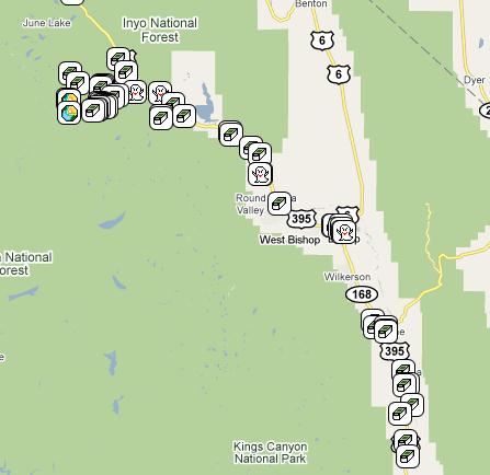
This year, our trip is going to take us all the way to Northern California, not as far as last year when we got all the way to the panhandle of Idaho and into Montana, but still a good distance.  Our first stop is Devils Postpile National Monument on the eastern side of the Sierra Nevada.  The last time I was at the Postpile was the week Elvis died (1977 for those of you who aren't old enough to remember).  We'd been backpacking in the area and had stopped at the Postpile at the beginning of our trek.  At the end, we stopped in Bishop, California for lunch which is when we found out that Elvis had died.

I can remember taking a picture of a pine tree about a foot tall growing out of a crack in the top of the postpile.  One of the things I'd like to see is how tall that tree has grown if it's survived.  There are also extensive hiking trails in the area and we plan on taking advantage of these while we geocache.

From there, we will head up to Lassen Volcanic National Park.  I have been camping in Lassen at least four times in the past, however the Tadpole has never been there.  There were several things that I wanted to take him to see, including a possible trip up to the top of the mountain.  The trail is fairly rigorous going to the top, but I'm pretty sure he'll be able to handle it this year.  However, this year, the entire west coast got a lot of rainfall, and thus in the higher elevations, a lot of snow.  The road through the park is still closed as they continue to work on snow removal.  I have serious doubts as to whether we'll be able to make it to the summit.

There are also thermal areas in the park, one near the south entrance and one further in along the southern entrance.  If the snow is still blocking the road, we may have to drive around to get to these areas, but it's something that's fairly unique to the park and I'd like him to see at least one of these.  One day while we're camping there, we also plan on driving up to Lava Beds National Monument.

This area has more volcanic activity, similar to Lassen, yet different.  If you were to look on a map of the United States, you could trace a line from Lava Beds, up to Yellowstone in Wyoming. The line would also run through Craters of the Moon in Idaho.  All three areas are volcanic and are theorized to be created by a hot spot  in the mantle of the earth.  As the North American tectonic plate moved over this hot spot, lava oozed to the surface or nearly to the surface, and caused many of the features that can be seen in these three parks.

Currently, the hot spot is under Yellowstone, but in the near future (geologicially speaking) it will move beyond that and many of Yellowstone's current features will cease to exist because there won't be heat under them to help them to continue, including Old Faithful Geyser.  If this theory holds up, our descendants can expect to see a new volcanic area forming to the northeast of Yellowstone.  It's pretty cool to think about.

Lava Beds National Monument, besides the geologic history, also has some cultural history.  It is the site of the Modoc Wars between Federal Cavalry troops and the Modoc Indian.  Outnumbered 5 to 1, the Modocs managed to hold out for over five months in this region during 1872-73 because they knew the lay of the land much better than the cavalry that was trying to remove them from the area.

In all of the years I've been camping, I don't believe we've ever been away from home for the 4th of July.  The town where we currently live has an annual parade down the main street, followed by speeches in the park and a fireworks show that evening.  We'll probably drive near Redding, California just west of Lassen to view their fireworks display.

The next day, we plan to drive into town and visit the Turtle Bay Museum, where a GPS Maze exhibit will be this entire summer.  When we discovered that this maze was going to be in Redding, we both decided that we wanted to go and see it.  It doesn't look like it will be coming to the Southern California area any time in the near future, so this would possibly be our only opportunity to see one of these.  I believe there's one happening currently in Baltimore, Maryland.

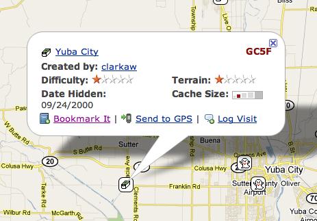
The last two days of our trip will be spent driving home, with a stop in Stockton, about midway between Lassen and home to visit my daughter, Tadpole's sister.  On the way, we plan at least one detour in Yuba City to find this cache.  Yuba City cache is the second oldest active cache in California, hidden in September 2000, almost 10 years ago.  It's so old that it only carries two digits after it's GC designation symbol.  It will definitely be the oldest cache I've ever found since starting this hobby.

This will be my last post for about a week, unless I can find a WiFi hotspot somewhere in Redding and can make a quick post, but I seriously doubt that will happen.  Besides, I will be on vacation, so I'm not really planning on checking in until after I get home.  Have fun in the meantime.

Profile for Webfoot

Thursday, June 24, 2010

Butterflies are free to fly

As you've probably guessed by now, I like to take pictures when I'm out geocaching.  I don't necessarily take pictures every time I geocache, but when there's a hike involved, I'll usually have my camera along with me.  One of my favorite subjects to take pictures of are butterflies.

I guess you could say I'm an amateur lepidopterologist.  When I see a butterfly in the field, I usually watch it for several minutes in the hopes that it will alight somewhere and pose for me so I can take a picture of it.  As a youngster, I can remember watching small yellow butterflies that were very common around my house.  I had been told that these particular ones were moths, but I have since learned they are actually a type of skipper.

Since I had only seen these types of insects during the day, it made sense for them to be butterflies, as they are usually active during the day, while moths tend to be active at night.  And that makes it nice to take pictures of butterflies, because they're out when I'm out.   Back in December, I wrote about one of the Monarch wintering grounds near Pismo Beach, California.  I can honestly say I've never seen so many Monarchs in one place ever.

I can remember growing up, reading about the Monarch butterfly and thinking if I'd ever get the chance to see one.  Living in California, I had a good chance, but the opportunity never seemed to arise and I figured it was going to be one of those elusive creatures that I would never get to see except at a laboratory specimen.  Then, one year while on our annual summer camping trip, I spotted one in Kings Canyon National Park in Zumwalt Meadows along a nature trail.  I have seen many Monarchs since then, including one while out hiding my latest cache.

The interesting thing about butterfly identification is it's not an exact science.  I tend to use this site as my guide when I'm trying to identify a butterfly.  When I saw the Western Checkerspot on a trail hike last month, I was surprised to find that it could have been one of about four different subspecies.

There was another time while doing the Groundspeak series of caches when I spotted a pretty small green butterfly.  It was late in the evening, so it was looking for a spot to rest of up for the night.  When it found a spot, it folded up its wings and settled in.  That didn't help with the identification, since much of the identity of a butterfly is on its top wings.  The best I could do with that one was to narrow it down to either a Desert Marble or perhaps a California Marble.  Once again, the identification guide is not fool proof, but it gave me a pretty good idea of what I was looking at.

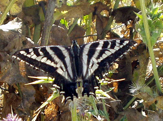
These pictures here represent just a small portion of the butterflies I've seen in my lifetime.  I have not been able to photograph them all, nor will I ever.  I just think they're interesting to look at and I find it kind of neat to be able to note that the swallowtail isn't just a swallowtail, but a Pale Swallowtail.

Pictures were taken at or near the following geocaches:
East Canyon Above and Beyond the Meadow - by SnakeSpotter
Micro N Post - by not tom
Carpe Diem! - by HaZaMaTt...

Profile for Webfoot

Tuesday, June 22, 2010

Kill Bill meets an Elephant

A couple of months ago, I posted about simulacra, the waymark where inanimate objects look like real live things.  Earlier this month, I was out in the desert finding a multi-cache.  The cache was a simple offset, where you find something, or go to a set of coordinates and then walk a certain direction away from those coordinates to find the cache.  I've created a cache similar to that, but I've turned it around and make the finder project a waypoint out and then head to those coordinates to get the final.

The original spot, as stated on the cache page, was at a sleeping elephant.  OK now.  Give me a break.  A sleeping elephant out in the desert of California.  Maybe in Africa, but not here.  Whoa!  Yep, that's a sleeping baby elephant all right.  Besides finding this cache, it also gave me the opportunity to post a waymark in the simulacra category for a sleeping baby elephant.  An added bonus was also posting a waymark in the movie scenes catergory, since the title of the cache is called Kill Bill's Church.  The church across the street from the elephant was used in the Kill Bill movies.

I always enjoy stumbling across stuff like this.  I was actually surprised that neither spot had previously been waymarked.  With the title of the movie as part of the cache description, one would think that some other geocacher would have thought to look on waymarking.com and done a search for it.  I did and found the nearest waymark to be 16.1 miles north of the spot, which gave me a pretty good indication that neither had been waymarked.

The problem, as I see it with waymarking, is you really don't know what's out there until start clicking on links on the geocaching site.  I have never been able to find an easy way to navigate around on the waymarking site.  When I wanted to waymark the piece of the Berlin Wall that's standing at the Reagan Library in Simi Valley, I wasn't sure where to start.  I think I started with a search of Berlin Wall.  Eventually, I figured that it would best fit in the Preserved Architectural Remnants and Ruins section.  Once a category is found, it's pretty easy to submit a waymark and the people who help approve the waymarks are pretty good about steering you to the right spot if you haven't quite got it, but I still think it should be easier.

I'm sure I could probably do a lot more waymarking than I do, but I don't know the criteria for each category.  There's almost 1000 different categories of different things, so for the most part, I stick to what interests me and stay there, although the movie category isn't one of the categories I usually end up submitting waymarks to, the Kill Bill Church being the first one.  I just happened to get lucky that I had taken a picture and had all the requisite information for the submission.

I sometimes think that since the removal of virtual caches from Geocaching, Waymarking has become the ugly stepsister of Geocaching.  They're not really sure what to do with it and so it just sits there, getting bigger, but not really improving in any way.  The geocaching site gets makeovers on a regular basis, but I don't see that happening on the Waymarking site.  That's a shame, as I think the site could be better utilized if it were better organized.  But then again, perhaps that's the best it can be, because of the scope of it.

Pictures were taken at or near the following geocache:
KILL BILL'S CHURCH - by fear it caches

Profile for Webfoot