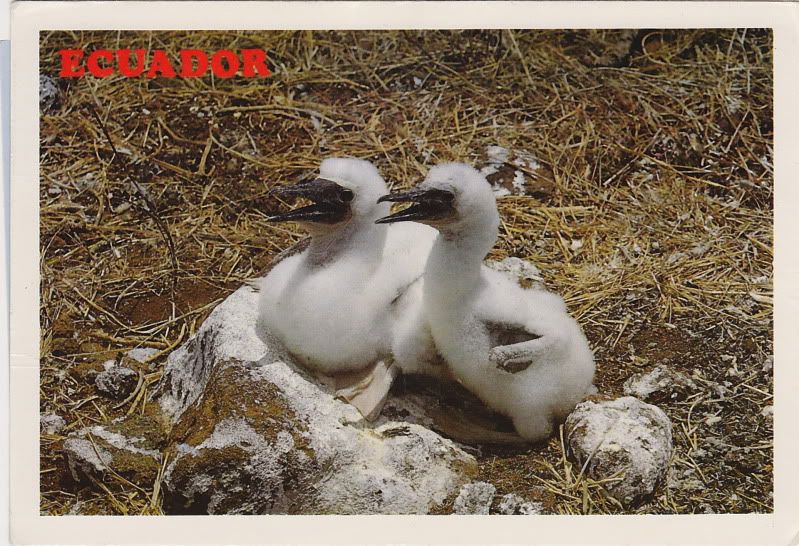
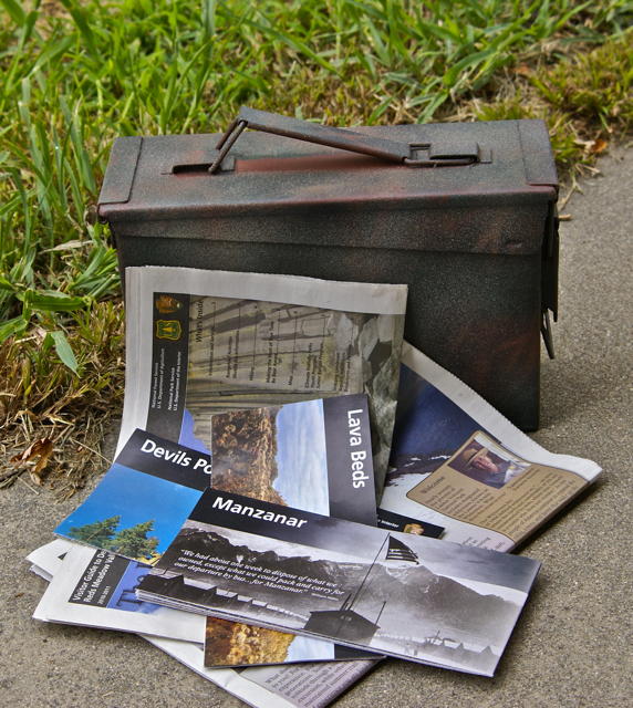
Most of the mail we get these days are bills. Email has become so prevalent, that we rarely get any written correspondence from anyone, so when something does come in the mail, we usually are surprised. Most of what I get in written correspondence are postcards.
Wednesday, August 11, 2010
Surprises in the mail
Labels: geocaching, postcards, Ribbit, Trip of a Lifetime
Saturday, August 7, 2010
Duck, Duck, Goose
When we're camping, every so often, the Tadpole and I take time out from Geocaching, just to enjoy what's near us. In the case of Lassen, it was Manzanita Lake, a gorgeous body of water right next door to the campground where we were camped. One of the days we were there, we decided to hike around the lake, a 1.8 mile loop, plus walk to and from our campsite, probably put it close to two and a half miles.
Since we were walking around a like, the terrain, for the most part was very flat. There were a few up and downhill sections, but it was an easy hike. We were out, just to enjoy the scenery and to get a little exercise in the process. We'd also learned at the visitors center that the trail would be open all the way around the lake. The park service had been doing a controlled burn along one part of the lake and the trail had been intermittently closed during the week. We were fortunate that day.
Hiking with the Tadpole has become an adventure over the past couple of years. My daughter and wife have always complained that I walk too fast for them. I have a quick pace, but I don't feel it's that fast. His pace, on the other hand, is freeway speed. And I really think that's probably not the right choice of speeds. He has very long legs and he just takes longer strides. Needless to say, I spent most every hike, catching up to him. That's not a bad thing, just an observation.
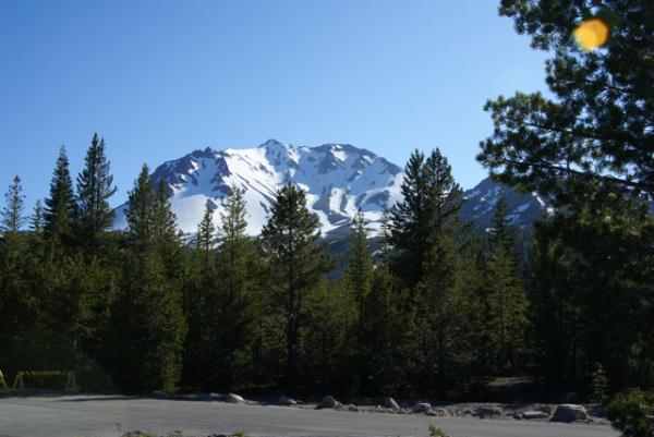
I had a couple of goals in mind when we went on this hike. The first and foremost was to enjoy myself. That was a pretty easy goal in reality. The walk was pleasant, and we ended up with several spectacular views of Mt. Lassen. This leads me to my second goal. I have a picture in my bedroom of Mt. Lassen that I took after I graduated from college. My friend had driven up with my family to see me graduate and then he and I went camping at Lassen and Yosemite before I came home and started the reality of life. It was one of those last flings before adulthood set in permanently.
I'd gotten a decent picture on the hike we took back then, and my goal was to get at least as good a shot this time. I figured that the likelihood would be that the shot, overall, would be better because of the excess snow on the mountain. I was not disappointed in the overall effect. The breeze was just strong enough that there wasn't a really good reflection in the lake, but you can still make out the form of the mountain in the lake's reflection.
From that spot, we headed through the controlled burn area. This was interesting from the standpoint of just seeing little smoldering areas. Signs had been posted telling not to report it, since they already knew of this fire. Also, the fire wasn't going to go anywhere, because it was very small, and the wind was blowing it to the lake's edge. There was no place for it to go, so it would naturally burn itself out anyway. I took a picture of one of the little tongues of flame coming from a small area of pine needles, but it didn't come out very well. The purpose of the burn was to clear out the underbrush, so when a natural fire does occur, it doesn't become catastrophic like many fires have become recently. I'll be writing about this more in depth in another post later on.
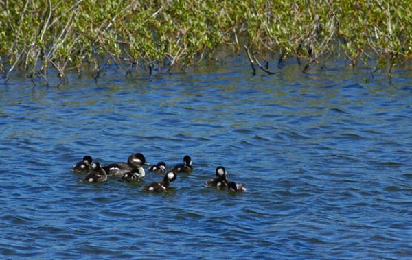
As we continued around, we stopped and watched a wood duck family enjoying what looked like one of their first outings outside of the nest. 8 little ducklings and mother were enjoying a fine day for a swim. We watched the ducks for about a half an hour, mainly because there was another duck harassing the mother, so we decided to stay and watch the interaction between mother and this intruder. Ducklings stayed together, almost in formation, while mother chased the intruder off. When mom was back, then they would break ranks, so to speak and be a little more adventurous. It was an interesting study in animal biology.
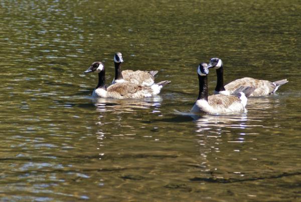
As we continued on, we rounded another bend and came upon four Canada Geese feeding on the shoreline. Canada Geese are very large birds and they were the dominant swimming bird in this lake and the nearby Reflection Lake. We'd actually seen a gosling earlier in the morning and it was the size of a large chicken. These geese were not the exception, but I was still very surprised when only three of them waded out into the shallows as we approached their feeding spot along the trail. One goose, apparently, couldn't have cared less that these two larger creatures were invading its space. It just kept eating and enjoying life.
We spotted several other groups of geese as we continued on our hike. They tended to congregate near the boat launching area of the lake, mainly because I believe they probably ended up getting some handouts from some of the tourists in that area. Needless to say, feeding the wildlife, no matter how hungry they appear to be, does the wildlife no good whatsoever. In fact, it harms them, because they'll become dependent upon people food and won't bulk up on their natural foods that are better for them. What was nice was none of the people who were at the boat landing area were even encouraging the geese to come over for food.
Fortunately, the park service is doing a fairly good job of educating the visitors to the park. Bear boxes seem to be the norm in most campgrounds in California now. I have think back to the early 80s to remember a time when there weren't bear resistant boxes in the campgrounds. My first camping trip to Sequoia National Park with my daughter in 1995 was the last time I've actually seen a bear. That's a good thing. Bears that stay away from humans will remain living bears. Bears that congregate near humans and start feeding on human food become dead bears much more quickly than bears that don't. The same holds true for the ducks and the geese.
We continued around the lake, ending up at our starting point, then headed back to our campground. No geocaches were found, but then again, none were attempted, so that was fine. We'd had a good day, just enjoying nature. And that worked for us.
Wednesday, August 4, 2010
A "Maze" ing
Long before we'd planned our summer camping trip, we knew the GPS Maze exhibit was going to be in Redding throughout this summer. After I pointed this out to the Tadpole early in the springtime, he stated he wanted to visit it, so I started planning our vacation around Redding. With Lassen National Park, just an hour or so to the east, it was a no brainer to figure out where we were going to camp, and at that point, things started to fall into place.
Later one, I found out that Chaosmanor was going to be up in the area sometime during the summer as well. Their youngest daughter was getting married in late June along the coast of California, and so we plotted to see whether we could meet up at the Maze at the same time. There was also an outside possibility that the maze could be their 4000th cache find as well, so it would be fun to share that with them.
Chaosmanor was coming from Klamath Falls, OR, and were farther away. We didn't know exactly when they'd get there, but we planned on meeting and having lunch at the Turtle Bay Museum and either going through the maze beforehand, or afterwards depending upon arrival times of both of us. The Tadpole and I headed out in the morning, grabbing a couple of caches along the way, including a nice benchmark virtual cache just east of Redding.
We got to the museum and paid our admission and then walked around the grounds. The Turtle Bay Exploration Park is a science museum and much more. It appears to be built upon an estuary of the Sacramento River. There were walkways from the entrance/gift shop over to the main building of the museum which sat on the bank of the Sacramento River. Surprisingly, the wetland area was relatively dry, considering how moist the winter had been.
We decided to wait on the museum, opting for the butterfly exhibit, where they had multitudes of different kinds of butterflies flying freely. We had to watch our step so as to not crush the butterflies that might be on the path. I've experienced one of these houses at the San Diego Zoo about 30 years ago, but this was a first for the Tadpole. Still, I'm not sure who was more excited about this little side excursion, he or me.
After an abortive attempt on a geocache just outside the fence to the park, we decided to head over to the museum and view some of the exhibits. The science museum is centered around the ecology of the Sacramento River, so there were many different exhibits with live fish from the river, as well as other exhibits about the Native American population that used to inhabit the area. We spent the better part of an hour enjoying ourselves with the different exhibits offered. There was also a photograph gallery, with some very good amateur photographs on display.
The only thing that we hadn't explored yet, was the GPS Maze. We walked into the entrance area for the maze, looked at some of the stuff available for sale at the gift kiosk located outside the maze, then decided to walk across the river on the bridge behind the museum (more on this in a later post). There were people out and about, enjoying the warm day with their family, friends and animals. We walked to the far side of the bridge, then decided to find a cache on that side. There were other caches further down, but we didn't take advantage of those, since we were both starting to get hungry and neither of us is a good cacher when we're hungry.
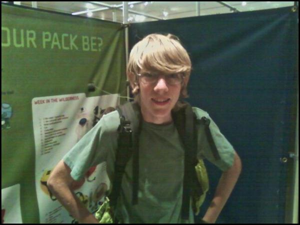
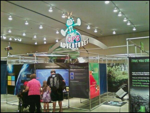
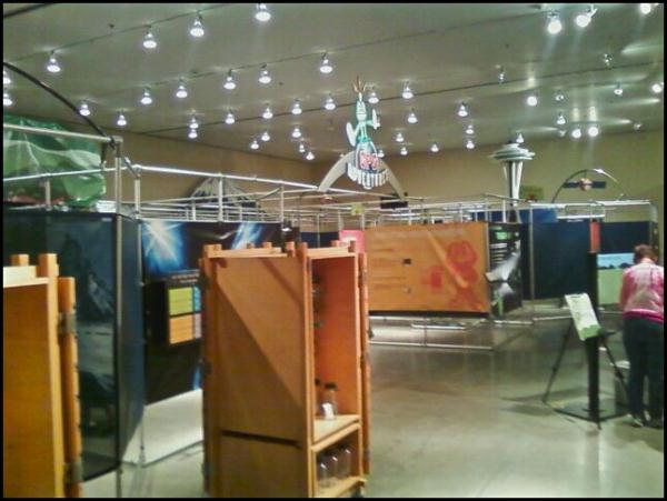
Fortunately, Chaosmanor called at that time saying they were outside and to expect them shortly, so we headed back across the bridge and met them in the museum foyer. After a hearty lunch, we headed over to the GPS Maze exhibit. The maze exhibit, is just that, a maze, with partitions and displays along almost all of the walls of the exhibit. The purpose is to explain GPS technology and the hobby of geocaching. While in the maze, we had to find four different geocaches, which contained clues that allowed us to enter locked rooms within the maze that held special areas. One entire locked room was dedicated to travel bugs and geocoins.
Almost immediately, we were separated from Chaosmanor as they chose a different path in the maze. We eventually met up with them and discovered that we'd each solved three of the locked areas and had but the same locked area to solve before we were able to get out of the maze. We did that last section together and it took all of us a fairly long time to find that last geocache. I think I had my fingers on it at one point, but didn't realize what I was touching. Eventually, we worked our way through the maze and back into the main area, where we both spent, probably more money than we should have on geocaching paraphernalia.
The overall construction of the maze was probably the highlight point of the maze. It had been made in such a way so as to not frustrate novice museum goers, who just wanted to experience the maze. It wasn't too difficult for them, yet it wasn't easy and possibly boring for experienced geocachers. It was truly well done.
We decided to walk the museum again with Chaosmanor, then went over to the butterfly exhibit again as well. We also went outside the park, and found that geocache I had been unable to find earlier in the day. One of the reasons I enjoy caching with others, is it gives one or more sets of eyes looking at the same things. I couldn't find it earlier, yet I was the one who came up with the find when all three of us were out there. Sometimes I think there is more pressure when you're by yourself to find the cache, and so the obvious doesn't always jump out at you. I seem, for whatever reason, to be able to make the geosensing jumps better when caching with others.
The maze is there until Labor Day. I'm actually hoping that as it hopscotches around the country, it makes an appearance in Southern California. I wouldn't mind taking a tour of it again. It was a fun day, exploring both the maze and the museum grounds.
My apologies for the poor quality pictures. My main camera's battery died the day before, so these were all taken with my cell phone.
Pictures were taken at or near the following geocache:
GPS Adventures Maze Exhibit-Turtle Bay Park - by Groundspeak
Labels: friendship, geocaching, museums, Ribbit
Monday, August 2, 2010
Lava Beds
As noted in my last post, a straight line is not always the shortest distance between two points. That could not be more apparent than the route we took to get from Lassen Volcanic National Park up to Lava Beds National Monument.
Although the monument is almost exactly due north from Lassen, the route to get there takes you northwest, then northeast, then northwest again. That's just the way the roads go up there. Finally, there's that little decision about which entrance to take, the north or the south?
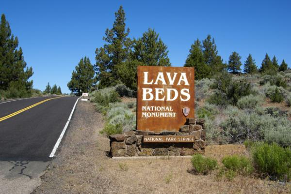
Because of the distance involved, we chose to drive straight up to Lava Beds, foregoing any caching along the way. We figured, we wanted to optimize our time, and there was only one objective as far as caching went. So, without caching, we drove, then came in through the southern entrance. You can't really see much, but if you look at the entrance sign post, you can definitely tell where the county road ends and the federal road begins. The county road was a lot worse in spots and not well maintained.
Lava Beds is a very interesting spot. The park protects an area of former volcanic activity. If you look at a map of the United States, you could draw a line, stretching from Lava Beds, up to Yellowstone. That line would also pass through or be near Craters of the Moon National Monument, another area of volcanic activity. The present theory is there is a hot spot of magma underneath Yellowstone, fueling the thermal and volcanic activity there. This hot spot used to be underneath Craters of the Moon and then previously Lava Beds as the earthen plates moved over the magma.
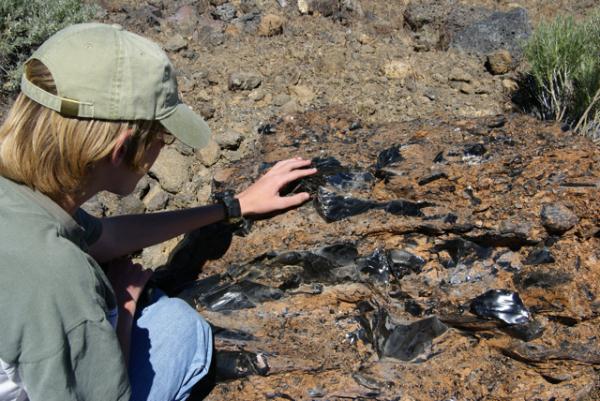
Lava Beds is an area of volcanic flows and a great amount of lava tubes, places where lava flowed, then as the lava subsided, large empty tubes, or caves were left behind. Several of these tubes are available for exploring and we brought out flashlights along just for this occasion. The park also rents hard hats out, but we weren't going to be exploring some of the low ceiling caves, so we didn't take advantage of that. There were large amounts of lava rock alongside the trail and we spotted one of the largest pieces of obsidian, known as volcanic glass, that I'd ever seen.
Because the area is dry, these caves are not what most people typically expect caves to be, full of fanciful formations. They have mostly a rough interior, but there are very few formations of any kind, no stalactites, no stalagmites or flow curtains. They are, nonetheless, impressive to see with some being over thirty feet in diameter. We explored several, including Mushpot Cave, Skull Cave and Valentine Cave, so named because it was discovered on that ever important day.
Skull Cave, where the only virtual cache is located in the park, is particularly interesting. Named because of skeletons found in the cave, it descends down into the earth. There are metal staircases going down and at the bottom there can be found ice year round. It's not one of those caves you'd want to stay in for very long, especially if you were dressed as we were, for the 90˚ weather topside. We walked down, felt the ice on the floor of the cave and then retreated to the surface.
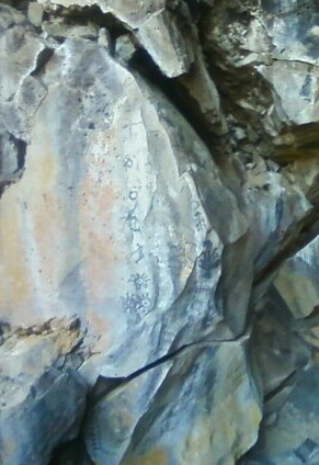
There were several caves in the park that had Native American petroglyph drawings on the cave walls. We hiked out to this cave and viewed those. Once again, I was struck by the toughness of life. At the entrance to one of these caves, there was a large tree growing out of the roof of the cave. We could not see any of the roots coming through the roof, yet the roof was probably only about 10 feet thick. The tree was probably twenty to thirty feet tall. Just amazing that it had been able to grow that large with such poor soil possibilities for it.
We ended up driving through the park and exiting via the northern entrance, then headed back to Lassen. The park is located in Siskiyou County, a county that I had already found a cache, but we had yet to find a cache in Modoc County. Once outside the park, we were in Modoc County, so it was just a matter of driving down the road and finding some caches before leaving the county to get that particular county checked off for the 58 California County Challenge Cache.
Because of the time driving to and from, we probably didn't spend as much time as we could have there. I think if I were to do this trip over again, I would have decided to move camp and camp up at Lava Beds for a night or two, but the day trip worked well for what we wanted to do this trip. As always, the caching and the companionship were excellent, so it was a good day.
Pictures were taken at or near the following geocaches and waymarks:
Lava Beds National Monument - by Webfoot
Skull Cache - by ChrissySkyking + Blaze
Labels: challenge caches, geocaching, hike, virtuals, Waymarking
Friday, July 30, 2010
Straight Line Caching
Every now and then, you run across a cache where you think you're smarter than the cache owner. I've had that happen on one of my caches, where I wanted cache finders to come in one way, but they came in another way. To be perfectly honest, I hadn't even explored that possibility when I hide the cache. I've gone in both ways and they both are adventures, although adventures of a different kind. One is a nice trail, the other requires more bushwhacking.
The Tadpole and I ran into those circumstances while up in Lassen earlier in the month. The cache is located just outside the park boundary on the western side of the park. There appears to be several possible access points leading to the cache, but the cache owners give only the western one. Well, we didn't feel we needed to follow the cache owners instructions, because we're smarter than the cache owner. Why hike six tenths of a mile, when you only have to hike .17 miles? Sounds easy, right?
Wrong. If you look at the cache page, the satellite view of the cache area shows the cache to be in an open area, surrounded by some sparsely scattered bushes. Well, from ground experience, those sparsely scattered bushes were a dense, impenetrable wall of manzanita bushes. Scratchy and very dense, it wasn't pleasant trying to bushwhack through those and we gave up, not once, but twice. We tried from the east which was a third of a mile away. No go. We tried from the north which was only .17. That was even worse.
The Tadpole wanted to try from a service area inside the park, which upon closer inspection shows the other end of the trail that is described on the cache page, but by that time, I'd decided that I'd already donated too much DNA to the surrounding plants, so we went in the cache owner's way. I was able to get the van in to about a half a mile before we hiked the rest of the way in. It was an adventure, but I need to remember if in doubt, follow the cache owner's guidance. They've been there before, you haven't. The shortest distance between two points is not necessarily a straight line.
Picture was taken at or near the following geocache:
Loomis - by 2dogs and mtnsteve
Labels: bushwhacking, geocaching, Ribbit
Wednesday, July 28, 2010
Lassen
There are a couple of national parks that protect historical and cultural treasures within our country. Most, if not all, protect scenic beauty and many also protect geological wonders. Lassen Volcanic definitely falls into the latter two categories.
One of the nice things about Lassen Volcanic National Park is it is one of the least visited national parks in the lower 48 states. Consequently, there are very few crowds in this park, even on a busy weekend. We happened to be at the park during the 4th of July weekend and were only confronted by crowds once, and that was in the visitors center. Once we were out on the trail or the park road, we encountered very few other people. Even the campground wasn't totally filled on that weekend, which I found surprising, since there is a substantial population to the west concentrated in several towns in the Sacramento Valley.
Probably one part of the equation was the winter we've had in California earlier in the year. The Sierra Nevada and the Cascade range got a large amount of snowfall this year. Hikers we encountered on the John Muir trail spoke of walking more often on snow as opposed to terra firma. One couple we spoke with told us there wasn't any trail to follow, so they were just following other's footsteps in the snow.
Snow in the high country isn't unheard of, but it's surprising to see that much of it, especially in late June and early July. My wife and I were in Crater Lake National Park on July 19th, 1987, basically snowed in. A storm had moved through Northern California and Oregon the day before and dropped a foot of brand new snow on the rim of the caldera. The rim drive had been shut down. It made for spectacular scenery, but it's a little disconcerting wearing winter gear in the middle of the summertime.
Lassen's elevation varies from around 5000 feet above sea level up to just over 10,000 feet at the summit of Mt. Lassen. The high point for the road that traverses the park is 8100 feet. As I noted in another post detailing where we would be going camping, we knew there would be snow at Lassen. We also knew the road was closed, but I decided to gamble that the road was open by the time we'd get there. I lost that gamble.
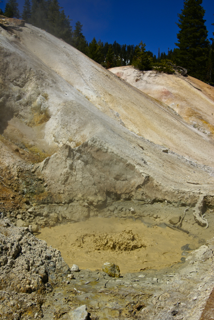
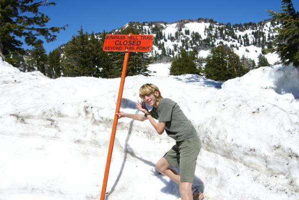
That didn't deter us from seeing the park. The major thermal area of Bumpass Hell was off limits due to the heavy snow. However, the small area of Sulphur Works, which is right by the road side was open. We got to see boiling water, colored a mustard yellow color and fumaroles steaming away. The smell of rotten eggs was prevalent.
The creek rushing downstream was a milk gray color from the sediments and minerals in the surrounding area. I wish Bumpass Hell had been open, as it would have been even more spectacular than what we saw, but I guess this just means we'll have to go back some other time to see it.
As it was, because of the snow, the two earthcaches that we'd planned on getting in the park were also out of the question. The Devil's Breath, was at Bumpass Hell. No way were we going to be able to get out there. I've camped at Lassen several times in the past, even hiked in hip deep snow to get to Bumpass Hell in June right after I graduated from college back in 1981. This time, the snow was overwhelming.
By not being able to drive through the park, we ended up driving completely around the park, something that we had planned for and were prepared to do should it come to that. That actually worked to our advantage, geocaching-wise, since instead of concentrating on those two earthcaches and possibly a couple of caches just outside the southern park border, we ended up getting over a dozen caches on our trip around the park. We gave ourselves several hours inside the park on the south side to view Sulphur Works and drive up to the Lassen Peak trailhead, where the other earthcache, Vulcan's Mecca was located. Once again, we were stopped by the snow from getting to the peak because the trail was closed about halfway up the peak. Next time.
On the drive down from the Lassen Peak parking lot, we stopped at a pullout to get a look at all of the snow. Helen Lake, which is at 8000 feet elevation still had a thin sheen of ice on its surface. If you didn't know the picture had been taken on July 2nd, you could swear you were in the middle of a clear winter's day. It was amazing to see.
The downside is we missed a couple of caches. There were so many upsides that it didn't matter. The scenery was spectacular and because of our change in itinerary, we ended up finding more geocaches because of it. Probably the best thing of all was our trip a couple of days later over to Whiskeytown National Recreation Area, which is to the west of Lassen.
Last year, when my older son and I drove through the same area in mid July, the lakes were down considerably, showing a bathtub ring which appeared to be fifty to a 100 feet deep. There was no bathtub ring to be seen this year in the lakes. Whiskeytown Lake was filled to capacity, with water right at the vegetation's edge as opposed to 100 feet away. Hopefully, we'll get another couple of good years like this past year, so we don't have to worry about water as much as we've had to in the past. Not enough water isn't a very good thing. This year, at least, we don't have to worry so much about that problem.
Pictures were taken at or near the following geocaches:
The Devil's Breath - by hafhas
Vulcan's Mecca - by Booty Buddies
Labels: geocaching, national parks, Ribbit
Monday, July 26, 2010
Cache hiding
In the past, I've dealt with what I think is the most efficient use of my time with regard to the hobby/game/silliness that we all know as geocaching. I've kept a goal for myself of a 1% threshold, where I have hidden at least 1 hide for every 100 I find. I probably could hide more than that, but there's an issue of quality in my mind. I don't hide micros. The smallest container I've ever hidden was a rectangular Altoids container. The only reason I hid that was as a replacement cache for the one that I accidentally lost in my haste to make the grab. Ooops.
Other than that cache, which really wasn't mine, the smallest has been a decon container. I like decon containers for a number of reasons. The first is they're large enough to hold a small travel bug or any geocoin. In my mind, I think a small should be able to hold at least something other than a log book. A geocoin makes this criteria. The second reason I like decon containers is they're small enough for general placement. I have a couple of decon containers that are hidden just off trails and every time I go out to check on them, they're a tough find. It's embarrassing having a tough time on your own cache. Usually when happens after I check on them is I up the difficulty rating on the cache by half a star or so.
Those and the traditional ammo can are usually my containers of choice for caches, but I've been know to use other things, particularly old coffee containers. But that's beside the point I'm trying to make here. It's more background information.
My arbitrary 1% threshold was set by me as a way to keep a balance in my caching. I hid my first two caches after only finding 14 caches. By my own standards, I don't think that's enough cache finds to adequately make a decent hide. There are always exceptions to the rule, but I think had I waited, I might have tried some camouflage techniques on the containers. Neither of the first two containers were camouflaged, just a container with a label on the outside indicating that it's a geocache (see the picture). Not that camouflage is a necessary requirement for a geocache, but I think they would look better if they had. And yet one is still out there after almost 9 years in the field, so i guess it's done OK for a non camoed cache.
The 1% threshold for me keeps me from having too many caches out there at any one time, yet at the same time, it allows me to give back to the caching community. At present I have hidden 35 caches, but only 22 are active. I think if I had more than about 30 caches active at a time, all I would be doing would be cache maintenance. Granted, cache maintenance is part of the game, but it's not the only part. I don't know how people who have 100 or so hides active do it unless they shirk that part of their caching responsibility. Nothing's worse in my opinion than coming across a cache site, not finding a cache and then checking the cache page and finding a string of DNFs dating back several months. That just shows that the cache owner doesn't care about their cache.
What this all really leads to is I'm approaching my 1% again. In the next couple of days, I will end up going over the mini milestone of 3400 cache finds, which will put me within 100 finds of the 1%. I've been working on a couple of hides, so it's now time for me to go out and place a couple more caches. The one I've been working on for the last couple of days is a puzzle cache with a theme to it, only the second time I've themed a cache.
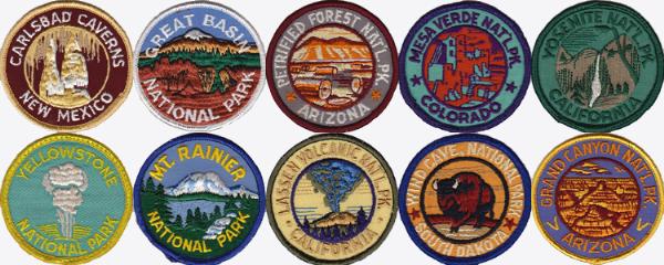
The graphic of national park patches comes from my collection of patches that I've purchased over the years. The Mesa Verde Patch was the very first patch I ever purchased, buying that particular patch back in the summer of 1971. I will be making a graphic for that cache, based on those patches that cache finders will have to de-cypher in order to find the cache. I guess local readers have an advanced warning, but they haven't see the puzzle yet, so it's really not a head start for them.
I hope to have this one out by the end of the week. Today would have been a good day to go out and hide it, since it was unseasonably cool this morning, but I had no energy this morning due to a migraine. If the weather continues in this vein, I might get out tomorrow or Wednesday to hide it. I'm hoping this one will be challenging for cachers.
Top picture was taken the following geocache:
Willow Creek Cache - by The Swamp Things
Labels: cache maintenance, geocaching, Ribbit
Friday, July 23, 2010
Hot Rock
One of the things about camping at higher elevations is the differences in weather that we're normally used to experience at our regular altitude. Before our camping trip, I had received an email from Chaosmanor asking what I was going to do about Lassen Volcanic National Park? I didn't know what the heck he was talking about, so I started investigating and discovered that the park road was still closed due to the high volume of snow.
I could postpone our trip, but I'm not sure if that was going to accomplish anything, so I decided to keep out timetable and leave when we had planned to leave. If there was snow, that would just add to the adventure. Besides, we had planned to meet Chaosmanor up at the GPS Maze exhibit on the 5th of July. If I postponed our trip, that visit wouldn't happen. It was something to consider, but for the most part, I didn't seriously think too long about postponing the trip. The snow could be fun.
The day we got to Lassen, we headed down the park road, which was cleared for about 10 miles into the park. The drive took us to several locations, one of which is interesting from the standpoint that we could get a feel for what Mt. St. Helens might look like in 70 years or so. Mt. Lassen erupted almost 100 years ago and today, it is a living laboratory. It's about 70 years ahead of Mt. St. Helens, which is a similar type of volcano, being in the same Cascade range.
Along the road, we stopped at the Hot Rock, a very large boulder that had been ejected from Mt. Lassen and come to rest approximately 5 miles away from where it had started in the mountain. I scanned a postcard that I purchased at the visitors center showing the rock only days after it had been ejected from the mountain. B. F. Loomis, a photographer had taken this photograph and had noted that the rock had glowed red hot for several days after it had made its final resting spot. Loomis' photos are a great historical record of the area, which can be compared with similar views today. The rock as noted on the postcard, was 20x18x14 feet, a massive rock. Today, it stands by the side of the park road, with no view of the mountain any more.
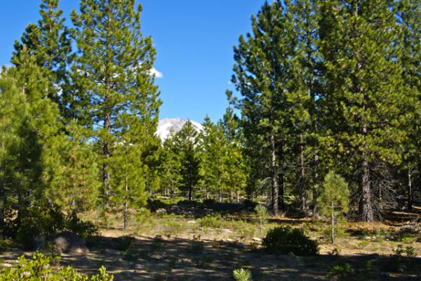
There is another area just down the road from the Hot Rock known as the Devastated Area. It has a similar view to the Hot Rock postcard picture. In the postcard, the ridge of trees to the right were spared, because of the local topography. The heat, volcanic winds and mud and landslides from that major eruption swept around or over the ridge sparing many of those trees. However, the other area to the left is clearly barren of any kind of plant life. That is what was called the Devastated Area. Compare that with the picture I took at the Devastated Area. Nature has a way of reclaiming its own eventually. This is a glimpse of what Mt. St. Helens could look like in the future.
Pictures were taken near the geocache:
Loomis - by 2dogs and mtnsteve