Growing up in Orange County, California, I was constantly reminded about local history during school, plus my parents took us to many historical locations around where we lived so that we knew about the local history of both Orange County and of California. Local history, no matter where you happen to be can be quite fascinating. When we went on camping trips in summer to other states, my dad would always make sure that if we were near a state capital building, that we'd get a picture taken near it, or try to arrange a tour of the building.
I've eaten a picnic lunch on the grounds of the state capital building in Cheyenne, Wyoming. 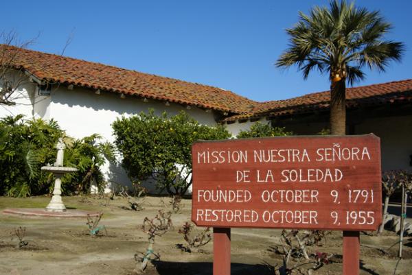
Part of the history of California is El Camino Real, the King's Highway, which stretches from San Diego to Sonoma where the Bear Flag Revolt happened, that started California on its way to independence from Mexico and eventual statehood in 1850. El Camino Real was a road developed over time to link up the missions established by Father Junipero Serra. Fr. Serra helped establish 21 missions in the late 1700s and early 1800s along the coast of California and there became a need to link them together for transportation and economic purposes. Thus became, El Camino Real.
The actual road today is, for the most part, gone, but there are bell markers along the side of Hwy 101 for most of its length between Sonoma and San Diego indicating where the original road had been. Other highways are also incorporated into the King's Highway, but the 101 is the main artery north and south of the central coast of California where most of the missions were constructed. As we were driving down the 101 from our trip north a couple of weeks ago, I noticed several of the bell markers. There is a Waymarking category for the bells and since I'm going to be using the 101 on a frequent basis over the next several years because of my son's choice of schools, it makes sense to put this one on my waymarking list of things to watch out for in the future.
As is our custom, we found several geocaches on the way down from Santa Cruz, including two at Mission Nuestra Señora de la Soledad, which was established in 1791, the 11th of the 21 missions to be so created. 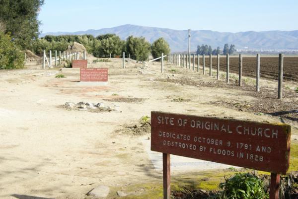
There also appeared to be some archeological digs going on behind several of the main buildings at the mission and it's probably a work in process. The mission is 2 miles away from Highway 101, and probably doesn't get many visitors, which probably means that funding for projects are not nearly as plentiful as they would be in Orange County where San Juan Capistrano is located.
We toured the two buildings, which included the church and chapel of the mission, looking at the exhibits first before heading out to get the information needed for the virtual cache there or finding the regular cache hidden by the entrance to the grounds. It was a nice quiet spot to get out and stretch our legs and learn a little bit more about California. I have now visited 6 of the 21 missions, with Soledad being the farthest north. I'm sure there will be more opportunities in the next couple of years to visit other missions along the King's Highway.
Pictures were taken at or near the following geocaches:
Mission Possible - by needlepointone and zieber
Mission: Soledad - by Great Scott!
Saturday, February 27, 2010
The King's Highway


Thursday, February 25, 2010
Fragility of Life
This has been an upside down kind of week. I had several blogs rattling around in the back of my mind, but events of the week changed those thoughts entirely. The fragility of life intervened this week and so I feel I must write about this instead.
Several months ago, I was able to reconnect with a friend of mine from high school. He sat behind me in my U.S. History class and I'm pretty sure I'd met him in junior high. I hadn't seen him since our ten year reunion, the last one I attended, but when I noticed his name show up on Facebook, I didn't hesitate to add Richard as a friend of mine.
During the next two months, I found myself interacting with Richard several times. He had become a fan of Sleeping in Tents, a blog site dedicated to tent camping. I found the site interesting and looked over some of the entries, liked what I saw and figured that I might as well become a fan as well. During this same time period, I discovered that he'd recently gotten married to my high school physics lab partner. The two of them were two of the nicest people I was acquainted with in high school.
Unfortunately, this blog does not have a very happy ending. Richard passed away this past Monday of a heart attack. Just last week, he'd been responding to one of my posts. Now, he's gone. Today, I mourn for his wife and for his memory. Although we hadn't been reconnected for very long, I know I shall miss him. Thank you for the short time we had Richard.
Saturday, February 20, 2010
Honored
Today I found a cache. Just one, but it was a nice one. I was aware this one was going to come on line sometime today as the cache owner had forewarned me about the possibility of a new cache in my area. When I left the house this morning at 10:30 to find some virtual flags in GeoVexilla, it hadn't come on-line yet, so I really didn't think much of it.
When I got home to log the flags that I'd found, I noticed an email from the cache owner encouraging me to get out there and find it and since the cache was only 1.62 "Crow Miles" away from home, I headed out again, much to the consternation of my wife. 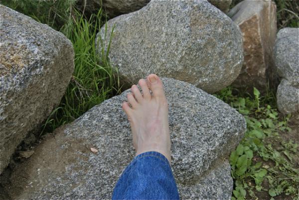
When I got to ground zero, there were already two people standing there. Looking at them, I didn't recognize them, but we made introductions and they were two other local cachers, whom I hadn't met, so that was a bonus right there. We spent a good ten to fifteen minutes looking for the cache and as I noted in my log, had the cache been alive, it would have bitten me on one of my webbed feet. I soon spotted the cache, then backed off for the other cacher to have the opportunity of finding the cache as well.
We exchanged some more pleasantries and then made our separate ways home. I decided to take a picture, just to dispel any rumors that surface from time to time as to where I actually got my cache name.
I am still at a loss for words that maddmaxxawr wanted to place a cache in my honor. I hope that I can live up to the standards that I have apparently been setting these many years that I have been caching. I know he's a follower of this blog, so I'll publicly thank him here for the great honor.
Picture was taken at the following geocache:
Webfoot has Webbfeet in Webb Canyon - by maddmaxxawr

Thursday, February 18, 2010
Brotherly Love
Every now and then, my older son surprises me. This past weekend, I took the Tadpole north to visit his sister in Stockton and his brother in Santa Cruz. I had a four day weekend, so it was easy to pull him out of school for a day so we could do this in a leisurely sort of way. 
When we first got there, he offered to give us a tour of the campus, primarily for his brother's benefit, since I've been to the campus several times. Santa Cruz's campus is located on the side of a hill, so there's several bridges that cross ravines and in general, it's a pretty hilly campus, but a very beautiful one. We saw 18 deer on campus that day, way more than my son said was usual. Apparently, the deer were enjoying the good weather just like we were.
About half way through our walk, my son turned to me and asked me whether we wanted to find any geocaches. Uh, sure son, but you're the one who calls geocaching, that "dorky thing Dad does" with my younger brother. But this time he was honestly sincere that we have a good time and he knew we liked to geocache. I hadn't brought the GPSr with me because I hadn't expected to geocache much that day, but I had brought along the iTouch which has all of my geocaching notes. Because of the WiFi on campus, I was able to pull up the Geocaching site and I noticed a cache called Thimann Tribulation.
My son then pointed and said that the building we were standing next to was Thimann Hall. So we looked up the description and the hint and figured out where the cache was hidden, finding it in what I call "Commando Style," that is, without the use of the GPS. 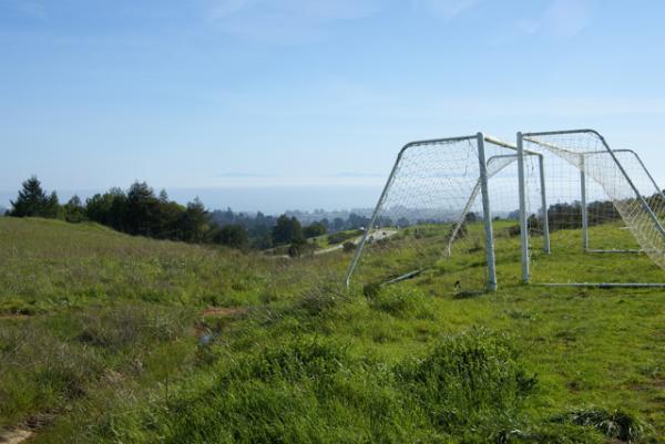
My son even consented to several pictures. It's very hard to get a good picture of him since he doesn't seem to like his picture being taken, but this day was also an exception, as I got several good ones of him around campus. The Tadpole commented after we left for the day that he had really enjoyed himself and really enjoyed spending time with his brother. That's a good thing, in my opinion. For those of you who don't have teenagers yet, this is what is in store for you. The Tadpole was shorter than his brother when his brother left for school last September. The kid is a bottomless pit right now.
Pictures were taken at or near the following geocache:
WUPH4_Best Soccer view in the world - by Mayela Mingi

Tuesday, February 9, 2010
It's that time of year again
February rolls around every year and because of the holidays attached to that month, I usually get to do a nice long road trip north to visit my children. My district this year decided that we would take one long 4 day weekend as opposed to two 3 day weekends as we have in other years. This Friday, I'm going to be taking the youngest out of school a little bit early and we'll head north to visit both of his siblings who are matriculating in college.
Our first stop will be Stockton where my daughter has been attending school at the University of the Pacific, majoring in violin performance and music education. 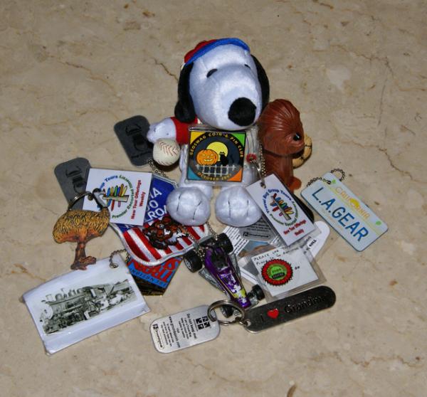
Following our visit to the Stockton area, we'll head over late Saturday night to Santa Cruz. My older son is in his first year at University of California at Santa Cruz. He hasn't declared his major yet, but as noted above, he's still a freshman so he has some time to make that decision. Right now, he's just enjoying the experience. Most of Sunday will be spent visiting with him and touring the campus for the Tadpole.
Monday, we'll head home, geocaching along the way. We have 9 travel bugs in our possession that we've picked up over the last couple of weeks, so we'll be distributing them freely across the trek we plan to take as well. For those who are interested, I've created a bookmark of the cache route we might take. The bookmark list has just about 300 caches in it, so I'll probably do two spot PQs for this trip, one centered on Stockton and the other centered on Santa Cruz.
It will definitely be a whirlwind trip, but it should be fun. This will be the first road trip that I'll be taking the Tadpole on that doesn't involve camping. We'll see how he adjusts to motel life.

Wednesday, February 3, 2010
Out of this world and other things
I thought I'd seen everything, but this has to be the hardest cache ever to find, especially since it's several hundred miles above the Earth's surface. Richard Garriott, one of the astronauts that have been on the International Space Station (ISS), hid a geocache in one of the lockers on the ISS. Not that I have enough money to buy my way on to one of the space tourism rockets planning on heading there probably in the next decade, but that would be a very cool cache to find.
In other news, Jeremy, the founder of Groundspeak, which runs geocaching.com tweeted about a travel bug rescue site that has started up recently. Here's the video posted to the front page of the travel bug rescue site.
I checked out the map on the site and discovered two travel bugs that are in need of rescuing near me. Near me is relative since they are both about 100 miles away from me. I've bookmarked the page for future reference. The likelihood that we could get close to rescue a travel bug would probably go up during the summer months when we're planning our camping trips.
The one cache near San Diego looks like it either got muggled or washed away. Reading the logs on that particular cache page indicates that the travel bug in question (Hoofy) isn't in the cache anymore. It's still an interesting concept that could work as the site grows.

Sunday, January 31, 2010
The long and winding trail
With January finished tonight, I ended up with 38 cache finds for the month, averaging slightly more than a cache find per day. Most of those were on a couple of cache runs on a the weekends, so it was not a sustained cache streak. 
There weren't many longish hikes during this month, mainly because weather didn't cooperate much this past month and because caching has evolved as a hobby and sport over the past 9 years. Back in the "olden" days, the majority of caches were placed on trails, far from civilization. You'd hike to a cache, find that one cache and you were done for the day. With so few cachers around, this was to be expected.
I didn't hide my first cache until four months after I'd started finding caches. I learned from others and how they hid caches. Since most cache hides were hikes, hidden away from the crowds, that's what I decided to do as well. Today, it's different.
Now, caches are hidden everywhere, on almost every street corner and every Wal-Mart parking lot. The lamppost hide, which has become rampant, was original at one time. I remember trying to find my first lamppost cache hide. It was hidden at the exit of a drive through of a burger place, not the best placement in my opinion, especially at lunchtime. 
Many of the trails around here have caches hidden on them, many of them my own caches. I don't hide micros, and most of my caches, a hike is needed to get to them. That's the way I learned about caching and that's the way I'll proceed. And no, I'm not above finding a micro or two or three from time to time, but every now and then, I need a hike like I took several years ago up to the top of Potato Mountain.
The hike took me beyond the spots where my furthest two caches, Black Friday and The Cats Made Me Do It, have been hidden. To get to the top of Potato Mountain, which is actually a smallish hill, the hike is probably a four mile hike from the parking lot down in the flat lands. It's a killer hike, but the reward is great. From on top, you have views of the mountains beyond, the valley below and on exceptionally clear days, you could probably see all the way out to Catalina Island, 24 miles away from the coast of California.
Back then it was simple. A four mile hike, one cache and a day well spent. Now? It's different. Some would say different in a bad way. I say, it's just different. We all get out of the hobby what we put into it. If I choose to go on a hike, I can do so. If I choose to hunt micros on a particular day, that's also my choice. 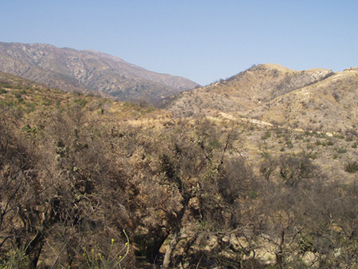
Pictures were taken at or near the following geocaches:
Potato Mountain Flat Place Reminiscence #1 - by Carharty
Scenic Value - by Webfoot
Trail Junction Cache - by catrunr

Thursday, January 28, 2010
None but the Brave
Last Saturday, after visiting my mom in the hospital, we headed east out to Riverside National Cemetery. A little over a year ago, I'd been out in the same general area, getting a virtual near March ARB. 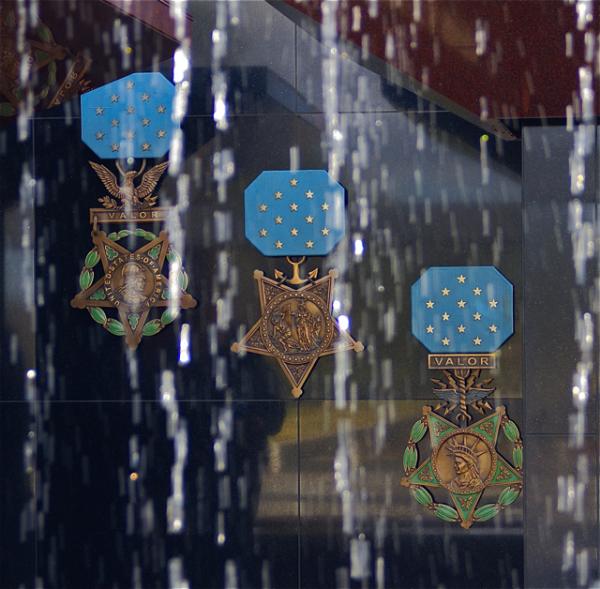
When we went out there, I was basically unaware of what we were going to be looking for, so I just followed the GPSr to ground zero. It became rather apparent the closer we got. There were signs pointing the way to the Medal of Honor Memorial. This particular memorial, is one of the four official Medal of Honor Memorials located in the United States, which honor all 3000+ Medal of Honor award winners since the inception of the award in 1862.
For the uninitiated, the Medal of Honor is the highest award that can be achieved by any person employed in the armed services for the United States. It is sometimes called the Congressional Medal of Honor, but that is a misnomer. The correct term is just Medal of Honor. There are three different medals, depending upon which branch of service the soldier/sailor is a part. I'm not sure, but I think one of the attributes of the "official" designation of these memorials is that every person awarded the medal has their named engraved in the memorial.
The other three memorials are located in Pueblo, Colorado, Indianapolis, Indiana and Charleston, South Carolina aboard the U.S.S. Yorktown, which is moored in Charleston Harbor. 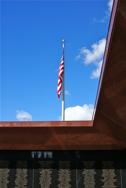
The center of the memorial is a pool with cascading water. The water is pumped into a steel rail that is over the top of the pool and water drops from that rail into the pool. I was so engrossed in other aspects of the memorial, that I failed to even look at how the rail was supported over the pool. From the entrance, we could look through the water dripping down and see large replicas of the Medal of Honor for each branch of service, from left to right in the picture: Army, Navy, Air Force.
Once inside, the litany of names were engraved on granite walls all around the fountain, starting with winners from the Civil War, all the way around to the two latest from the conflict in Afghanistan. Due to the nature and criteria of the award, 60% of the award receivers are awarded their medal posthumously.
While getting the information needed for the virtual cache, we ended up going all around the memorial. We'd have done this anyway and I think we spent a good half hour just in awe of all these brave men, many of whom gave their life for their country. There were more Civil War veterans listed than any other war, mostly due to looser conditions for the awarding of the medal in the first place. I'll not quibble with anyone who is on that wall.
As we walked around, I looked for certain people that I was pretty sure were on the wall. I missed Audie Murphy's name, he being the most decorated soldier in American History, but I was able to find Joshua Chamberlain's name. 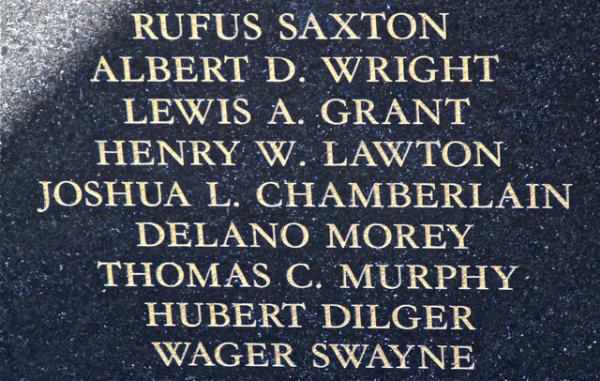
We also found several servicemen with our surname, plus one of my admired Presidents, Theodore Roosevelt. On another panel, in another war, was Roosevelt's son, Theodore Jr. The stories on those walls were endless. I left thinking that I was glad that I hadn't been able to get this virtual a year ago because the Tadpole would have missed the experience. Although, I'm pretty sure that I would have taken him back here because he needed to see this. I'm hoping he'll understand what this was all about in the future.
The encouraging thing about these four memorials is they are spread across the country in a way that almost all Americans living in the contiguous United States are only about a day's drive away from one of the memorials. Unlike many of the memorials in a city like Washington D.C., where there is only one, people don't have to travel long distances to appreciate the sacrifices made by these men. In my opinion, that's a good thing.
Pictures were taken at or near the following geocache:
Bravest of the Brave - by SlowMover

