When I first started geocaching, I was strictly a paper kind of guy, since I had an old school GPSr Garmin 12. No computer connection with that one, so every coordinate had to be entered by hand. Make one mistake and your searching far away from your intended cache.
Once I got the new GPSr - yeah it's still a Garmin - and a PDA, I went paperless. It was great having the nearest 500 caches in your GPSr all the time. Going out on an errand? Oh look! There's a cache over there. I took my daughter to a music audition and she "gave" me permission to find a cache before we came home. That was assuming that I had my GPSr with me she asked. I gave her a wry look and off we went, to find a really nifty lamppost cache. Well, the cache wasn't nifty perhaps, but the surrounding landscape was very cool, a sculpture made from some of the remnants from the Northridge earthquake from about ten years ago. The power of Mother Nature is awesome.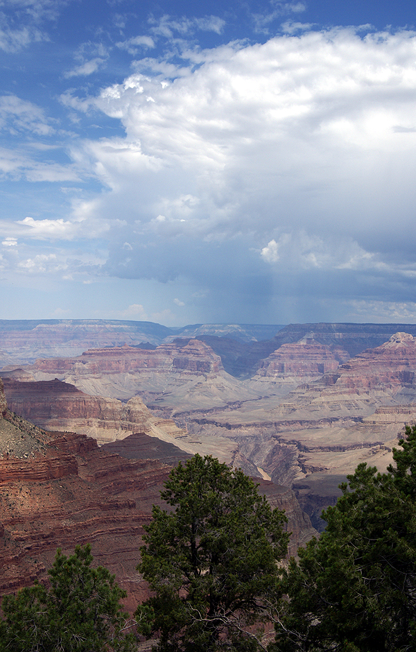 Now where was this going? My youngest is the only one who caches with me on a regular basis. Every summer, we'd pick a place to go camping and then we'd start plotting out which caches looked good to get. Then, I'd print out the cache pages and we'd have a stack of 15 to 25 cache pages that we would attempt to find. It was not a very efficient way of caching. If we couldn't find the cache, that was one cache we couldn't find and we wouldn't necessarily have any other close caches to find because of our paper stack. Throwing away those printed pages, was almost like throwing away a friend. Our best trip was a camping trip we took to Utah and Nevada where we ended up finding 18 caches, many of those were locationless caches (before they'd been archived out of the system) and virtuals.
This past summer, we decided that we'd be camping at the Grand Canyon and surrounding areas down near Flagstaff. I'd played around with the Google Routes in the past, but this was the first time I actually put the route query into play. From our area in Southern California, I ran my first route from Barstow, CA to Cameron, AZ, which is north of Flagstaff. I'd originally thought of just sending it to Flagstaff, but I couldn't get Google to create a route the way I wanted to go if I stopped the first route in Flagstaff, so I had to make the route a little longer, so it would go the correct way.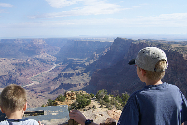 From there, I created a second route from Cameron to Grand Canyon and then I created a third from the Grand Canyon to Williams, AZ creating a large backwards shaped P lying on its back across the Arizona landscape following Interstate 40 and other Arizona Highways with the footing of the P in the eastern California Mojave desert.
I then saved the routes from Google, uploaded them to Geocaching.com and then ran the queries. With the route, I was able to set parameters, like how far off the route do you want to search? What kind of caches? I set the width at 2 miles figuring we wouldn't be doing off roading and also figuring that some towns that had been bypassed by the Interstate, might have some interesting caches, but might be more than a mile from the Interstate.
Once that was done, I then did some spot queries to fill in gaps. I ran one around Flagstaff, since we'd be spending some time there and one around Grand Canyon since I noticed that the route didn't pull in the four virtuals that were in the western part of the park, more than 2 miles from the route. With that done, I then loaded all the queries into GSAK and found I had 429 caches f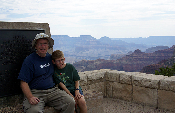 or this seven day trip. I knew we wouldn't be able to find all of those, but it was nice to know we had those available to look for depending upon where we ended up going. I figured that if we found 5% of the ones in the GPSr, we'd be doing pretty well.
Once we started on our trip, it became evident that we'd find a lot more than that. We found four on the first day without any difficulty at all, just stopping at rest areas along the way. Using the old way of searching Geocaching.com, we might not have even noticed all of those caches along the road. This way, all we had to do was watch the GPSr and let it do the work for us as opposed to the other way around. "Oh, look Dad, there's a rest area up ahead with a geocache. PDA cache page says it's an ammo can!" Yep, we're going for this one.
In the end, we ended up finding a variety of caches of nearly all types - some puzzles, some virtuals and a lot of traditionals - for a grand total of 43 caches in six days. That was double my original estimate and a pretty good average of 7 cache finds per day. Yeah, we probably could have had more, but we also took in the views as well. This was the first time I'd ever used a route query and I was hooked. One of the nice aspects of the route, was you had a full set of caches at your disposal, not just a couple that you'd printed out. If you couldn't find a particular cache, it wasn't going to be the end of the world, because you knew there were others close by. Just do a search with your GPSr for closest caches and pick another. That was especially handy when I had the kid in tow. He wanted to find caches. This made it much easier.
I've used a route query now four more times, with varying degrees of success, but always with better success than just picking caches that "look good" while looking at areas that you might be near. My last trip, this past weekend, I was able to find 5% of the caches that I uploaded into the GPSr and if I'd been a little bit more patient in my search techniques, the results would have been higher. Getting back to the title of this article - I know what the answer will be for me in the future.
Monday, January 14, 2008
To route, or not to route, that is the question
![]()
![]()
Subscribe to:
Post Comments (Atom)
1 comment:
I've used PQ routes a number of times now and have to agree they are great. Thanks for the story and pictures.
Post a Comment