Last week, Chaosmanor and I went up into San Francisquito Canyon to do some geocaching. One of the caches we looked for was the earthcache, 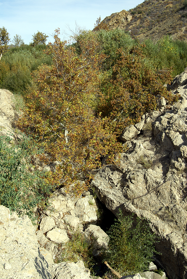 St. Francis Dam Failure, Saugus California. Obviously, the earthcache has you examine some of the things that led to the failure of the St. Francis Dam, back in March 1928 over 80 years ago.
As noted previously in my last post, the road used to lead right past the dam site, but the dam, or what's left of the dam is now shielded from the new road course. I don't believe this was done intentionally, but we both noticed that you cannot see the dam either coming or going along the new course of the rive. Well, I take that back. You can see the dam as you make your way south out of the canyon, but only if you really know what you're looking for, which probably leaves most of us out.
The dam was constructed between 1925 and 1926 and then was slowly filled over the course of the next couple of years. It was designed by William Mulholland, the chief architect of the Los Angeles aqueduct that brings needed water to the city from Owens Valley along the east side of the Sierra Nevada. This reservoir was designed as one of the storage sites for that water.
As the dam slowly filled, cracks and leaks were noticed in the face of the dam, but they were pronounced normal for the dam by Mulholland. As the lake increased behind the dam and more pressure was exerted on the dam, more cracks and leaks developed, each one being dismissed by Mulholland as normal for a dam of this size. The lake was at full capacity for five days before the dam collapsed, first on the east side, then on the west side leaving a large portion of the 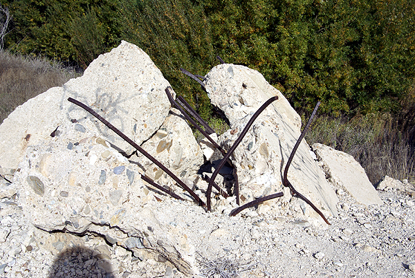 dam upright and standing in the middle of the stream with water flowing around it.
The dam pieces were pushed downstream up to a quarter mile away as the water rushed down San Francisquito Canyon. No one know for sure how many people dies in the flooding that followed. I've seen counts as low as 450 and as high as 600. Those are "official" counts and are also acknowledged as being on the low side because there was no accounting for the migrant farm workers that were living in the area. I also read a report that stated they were still finding bodies as late as the 1970s.
This disaster, obviously ended William Mulholland's career. The geology of the area known in the 1920s was not enough to prevent the dam from collapsing. Newer developments would have been able to see the flaws that led to the collapse of the dam and the dam would not have been built in that particular position in the canyon. As we stood on the top of what's left of the dam, we figured out why Mulholland chose that particular site. It was a natural site for a dam, a fairly narrow canyon that opened up onto a broad expansive valley upstream. The place where the dam was built was narrow and 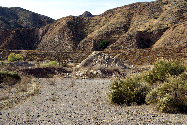 would have trapped a large volume of water behind it. It was just built, geologically, in the wrong spot.
It's interesting that Mulholland admitted he made a mistake and claimed full responsibility, yet there doesn't seem to be any major lawsuits brought forth following the disaster. Perhaps it was because the inquest placed the responsibility at his agency's door, but also stated that Mulholland had no way of knowing the geologic formations where the dam was placed would cause the failure of the dam. I'm pretty sure we would not see the same kind of reaction from the general public if a similar dam were to collapse now. Lessons were learned and have been applied to other dams built afterward, similar to lessons learned when the Titanic sank.
I'll not get into the specifics of the earthcache itself. If you wish to do this earthcache, it's fairly straightforward and easy to do. 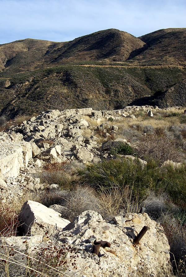 You get a lot of insight into dam building and what caused the failure, plus you can see the raw power of 12 billion gallons of water. The pile of debris in the third picture is pieces of the dam at least a quarter mile away from the actual site, moved there by the water as the dam collapsed.
Another geocache took us up to the top of the western part of the dam that was still there. The middle part of the dam, that was left standing after the flood, was later demolished after someone was killed attempting to climb it. Standing up on top of the dam was where we got to see why the dam was placed there. The broad valley behind the dam was perfect. Had the dam not fallen, I could see where this area would be a perfect recreational area for boaters. This would have been a huge lake.
At the same time, had someone been standing up on the western side of the dam when the other part collapsed, it probably would have been mind numbing to see it happen. It took close to two years to fill the lake completely and it drained in less than two hours. I've seen pictures of people who were standing on the top of Mt. Adams when nearby Mt. St. Helens exploded back in May 1980. One woman just fell to her knees as she watched that drama unfold. I can only imagine it might have been similar here, had there been a witness who survived.
South of the actual site there is a California Historical Marker noting the disaster, but that seems to be the only official noting of the 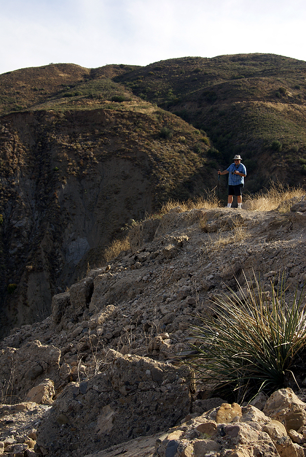 tragedy. The site is in the process of generalized decay. There is still quite a bit to see considering the site is 80 years old. The main portion of the west wall is still intact and accessible from a trail head that starts south of the dam, or from the beginning of a road cut that was made when the newer portion of the road was made a couple of years ago. There are huge chunks of the dam sitting in the middle of the canyon, some with inch thick rebar and rusting pipes jutting out of the sides of these pieces. Smaller pieces of the dam, I'm sure, are disappearing as souvenir hunters comb the area, but the main pieces won't be going anywhere anytime soon. If you get to this area, I highly recommend a side trip up here, just for the historical interest of the site.
It's unfortunate that a disaster such as this has to happen to spur government officials to act in the best interests of the people. That seems to be our way of life. Fortunately, these types of incidents don't happen nearly as frequently as they did earlier in the last couple of centuries. Yes, it was an ugly incident, but some good did come of it, and that is a good thing.
Pictures were taken at or near the following geocaches:
St. Francis Dam Failure, Saugus California - by TerryDad2
In the Shadow of St. Francis Dam - by Yosemite John and Debbie
St. Francis Cache - by Tom and Tommy
Friday, November 28, 2008
St. Francis Dam

![]()
![]()
Subscribe to:
Post Comments (Atom)
3 comments:
Fascinating report and good illustrative pictures. Math's a little fuzzy, though. 1928 was 80 years ago, wasn't it?
Yeah, you're right on the math. It used to be my strong point when I was in high school. I blame a poor trigonometry teacher.
I fixed the math on the post.
Post a Comment