Whenever I go geocaching, I'm always on the lookout for memorials. There is something about memorials that deeply touch me, especially soldier memorials. 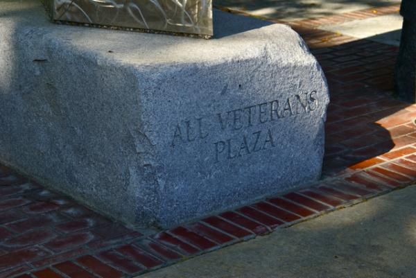
But for many men and women, it is their choosing and I salute them for it. It must be extremely difficult to be away from your family during the holiday season. I can't imagine being thousands of miles from home, away from my family, let alone having these conditions imposed upon me and also being shot at in the process.
I've made it my custom, when I come upon a soldier memorial to take as many pictures as possible. The memorial is a poignant reminder of those who never come back from those far distant lands. It reminds me of the family left at home grieving for their lost husband, son or Daddy. It reminds me that I have been truly blessed to live in a country where we value freedom so highly.
A friend of mine is serving in Afghanistan right now, away from his wife and children. A former student of mine was killed earlier this year over there one week before his 20th birthday. 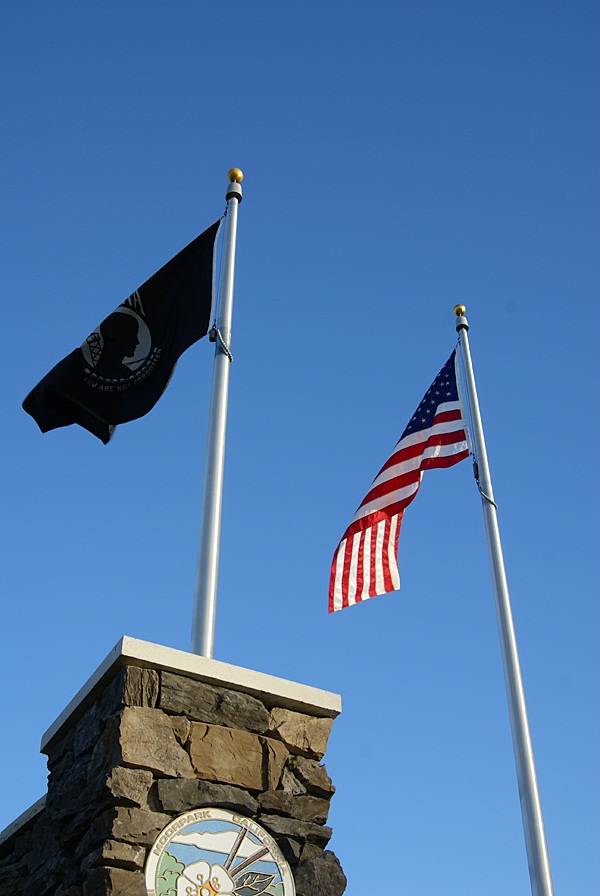
I leave you with a You Tube video that a friend of mine posted earlier today on Facebook.
I know we will always have soldiers overseas, but hopefully next year, we will have fewer of them in harm's way.
Merry Christmas to all, and to all a good night.
Pictures were taken at or near the following geocaches:
Cricket's Reflection - by GeoCrickets
"United We Stand" - by Lizard Man
Friday, December 24, 2010
Sobering thoughts


Monday, December 20, 2010
Here I go, There I go, Where I go
Last month, while on a road trip to Stockton, Chaosmanor and I were fortunate to attempt a couple of Wherigo caches. A Wherigo cache is similar to a multi-cache in that you have to find clues as you walk along a route planned out by the cache hider. You need a Wherigo enabled GPS unit in order to complete a Wherigo cache. 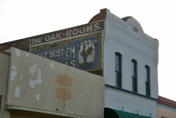
Wherigo is a toolset for creating and playing GPS-enabled adventures in the real world. By integrating a Wherigo experience, called a cartridge, with finding a cache, the geocaching hunt can be an even richer experience. Among other uses, Wherigo allows geocachers to interact with physical and virtual elements such as objects or characters while still finding a physical geocache container. A Wherigo-enabled GPS device is required to play a cartridge.Since I don't have a Wherigo enabled GPS, I haven't been able to find one until now. In fact, the closest Wherigo caches is 20 miles away from me. Chaosmanor recently purchased a Garmin Oregon GPS unit and it is one of the ones that are Wherigo enabled, so when we were planning out this route, I spotted a couple of Wherigo caches in Lemoore, CA and decided to put them in our bookmarked route.
As I noted above, doing a Wherigo is similar to a multi-cache, only the clues are given to you on your GPS unit. You load the cartridge form the Wherigo website into your GPS unit, then head out to the starting coordinates and play the cartridge. There are several ways to play the game.
One way is to play locationless cartridges. These cartridges can be played anywhere. There's a tutorial at the Wherigo site that allows you to try a Wherigo out before actually doing an actual physical Wherigo cache. When we got to Lemoore, Chaosmanor let me have his GPS and I tried the tutorial out in a little park south of the first cache we were going to attempt. If you're familiar with GPS units, the learning curve for these isn't that tough, although it took five to ten minutes for me to get the hang of it. Once I solved the relatively easy tutorial, we walked across the street and tried the physical Wherigo.
This second cache was a relatively easy cache to do. It was located in a large park, with very little tree cover, giving us ample signal strength to our GPS. We picked up the clues by answering questions, then headed to the second waypoint. Each waypoint is located in a zone, which is the way the Wherigo cartridge works.
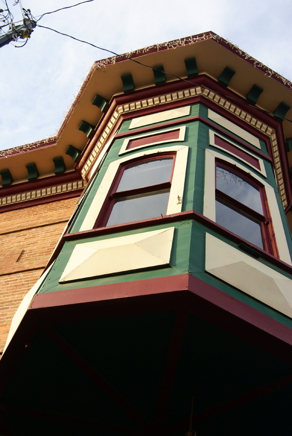 Once you get to the next zone (which can be a variety of sizes), you then can get your next clue. Eventually, the clues and cartridge took us over to where the cache was actually hidden allowing us to log our find.
 We then headed into downtown Lemoore to attempt the other Wherigo cache. We parked near the starting point, opened the cartridge and began. This one was a little trickier since we were walking through the old town section of town. Tall buildings cause signal bounce, so we didn't always get as close as we could to the center of the zone in order to answer the questions which would lead us on to the next waypoint. This could be because the zone may have been too large. I'm not sure on this, but it's something to consider if you're going to attempt a Wherigo in a city environment.
I enjoyed the second Wherigo more than the first probably for a couple of reasons. One, the first one was in a park, where any kind of cache could have been hidden. There wasn't much interest generated outside of going through the steps and finding the cache. I also was new, it being only my second attempt following the tutorial. The downtown Wherigo, I had a little bit more experience utilizing the cartridge and the buildings in the downtown area had some local history attached to them, which made the walk more interesting in my opinion. Your mileage may vary depending upon your own experiences.
I enjoyed walking through the downtown area. I'd been there previously, finding a virtual cache in one of the areas we walked through on this caching experience. Looking at some of the turn of the 20th century buildings was enjoyable to me, especially looking at some of the Victorian architecture. It gave me an idea for a Wherigo cache in my local area, although I'm not sure how I'll be able to set it up, since I don't have a Wherigo enabled GPS at the moment.
I'll have to download the Wherigo builder onto my other computer and try it out. Perhaps I will be able to create one, without the need of a Wherigo enabled GPS. We'll have to see about that.
There are quite a few Wherigo caches in California. I noticed one in Yosemite Valley near Yosemite Fall. I found this interesting because the National Park Service doesn't allow physical caches, but when I investigated it further, I discovered that the physical part of this Wherigo is outside the park in nearby El Portal. I've heard rumors about Geocaching possibly bringing back the virtual cache. If this does become a reality, I can see where some very interesting Wherigo virtuals could be created, especially in a National Park environ.
The upshot of all of this was it was a new experience for me to try, using my GPS. They probably aren't for geocachers who are numbers runners. They take more time than the regular cache. I would estimate the first cache we found in the park took us 15 minutes to complete and the second one in downtown took us closer to 45 minutes. We might have been able to solve the second one more quickly but we did get sidetracked. All in all, they were enjoyable experiences, something that I'd like to try again in the future. I'd also like to create one.
Pictures were taken at or near the following geocache:
Lemoore's First Wherigo! - by JohnE5

Friday, December 17, 2010
Night caching and photography
Every now and then there are surprises that show up while you're out. Chaosmanor and I, while on our road trip last month, stumbled upon a cache at night. Now, I don't do much night caching and we weren't really going to do any night caching on this trip, but we were on our way back to our hotel room and I spotted this cache just off the freeway, so we thought we'd attempt it.

This leads me to another topic, that of the 365 project. Chaosmanor showed this to me, so I thought I'd look into this as well. I'm going to try and do a literal 365 day project, starting on January 1st, 2011 and work through the year. I probably won't get anything really earth shattering on some days, maybe even just the top of my foot or something along that line, but I do take a lot of photos and I think I'd like to try something like this. I keep seeing the 12 on 12 projects, taking 12 photos on the 12th, but for some reason, I always seem to forget about the day until after the fact. Perhaps with this, since I know I'll need to take at least one photo each day, I'll persevere. We shall see.
Picture was taken at the following geocache:
Worthy Steed - by Original owner gallahad Adopted by Pamelot 7-2007

Thursday, December 9, 2010
And the hard part begins
I found two caches today. There's nothing really earth shattering about that, but it helped me fill another calendar date. Almost 10 years of caching and I'd never found one on December 9th before. But, as the title says, the hard part begins now.

I have 19 days left to fill. Five are scattered in September and October. I'm not worried about those, nor am I worried about the ones left in January and February. I'm worried about the ones that I have to fill in December. I have 6 more dates in December to fill, four of which are directly in the week of Christmas, including Christmas Day. As I noted last year at this time, December can be a very tricky month, because it looks like there's all this free time available to do things, like geocaching, yet when all is said and done, much of that first week is tied up in doing things preparing for that big day.
Six open dates in the nice days preceding Christmas Day. The only date I was able to fill in last year was Christmas Eve. This should be interesting to see if I can pull it off this year.

Sunday, December 5, 2010
Desert creatures and other things
My last cache hide was a multi-cache hidden up on my favorite trail. It's now been hidden for over a month and has a grand total of two finds, one of which is the beta tester who went with me when I was laying out the final coordinates. 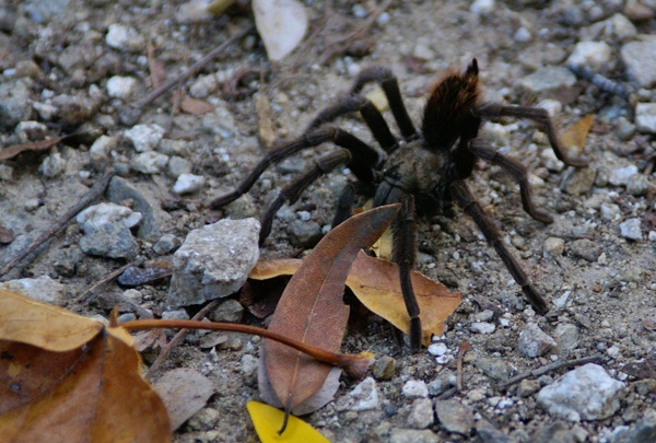
The reason why I bring this up is while on that hike, CraigsOutside and I encountered a tarantula on the trail. That's not necessarily surprising since the area is know to have tarantulas, but what is surprising is before that hike, I've seen a tarantula in the wild only one other time and it was about 2 weeks before that when I spotted two others.
One was on the trail and was actually discovered by a couple of bicyclists coming down the hill. One stopped about 50 feet up the trail from me and pointed it out to his riding partners who were behind him. By the time I got up there, it was just ambling across the fire road. Later on that same hike, I nearly stepped on one at ground zero of the first stage of my multi-cache. If that doesn't get your adrenaline up, nothing will I guess. Either that, or you're just a calmer person than I.
I've encountered my fair share of creepy crawly things while out geocaching. I've spotted snakes from time to time. Once, while out hiking we came across a very large rattlesnake. Unfortunately, it wasn't really pleased with us being there, but there wasn't a whole lot we could do about it at the time, since we had it surrounded on a couple of sides. We did the best thing we could do and that was to back up and make wide circles around it. This snake encounter was in May, when the environment is becoming more habitable for all creatures in this area, but particularly reptiles, since they rely on the air temperature for warmth.
My friend CraigsOutside was bitten last year by a rattlesnake (read about it here). 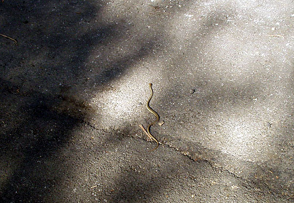
Before last year, I wouldn't have had rattlesnakes on my mind at all in November or December or any of the cold months of the year. Craig's encounter had me a lot more cautious yesterday while I was looking through a pile of rocks on the side of the road. I keep thinking that I really should get a hiking stick of some kind to carry along with me. Many of my friends take one along when we go on hikes. I've never found the need to carry one, mainly because it's one more thing in your hands while you're walking. Maybe I need to rethink that.
I'll be hiking out in the desert over the next couple of months. It's the most pleasant time to be hiking out there. It's cool and comfortable, much more pleasant than during the middle of the summer time. There's another figure out in the desert that we're going to create. I've written about the Smiley series and the Groundspeak logo in the past. Now, in the same general area to the west of the Smiley Series is a large PacMan. There are 30 caches, plus one mystery which makes up the eye of the PacMan. I have this feeling after we go out and find all of those, we might be singing "PacMan Fever" for awhile.
It appears as if each cache is about two tenths of a mile from the next cache, meaning this will be a 6 mile hike. That will make for a good hike if we do it all in one day. If we spread it out over two days, it'll be two good hikes. Anything over a mile is a good hike, in my opinion. And since one of our proposed hiking dates happens to fall on one of my open cache dates, that's always a bonus.
Pictures were taken at or near the following geocaches:
Give or Take 20ft - by madmaxxawr
Curiouser and Curiouser - by Terra Girl, Bean Dog, and my faithful sherpa Max

Friday, November 26, 2010
Beta Testing
Sometimes, when I hide a cache, I like to have the cache tested out by someone else. A beta tester to a geocache serves a couple of important functions for the cache hider. The primary job of the beta tester is to check the coordinates of the cacher. 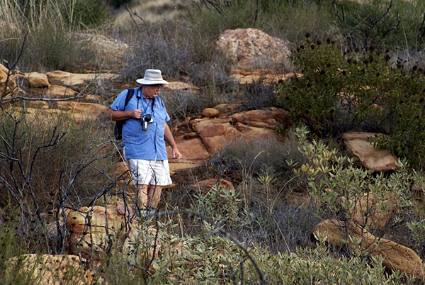
As I posted in my last post, the accuracy of hand held GPS receivers are only good to about 30 feet. When I got to the degree confluence, my receiver said I was at the point +/- 7 feet. That was pretty good, but thirty feet could be a different story, especially if you're looking for a smaller type of container, which is where the beta tester comes into play.
I've been a beta tester on a couple of caches. I enjoy being a beta tester for a number of reasons. Sometimes, it's interesting to watch a person as they go through their hide process. Other times, it's interesting to see how close our two GPSrs are with regard to signal. Sometimes they're way off and the hider will have to do some checking to see whether it's his unit or mine that appears to be off. It can go either way.
The last time I was a beta tester, I chose to stand several hundred feet away and take pictures of the scenery. I also took a picture after my friend Chaosmanor had hidden his cache and watched as he tried to verify his coordinates. There was no way I could have seen where it was hidden and I actually had a tough time finding his cache, although I shouldn't have since it was fairly exposed from a certain angle. I didn't approach the cache from that particular angle and had a more difficult time finding it.
On another of his cache hides, he called out his coordinates to me and I inputted them into my receiver and then went on the hunt. My receiver sent me over there, which disagreed with his receiver. 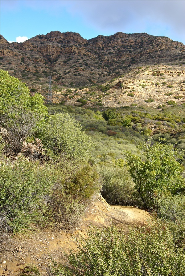
The second reason I like to have another cacher beta test my hides is I get to see the reaction of someone finding the cache. On my last hide, CraigsOutside came along on the hike. I had already hidden the cache, but was having some proximity issues with another one of my own caches. This particular multi-cache had to have its second waypoint moved in order to be published. The look on CraigsOutside's face when he found both ends of the cache was priceless. As a cache owner, you only get to rely on the log write-ups of others to see how good the cache is most of the time. When you get to see others attempt your own cache, it furthers the fun.
In reality, I think that every cache hide should have a beta tester. I think many people hide caches too quickly and don't get accurate readings for their cache hides. This leads to frustrations for cache hunters when the coordinates don't end up being very accurate. Even with an accuracy rating of +/- 30 feet, there are things that a cache owner can do to make sure that accuracy is better than that.
Having patience when taking the initial coordinates is probably the first thing that a cache owner can do to insure accurate readings. Taking more than one reading, or averaging the initial reading is always helpful, especially if there is overhead site disturbances, such as trees that could block the signals from the satellites above. Having a beta tester along for the ride will also help, in my opinion.
Pictures were taken at or near the following geocaches:
Sandstone Game Paths - by Chaosmanor
Pathfinder 59s - by Chaosmanor

Wednesday, November 24, 2010
Degree Confluence
I've always been fascinated with maps. I usually got to ride "shotgun" when we went on family trips. I was the navigator, which meant I got to follow our progress on the road atlas. 
Such was the case over Veteran's Day weekend. Chaosmanor and I planned a trip up to Stockton. The two main routes north are either Interstate 5 or State Hwy 99. My usual route is to take the 99, because I find it slightly more scenic than the 5. More importantly, there seems to be natural breaks along the route, which helps gauge where you are on the trip. There are many towns along the 99 and I know I can usually make it to Bakersfield in around 2 hours, to Fresno in another 2 hours and then to Stockton in approximately another 2 hours.
The 5 is bereft of many cities and town and the scenery is pretty much the same with the exception of the cattle stockyards near Coalinga. Other than that, there's no way to really tell where you are or how long you have to go until you've reached your destination. If you're in a hurry, the 5 is the way to go because it's about a half an hour shorter than the 99. But the main purpose of this trip was to take the scenic route - well scenic in regard to geocaching.
Outside of the geocaches in the major cities along the 99, I've pretty much cleared out most caches along that route. So Chaosmanor suggested we take the less traveled road, parallel to the 99. It would still take us north, but we would avoid most of the larger cities, while driving through open country, which is where you can usually find large numbers of caches without the worry of caches being muggled, or having to worry about crowded situations.
As we made our way north, I saw one of the caches that Chaosmanor had added to his route. Many caches like this I've found in the past usually are mystery caches, not actually near the geographic coordinates that are posted on the cache page. This one, however, was a regular with coordinates N 36˚ W 119˚. This would be a degree confluence, one of many points on the earth where a line of latitude and longitude intersect.
According to the Degree Confluence Project, you are within 49 miles of a degree confluence anywhere you happen to be. Just because you're close, doesn't mean that you can necessarily access these points, however. If you think about it, you'll realize that 70% of the degree confluences fall in water and are difficult to access. Many more fall on rough terrain. Although a map is flat, the world isn't and we have to take into account the lay of the land. But there are some, like the one we visited, that are very easy to access.
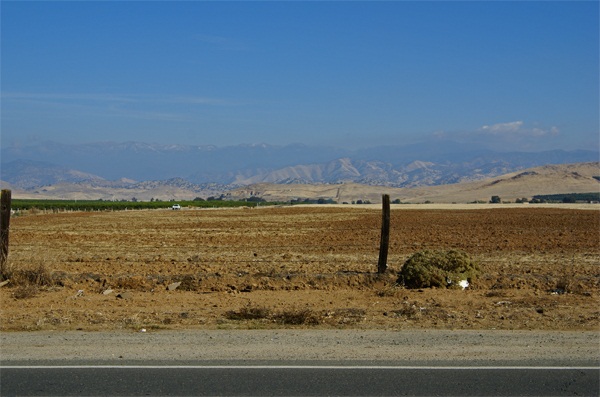
The confluence point was literally by the side of a road. To the west, was a large orange grove. To the south and north, the road traveled onward. To the east, the view was of foothills and in the distance, the Great Western Divide which makes up that portion of the Sierra Nevada. There was a slight dusting of snow on top of the mountains. I'm sure there's a lot more snow up there now as we've had several winter storms come through California in the past week.
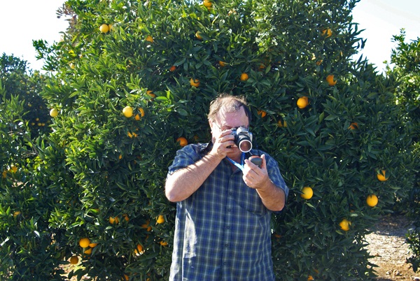
According to my GPS receiver, I was within 7 feet of the confluence, based upon the accuracy of my unit at the time I took that picture. You can also see that each of our receivers didn't agree, as I later took a picture of Chaosmanor attempting to zero his receiver out. He was standing about 15 feet away from me while I was at my ground zero point.
After I found the cache, which was hidden nearby, I discovered that my receiver had decided to creep a little bit to the west, closer to my friend's point of confluence. This isn't uncommon. When we go out caching, our units very rarely agree on a particular point, but usually get us close. For $200, I'll not quibble about slight inaccurate readings I received that day. The point is, I was the closest I've ever been to a degree confluence with fairly accurate readings. And from a geek standpoint, it really is kind of cool to see all those zeroes show up on your GPS screen.
Pictures were taken at or near the following geocache:
Confluence N36 00.000 and W119 00.000 - by TheeSugaBear

Friday, November 5, 2010
On a clear day...
In November, Los Angeles gets treated to the annual U.C.L.A./U.S.C. football game. An old saying I've heard in the past was, "On a clear day, U.C.L.A. . . . . . . . . on any other day, U.S.C. Obviously, this one was created by a Trojan fan, but if this past week is any indication, U.S.C. might be in trouble this year. 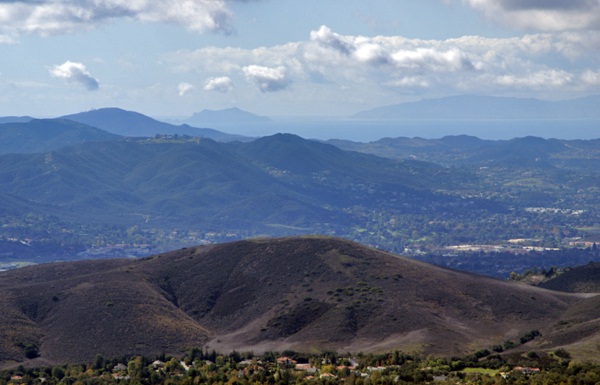
Last Saturday, I went on a hike with my friend Chaosmanor in the Agoura Hills area of the Los Angeles Basin. We'd planned a trip to get us several geocaches, plus a virtual flag that would score me the maximum number of points in the game. We found several caches before heading up to the trailhead to begin our hike.
The first part of the hike was on a new trail open for about a year or so. Surprisingly, it had no caches on the trail, so Chaosmanor took it upon himself to hide a couple while on our way. Soon after those hides, we were on a fire road heading up to some caches that hadn't been found in exactly a year. Well, they still haven't been found. One cache we started to attempt, but didn't finish, mainly because the terrain had changed slightly in the past year. There was a lot of plant growth, which concealed the main way up to the cache and any other route that we could see, looked extremely treacherous and so we passed on it.
The second cache was similar, so we didn't even make an attempt to get up to it. The third cache was attempted after a nice lunch at the end of the fire road on which we'd hiked. This one was probably the most frustrating of the three since we were able to hike up to the cache site and do a very thorough search of the area. After calling a lifeline, we were pretty much able to verify where the cache probably had been, but we couldn't find the ammo can that had been placed there. 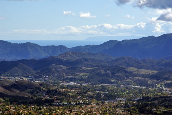
After striking out there, we headed further up along a game trail and found another more established trail that took us up to the virtual flag and a couple of other caches, including a virtual cache at the top of Simi Peak, just inside the Santa Monica Mountains National Recreation Area. This stop was probably the highlight of the day.
The peak is only 2403 above sea level. I was able to verify that with a laminated sheet at the peak. I put my GPSr down next to the sheet and eventually, it also read the same elevation above sea level. Just after I took the picture, the elevation on my GPSr changed again. I've noticed that on other occasions as well, so I'm not ready to say that my GPSr has great accuracy when it comes to elevation, just that I was able to get the two numbers to coincide.
That didn't make the highlight reel though. What made this spot truly noteworthy was the view. Even though we were at fairly low altitude, we had a complete 360˚ view which stretched for miles and miles, literally. Originally, I had been looking to the west from the peak. Chaosmanor had already pointed out the ocean from further down, but once we got on top of the peak, we spotted Anacapa Island and behind it, Santa Cruz Island, both within Channel Islands National Park. Looking at the map, it looks like we were at least 30 miles, probably more distant from those two islands.
Then we got a bigger shock, I believe, when we looked south and could see the ocean and Catalina Island in the distance. 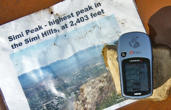
The weather conditions were just right that day where we were. Other hikers might not be so fortunate, but hopefully, that won't stop them from coming up there. I can imagine that peak in fog. That would give an entirely different perspective to the area, that's for sure. We spent a great deal of time up there, getting the necessary information to fulfill the requirements, take pictures of the scenery, take pictures of the benchmark that's also at the top and also just to enjoy the view. It's not often that the Los Angeles area is that clear. Besides the ocean views, we also had amazing views of Simi Valley to the north and the San Fernando Valley to the east. It was a picture perfect day.
Eventually, we knew we'd have to descend back into civilization and we did it reluctantly. We hiked down the trail heading to other geocaches further down the slopes of Simi Peak. At one point we missed a trail junction and ended up further north than we had originally anticipated being, so that added another mile or so to our overall hike, but it was definitely worth the effort. It had been a good climb up and a good hike totally just over 8 miles. It had been a good day.
Pictures were taken at or near the following geocache:
Simi Peak Returns - by WM6P

